


VerkehrszeichenWeltweit
 Verkehrsregeln
 Weltweit
101. Seitenstreifen
Ein Seitenstreifen ist der Landstreifen neben einer Fahrbahn zwischen der Fahrbahn und Elementen wie Graben, Böschung, Grundstücksgrenze oder anderem Straßenrandbereich. Er kann auf gleicher Höhe mit der Fahrbahn liegen oder erhöht sein und aus Gras, Kies, Erde oder anderem Material bestehen.
Ein Seitenstreifen ist normalerweise von Fahrbahn, Gehweg und Radweg getrennt. Je nach örtlichem Verkehrsrecht können Fußgänger, Radfahrer oder Fahrzeuge ihn unter bestimmten Umständen benutzen; auch für Halten und Parken können besondere Regeln gelten.
What is a verge?
A verge is an area alongside a roadway, generally between the roadway and a ditch, embankment, property boundary or other roadside feature.
Is a verge part of the roadway?
No. A verge is normally a separate part of the road environment alongside the roadway.
Is a verge the same as a pavement?
No. A pavement or sidewalk is specifically intended for pedestrians, while a verge may primarily form the roadside margin and may not be paved or comfortably walkable.
Is a verge the same as a cycle path?
No. A cycle path is specifically designated for cyclists and other permitted users. A verge has a different function and legal status.
Can a verge be level with the roadway?
Yes. A level verge lies approximately at the same height as the roadway and may consist of grass, gravel, soil or another surface.
Can a verge be raised?
Yes. A raised verge lies above the level of the roadway and is normally clearly distinguishable from it.
Can pedestrians walk on a verge?
Yes, where local rules permit or require it. A verge may provide a walking route where no suitable pavement or dedicated pedestrian facility is available.
Can cyclists ride on a verge?
This depends on the country, type of verge and available cycling facilities. Local traffic law may permit cyclists to use a suitable verge in particular circumstances.
Can vehicles drive on a verge?
Normally vehicles use the roadway, but local rules may permit temporary use of a suitable verge for purposes such as passing, meeting oncoming traffic or accessing property.
Can vehicles park on a verge?
This depends on local traffic law, the type of verge and the location. Where verge parking is permitted, sufficient space may have to remain available for pedestrians and other road users.
Should you drive onto a soft verge at high speed?
No. A soft or uneven verge can provide significantly less grip than the roadway and may affect steering or vehicle stability. Reduce speed and return to the roadway safely when possible.
Can a verge contain roadside signs or other equipment?
Yes. Verges commonly provide space for traffic signs, lighting, drainage, utility equipment, vegetation and other roadside infrastructure.

102. Ringstraße
Eine Ringstraße ist eine Straße oder ein zusammenhängendes Straßensystem, das um eine Stadt, einen Ort oder ein städtisches Gebiet herum oder teilweise darum herumführt. Sie soll Verkehr zwischen verschiedenen Teilen des Gebiets verteilen und Durchgangsverkehr an überlasteten zentralen Straßen vorbeiführen.
Eine Ringstraße ist nicht zwingend eine Autobahn oder Schnellstraße. Sie kann aus Autobahnen, baulich getrennten Fernstraßen, gewöhnlichen Straßen oder einer Kombination verschiedener Straßentypen bestehen. Geschwindigkeitsbegrenzungen, Zufahrtsbeschränkungen, Vorfahrts- und Fahrstreifenregeln richten sich daher nach dem jeweiligen Abschnitt und den örtlichen Verkehrszeichen und Vorschriften.
What is a ring road?
A ring road is a road or connected route that runs around or partly around an urban area and helps distribute traffic between different destinations without requiring all traffic to pass through the centre.
Why are ring roads built?
Ring roads are commonly used to divert through traffic, connect major roads and provide access to different parts of a city. They can reduce the amount of traffic travelling through central streets.
Is a ring road always a complete circle?
No. A ring road may completely surround a city, form only part of a loop or consist of several connected roads that together perform a ring-road function.
Is a ring road the same as a motorway?
No. Some ring roads are motorways, while others consist of expressways, ordinary roads or a mixture of road types. Motorway rules apply only where the road is legally designated as a motorway.
What is the speed limit on a ring road?
There is no universal ring-road speed limit. The applicable speed depends on the country, road classification, location and posted traffic signs.
How can you recognise a ring road?
Ring roads are usually indicated by route numbers, directional signs or the name of the ring. The signs may also show destinations that can be reached by travelling clockwise or anticlockwise around the urban area.
Can a ring road have intersections and traffic lights?
Yes. Ordinary ring roads may contain intersections, roundabouts and traffic lights. Fully controlled-access ring roads or motorway sections generally use grade-separated junctions instead.
Can pedestrians and cyclists use a ring road?
This depends on the road type and local access rules. They may use some ordinary-road sections but are normally prohibited from motorway sections and other roads where signs restrict access.
Which lane should you use on a ring road?
Follow the country's normal lane-use rules and any lane-direction signs. On multi-lane sections, choose the appropriate lane in good time when approaching an interchange or exit.
What should you do if you miss an exit on a ring road?
Continue safely to the next suitable junction or exit. Never reverse, make an unsafe U-turn or cross restricted areas in an attempt to return to a missed exit.
103. Rampe
Eine Rampe ist eine Verbindungsstraße, über die Fahrzeuge eine andere Straße erreichen oder verlassen, insbesondere eine Autobahn, Schnellstraße oder andere höhenfrei geführte Straße. Rampen werden häufig an Anschlussstellen verwendet, um Straßen miteinander zu verbinden, ohne dass sich die Verkehrsströme höhengleich kreuzen.
Eine Auffahrtsrampe führt den Verkehr auf die Hauptstraße, eine Abfahrtsrampe von ihr weg. Fahrer sollten Verkehrszeichen und Fahrbahnmarkierungen beachten, ihre Geschwindigkeit anpassen und sorgfältig auf ein- oder ausfädelnden Verkehr achten.
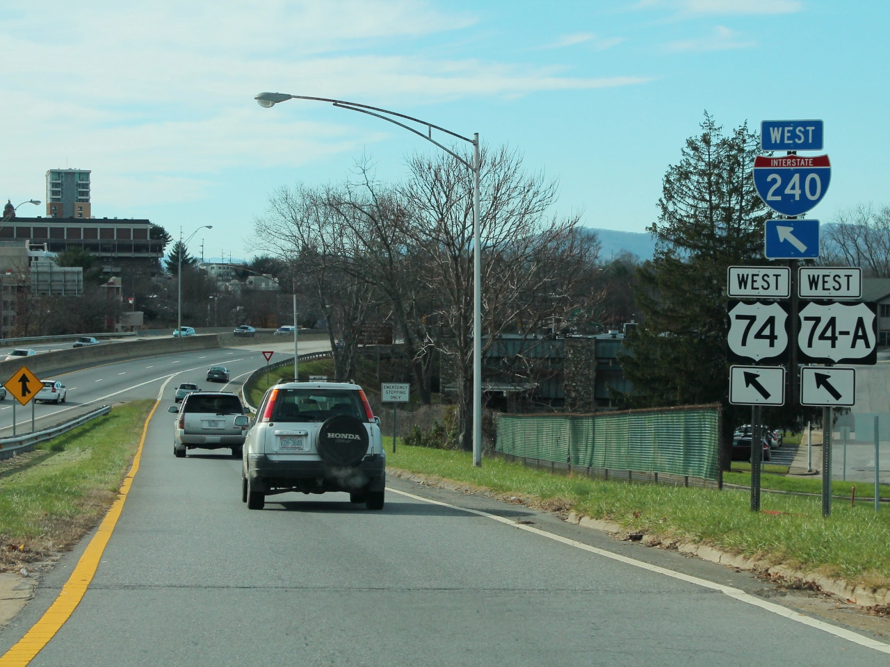
What is a road ramp?
A ramp is a connecting road used to enter or leave another road, particularly a motorway, expressway or grade-separated highway.
What is the difference between an entrance ramp and an exit ramp?
An entrance ramp carries traffic toward the main road, while an exit ramp carries traffic away from it toward another road or destination.
How should you use a motorway entrance ramp?
Follow the signs and road markings, use the ramp to adjust your speed to the traffic on the motorway and merge only when it is safe and permitted. The exact priority rules depend on the country.
104. Ausfahrt
Eine Ausfahrt ist eine ausgewiesene Strecke oder Stelle, an der Verkehr eine Straße, Autobahn, Schnellstraße oder andere Hauptverkehrsroute verlässt. Auf Hochgeschwindigkeitsstraßen führt eine Ausfahrt normalerweise von der Hauptfahrbahn auf einen Ausfahrstreifen oder eine Rampe, die mit einer anderen Straße oder einem Ziel verbunden ist.
Fahrer sollten vor einer Ausfahrt Wegweiser und Fahrbahnmarkierungen beachten, sich rechtzeitig in den richtigen Fahrstreifen einordnen und ihre Geschwindigkeit nach Verlassen des Hauptverkehrsflusses bei Bedarf anpassen.
What is a road exit?
An exit is a designated route or point that allows traffic to leave a road, motorway or expressway and continue toward another road or destination.
How should you prepare for an exit?
Check the direction signs, select the correct lane in good time, signal when required and avoid sudden lane changes when approaching the exit.
What should you do if you miss your exit?
Continue safely along the road and use a later exit or another permitted route. Do not stop, reverse or make a dangerous sudden manoeuvre simply to reach an exit you have missed.
105. Standstreifen
Ein Standstreifen ist ein Streifen neben den Hauptfahrstreifen einer Autobahn oder anderen Schnellstraße, der normalerweise vom regulären Verkehr freigehalten wird. Er bietet Platz für Fahrzeuge mit Panne oder in einer Notsituation und kann, soweit örtliche Regeln dies erlauben, auch von Einsatz- oder autorisierten Servicefahrzeugen genutzt werden.
Fahrer sollten einen Standstreifen nicht als normalen Fahrstreifen benutzen. Muss ein Fahrzeug dort wegen eines Notfalls anhalten, sollten die Insassen die geltenden Sicherheitsmaßnahmen befolgen und sich möglichst weit vom fließenden Verkehr entfernt aufhalten.
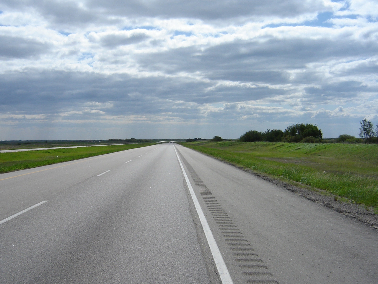
What is an emergency lane?
An emergency lane is a lane or strip beside the normal traffic lanes that is primarily intended for emergencies, breakdowns and authorised vehicles.
Can you normally drive in an emergency lane?
No. Emergency lanes are generally not intended for ordinary traffic, although specific countries may permit their use in certain situations or when indicated by traffic signs or signals.
What should you do if your vehicle breaks down in an emergency lane?
Stop as far from moving traffic as safely possible, activate the hazard warning lights and follow the country's breakdown procedures. Occupants should avoid remaining close to moving traffic and move to a safer location when possible.
106. Verkehrsspitzen-Fahrstreifen
Ein Verkehrsspitzen-Fahrstreifen ist ein zusätzlicher Fahrstreifen, der bei starkem Verkehr vorübergehend geöffnet wird, um die Kapazität einer Straße zu erhöhen. Er findet sich häufig auf Autobahnen und kann einen Teil des Standstreifens oder einen anderen normalerweise für den regulären Verkehr gesperrten Fahrstreifen nutzen.
Solche Fahrstreifen werden normalerweise durch dynamische Verkehrszeichen oder Fahrstreifensignale gesteuert. Fahrer dürfen sie nur benutzen, wenn sie ausdrücklich als geöffnet angezeigt werden, und müssen sie verlassen, wenn Zeichen oder Signale eine Schließung anzeigen.

What is a rush-hour lane?
A rush-hour lane is an additional lane that can be opened temporarily during periods of heavy traffic to provide extra road capacity.
When can you use a rush-hour lane?
You may use a rush-hour lane only when the applicable traffic signs or lane-control signals indicate that it is open. The exact rules and signals vary between countries.
What should you do when a rush-hour lane is closed?
Do not continue driving in the lane when signs or signals indicate that it is closed. Move into an open traffic lane safely and follow any directional signals provided above the roadway.
107. Verkehrsberuhigung
Verkehrsberuhigung bezeichnet bauliche Maßnahmen, die Fahrzeuggeschwindigkeiten reduzieren und die Sicherheit verbessern sollen, insbesondere in Bereichen, in denen Fahrzeuge eng mit Fußgängern und Radfahrern interagieren. Dazu können Bremsschwellen, angehobene Überwege, Fahrbahnverengungen, Verschwenkungen, Verkehrsinseln und Änderungen von Straßenführung oder Oberfläche gehören.
Ziel der Verkehrsberuhigung ist es, Fahrer zu einer niedrigeren und angemesseneren Geschwindigkeit zu bewegen, anstatt sich nur auf Geschwindigkeitsbegrenzungsschilder zu verlassen. Die eingesetzten Maßnahmen und ihre rechtlichen Anforderungen unterscheiden sich je nach Land.

What is traffic calming?
Traffic calming is the use of road-design measures to reduce vehicle speeds and create safer conditions for pedestrians, cyclists and other road users.
What are common traffic-calming measures?
Common measures include speed humps, raised crossings, chicanes, narrowed carriageways, traffic islands and redesigned intersections.
Where is traffic calming commonly used?
Traffic calming is commonly used in residential areas, school areas, town centres and other places with significant pedestrian or cyclist activity.
108. Informationsstelle
Eine Informationsstelle ist ein ausgewiesener Ort, an dem Reisende Informationen über die Umgebung, örtliche Dienstleistungen, Sehenswürdigkeiten, Routen oder andere nützliche Einrichtungen erhalten können. Sie kann an einer Straße, auf einem Rastplatz, in einem Ort oder in der Nähe eines wichtigen Ziels liegen.
Informationsstellen werden häufig durch ein Service- oder Informationszeichen gekennzeichnet. Je nach Standort können sie Karten, Broschüren, Routeninformationen, touristische Hilfe oder digitale Besucherinformationen anbieten.
What is an information point?
An information point is a place where travellers can obtain information about local destinations, attractions, services, routes or other useful facilities.
What information can you find at an information point?
Depending on the location, an information point may provide maps, tourist information, directions, information about attractions and details about nearby services.
How is an information point indicated?
Many countries use a service or information sign to direct road users toward an information point. The exact symbol and sign design vary between countries.
109. Reiten
Reiten bezeichnet das Reiten und Aktivitäten mit Pferden und Reitern. Im Straßenverkehr können Reiter je nach Regeln und Infrastruktur Straßen, Reitwege oder speziell ausgewiesene Routen nutzen.
Fahrer, die sich Pferden und Reitern nähern, sollten die Geschwindigkeit verringern, ausreichend Abstand halten und plötzlichen Lärm oder Bewegungen vermeiden, die das Tier erschrecken könnten. Auch Reiter müssen die für sie geltenden Verkehrsregeln beachten.
What does equestrian mean in road traffic?
Equestrian refers to horse riding and, in a traffic context, particularly to people travelling on horseback or using designated horse-riding routes.
Where can equestrians ride?
Depending on local rules, riders may use roads, bridleways, paths or routes specifically designated for horse riding.
How should drivers behave near horse riders?
Drivers should slow down, leave plenty of space and pass calmly, avoiding sudden acceleration, horn use or other actions that could frighten the horse.
110. Vorläufiger Führerschein
Ein vorläufiger Führerschein erlaubt einem Fahrschüler, vor Erhalt des vollständigen Führerscheins auf öffentlichen Straßen zu üben. Die Bedingungen unterscheiden sich je nach Land und können festlegen, ob eine anerkannte Begleitperson mitfahren muss, welche Fahrzeuge geführt werden dürfen, wo und wann gefahren werden darf und wie lange der Führerschein gültig bleibt. Ein vorläufiger Führerschein unterliegt normalerweise strengeren Regeln als ein vollständiger Führerschein und dient ausdrücklich dem Lernen und Sammeln praktischer Fahrerfahrung.
What is a provisional driving licence?
A provisional driving licence allows a learner driver to practise driving under specified conditions before obtaining a full driving licence.
Can you drive alone with a provisional licence?
This depends on the type of provisional licence and local rules. Some licences require an approved supervisor, while others allow the learner to practise alone after completing specified training.
How long is a provisional licence valid?
The validity period varies between countries and licence types. If it expires before the learner passes the practical exam, additional conditions may apply before another provisional licence can be obtained.
Can you drive abroad with a provisional licence?
Often not. A provisional licence may be valid only in the country that issued it. Learners should check the applicable rules before attempting to drive abroad.
Are there restrictions on when a learner may drive?
Yes, in some countries. Provisional licences may include restrictions on night driving, passengers, trailers, vehicle types or certain roads.
Do you need to display a learner sign?
Many countries require a learner vehicle to display an L plate or another learner-driver sign. The design and conditions vary by country.
111. Gefahrgut
Gefahrgut, auch gefährliche Güter genannt, umfasst Stoffe oder Gegenstände, die während des Transports ein erhebliches Risiko für Menschen, Eigentum oder Umwelt darstellen können. Beispiele sind Explosivstoffe, entzündbare Flüssigkeiten und Gase, giftige Stoffe, ätzende Materialien und radioaktive Stoffe.
Für den Transport von Gefahrgut können besondere Verpackungen, Kennzeichnungen, Fahrzeugmarkierungen, Dokumente, Ausrüstung und Fahrerschulungen erforderlich sein. Je nach Art und Menge der gefährlichen Güter können außerdem zusätzliche Strecken- oder Tunnelbeschränkungen gelten.
What is considered hazardous cargo?
Hazardous cargo includes substances and articles classified as dangerous for transport, such as explosives, gases, flammable materials, toxic or infectious substances, radioactive materials and corrosive substances.
Does hazardous cargo need special markings?
Yes, when the applicable dangerous-goods rules require them. Packages and vehicles can require hazard labels, placards, identification numbers or other markings that identify the nature of the danger.
Can hazardous cargo be prohibited on certain roads or in tunnels?
Yes. Dangerous-goods vehicles can be subject to route and tunnel restrictions according to the type and quantity of goods being transported and the classification of the road or tunnel.
112. Notausgang
Ein Notausgang ist ein gekennzeichneter Fluchtweg, über den Verkehrsteilnehmer einen Tunnel oder eine andere geschlossene Verkehrsanlage bei einem schweren Ereignis wie Brand, Rauchentwicklung oder einem anderen Notfall verlassen können. Notausgänge führen in einen sichereren Bereich, der von der unmittelbaren Gefahr getrennt ist.
Im Notfall sollten Insassen ihr Fahrzeug verlassen, wenn eine Evakuierung erforderlich ist, und den Notausgangsschildern und Anweisungen folgen. Sie sollten sich von der Gefahr entfernen, statt im Tunnel zu bleiben oder zum Fahrzeug zurückzukehren.
What is an emergency exit in a road tunnel?
An emergency exit is a designated escape route that allows people to leave the traffic area of a tunnel and reach a safer location during an emergency.
When should you use a tunnel emergency exit?
Use an emergency exit when evacuation is necessary because of fire, smoke or another serious danger, or when instructed to evacuate by tunnel personnel or emergency services.
Should you take your vehicle through an emergency exit?
No. Tunnel emergency exits are intended for people evacuating on foot. Leave the vehicle when necessary and follow the marked escape route towards safety.
113. Notfall-Auslaufspur
Eine Notfall-Auslaufspur, auch Notfallfluchtspur genannt, ist ein speziell angelegter Fahrstreifen, der ein Fahrzeug mit ausgefallener oder unzureichender Bremswirkung zum Stillstand bringen soll, insbesondere ein schweres Fahrzeug bei einer steilen Talfahrt. Die Spur kann eine Gegensteigung, tiefen Kies oder eine andere energieabsorbierende Oberfläche nutzen, um das Fahrzeug abzubremsen und anzuhalten.
Ein Fahrer mit Bremsversagen sollte die Notfallspur so früh und sicher wie möglich benutzen, statt weiter bergab zu fahren. Solche Spuren sind reine Notfalleinrichtungen und dürfen nicht zum normalen Halten, Parken oder Wenden verwendet werden.
What is a runaway truck ramp used for?
It provides an emergency stopping area for a vehicle that can no longer slow down adequately with its normal brakes. It is particularly intended for heavy vehicles on long or steep descents.
How does a runaway truck ramp stop a vehicle?
Depending on its design, the ramp may rise uphill or contain deep gravel, sand or another arresting material that creates resistance and rapidly reduces the vehicle's speed.
Can you use a runaway truck ramp for normal stopping or parking?
No. An escape ramp is an emergency safety facility and should be kept clear for vehicles that have lost effective braking or control.
114. Verkehrsfunk
Verkehrsfunk ist ein Radiodienst, der Fahrer über Staus, Straßensperrungen, Unfälle, Wetterbedingungen oder andere Ereignisse informiert, die eine Fahrt beeinflussen. Straßenschilder können einen bestimmten Sender und eine Frequenz anzeigen, auf der Verkehrsinformationen verfügbar sind.
Fahrer können die angegebene Frequenz einstellen, um während der Fahrt örtliche Verkehrsmeldungen zu empfangen. Der Dienst dient der Information und ersetzt keine Verkehrszeichen, Signale oder Anweisungen befugter Personen.
What is a traffic radio service?
A traffic radio service broadcasts information for road users, such as congestion, collisions, roadworks, closures or other conditions that may affect traffic.
What does a radio service road sign indicate?
It indicates a radio station or frequency on which drivers can receive traffic information relevant to the road or surrounding area.
Do radio traffic reports override road signs?
No. Radio information can help drivers anticipate conditions and choose a route, but drivers must continue to obey traffic signs, signals, road rules and instructions from authorised persons.
115. Überbreite oder übergroße Ladung
Eine übergroße Ladung ist eine Ladung, durch die ein Fahrzeug oder eine Fahrzeugkombination die normalerweise zulässigen Abmessungen im Straßenverkehr überschreitet, etwa bei Länge, Breite oder Höhe. Solche Transporte betreffen häufig große Maschinen, Bauteile oder andere Gegenstände, die sich nicht sinnvoll in kleinere Ladungen aufteilen lassen.
Der Transport einer übergroßen Ladung kann eine Sondergenehmigung, eine genehmigte Route, Warnzeichen, Beleuchtung oder Begleitfahrzeuge erfordern. Fahrer müssen die Bedingungen der für die befahrenen Straßen zuständigen Behörden einhalten.
What is an oversize load?
An oversize load is a load that makes a vehicle or vehicle combination exceed one or more of the normal legal dimensions for road use, such as its permitted width, height or length.
Does an oversize load require a special permit?
Often yes. Depending on the country, dimensions and route, a permit may be required and can specify where and when the vehicle may travel and what additional safety measures must be used.
Why might an oversize load need an escort vehicle?
Escort vehicles can warn other road users, help manage difficult road sections and assist the exceptional vehicle when its size creates additional traffic risks. The number and type of escorts required depend on national rules and the dimensions of the transport.
116. Fahrstreifen
Ein Fahrstreifen ist ein längs verlaufender Teil einer Fahrbahn, der für eine Reihe fahrender Fahrzeuge bestimmt ist. Eine Fahrbahn kann einen oder mehrere Fahrstreifen für Verkehr in derselben oder entgegengesetzten Richtung enthalten.
Fahrstreifen werden häufig durch durchgezogene oder unterbrochene Fahrbahnmarkierungen getrennt. Verkehrszeichen, Fahrstreifenpfeile und Fahrstreifensignale können anzeigen, welche Fahrzeuge einen Fahrstreifen benutzen dürfen, in welche Richtung gefahren werden muss oder ob ein Fahrstreifen geöffnet oder gesperrt ist.
What is a traffic lane?
A traffic lane is a longitudinal part of a roadway intended for a line of moving vehicles.
Is a lane the same as a roadway?
No. A roadway is the larger area intended for vehicle traffic and may contain one or several individual lanes.
How are traffic lanes normally marked?
Lanes are commonly separated by continuous or broken longitudinal road markings. Their appearance and legal meaning depend on the local traffic-sign system.
Can you cross a broken lane line?
Normally yes, when permitted and safe, for example when changing lane or overtaking. Drivers must still check surrounding traffic and follow local rules.
Can you cross a continuous lane line?
Normally no, except where local law provides a specific exception. A continuous line generally indicates that crossing the marking is prohibited.
Should you signal before changing lane?
Yes. Drivers should indicate their intention in sufficient time and change lane only after making sure the movement can be completed safely.
Who has priority when changing lane?
A driver changing lane generally must give way to traffic already travelling in the lane being entered, although specific merging rules may apply in some situations.
Can a lane be reserved for certain vehicles?
Yes. Particular lanes may be reserved for buses, bicycles, high-occupancy vehicles or other specified traffic according to local signs and regulations.
Can a traffic lane be temporarily closed?
Yes. Lane-control signals, temporary signs, barriers or roadworks markings may close a lane or direct traffic into another lane.
What should you do when your lane ends?
Follow the merging rules and road markings, observe surrounding traffic and move into the continuing lane safely. Special zipper-merging rules may apply during congestion.
What do lane-direction arrows mean?
Arrows painted in a lane can indicate the direction or directions that traffic using that lane must follow, particularly when approaching an intersection.
Should you remain in one lane when possible?
Yes. Avoid unnecessary lane changes. Choose an appropriate lane and change only when needed for overtaking, turning, merging or following the required route.
117. Radschnellweg
Ein Radschnellweg ist eine hochwertige, durchgehende Radroute für schnelles, direktes und komfortables Fahren über längere Strecken. Radschnellwege verbinden häufig Städte, Wohngebiete, Arbeitsplätze, Schulen, Knotenpunkte des öffentlichen Verkehrs und andere wichtige Ziele.
Ein Radschnellweg kann aus separaten Radwegen, gemeinsam genutzten Wegen, ruhigen Straßen, Brücken, Tunneln oder anderer Radinfrastruktur bestehen und ist daher nicht zwingend ein durchgehend gleicher Straßentyp. Zugangsregeln, Vorfahrt, Geschwindigkeitsbegrenzungen und zugelassene Nutzer richten sich nach den einzelnen Abschnitten sowie den örtlichen Verkehrszeichen und Vorschriften.
What is a cycle highway?
A cycle highway is a continuous cycling route designed to make longer bicycle journeys fast, direct, safe and comfortable. It commonly connects towns, cities and important destinations.
Is a cycle highway the same as a cycle path?
No. A cycle path is a particular part of a road or a separate path intended for cyclists. A cycle highway is an entire route and may contain several different types of cycling infrastructure.
Does a cycle highway always have a separate cycle path?
No. Although high-quality separated infrastructure is common, a cycle highway may also use quiet streets, shared roads, greenways, bridges, tunnels and other suitable connections.
Do cyclists automatically have priority on a cycle highway?
No. The designation of a route as a cycle highway does not by itself give cyclists priority at every intersection or crossing. Priority is determined by the applicable traffic signs, markings and local traffic rules.
Are motor vehicles prohibited from cycle highways?
Not necessarily. Some sections may be completely separated from motor traffic, while others may follow roads that are also open to cars or other vehicles. Access depends on the rules applying to each section.
Can pedestrians use a cycle highway?
This depends on the infrastructure. Some sections may be shared with pedestrians, while others may be reserved for cyclists or particular categories of road users. Follow the signs at the location.
Can electric bicycles use a cycle highway?
Ordinary electrically assisted bicycles can generally use routes available to bicycles. Different rules may apply to high-speed electric bicycles or speed pedelecs, depending on their legal classification and the signs applying to each section.
Is there a special speed limit on a cycle highway?
There is no universal cycle-highway speed limit. Speed rules depend on the country, type of infrastructure, vehicle category and locally displayed restrictions.
Can a cycle highway have intersections?
Yes. Cycle highways may cross roads, railway lines and other routes. High-quality networks often use bridges, tunnels or carefully designed crossings to reduce delays and conflicts, but intersections may still occur.
How can you recognise a cycle highway?
Cycle highways may be identified by route numbers, logos, destination signs or distinctive wayfinding markings. The appearance and legal significance of this signage vary between countries and regions.
118. Reifendruckstation
Eine Reifendruckstation ist eine Einrichtung, an der Fahrer den Luftdruck in den Reifen ihres Fahrzeugs prüfen und anpassen können. Sie befindet sich häufig an Tankstellen, Rastanlagen, Werkstätten oder anderen Einrichtungen am Straßenrand und bietet normalerweise ein Druckmessgerät und einen Druckluftschlauch.
Der richtige Reifendruck trägt zu sicherem Fahrverhalten, Bremsleistung, Reifenverschleiß sowie Kraftstoff- oder Energieeffizienz bei. Fahrer sollten die Reifen auf den für Fahrzeug und Beladungszustand empfohlenen Druck einstellen.

What is an air pressure station?
An air pressure station is a facility where drivers can measure and adjust the air pressure in their vehicle's tyres.
Where can you find an air pressure station?
Air pressure equipment is commonly available at filling stations, service areas, garages and other vehicle-service facilities.
What tyre pressure should you use?
Use the tyre pressure recommended by the vehicle manufacturer. The required pressure can vary according to the vehicle, tyres and load.
119. Geldautomat
Ein Geldautomat (ATM) ist ein Selbstbedienungsgerät für Bankgeschäfte, mit dem Nutzer Bargeld abheben und je nach Gerät und Bank Kontostände prüfen oder weitere Bankdienstleistungen nutzen können. Geldautomaten befinden sich unter anderem bei Banken, Einkaufsbereichen, Tankstellen, Rastanlagen und anderen öffentlichen Orten.
Wenn ein Geldautomat als Straßendienstleistung verfügbar ist, kann er durch ein Bank-, Bargeld- oder Servicesymbol gekennzeichnet sein. Die zur Kennzeichnung verwendeten Symbole und Zeichen unterscheiden sich je nach Land und Betreiber.
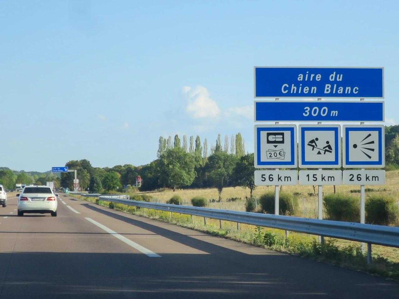
What is an ATM?
An ATM is an automated teller machine that allows users to withdraw cash and perform certain other banking transactions without entering a bank.
Where can ATMs be found?
ATMs may be located at banks, shopping areas, filling stations, service areas, transport facilities and other public locations.
Is there an international road sign for an ATM?
Not universally. Some countries or service operators use banking or cash symbols to indicate an ATM, but the design and legal status of these signs vary.
120. Bed and Breakfast
Ein Bed and Breakfast ist eine Unterkunftsform, die Gästen eine Übernachtung und Frühstück bietet, normalerweise in einem kleineren Betrieb wie einem Privathaus, Gästehaus oder kleinen Beherbergungsbetrieb. Ausstattung und Leistungen unterscheiden sich je nach Betrieb und Land.
Bed-and-Breakfast-Unterkünfte können insbesondere in touristischen Gebieten durch touristische oder Unterkunftswegweiser angezeigt werden. Symbole und Bezeichnungen unterscheiden sich je nach Land.

What is a bed and breakfast?
A bed and breakfast, often abbreviated to B&B, is accommodation that normally provides an overnight stay together with breakfast.
How is a bed and breakfast different from a hotel?
A bed and breakfast is typically a smaller accommodation establishment and may be operated from a private residence or guesthouse, while hotels generally provide a wider range of rooms and services.
Can bed and breakfasts be indicated by road signs?
Yes. Some countries allow tourist or accommodation signs to direct travellers toward bed and breakfasts, although the signs and symbols used vary between countries.
121. Anlegestelle
Eine Anlegestelle oder ein Liegeplatz ist ein ausgewiesener Ort am Wasser, an dem ein Boot oder Schiff anlegen und gesichert werden kann. Dazu können Kai, Pier, Steg oder Hafenbauwerk gehören; ein Liegeplatz kann aus einem Platz, einer Boje oder einem anderen festen Befestigungspunkt bestehen.
Verkehrszeichen können Reisende zu Häfen, Marinas, Fährterminals oder anderen Einrichtungen am Wasser führen. Die verwendeten Begriffe und Symbole unterscheiden sich je nach Land.

What is a dock or mooring?
A dock or mooring is a place where a boat or ship can stop and be secured alongside a structure or to a designated mooring point.
What is the difference between a dock and a mooring?
A dock usually refers to a waterside structure or berthing area, while a mooring refers more generally to a place or equipment used to secure a vessel.
Can docks and moorings be indicated by road signs?
Yes. Direction or tourist signs may indicate harbours, marinas, ferry terminals and other waterside facilities, although the symbols used vary between countries.
122. Seilbahn
Eine Seilbahn ist ein Personenverkehrssystem, bei dem Kabinen oder Wagen durch Seile bewegt werden, häufig zwischen Orten mit großem Höhenunterschied. Seilbahnen werden oft in Bergregionen, Tourismusgebieten und teilweise in städtischen Verkehrsnetzen eingesetzt.
Verkehrs- oder Wegweiser können Reisende zu einer Seilbahnstation oder Tal-/Bergstation als Verkehrs- oder Tourismuseinrichtung führen. Die verwendeten Symbole und Bezeichnungen unterscheiden sich je nach Land.

What is a cable car?
A cable car is a transport system in which passenger cabins or cars are moved along a route by cables.
Where are cable cars commonly used?
Cable cars are commonly found in mountainous areas, ski resorts, tourist destinations and some cities where they provide transport across steep or difficult terrain.
Can cable car stations be indicated by road signs?
Yes. Road or tourist direction signs may guide travellers toward cable car stations, although the symbols and sign designs used vary between countries.
123. Café
Ein Café ist ein Betrieb, in dem Getränke und häufig leichte Speisen oder Snacks angeboten werden. Cafés können sich in Städten, Rastanlagen, Touristengebieten oder anderen Orten befinden, an denen Reisende eine Pause zur Verpflegung einlegen können.
Cafés und ähnliche Verpflegungseinrichtungen können durch Service-, Tourismus- oder Wegweiserzeichen angezeigt werden. Die verwendeten Symbole und Bezeichnungen unterscheiden sich je nach Land.

What is a café?
A café is an establishment where customers can obtain drinks and often light meals, snacks or other refreshments.
Can cafés be indicated by road signs?
Yes. Some countries use service, tourist or direction signs to indicate cafés, refreshment facilities or similar establishments.
Is a café sign the same as a restaurant sign?
Not necessarily. Some road-sign systems distinguish between restaurants and establishments primarily offering drinks or refreshments.
124. Entsorgungsstation
Eine Entsorgungsstation für Camper ist eine ausgewiesene Einrichtung, an der Reisemobile, Campervans oder Wohnwagen Abwasser aus ihren Bordtanks sicher entleeren können. Je nach Anlage können getrennte Entsorgungsstellen für Grauwasser aus Waschbecken und Duschen sowie für Toilettenabwasser aus Kassetten- oder Fäkalientanks vorhanden sein.
Solche Entsorgungsanlagen finden sich häufig auf Campingplätzen, Wohnmobil-Serviceplätzen sowie manchen Rast- oder Parkplätzen. Abwasser darf nur in das dafür vorgesehene System und gemäß den Anweisungen der Anlage eingeleitet werden.

What is camper drainage?
Camper drainage is a facility where wastewater from a motorhome, campervan or caravan can be emptied into an appropriate disposal system.
What types of camper wastewater can be emptied?
Facilities may provide disposal for grey water from sinks and showers and toilet waste from cassette or holding tanks. Separate disposal points may be required.
Where can camper drainage facilities be found?
They are commonly available at campsites, motorhome service areas and specially equipped parking or rest areas. Facilities vary by location.
125. Fähre
Eine Fähre ist ein Schiff, das Passagiere, Fahrzeuge oder Güter über einen Fluss, See, Meeresarm oder ein anderes Gewässer transportiert. Autofähren sind Teil mancher Straßenverbindungen und ermöglichen die Weiterfahrt dort, wo keine Brücke, kein Tunnel oder keine durchgehende Straßenverbindung vorhanden ist.
Fahrer sollten sich einem Fährterminal unter Beachtung der Wegweiser, Fahrbahnmarkierungen und Anweisungen des Fährpersonals nähern. Einschiffungsverfahren, Fahrzeugbeschränkungen, Fahrpläne und Zahlungsanforderungen unterscheiden sich je nach Fährdienst.

What is a ferry?
A ferry is a vessel that carries passengers, vehicles or goods across a body of water between designated terminals.
Can a ferry form part of a road route?
Yes. Vehicle ferries can connect sections of a road network where traffic must cross a river, lake, channel or other body of water.
What should drivers do when approaching a ferry?
Follow the direction signs, designated lanes and instructions from ferry personnel, and wait or board only when instructed to do so.