


QuizTraffic signsBelgium
Test your knowledge with our multiple-choice quiz. Learn from each answer and improve your understanding of the traffic rules and road signs of Belgium.
 Traffic signs
 Traffic rules
 Belgium
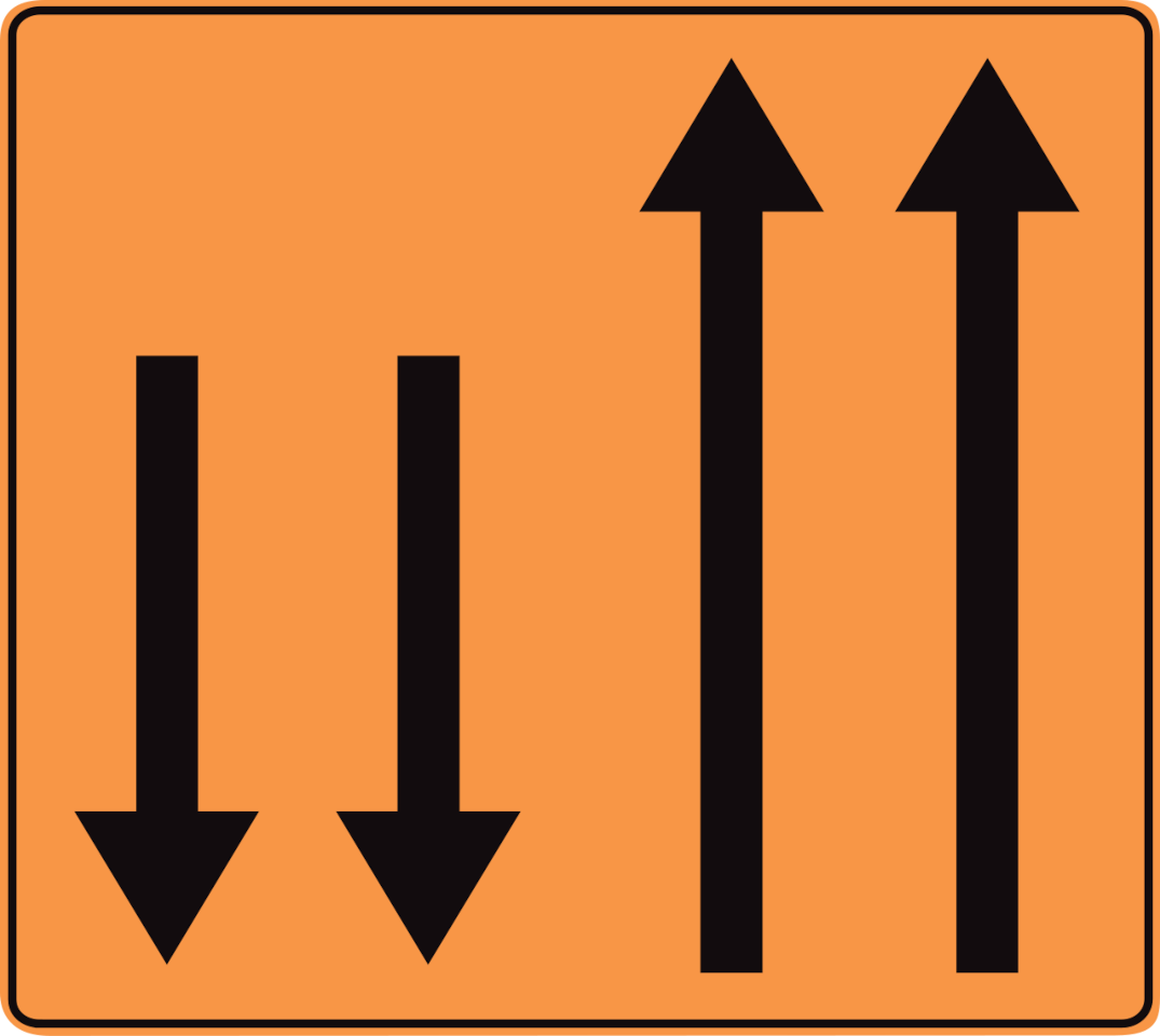
1. What does this traffic sign mean?
This traffic sign indicates the temporary lane arrangement. The arrows indicate how many lanes are available in each direction of travel. Follow the temporary road markings and remain in the lane assigned to your direction.

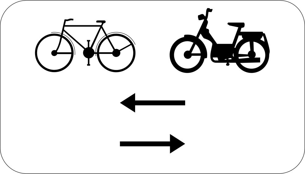
2. What kind of traffic sign is this?
The sign shown is a supplementary sign. It provides additional information that modifies or clarifies the meaning of the main traffic sign it accompanies.
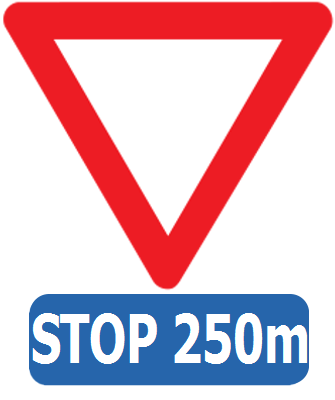
3. What does this traffic sign mean?
This traffic sign indicates that 250 metres ahead you have to stop and give way.

4. What does this traffic sign mean?
This traffic sign indicates that turning around (making a U-turn) is prohibited. A U-turn may not be made where the prohibition applies. Other movements may still be permitted unless another restriction applies.
English • Traffic sign C33 • U-turns are prohibited from the sign up to and including the next junction.
Français • Signal routier C33 • A partir du signal jusqu'au prochain carrefour inclus, interdiction de faire demi-tour.
Nederlands • Verkeersbord C33 • Vanaf het verkeersbord tot en met het volgend kruispunt, verbod te keren.
Sources
SVG source: Commons.wikimedia.org
Vascer • Public domain. Original SVG unmodified.
🔗 Wegcode.be • Artikel 68. Verbodsborden (NL)
🔗 Codedelaroute.be • Article 68. Signaux d'interdiction (FR)

5. What does this traffic sign mean?
This traffic sign indicates a recommended route for cyclists to a tourist destination. Follow the arrow to continue along the suggested cycling route.
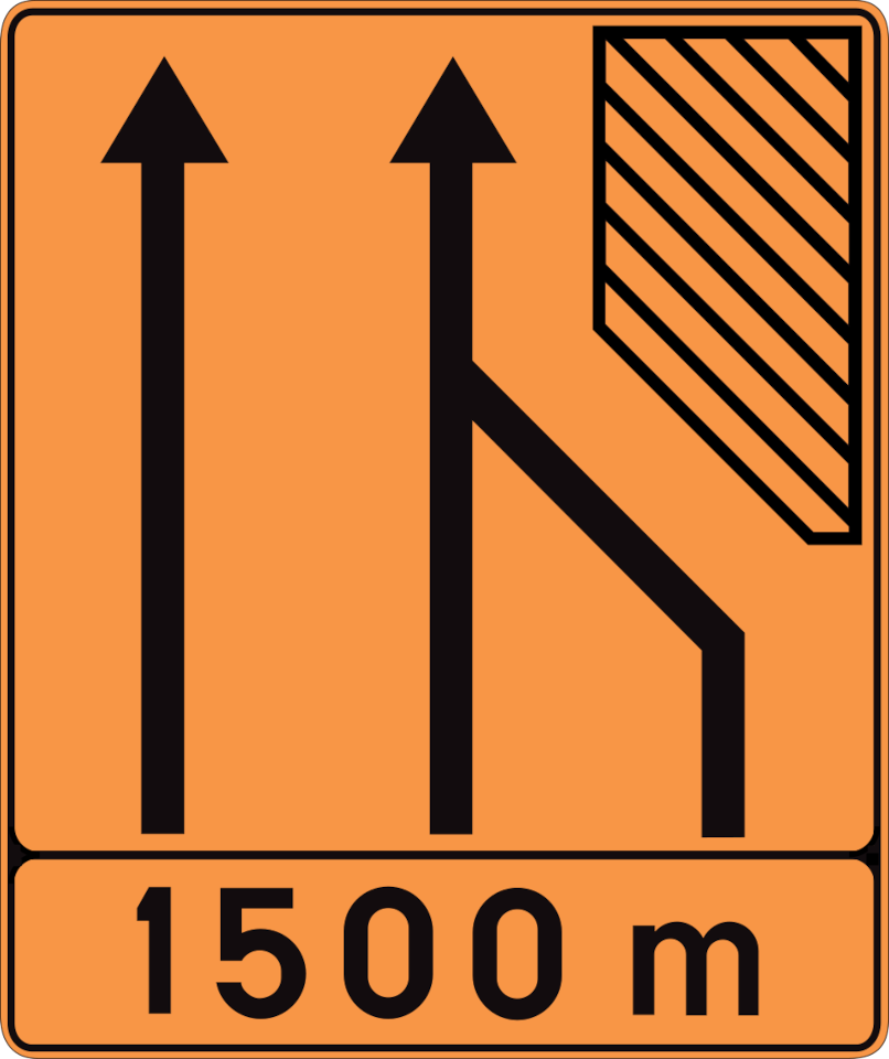
6. What does this traffic sign mean?
This traffic sign indicates that one traffic lane ends temporarily ahead. Drivers in the ending lane must merge into a continuing lane according to the temporary road layout, markings and applicable merging rules.
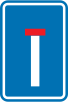
7. What does this traffic sign mean?
This traffic sign indicates a dead end street. The road has no through route for vehicles, although access to properties or other destinations along the road may still be possible.
English • Traffic sign F45 • No through road.
Français • Signal routier F45 • Voie sans issue.
Nederlands • Verkeersbord F45 • Doodlopende weg.
Sources
SVG source: Commons.wikimedia.org
Vascer • Public domain. Original SVG unmodified.
🔗 Wegcode.be • Artikel 71. Aanwijzingsborden (NL)
🔗 Codedelaroute.be • Article 71. Signaux d'indication (FR)

8. What does this traffic sign mean?
This traffic sign indicates half-monthly alternate-side parking. Parking alternates between the two sides of the road according to the indicated dates and applicable local rules. Follow the prescribed side and changeover times.
English • Traffic sign E11 • Half-monthly alternate parking throughout the built-up area.
Français • Signal routier E11 • Stationnement semi-mensuel dans toute l'agglomération.
Nederlands • Verkeersbord E11 • Halfmaandelijks parkeren in gans de bebouwde kom.
Sources
SVG source: Commons.wikimedia.org
Vascer • Public domain. Original SVG unmodified.
🔗 Wegcode.be • Artikel 70. Verkeersborden betreffende het stilstaan en het parkeren (NL)
🔗 Codedelaroute.be • Article 70. Signaux relatifs à l'arrêt et au stationnement (FR)

9. What does this traffic sign mean?
This traffic sign indicates that turning left is mandatory at the junction ahead. Traffic must turn left and may not continue straight ahead or turn right.
English • Traffic sign D1 • The direction indicated by the arrow must be followed. The road layout determines the position of the arrow. If a sign with a straight arrow is placed on an obstacle, it requires passing on the side indicated by the arrow.
Français • Signal routier D1 • Obligation de suivre la direction indiquée par la flèche. La disposition des lieux détermine la position de la flèche. Si le signal présentant une flèche non coudée, est placé sur un obstacle, il signifie obligation de passer du côté indiqué par la flèche.
Nederlands • Verkeersbord D1 • Verplichting de door de pijl aangeduide richting te volgen. De plaatsgesteldheid bepaalt de stand van de pijl. Wanneer het verkeersbord dat een niet-gebogen pijl voorstelt, op een hindernis geplaatst is, betekent het dat langs de door de pijl aangeduide richting moet voorbijgereden worden.
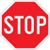
10. What does this traffic sign mean?
This traffic sign means stop and give way. You must come to a complete stop before entering the intersection and give way to traffic that has priority. Proceed only when it is safe.
English • Traffic sign B5 • Stop and give way.
Français • Signal routier B5 • Marquer l’arrêt et céder la priorité.
Nederlands • Verkeersbord B5 • Stoppen en voorrang verlenen.
Sources
SVG source: Commons.wikimedia.org
Vascer • Public domain. Original SVG unmodified.
🔗 Wegcode.be • Artikel 67. Verkeersborden betreffende de voorrang (NL)
🔗 Codedelaroute.be • Article 67. Signaux relatifs à la priorité (FR)

11. What does this traffic sign mean?
This traffic sign indicates a mandatory direction to the right. Traffic must proceed to the right at the sign and may not continue straight ahead or to the left.
English • Traffic sign D1 • The direction indicated by the arrow must be followed. The road layout determines the position of the arrow. If a sign with a straight arrow is placed on an obstacle, it requires passing on the side indicated by the arrow.
Français • Signal routier D1 • Obligation de suivre la direction indiquée par la flèche. La disposition des lieux détermine la position de la flèche. Si le signal présentant une flèche non coudée, est placé sur un obstacle, il signifie obligation de passer du côté indiqué par la flèche.
Nederlands • Verkeersbord D1 • Verplichting de door de pijl aangeduide richting te volgen. De plaatsgesteldheid bepaalt de stand van de pijl. Wanneer het verkeersbord dat een niet-gebogen pijl voorstelt, op een hindernis geplaatst is, betekent het dat langs de door de pijl aangeduide richting moet voorbijgereden worden.
Sources
SVG source: Commons.wikimedia.org
Gigillo83 • Public domain. Original SVG unmodified.
🔗 Wegcode.be • Artikel 69. Gebodsborden (NL)
🔗 Codedelaroute.be • Article 69. Signaux d'obligation (FR)
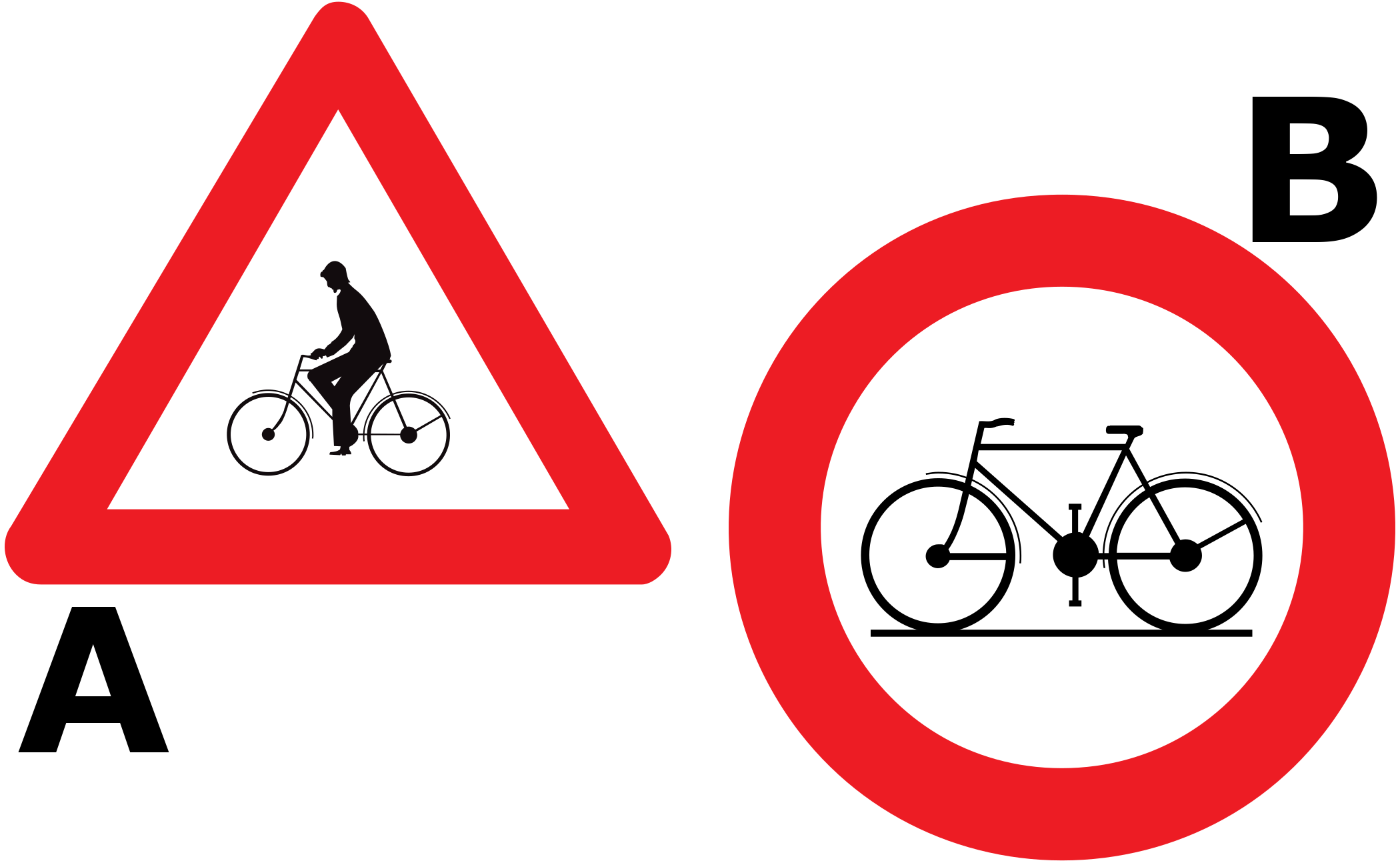
12. Which traffic sign warns of cyclists?
Traffic sign A warns of cyclists. Traffic sign B indicates a place where cyclists are prohibited.

13. What does this traffic sign mean?
This traffic sign indicates that vehicles wider than indicated are prohibited. A vehicle or vehicle combination whose overall width, including its load, exceeds the displayed limit may not continue beyond the sign.
English • Traffic sign C27 • No drivers of vehicles whose width, including the load, exceeds the indicated width.
Français • Signal routier C27 • Accès interdit aux conducteurs de véhicules ayant, chargement compris, une largeur supérieure à celle indiquée.
Nederlands • Verkeersbord C27 • Verboden toegang voor bestuurders van voertuigen waarvan de breedte, lading inbegrepen, groter is dan de aangeduide.
Sources
SVG source: Commons.wikimedia.org
Vascer • Public domain. Original SVG unmodified.
🔗 Wegcode.be • Artikel 68. Verbodsborden (NL)
🔗 Codedelaroute.be • Article 68. Signaux d'interdiction (FR)
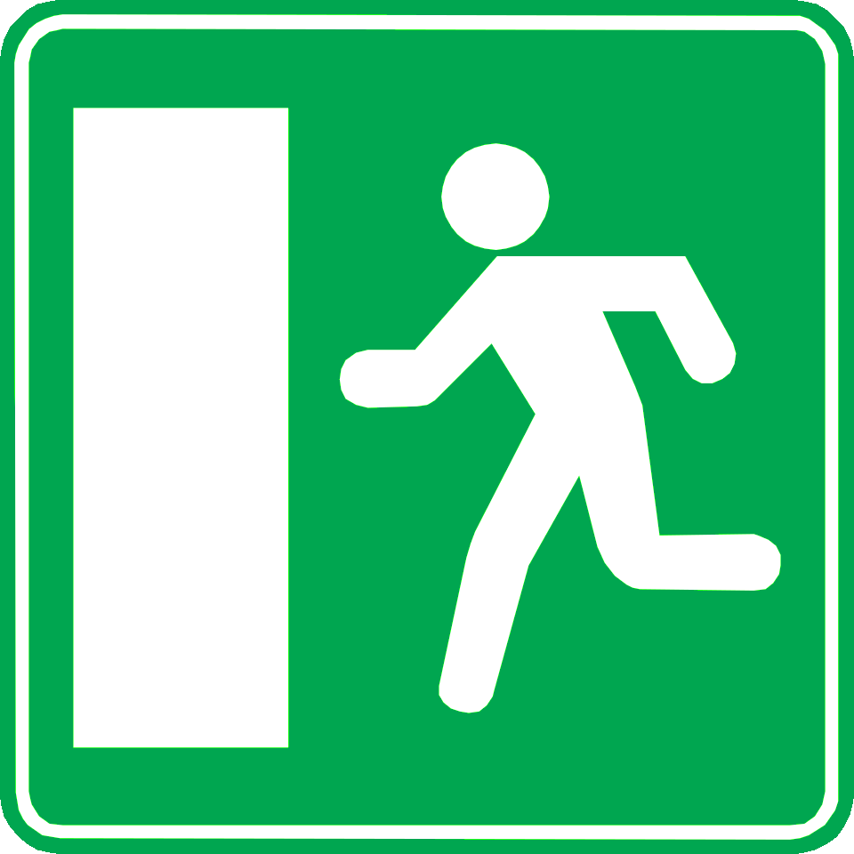
14. What does this traffic sign mean?
This traffic sign indicates an emergency exit. The exit provides an evacuation route to be used when leaving the area in an emergency.
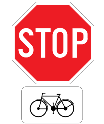
15. What does this traffic sign mean?
This traffic sign indicates that cyclists have to stop and give way.
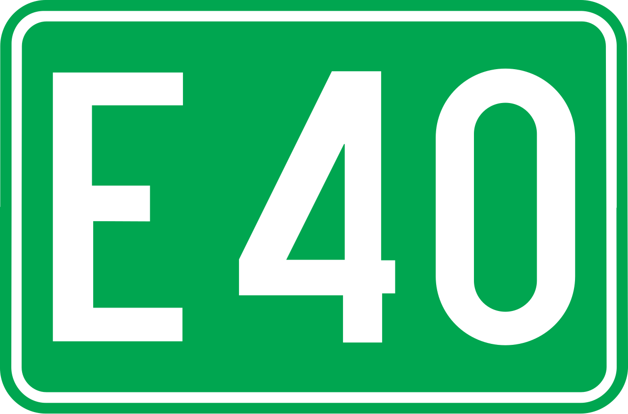
16. What does this traffic sign mean?
This traffic sign indicates an E-route number. E-routes form part of the international European road network and are identified by the letter E followed by a route number.

17. What does this traffic sign mean?
This traffic sign indicates a warning for a movable bridge. The bridge ahead can open, lift or move to allow water traffic to pass. Reduce speed and be prepared to stop when required by barriers, traffic lights or other signals.
English • Traffic sign A9 • Opening bridge.
Français • Signal routier A9 • Pont mobile.
Nederlands • Verkeersbord A9 • Beweegbare brug.
Sources
SVG source: Commons.wikimedia.org
Vascer • Public domain. Original SVG unmodified.
🔗 Wegcode.be • Artikel 66. Gevaarsborden (NL)
🔗 Codedelaroute.be • Article 66. Signaux de danger (FR)

18. What does this traffic sign mean?
This traffic sign indicates the direction and remaining distance to the named destination.

19. What does this traffic sign mean?
This traffic sign indicates a warning for a railway crossing without barriers. It alerts drivers to an upcoming level crossing where railway tracks cross the road and no barriers or gates are present to stop traffic. Drivers should slow down and look both ways for trains.
English • Traffic sign A43 • Level crossing without barriers.
Français • Signal routier A43 • Passage à niveau sans barrières.
Nederlands • Verkeersbord A43 • Overweg zonder slagbomen.
Sources
SVG source: Commons.wikimedia.org
Vascer • Public domain. Original SVG unmodified.
🔗 Wegcode.be • Artikel 66. Gevaarsborden (NL)
🔗 Codedelaroute.be • Article 66. Signaux de danger (FR)
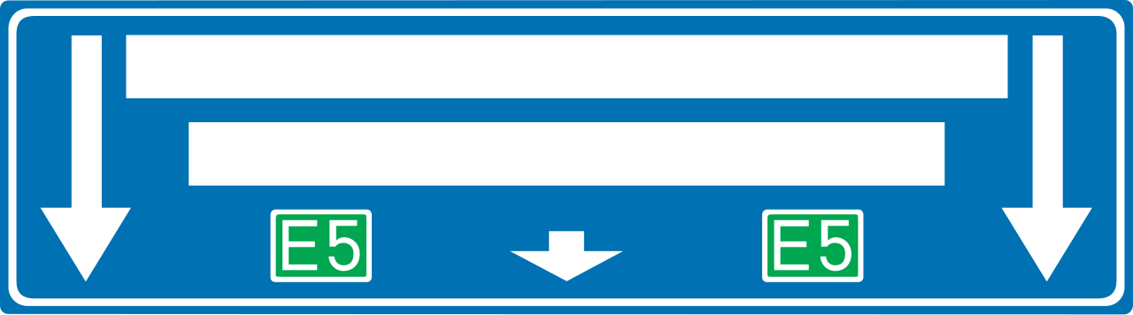
20. What does this traffic sign mean?
This traffic sign gives general information about road directions. The arrows, destinations and route information show which direction to follow.

21. What does this traffic sign mean?
This traffic sign indicates that you have priority at the next intersection. A side road joins from the right, and traffic entering from that side road must give way.
English • Traffic sign B15 • Priority of passage. The horizontal bar of the symbol may be modified to represent the road layout more clearly.
Français • Signal routier B15 • Priorité de passage. La barre horizontale du symbole peut être modifiée de façon à représenter plus clairement la disposition des lieux.
Nederlands • Verkeersbord B15 • Voorrang. De horizontale streep van het symbool mag worden gewijzigd om duidelijker plaatsgesteldheid weer te geven.

22. What does this traffic sign mean?
This traffic sign indicates a warning for low-flying aircraft. Aircraft may pass over the road at low altitude and can create sudden noise or visual distraction. Keep your attention on the road and maintain control of the vehicle.
English • Traffic sign A35 • Low-flying aircraft.
Français • Signal routier A35 • Survol d’avions à basse altitude.
Nederlands • Verkeersbord A35 • Overtocht van vliegtuigen op geringe hoogte.
Sources
SVG source: Commons.wikimedia.org
Vascer • Public domain. Original SVG unmodified.
🔗 Wegcode.be • Artikel 66. Gevaarsborden (NL)
🔗 Codedelaroute.be • Article 66. Signaux de danger (FR)
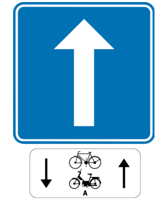
23. What does this traffic sign mean?
This traffic sign indicates a road with one-way traffic, except for cyclists and class A mopeds. The excepted road users may travel in the opposite direction where permitted by the sign.

24. What does this traffic sign mean?
This traffic sign indicates a warning for cyclists. Cyclists may be riding along or crossing the road ahead. Reduce speed, watch carefully for cyclists and maintain the passing distance required by the applicable local rules.
English • Traffic sign A25 • Crossing for bicycle and two-wheeled moped riders, or a place where those riders enter the carriageway from a cycle track.
Français • Signal routier A25 • Passage pour conducteurs de bicyclettes et de cyclomoteurs à deux roues, ou endroit où ces conducteurs débouchent d'une piste cyclable sur la chaussée.
Nederlands • Verkeersbord A25 • Oversteekplaats voor fietsers en bestuurders van tweewielige bromfietsen of plaats waar die bestuurders van een fietspad op de rijbaan komen.
Sources
SVG source: Commons.wikimedia.org
Vascer • Public domain. Original SVG unmodified.
🔗 Wegcode.be • Artikel 66. Gevaarsborden (NL)
🔗 Codedelaroute.be • Article 66. Signaux de danger (FR)

25. What does this traffic sign mean?
This traffic sign indicates a warning for a pedestrian crossing. A designated pedestrian crossing lies ahead. Reduce speed when necessary, watch carefully for pedestrians and be prepared to give way or stop according to the applicable local priority rules.
English • Traffic sign A21 • Pedestrian crossing.
Français • Signal routier A21 • Passage pour piétons.
Nederlands • Verkeersbord A21 • Oversteekplaats voor voetgangers.
Sources
SVG source: Commons.wikimedia.org
Vascer • Public domain. Original SVG unmodified.
🔗 Wegcode.be • Artikel 66. Gevaarsborden (NL)
🔗 Codedelaroute.be • Article 66. Signaux de danger (FR)
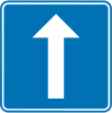
26. What does this traffic sign mean?
This traffic sign indicates a road with one-way traffic. Vehicular traffic may travel only in the permitted direction, subject to any exceptions indicated by traffic signs or local rules.
English • Traffic sign F19 • One-way public road.
Français • Signal routier F19 • Voie publique à sens unique.
Nederlands • Verkeersbord F19 • Openbare weg met eenrichtingsverkeer.
Sources
SVG source: Commons.wikimedia.org
Vascer • Public domain. Original SVG unmodified.
🔗 Wegcode.be • Artikel 71. Aanwijzingsborden (NL)
🔗 Codedelaroute.be • Article 71. Signaux d'indication (FR)

27. What does this traffic sign mean?
This traffic sign indicates the river or other watercourse being crossed. It is an information sign and does not impose a traffic rule.

28. What does this traffic sign mean?
This traffic sign indicates a bike box. A bike box, also called an advanced stop area, is a marked space at a signal-controlled junction where cyclists may position themselves ahead of other traffic when the applicable signal requires them to stop.
English • Traffic sign F14 • Advanced area for cyclists and two-wheeled moped riders.
Français • Signal routier F14 • Zone avancée pour cyclistes et conducteurs de cyclomoteurs à deux roues.
Nederlands • Verkeersbord F14 • Opstelvak voor fietsers en bestuurders van tweewielige bromfietsen.
Sources
SVG source: Commons.wikimedia.org
Vascer • Public domain. Original SVG unmodified.
🔗 Wegcode.be • Artikel 71. Aanwijzingsborden (NL)
🔗 Codedelaroute.be • Article 71. Signaux d'indication (FR)

29. What does this traffic sign mean?
This traffic sign indicates a warning for strong crosswinds. Side winds may suddenly affect vehicle stability and steering. Reduce speed, keep a firm but controlled grip on the steering wheel and take extra care with high-sided vehicles, motorcycles and trailers.
English • Traffic sign A37 • Crosswinds.
Français • Signal routier A37 • Vent latéral.
Nederlands • Verkeersbord A37 • Zijwind.
Sources
SVG source: Commons.wikimedia.org
Vascer • Public domain. Original SVG unmodified.
🔗 Wegcode.be • Artikel 66. Gevaarsborden (NL)
🔗 Codedelaroute.be • Article 66. Signaux de danger (FR)
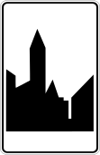
30. What does this traffic sign mean?
This traffic sign indicates the start of a built-up area. From this point, the traffic rules that apply to built-up areas take effect according to the applicable local regulations.
English • Traffic sign F1b • Beginning of a built-up area. This sign is placed on the right at every entrance to a built-up area; it may be repeated on the left.
Français • Signal routier F1b • Commencement d'une agglomération. Ce signal est placé à droite, à chaque accès d'une agglomération; il peut être répété à gauche.
Nederlands • Verkeersbord F1b • Begin van een bebouwde kom. Dit verkeersbord wordt rechts geplaatst op elke toegangsweg tot een bebouwde kom; het mag links herhaald worden.
Sources
SVG source: Commons.wikimedia.org
Vascer • Public domain. Original SVG unmodified.
🔗 Wegcode.be • Artikel 71. Aanwijzingsborden (NL)
🔗 Codedelaroute.be • Article 71. Signaux d'indication (FR)
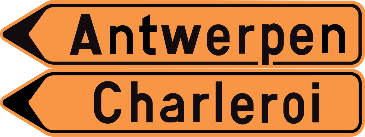
31. What does this traffic sign mean?
This traffic sign indicates a detour. The temporary route guides traffic around a road closure, roadworks or another disruption affecting the normal route.
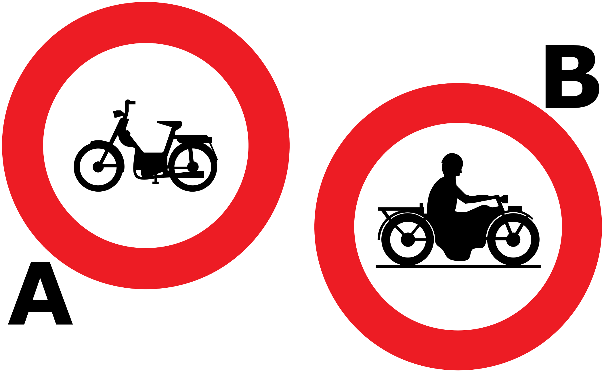
32. Which traffic sign indicates that mopeds are prohibited?
Traffic sign A indicates a place where mopeds are prohibited. Traffic sign B indicates a place where motorcycles are prohibited.
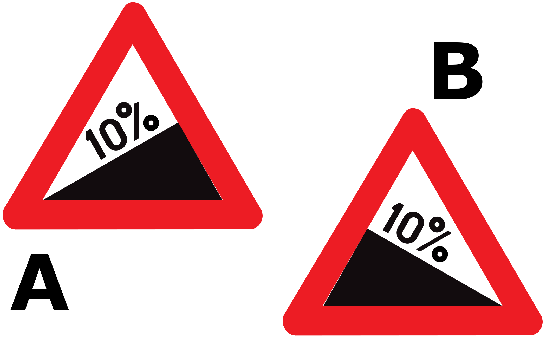
33. Which traffic sign warns of a steep descent?
Traffic sign A warns of a steep ascent. Traffic sign B warns of a steep descent.

34. What does this traffic sign mean?
This traffic sign indicates a warning for cattle. Cattle or other livestock may be crossing, walking along or standing near the road. Reduce speed, be prepared to stop and avoid sudden movements or unnecessary use of the horn that could startle the animals.
English • Traffic sign A29 • Cattle crossing.
Français • Signal routier A29 • Traversée de bétail.
Nederlands • Verkeersbord A29 • Doortocht van vee.
Sources
SVG source: Commons.wikimedia.org
Vascer • Public domain. Original SVG unmodified.
🔗 Wegcode.be • Artikel 66. Gevaarsborden (NL)
🔗 Codedelaroute.be • Article 66. Signaux de danger (FR)
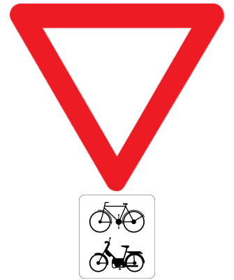
35. What does this traffic sign mean?
This traffic sign indicates that cyclists and mopeds have to give way.

36. What does this traffic sign mean?
This traffic sign means no entry. Drivers may not enter from the direction in which the sign is placed.
English • Traffic sign C1 • No entry for any driver or rider.
Français • Signal routier C1 • Sens interdit à tout conducteur.
Nederlands • Verkeersbord C1 • Verboden richting voor iedere bestuurder.
Sources
SVG source: Commons.wikimedia.org
Vascer • Public domain. Original SVG unmodified.
🔗 Wegcode.be • Artikel 68. Verbodsborden (NL)
🔗 Codedelaroute.be • Article 68. Signaux d'interdiction (FR)

37. What does this traffic sign mean?
This traffic sign indicates a warning for loose chippings. Loose stones or gravel may reduce tyre grip and can be thrown up by passing vehicles. Reduce speed, increase your following distance and avoid sudden braking, acceleration or steering movements.
English • Traffic sign A17 • Flying loose chippings.
Français • Signal routier A17 • Projection de gravillons.
Nederlands • Verkeersbord A17 • Kiezelprojectie.
Sources
SVG source: Commons.wikimedia.org
Vascer • Public domain. Original SVG unmodified.
🔗 Wegcode.be • Artikel 66. Gevaarsborden (NL)
🔗 Codedelaroute.be • Article 66. Signaux de danger (FR)

38. What does this traffic sign mean?
This traffic sign indicates that buses are prohibited. Buses covered by the sign may not enter or continue beyond it. Other road users may still be permitted unless another restriction applies.
English • Traffic sign C22 • No coach drivers.
Français • Signal routier C22 • Accès interdit aux conducteurs d'autocars.
Nederlands • Verkeersbord C22 • Verboden toegang voor bestuurders van autocars.
Sources
SVG source: Commons.wikimedia.org
Vascer • Public domain. Original SVG unmodified.
🔗 Wegcode.be • Artikel 68. Verbodsborden (NL)
🔗 Codedelaroute.be • Article 68. Signaux d'interdiction (FR)

39. What does this traffic sign mean?
This traffic sign indicates a warning for a steep ascent. A steep uphill gradient lies ahead and may cause heavy or low-powered vehicles to lose speed. Select a suitable gear, maintain a safe following distance and be prepared for slower traffic.
English • Traffic sign A5 • Steep ascent.
Français • Signal routier A5 • Montée à forte inclinaison.
Nederlands • Verkeersbord A5 • Steile helling.
Sources
SVG source: Commons.wikimedia.org
Vascer • Public domain. Original SVG unmodified.
🔗 Wegcode.be • Artikel 66. Gevaarsborden (NL)
🔗 Codedelaroute.be • Article 66. Signaux de danger (FR)
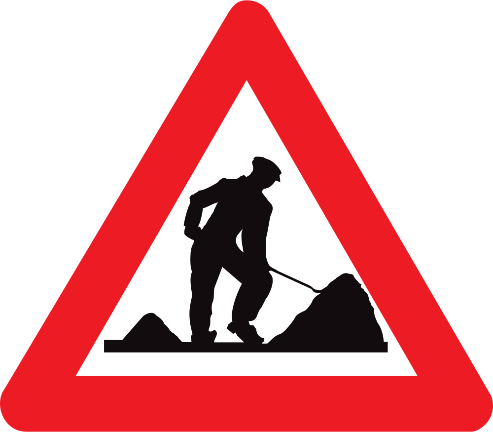
40. What kind of traffic sign is this?
The sign shown is a warning sign, identified here by its triangular shape and red border.
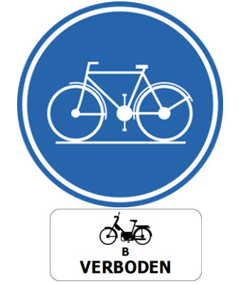
41. What does this traffic sign mean?
This traffic sign indicates the start of a path for cyclists. Class B mopeds are prohibited from using the path.
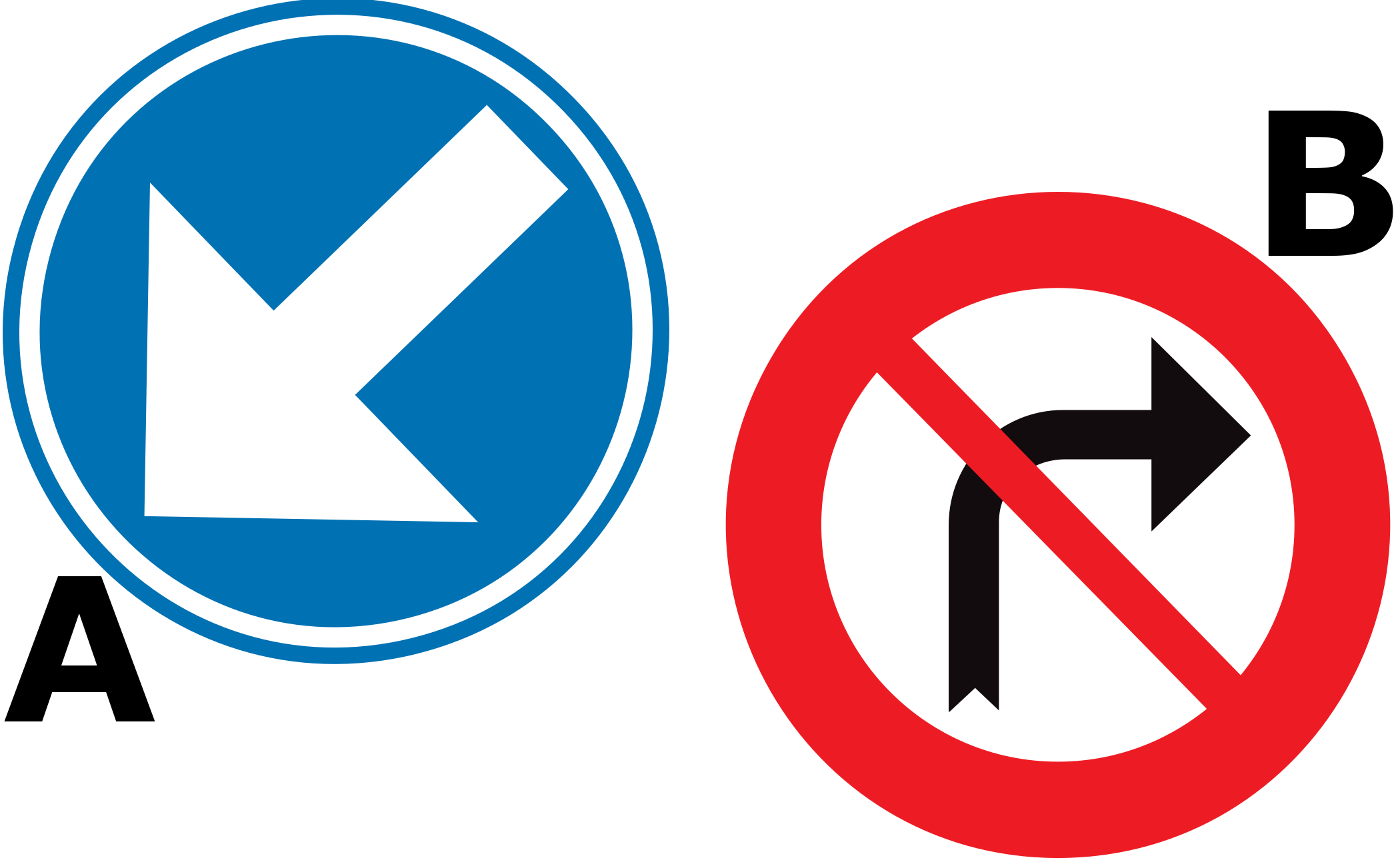
42. Which traffic sign is a prohibitory sign?
Traffic sign A is a mandatory sign, identified here by its round shape and blue background. Traffic sign B is a prohibitory sign, identified here by its round shape and red border.
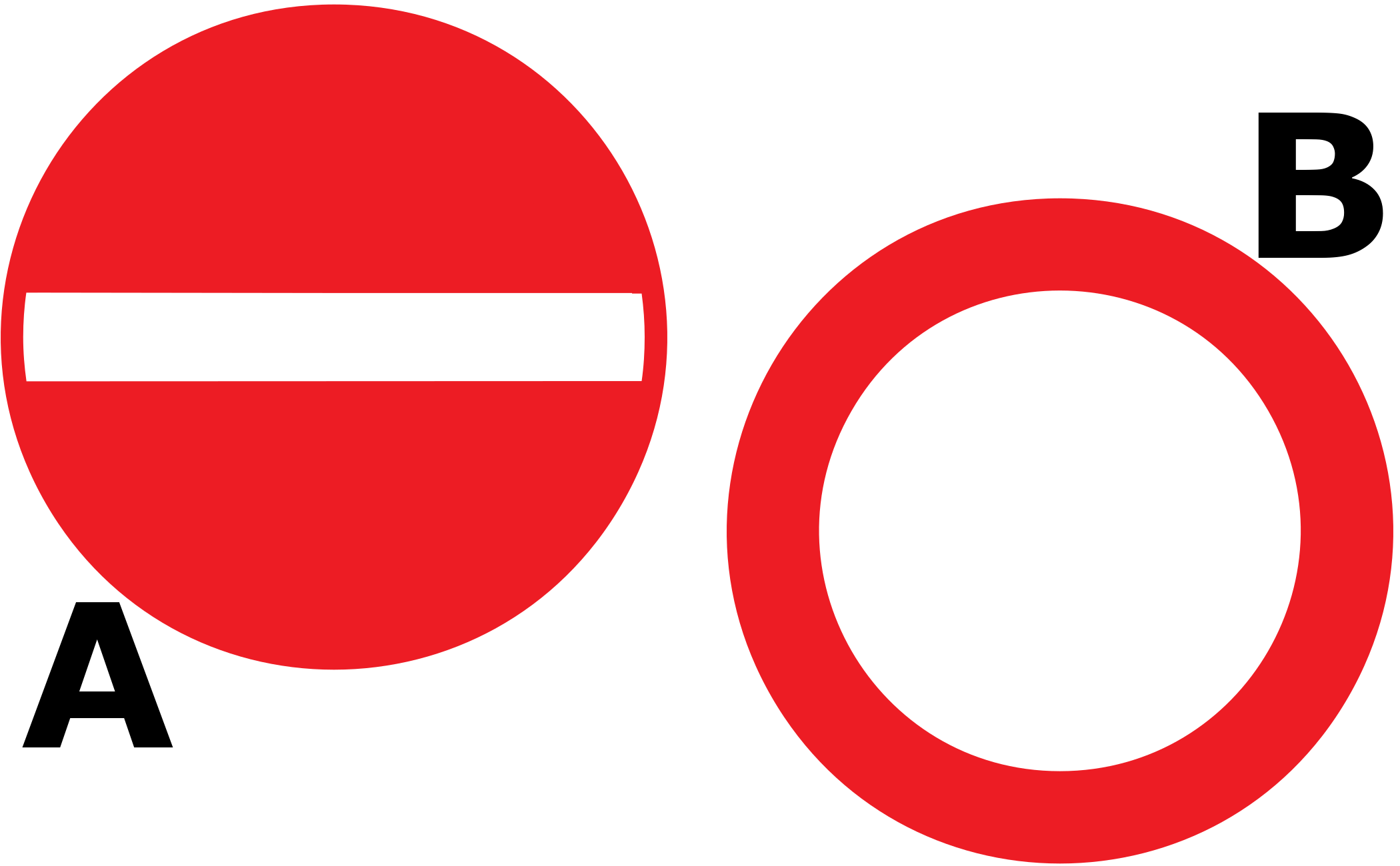
43. Which traffic sign prohibits access in both directions?
Traffic sign A means no entry from the direction in which the sign is placed. Traffic sign B indicates that access is prohibited in both directions.

44. What does this traffic sign mean?
This traffic sign indicates a warning for a road narrowing on the right. The available road width decreases from the right side ahead. Reduce speed, follow the lane markings and maintain sufficient clearance from other traffic and the road edge.
English • Traffic sign A7c • Road narrows.
Français • Signal routier A7c • Rétrécissement de la chaussée.
Nederlands • Verkeersbord A7c • Rijbaanversmalling.
Sources
SVG source: Commons.wikimedia.org
Vascer • Public domain. Original SVG unmodified.
🔗 Wegcode.be • Artikel 66. Gevaarsborden (NL)
🔗 Codedelaroute.be • Article 66. Signaux de danger (FR)
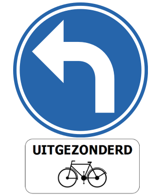
45. What does this traffic sign mean?
This traffic sign indicates that all drivers must turn left, except cyclists.

46. What does this traffic sign mean?
This traffic sign indicates a warning for a curve to the right. A right-hand bend lies ahead. Reduce speed before entering the curve, maintain your lane position and use smooth steering.
English • Traffic sign A1b • Dangerous bend. Right-hand bend.
Français • Signal routier A1b • Virage dangereux. Virage à droite.
Nederlands • Verkeersbord A1b • Gevaarlijke bocht. Bocht naar rechts.
Sources
SVG source: Commons.wikimedia.org
Vascer • Public domain. Original SVG unmodified.
🔗 Wegcode.be • Artikel 66. Gevaarsborden (NL)
🔗 Codedelaroute.be • Article 66. Signaux de danger (FR)
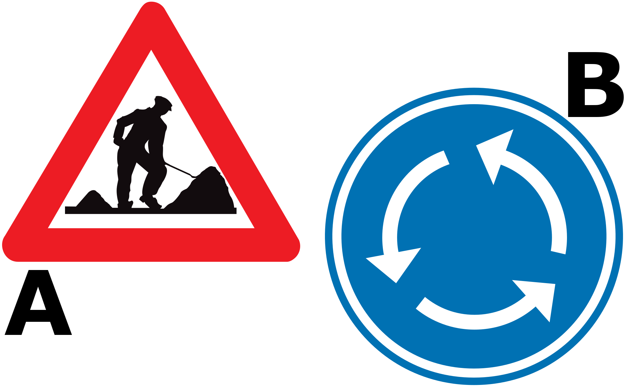
47. Which traffic sign is a mandatory sign?
Traffic sign A is a warning sign, identified here by its triangular shape and red border. Traffic sign B is a mandatory sign, identified here by its round shape and blue background.

48. What does this traffic sign mean?
This traffic sign indicates a warning for trams. Tram tracks cross or run along the road ahead, and trams may enter the traffic path. Reduce speed, watch carefully for approaching trams and follow the applicable traffic signals, priority signs and local rules.
English • Traffic sign A49 • Public road crossed by one or more railway tracks laid in the carriageway.
Français • Signal routier A49 • Croisement de la voie publique par une ou plusieurs voies ferrées établies sur la chaussée.
Nederlands • Verkeersbord A49 • Kruising van een openbare weg door een of meer in de rijbaan aangelegde sporen.
Sources
SVG source: Commons.wikimedia.org
Vascer • Public domain. Original SVG unmodified.
🔗 Wegcode.be • Artikel 66. Gevaarsborden (NL)
🔗 Codedelaroute.be • Article 66. Signaux de danger (FR)

49. What does this traffic sign mean?
This traffic sign indicates that driving straight ahead is mandatory. Traffic must continue straight ahead and may not turn left or right at the location to which the sign applies.
English • Traffic sign D1 • The direction indicated by the arrow must be followed. The road layout determines the position of the arrow. If a sign with a straight arrow is placed on an obstacle, it requires passing on the side indicated by the arrow.
Français • Signal routier D1 • Obligation de suivre la direction indiquée par la flèche. La disposition des lieux détermine la position de la flèche. Si le signal présentant une flèche non coudée, est placé sur un obstacle, il signifie obligation de passer du côté indiqué par la flèche.
Nederlands • Verkeersbord D1 • Verplichting de door de pijl aangeduide richting te volgen. De plaatsgesteldheid bepaalt de stand van de pijl. Wanneer het verkeersbord dat een niet-gebogen pijl voorstelt, op een hindernis geplaatst is, betekent het dat langs de door de pijl aangeduide richting moet voorbijgereden worden.
Sources
SVG source: Commons.wikimedia.org
Vascer • Public domain. Original SVG unmodified.
🔗 Wegcode.be • Artikel 69. Gebodsborden (NL)
🔗 Codedelaroute.be • Article 69. Signaux d'obligation (FR)
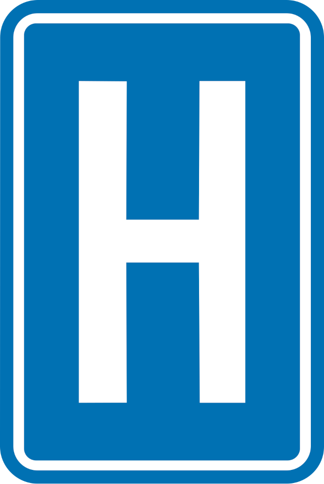
50. What does this traffic sign mean?
This traffic sign indicates a hospital or medical facility. Follow any accompanying direction or distance information to reach it.