

Traffic signsSwitzerland
 Traffic rules
 Switzerland
51. Junction layout
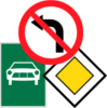
A junction layout is a schematic representation of the layout of an upcoming intersection or junction. It can show how roads branch, cross or continue and may help drivers understand which direction to follow before reaching the intersection.
Crossroad-shape diagrams are commonly used on advance direction signs. Depending on the country's sign system, the diagram may also distinguish the main road, side roads, route numbers or destinations.
Wikimedia.org • Marc Mongenet • CC BY-SA
What can a junction-layout diagram tell you in Switzerland?
The main-road-direction panel shows a main road changing direction at the junction, using a broad line for the main road. With a stop or give-way sign, it requires yielding to vehicles travelling on or leaving that main road. A destination diagram serves a different purpose.
🔗 fedlex.admin.ch • Switzerland: OSR article 65(1), panel 5.09; OCR article 15
🔗 fedlex.admin.ch • Switzerland: Traffic Rules Ordinance, state 1 October 2026
🔗 fedlex.admin.ch • Switzerland: Road Traffic Act, state 1 July 2026
Does a junction-layout picture itself give priority at a junction in Switzerland?
A supplementary diagram helps identify the course of the priority route, but its meaning depends on the accompanying priority sign and local rules. It does not cancel traffic signals or obligations to drive safely.
🔗 fedlex.admin.ch • Switzerland: OSR article 65(1), panel 5.09; OCR article 15
🔗 fedlex.admin.ch • Switzerland: Traffic Rules Ordinance, state 1 October 2026
🔗 fedlex.admin.ch • Switzerland: Road Traffic Act, state 1 July 2026
Should the drawing be treated as an exact map of the junction in Switzerland?
No. A schematic diagram can omit islands, turning lanes, cycle facilities and minor road details. Slow down, check the actual road layout, and follow lane arrows, signs and signals when you reach the intersection.
🔗 fedlex.admin.ch • Switzerland: OSR article 65(1), panel 5.09; OCR article 15
🔗 fedlex.admin.ch • Switzerland: Traffic Rules Ordinance, state 1 October 2026
🔗 fedlex.admin.ch • Switzerland: Road Traffic Act, state 1 July 2026

52. Driving licence
A driving licence is an official document authorising a person to drive one or more specified categories of motor vehicle. It may contain conditions, restrictions, category codes and expiry dates that determine which vehicles the holder may drive.
Drivers must hold a licence that is valid for the vehicle category and jurisdiction concerned. A licence may be provisional, full, restricted, suspended or withdrawn, and additional qualifications may be required for professional driving.
Wikimedia.org • Bundesamt für Strassen • CC0
Which driving-licence entitlement is needed for an ordinary car in Switzerland?
In Switzerland, an ordinary passenger car generally falls under category B, subject to its authorised mass and other limits. A different entitlement may be needed for motorcycles, heavy vehicles, trailers or passenger transport.
🔗 ch.ch • Swiss Government ch.ch — cars category B and licensing pathway
Can a visitor drive in Switzerland using a driving licence issued abroad?
Recognition depends on where the licence was issued, the category, its validity and the visitor’s status or length of stay. Check the local licensing authority before driving; temporary residence or employment can change the conditions.
Does an International Driving Permit replace the original licence in Switzerland?
No. An International Driving Permit (IDP) is not a standalone driving licence. Where it is recognised or required, carry the underlying valid licence as well and check the accepted convention or translation requirements. An IDP cannot override a suspension, unsuitable vehicle category or local minimum age.
🔗 ch.ch • Swiss Government ch.ch — IDP only valid with the national licence
53. Location marker
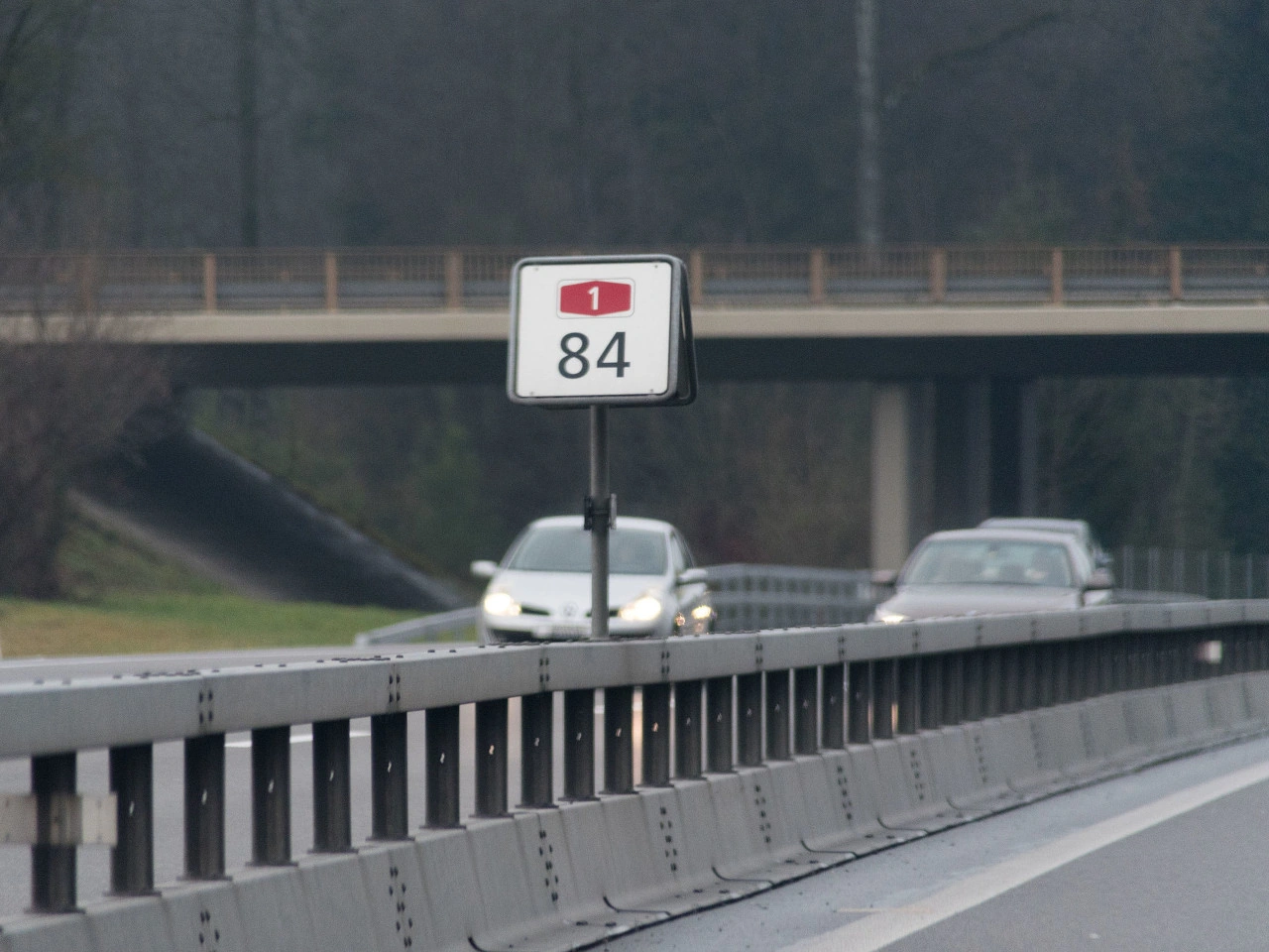
A location marker is a roadside reference showing a measured position along a road. It normally identifies a kilometre, mile or smaller interval measured from an established starting point on that route.
Kilometre and hectometre markers help road users, emergency services, road authorities and maintenance crews identify an exact section of road. They do not impose a speed limit, priority rule or access restriction.
Wikimedia.org • CC BY-SA
What does a roadside location marker tell you in Switzerland?
Swiss signs include kilometre and hectometre plates for motorways, semi-motorways and specified national roads outside built-up areas. Read the plate together with the road and travel direction when describing your position; the number is not a speed limit.
🔗 fedlex.admin.ch • Switzerland: OSR89a(5),4.72-4.73; OCR18-19; practical location-reporting advice
🔗 fedlex.admin.ch • Switzerland: Traffic Rules Ordinance, state1October2026
🔗 fedlex.admin.ch • Switzerland: Road Traffic Act, state1July2026
How can a location marker help in an emergency in Switzerland?
If you can see a marker safely, give the emergency operator the route number or road name, travel direction and marker reading. Additional landmarks, exits and GPS position can help. Do not leave a safe place or enter traffic to read a post.
🔗 fedlex.admin.ch • Switzerland: OSR89a(5),4.72-4.73; OCR18-19; practical location-reporting advice
🔗 fedlex.admin.ch • Switzerland: Traffic Rules Ordinance, state1October2026
🔗 fedlex.admin.ch • Switzerland: Road Traffic Act, state1July2026
Does a location marker set a speed limit or permit stopping in Switzerland?
No. A location marker is for orientation and road management; it does not itself set a speed limit, change priority or permit parking. Follow the actual traffic signs and stop only where the law and safety allow.
🔗 fedlex.admin.ch • Switzerland: OSR89a(5),4.72-4.73; OCR18-19; practical location-reporting advice
🔗 fedlex.admin.ch • Switzerland: Traffic Rules Ordinance, state1October2026
🔗 fedlex.admin.ch • Switzerland: Road Traffic Act, state1July2026
54. Road number
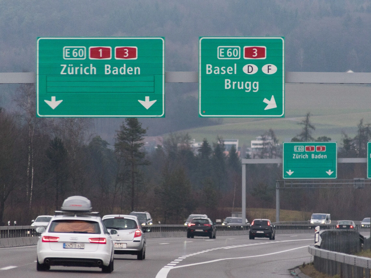
A road number is a number or combination of letters and numbers used to identify a particular road or route within a road network. Road numbers help drivers follow routes, distinguish between different types of roads and navigate between cities, regions and countries.
Road numbers are commonly displayed on route markers and direction signs. Their format, colour and prefixes vary between countries and may indicate whether a route is a motorway, national road, regional road or international route.
Wikimedia.org • Gestrandete 55-cm-Geschirrspülmaschine • CC BY-SA
How are road or route numbers identified in Switzerland?
Swiss number panels distinguish European E-routes, motorways and semi-motorways, and principal roads. The motorway and semi-motorway panel has a white number on red; the principal-road panel has a white number on blue. Read the panel with the destination and road-category signs.
🔗 fedlex.admin.ch • Switzerland: OSR56,4.56-4.59; LCR27,32
🔗 fedlex.admin.ch • Switzerland: Traffic Rules Ordinance, state1October2026
🔗 fedlex.admin.ch • Switzerland: Road Traffic Act, state1July2026
Does a route number by itself establish a speed limit in Switzerland?
No. A route number is an identification and navigation reference. Legal speed limits and other restrictions come from the applicable road category, vehicle rules and regulatory signs; the same route number may include sections with different limits.
🔗 fedlex.admin.ch • Switzerland: OSR56,4.56-4.59; LCR27,32
🔗 fedlex.admin.ch • Switzerland: Traffic Rules Ordinance, state1October2026
🔗 fedlex.admin.ch • Switzerland: Road Traffic Act, state1July2026
What should you check when following a numbered route in Switzerland?
Check the route number, destination, direction and junction or exit signs. If the route shares the road with another number or continues onto a different road class, follow the signs rather than relying solely on a navigation app.
🔗 fedlex.admin.ch • Switzerland: OSR56,4.56-4.59; LCR27,32
🔗 fedlex.admin.ch • Switzerland: Traffic Rules Ordinance, state1October2026
🔗 fedlex.admin.ch • Switzerland: Road Traffic Act, state1July2026
55. Countdown markers
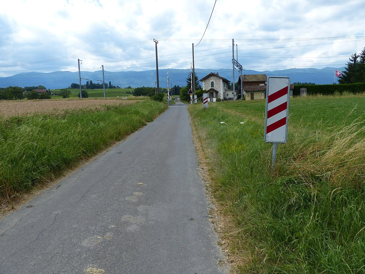
Countdown markers are a sequence of roadside signs that indicate that a particular point, such as a motorway exit, junction or railway crossing, is getting closer. They commonly use a decreasing number of bars or other symbols so drivers can judge their progress toward the upcoming location.
The markers are normally positioned at successively shorter distances from the point ahead. Their design, spacing and meaning vary between countries, so drivers should not assume that each bar always represents the same distance.
Wikimedia.org • Marc Mongenet • CC BY-SA
What do countdown or exit-approach markers mean in Switzerland?
Swiss motorway junction guidance includes an advance announcement, a nearer direction sign, a sign at the start of the deceleration lane and an exit sign at the split. Use this sequence and the displayed exit information to prepare your lane choice.
🔗 fedlex.admin.ch • Switzerland: OSR86(2),89a; OCR36
🔗 fedlex.admin.ch • Switzerland: Traffic Rules Ordinance, state1October2026
🔗 fedlex.admin.ch • Switzerland: Road Traffic Act, state1July2026
Does each countdown bar always represent the same distance in Switzerland?
Read the particular Swiss sign and distance rather than applying a foreign bar-count rule. The standard junction sequence places the advance announcement 1000 m before the deceleration lane and the next advance direction sign 500 m before it; these distances refer to the start of that lane.
🔗 fedlex.admin.ch • Switzerland: OSR86(2),89a; OCR36
🔗 fedlex.admin.ch • Switzerland: Traffic Rules Ordinance, state1October2026
🔗 fedlex.admin.ch • Switzerland: Road Traffic Act, state1July2026
What should you do if you are too late to take a motorway exit in Switzerland?
Continue safely to the next lawful exit or junction. Do not stop, reverse, make a U-turn or cross the median to reach a missed exit. Plan lane changes early and follow any lane-control signals.
🔗 fedlex.admin.ch • Switzerland: OSR86(2),89a; OCR36
🔗 fedlex.admin.ch • Switzerland: Traffic Rules Ordinance, state1October2026
🔗 fedlex.admin.ch • Switzerland: Road Traffic Act, state1July2026
56. Traffic mirror
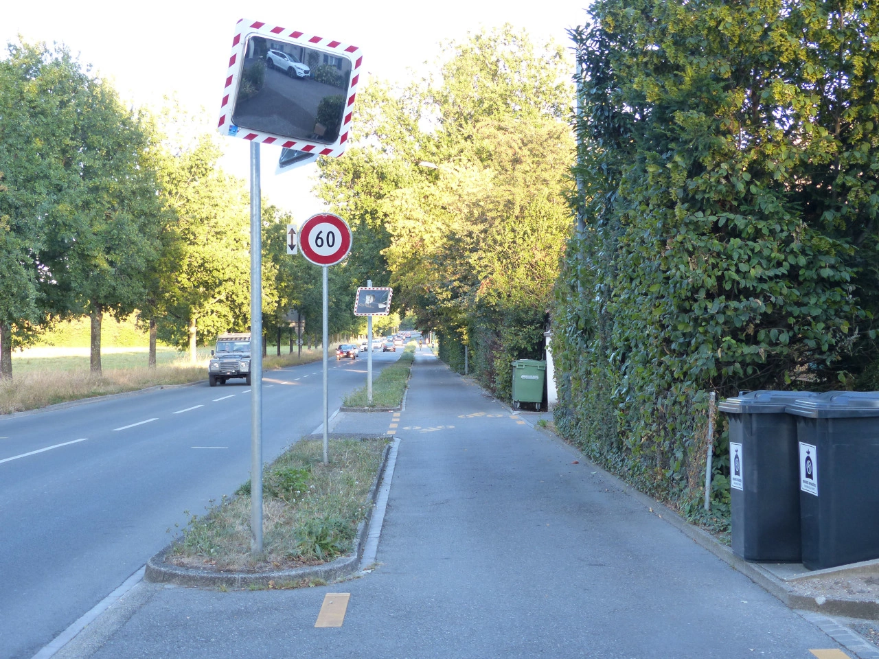
A traffic mirror is a convex mirror installed near an intersection, driveway, bend or other location with restricted visibility. Its curved surface provides a wider view of approaching road users than an ordinary flat mirror.
A traffic mirror is only a visibility aid. It may distort distance, speed and direction and may be affected by darkness, weather, dirt or damage. Drivers must continue to observe the road directly, obey all priority rules and proceed only when it is safe.
Wikimedia.org • Marc Mongenet • CC BY-SA
What is a traffic mirror?
A traffic mirror is a roadside visibility aid that can help users see around a blind corner or obstruction. It gives an indirect view, which may be restricted or distorted; it does not replace checking whether it is safe to proceed.
🔗 monmouthshire.gov.uk • Monmouthshire Council, roadside visibility mirrors
🔗 devon.gov.uk • Devon County Council, mirrors on the highway
Does a traffic mirror show an exact image?
No. The reflected image can be distorted, and glare, bad weather or dirt can restrict the view. Judging an approaching vehicle’s speed from a mirror can be difficult. Do not rely on the mirror alone.
🔗 monmouthshire.gov.uk • Monmouthshire Council, roadside visibility mirrors
🔗 devon.gov.uk • Devon County Council, mirrors on the highway
Does seeing an empty mirror mean the road is clear?
No. Another road user may be outside the reflected area, hidden by glare or too small to notice. Always check the road directly before proceeding.
🔗 monmouthshire.gov.uk • Monmouthshire Council, roadside visibility mirrors
🔗 devon.gov.uk • Devon County Council, mirrors on the highway
57. Emergency telephone
An emergency telephone is a dedicated roadside or tunnel telephone that connects road users directly with an emergency, traffic-control or roadside-assistance centre. Emergency telephones are commonly installed in tunnels, along motorways or at other locations where quickly reporting an accident, breakdown or fire is important. They can provide operators with useful information about the caller’s location and may remain available where mobile-phone reception is poor.
Wikimedia.org • Marc Mongenet • CC BY-SA
What is an emergency telephone?
An emergency telephone is a dedicated telephone used to contact emergency services, a traffic-control centre or roadside assistance from the road.
🔗 gov.uk • Great Britain Highway Code, Rules 275–279; national guidance example
🔗 gov.uk • Great Britain Highway Code, Rules 270–274; national guidance example
Where are emergency telephones commonly found?
They are commonly installed in road tunnels, motorway emergency areas and other locations where rapid assistance may be needed.
🔗 gov.uk • Great Britain Highway Code, Rules 275–279; national guidance example
🔗 gov.uk • Great Britain Highway Code, Rules 270–274; national guidance example
When should you use an emergency telephone?
Use an emergency telephone to report situations such as a breakdown, accident, fire or other serious road emergency when assistance is required.
🔗 gov.uk • Great Britain Highway Code, Rules 275–279; national guidance example
🔗 gov.uk • Great Britain Highway Code, Rules 270–274; national guidance example
58. International border
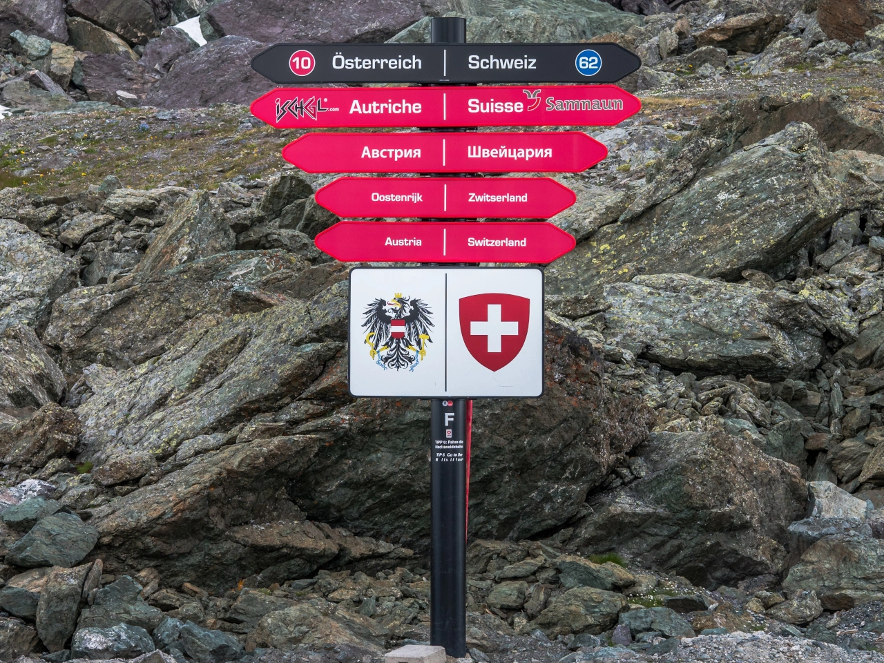
An international border is the legal boundary between two countries. A border sign may identify the country being entered and remind drivers that different traffic laws, speed limits, road signs, vehicle requirements and document rules may apply.
The border sign itself does not normally require drivers to stop. Passport, immigration or customs controls may take place at a checkpoint, but some international borders can be crossed without routine controls under regional agreements.
Wikimedia.org • Basotxerri • CC BY-SA
Can you cross into Switzerland without thinking about customs?
No. Switzerland belongs to the Schengen area, but you may still have customs declaration obligations when bringing goods into Switzerland. The absence of routine passport checks is not a customs exemption.
59. Pedestrian underpass
A pedestrian underpass is a passage that allows pedestrians to travel beneath a road, railway or other obstacle without crossing the traffic route at the same level. It is a form of grade-separated pedestrian crossing.
Pedestrian underpasses may be reached by stairs, ramps or lifts and can form part of a wider footpath or pedestrian network. Cyclists and other users may use the underpass only when the design, signs and local regulations permit them to do so.

Wikimedia.org • Marc Mongenet • CC BY-SA
What is a pedestrian underpass?
A pedestrian underpass is a passage that allows pedestrians to cross beneath a road, railway or other obstacle without entering the traffic route above.
Why are pedestrian underpasses used?
They separate pedestrians from motor vehicles, trains or other traffic, reducing direct conflicts at busy or high-speed crossings.
Does an underpass give pedestrians priority over traffic above?
The underpass physically separates the movements, so pedestrians do not directly cross the traffic route above. Priority rules still apply wherever the pedestrian route later crosses another roadway or cycle facility.
60. Cycling route
A cycling route is a planned or signposted route intended to guide cyclists between places or through a particular area. It may follow cycle paths, quiet streets, shared roads, greenways or other routes considered suitable for cycling.
A cycling route does not necessarily give cyclists exclusive use of the road or path and should not be confused with a cycle path or cycle lane. The traffic rules, priority rules and permitted road users depend on the individual roads and paths that form the route and on the local signs and regulations.
Wikimedia.org • Kaitu • CC BY-SA
How can you recognise a cycling route?
Cycling routes are commonly indicated by direction signs, bicycle symbols, route numbers, colours or destination markers. The design of the signs and route-numbering system varies between countries and regions.
Do cyclists have priority on a cycling route?
Not automatically. Being on a designated cycling route does not normally change the priority rules. Cyclists must continue to obey traffic lights, give-way and stop signs, crossing rules and other applicable traffic regulations.
What should you do when a cycling-route sign conflicts with a traffic sign?
Always follow the official traffic signs, signals and road markings. A route marker provides navigation and does not override a prohibition, mandatory direction, road closure or other traffic regulation.
61. End of restriction
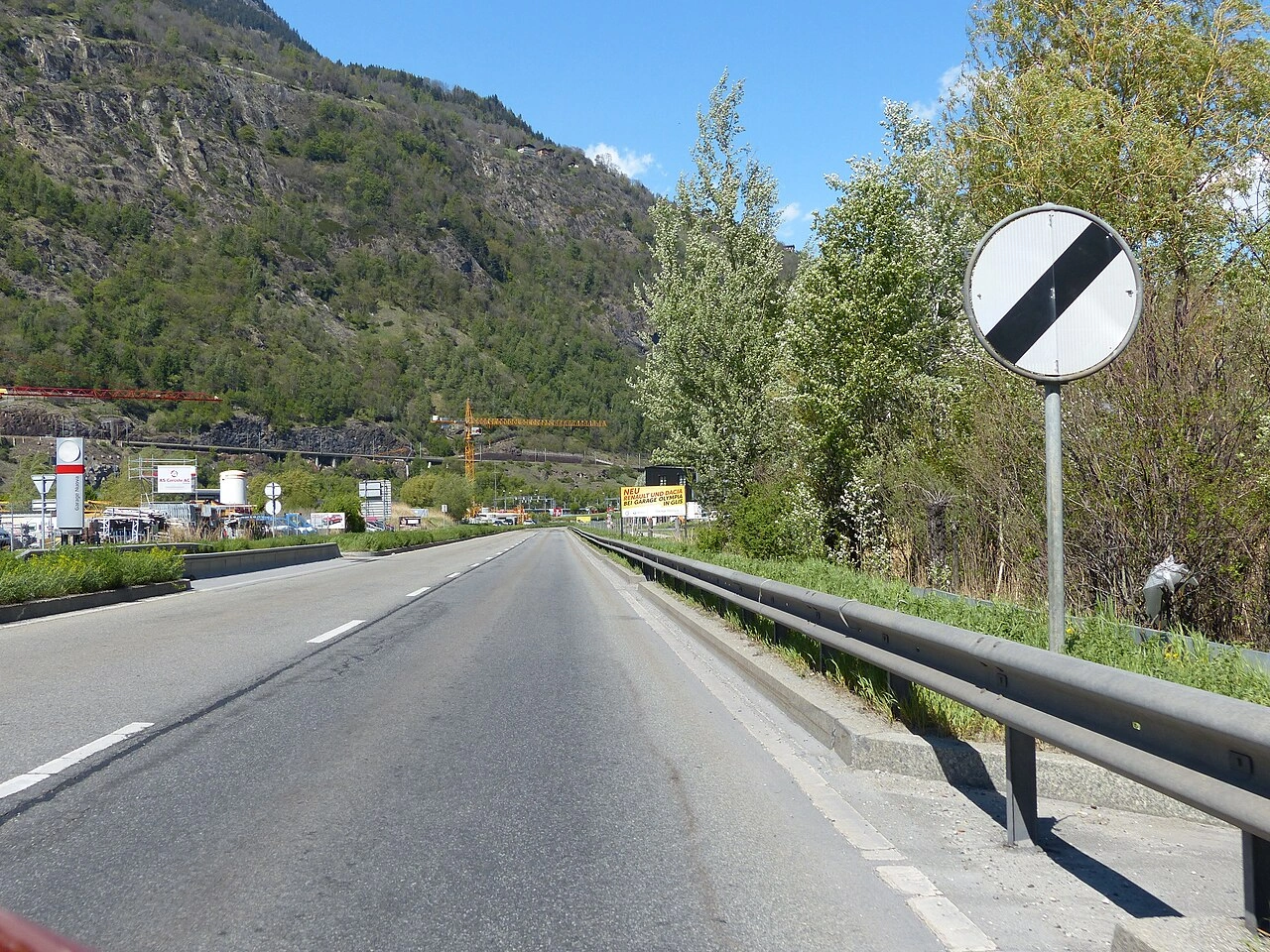
End of restriction means the end of one or more local traffic restrictions that applied to vehicles on the preceding section of road. It may be indicated by a specific end-of-restriction sign, by the crossed-out version of an earlier restriction sign or by another sign that establishes a new rule.
After a de-restriction sign, drivers must follow the normal traffic rules and any new restrictions that apply. It does not mean that there are no speed limits or traffic rules beyond the sign.
Wikimedia.org • Marc Mongenet • CC BY-SA
What does de-restriction mean?
De-restriction means that a previously imposed local traffic restriction has ended.
How is the end of a restriction indicated?
Depending on the country, it may be indicated by an end-of-restriction sign, a crossed-out restriction sign or another sign introducing a new rule.
 End of local restrictions.
62. Parking
Parking means leaving a vehicle stationary at a place for a period of time rather than stopping only briefly because of traffic conditions or another immediate necessity. Many countries distinguish parking from a short stop made to pick up or drop off passengers or to load or unload goods, although the exact legal definition varies.
Parking may be permitted, restricted, reserved, time-limited or prohibited by traffic signs, road markings, parking zones and local regulations. Drivers must park without creating a danger or unnecessary obstruction and must comply with any conditions concerning payment, permits, vehicle categories or maximum parking duration.
Wikimedia.org • Marc Mongenet • CC BY-SA
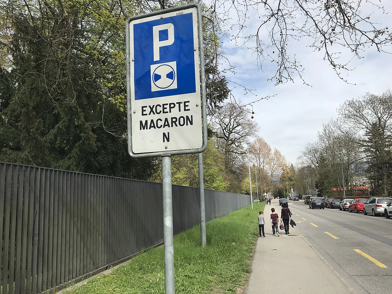
How do Swiss blue-zone parking times work?
Where a blue-zone parking disc is required, the driver sets it to the half-hour mark following arrival. The usual permitted period is not a universal 60 minutes from actual arrival; the official disc table includes special rules at midday and overnight.
🔗 police.be.ch • Bern Cantonal Police, blue-zone parking rules and timing table
Does waiting inside a car count as parking in Switzerland?
Yes, if it is not merely for boarding, alighting or loading goods. Remaining in the driver’s seat does not turn other waiting into a permitted stop.
63. No parking
No parking indicates that vehicles may not be left parked at the location or along the section of road covered by the restriction. Depending on local law, a driver may still be allowed to stop briefly to pick up or drop off passengers or to load or unload goods, provided stopping itself is not prohibited.
A no-parking restriction may apply continuously or only during specified times, days, vehicle categories or sections of road. Its exact extent and exceptions are determined by the traffic sign, supplementary panels, road markings and local traffic regulations.

Wikimedia.org • EtschPat • CC BY-SA
May you let passengers out where a Swiss no-parking sign applies?
A parking-only prohibition does not itself ban boarding, alighting or genuine goods loading. Any separate stopping ban or other restriction still applies.
 Parking prohibited.
English • Traffic sign 2.50 • No parking.
Deutsch • Verkehrssignal 2.50 • Parkieren verboten.
Français • Signal 2.50 • Interdiction de parquer.
Italiano • Segnale 2.50 • Divieto di parcheggio.
Sources
🔗 Commons.wikimedia.org
🔗 Fedlex.admin.ch • SSV, Anhang 2 (DE)
🔗 Fedlex.admin.ch • OSR, annexe 2 (FR)
🔗 Fedlex.admin.ch • OSStr, allegato 2 (IT)
SVG source: Commons.wikimedia.org • Original SVG
Bundesamt für Strassen (ASTRA) • Public domain • Original revision 2022-01-27. Wikimedia original unmodified.
Artwork reviewed against the Swiss signalling ordinance, version 1 October 2026, annex 2: Fedlex.admin.ch • Signal 2.50, PDF page 108. Catalogue-equivalent illustration; intentional update from the previous PNG. This is an educational illustration, not a manufacturing specification.
64. No stopping
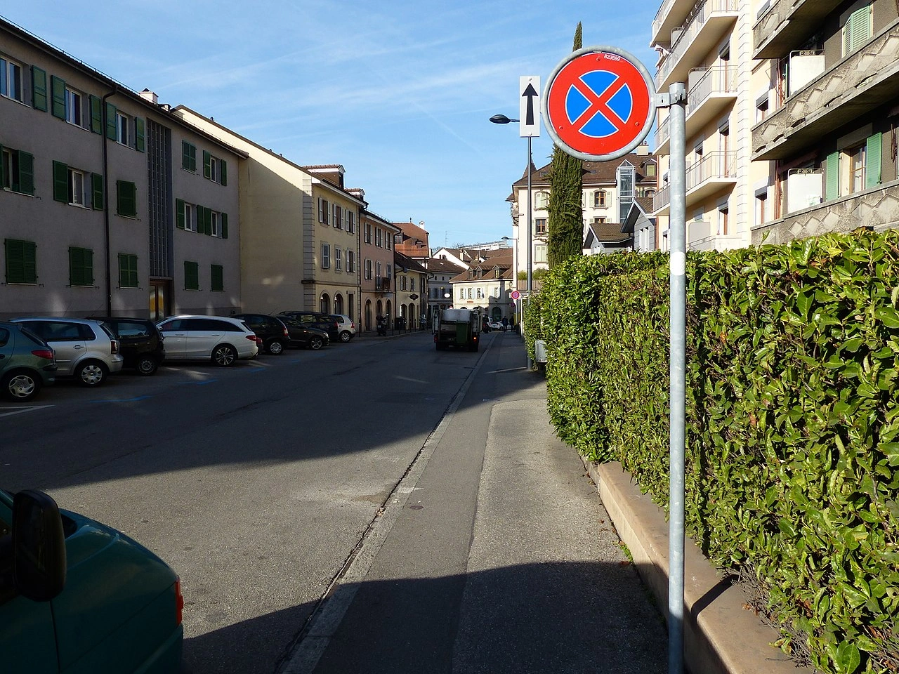
No stopping means that vehicles are not permitted to stop voluntarily at the indicated location, even briefly for picking up or dropping off passengers or loading or unloading goods. It is a stricter restriction than a no-parking rule.
A no-stopping restriction may be indicated by a traffic sign, road marking or local traffic regulation. Drivers should continue to a place where stopping is permitted unless they are forced to stop by traffic conditions, an emergency or another legal requirement.
Wikimedia.org • Marc Mongenet • CC BY-SA
Does a Swiss no-stopping sign also cover the adjoining pavement?
Yes, when placed at the carriageway edge. It prohibits voluntary stopping on the indicated side and also applies to the adjoining pavement.
 Parking and stopping prohibited.
English • Traffic sign 2.49 • No stopping.
Deutsch • Verkehrssignal 2.49 • Halten verboten.
Français • Signal 2.49 • Interdiction de s’arrêter.
Italiano • Segnale 2.49 • Divieto di fermata.
Sources
🔗 Commons.wikimedia.org
🔗 Fedlex.admin.ch • SSV, Anhang 2 (DE)
🔗 Fedlex.admin.ch • OSR, annexe 2 (FR)
🔗 Fedlex.admin.ch • OSStr, allegato 2 (IT)
SVG source: Commons.wikimedia.org • Original SVG
Bundesamt für Strassen (ASTRA) • Public domain • Original revision 2022-01-27. Wikimedia original unmodified.
Artwork reviewed against the Swiss signalling ordinance, version 1 October 2026, annex 2: Fedlex.admin.ch • Signal 2.49, PDF page 108. Catalogue-equivalent illustration; intentional update from the previous PNG. This is an educational illustration, not a manufacturing specification.
65. Parking disc
A parking disc is a device used to indicate the time a vehicle was parked in an area where parking duration is limited. The driver sets the disc to the required arrival time and displays it clearly inside the vehicle.
Parking-disc systems are commonly used in blue zones or other time-limited parking areas. The permitted parking duration, operating hours and method for setting the disc depend on national or local rules and the traffic signs in place.
Wikimedia.org • CC0
How should you set the disc in a Swiss blue zone?
The arrow is placed at the half-hour mark following the actual time of arrival. For example, an arrival at 08:10 is indicated as 08:30. Observe the official blue-zone timing table and any local signs.
🔗 police.be.ch • Bern Cantonal Police, blue-zone parking rules and timing table
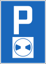 Parking only allowed for a limited time.
English • Traffic sign 4.18 • Parking with a parking disc.
Deutsch • Verkehrssignal 4.18 • Parkieren mit Parkscheibe.
Français • Signal 4.18 • Parcage avec disque de stationnement.
Italiano • Segnale 4.18 • Parcheggio con disco.
Sources
🔗 Commons.wikimedia.org
🔗 Fedlex.admin.ch • SSV, Anhang 2 (DE)
🔗 Fedlex.admin.ch • OSR, annexe 2 (FR)
🔗 Fedlex.admin.ch • OSStr, allegato 2 (IT)
SVG source: Commons.wikimedia.org • Original SVG
Bundesamt für Strassen (ASTRA) • Public domain • Original revision 2017-06-30. Wikimedia original unmodified.
Artwork reviewed against the Swiss signalling ordinance, version 1 October 2026, annex 2: Fedlex.admin.ch • Signal 4.18, PDF page 115. Catalogue-equivalent illustration; intentional update from the previous PNG. This is an educational illustration, not a manufacturing specification.
Does Swiss blue-zone parking always mean exactly one hour from arrival?
No. The Swiss official disc table includes special cases for midday and overnight. Standard daytime parking is calculated from the indicated half-hour mark, not necessarily the exact minute of arrival.
🔗 police.be.ch • Bern Cantonal Police, blue-zone parking rules and timing table
Can you reset a Swiss parking disc while the vehicle stays parked?
No. Keep the setting unchanged until departure. Moving within the same street does not restart parking time unless the vehicle has first rejoined traffic.
🔗 police.be.ch • Bern Cantonal Police, parking and blue-zone rules
Do you need a Swiss blue-zone disc when parking overnight?
Under the ordinary blue-zone rules, no disc is needed between 19:00 and 07:59 if you leave before 08:00. Later departure requires the prescribed disc setting; check local signs.
🔗 police.be.ch • Bern Cantonal Police, parking and blue-zone rules
66. Reversing
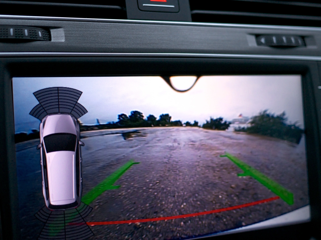
Reversing means driving a vehicle backwards. It is commonly used when parking, leaving a confined space or repositioning a vehicle where forward movement is not practical.
Before reversing, the driver should check mirrors and blind spots, look carefully around the vehicle and make sure the area behind is clear. Reversing should be performed slowly and only for as long as necessary because visibility behind the vehicle is often limited.
Wikimedia.org • Kārlis Dambrāns • CC BY
What should you check before reversing?
Check behind and around the vehicle for pedestrians, cyclists, other vehicles and obstacles. Use mirrors and cameras where available, but also look directly because monitoring systems can have blind spots.
🔗 gov.uk • Great Britain Highway Code, Rules 200–203; national guidance example
Should you reverse for a long distance?
No. Reversing should normally be limited to the distance necessary to complete the manoeuvre safely. Driving forward generally provides better visibility and vehicle control.
🔗 gov.uk • Great Britain Highway Code, Rules 200–203; national guidance example
67. U-turn
A U-turn is a driving manoeuvre in which a vehicle turns around to travel in the opposite direction. It normally involves crossing part of the roadway and re-entering traffic facing the direction from which the vehicle came.
Before making a U-turn, the driver should check surrounding traffic, pedestrians and cyclists, signal when required and make sure there is enough visibility and space to complete the manoeuvre safely. U-turns may be prohibited by traffic signs or on particular types of roads.

Wikimedia.org • Marc Mongenet • CC BY-SA
Should you turn around during a Swiss tunnel fire?
No. Do not turn around.
68. Traffic jam
A traffic jam is a situation where traffic becomes heavily congested and vehicles move very slowly or stop for extended periods. Traffic jams are commonly caused by high traffic volumes, accidents, roadworks, lane closures or poor weather. Drivers should remain patient, keep a safe distance, avoid unnecessary lane changes and watch for motorcycles, emergency vehicles and sudden braking. Where lanes merge during congestion, local rules may require drivers to use a zipper-merging system.

Wikimedia.org • Marc Mongenet • CC BY-SA
Should you repeatedly change lanes in Swiss queues?
No. Unnecessary changes disrupt traffic flow.
Must Swiss queueing drivers remember the emergency corridor?
Yes. ASTRA emphasises keeping it clear.
69. Detour
A detour, also called a diversion, is a temporary alternative route used when the normal road is closed, blocked or unavailable. Detours are commonly introduced during roadworks, accidents, public events, flooding or other disruptions. Drivers should follow the temporary direction signs carefully, reduce speed where necessary and expect unfamiliar roads, changed priorities or additional traffic along the alternative route.

Wikimedia.org • Marc Mongenet • CC BY-SA
What is a detour?
A detour is an alternative route that directs traffic around a closed, blocked or restricted section of road.
🔗 gov.uk • Great Britain Highway Code, Rules 259 and 263–274; national guidance example
Why are detours used?
Detours may be introduced because of roadworks, accidents, flooding, public events or other temporary obstructions that prevent normal use of the road.
🔗 gov.uk • Great Britain Highway Code, Rules 259 and 263–274; national guidance example
What is the difference between a detour and a diversion?
Detour and diversion generally describe the same concept: an alternative route around a road that cannot be used normally. The preferred term varies between countries and languages.
🔗 gov.uk • Great Britain Highway Code, Rules 259 and 263–274; national guidance example
70. Uncontrolled crossroad
An uncontrolled crossroad is an intersection where traffic priority is not specifically regulated by traffic lights, an authorised person or signs assigning priority to particular approaches. Drivers must therefore determine who has priority using the default traffic rules that apply in that country.
The applicable rule varies between countries and may include priority from the right, priority from the left or another default right-of-way rule. Drivers should approach an uncontrolled crossroad carefully, observe traffic from every direction and never assume that a wider or busier road automatically has priority.

Wikimedia.org • Marc Mongenet • CC BY-SA
What is an uncontrolled crossroad?
An uncontrolled crossroad is an intersection where priority is not specifically assigned by traffic lights, an authorised person or priority signs. Drivers must use the default priority rules of the country.
Who has priority at an uncontrolled crossroad?
This depends on the local traffic law. Some countries use priority from the right, while others use different rules. Drivers should know the default intersection rule of the country in which they are driving.
What should you do if you are unsure who has priority?
Reduce speed and be prepared to stop. Never force your way through an intersection simply because the priority situation is unclear.
71. Road surface
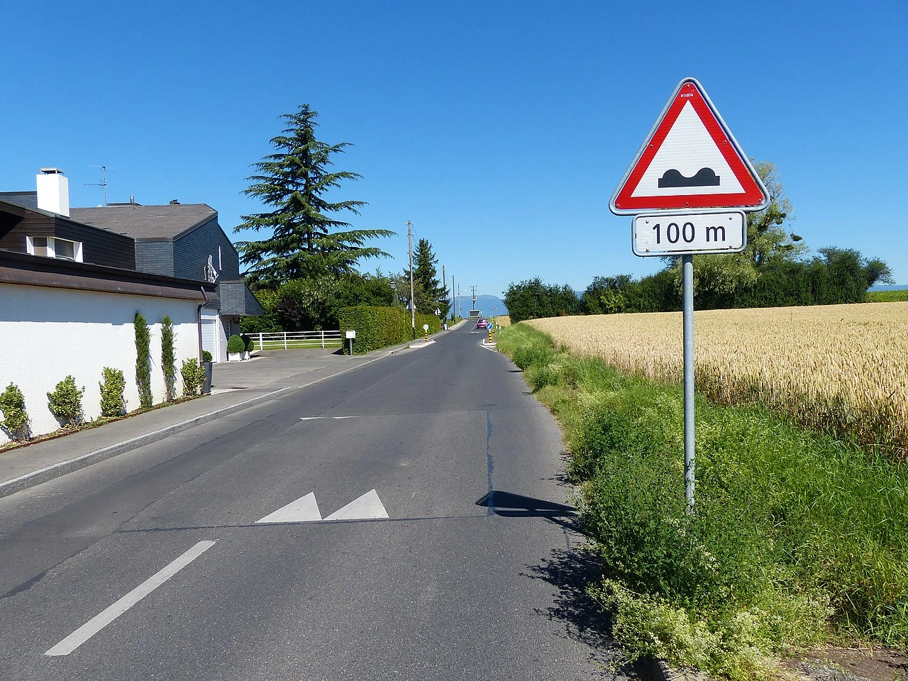
A road surface warning indicates that the road ahead may be uneven, damaged or in poor condition and could affect the stability, steering or braking of a vehicle. The hazard may include bumps, depressions, potholes, broken pavement or other irregularities in the road surface.
Drivers should reduce speed where necessary, maintain a safe distance and avoid sudden steering or braking when passing over an irregular surface. The exact meaning and appearance of the warning sign vary between countries, so drivers must follow the local traffic signs and regulations.
Wikimedia.org • Marc Mongenet • CC BY-SA
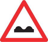
Warning for a bad road surface.
What does a road surface warning mean?
A road surface warning indicates that the surface ahead may be uneven, damaged or otherwise capable of affecting the safe movement of vehicles.
🔗 gov.uk • Great Britain Highway Code, Rules 226–237; national guidance example
 Warning for a bad road surface.
What should you do when you see a road surface warning?
Reduce speed where necessary, increase your awareness of the road ahead and be prepared for changes in the vehicle's stability or direction.
🔗 gov.uk • Great Britain Highway Code, Rules 226–237; national guidance example
Does a road surface warning impose a specific speed limit?
Not normally. A warning sign alerts drivers to a hazard rather than establishing a numerical speed limit. A separate speed-limit sign may be used where a particular maximum speed is required.
🔗 gov.uk • Great Britain Highway Code, Rules 226–237; national guidance example
72. Exit
An exit is a designated route or point where traffic leaves a road, motorway, expressway or other major route. On high-speed roads, an exit usually leads from the main carriageway onto an exit lane or ramp that connects with another road or destination.
Drivers approaching an exit should follow the direction signs and road markings, move into the appropriate lane in good time and adjust their speed as necessary after leaving the main traffic flow.
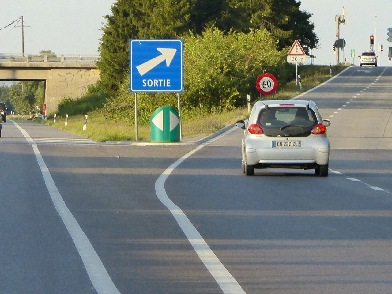
Wikimedia.org • Marc Mongenet • CC BY-SA
When does ASTRA advise signalling for a motorway exit?
About 200 metres before the exit.
Where does ASTRA advise braking for an exit?
On the deceleration lane.
73. Information point
An information point is a designated place where travellers can obtain information about the surrounding area, local services, tourist attractions, routes or other useful facilities. It may be located beside a road, at a rest area, in a town or near an important destination.
Information points are often indicated by a service or information sign. Depending on the location, they may provide maps, brochures, route information, tourist assistance or digital information for visitors.
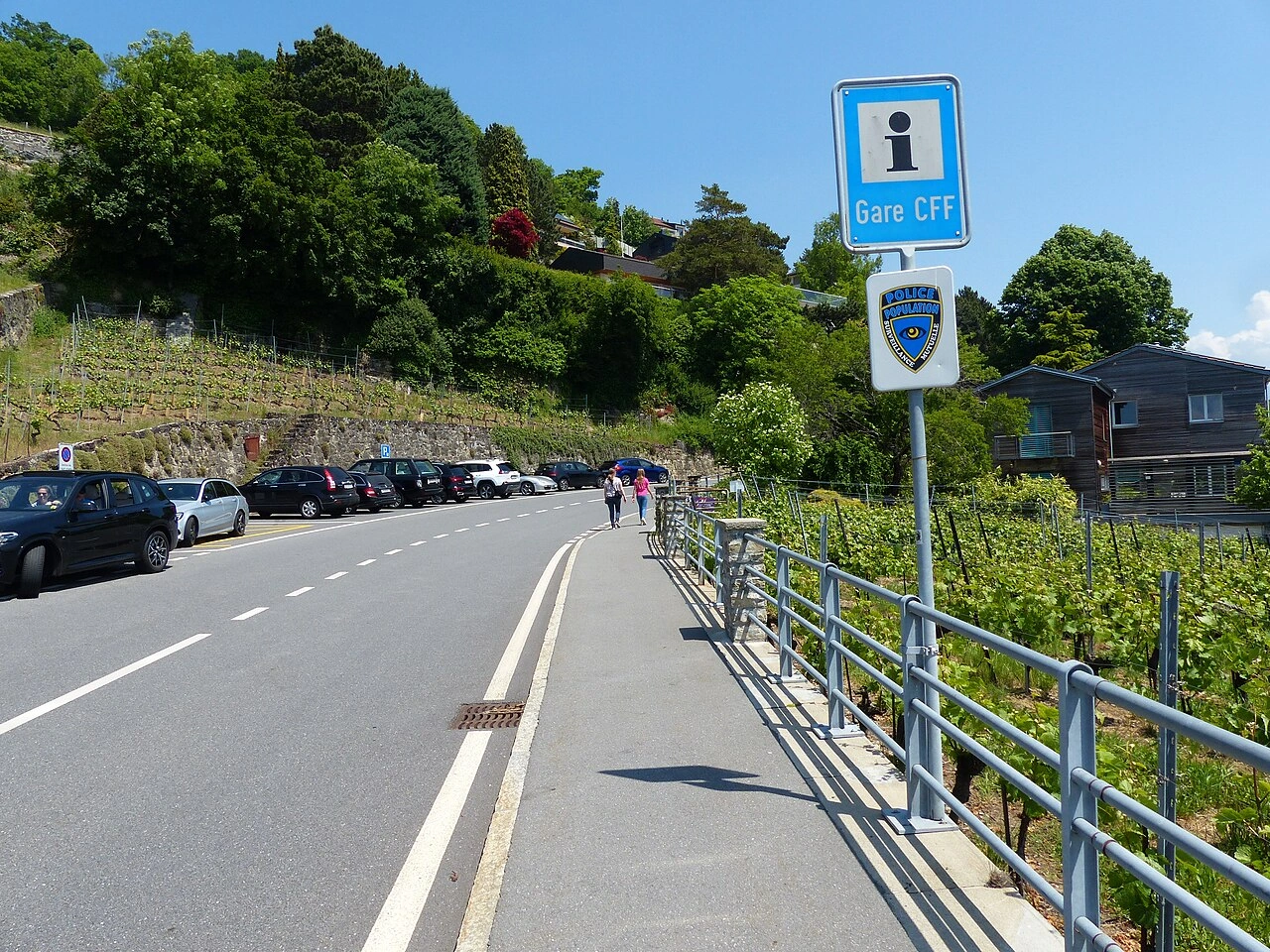
Wikimedia.org • Marc Mongenet • CC BY-SA
How is an information point indicated?
Many countries use a service or information sign to direct road users toward an information point. The exact symbol and sign design vary between countries.
🔗 rijksoverheid.nl • Dutch Government, reading motorway location markers; Dutch example
74. Horse riding
Horse riding includes activities involving horses and riders. In road traffic, an equestrian or horse rider may use roads, bridleways or specially designated routes, depending on the rules and infrastructure provided.
Drivers approaching horses and riders should reduce speed, leave sufficient space and avoid sudden noise or movements that could frighten the animal. Riders must also follow the traffic rules that apply to them.
Wikimedia.org • Jag9889 • CC BY-SA
What does equestrian mean in road traffic?
Equestrian refers to horse riding and, in a traffic context, particularly to people travelling on horseback or using designated horse-riding routes.
🔗 gov.uk • Great Britain Highway Code, Rule 215; national guidance example
How should drivers behave near horse riders?
Drivers should slow down, leave plenty of space and pass calmly, avoiding sudden acceleration, horn use or other actions that could frighten the horse.
🔗 gov.uk • Great Britain Highway Code, Rule 215; national guidance example
75. Emergency exit
An emergency exit is a marked escape route that allows road users to leave a tunnel or other enclosed traffic facility during a serious incident such as a fire, smoke development or another emergency. Emergency exits lead towards a safer area separated from the immediate danger.
In an emergency, occupants should leave their vehicle when evacuation is necessary and follow the emergency-exit signs and instructions. They should move away from the danger rather than remaining inside the tunnel or returning to their vehicle.
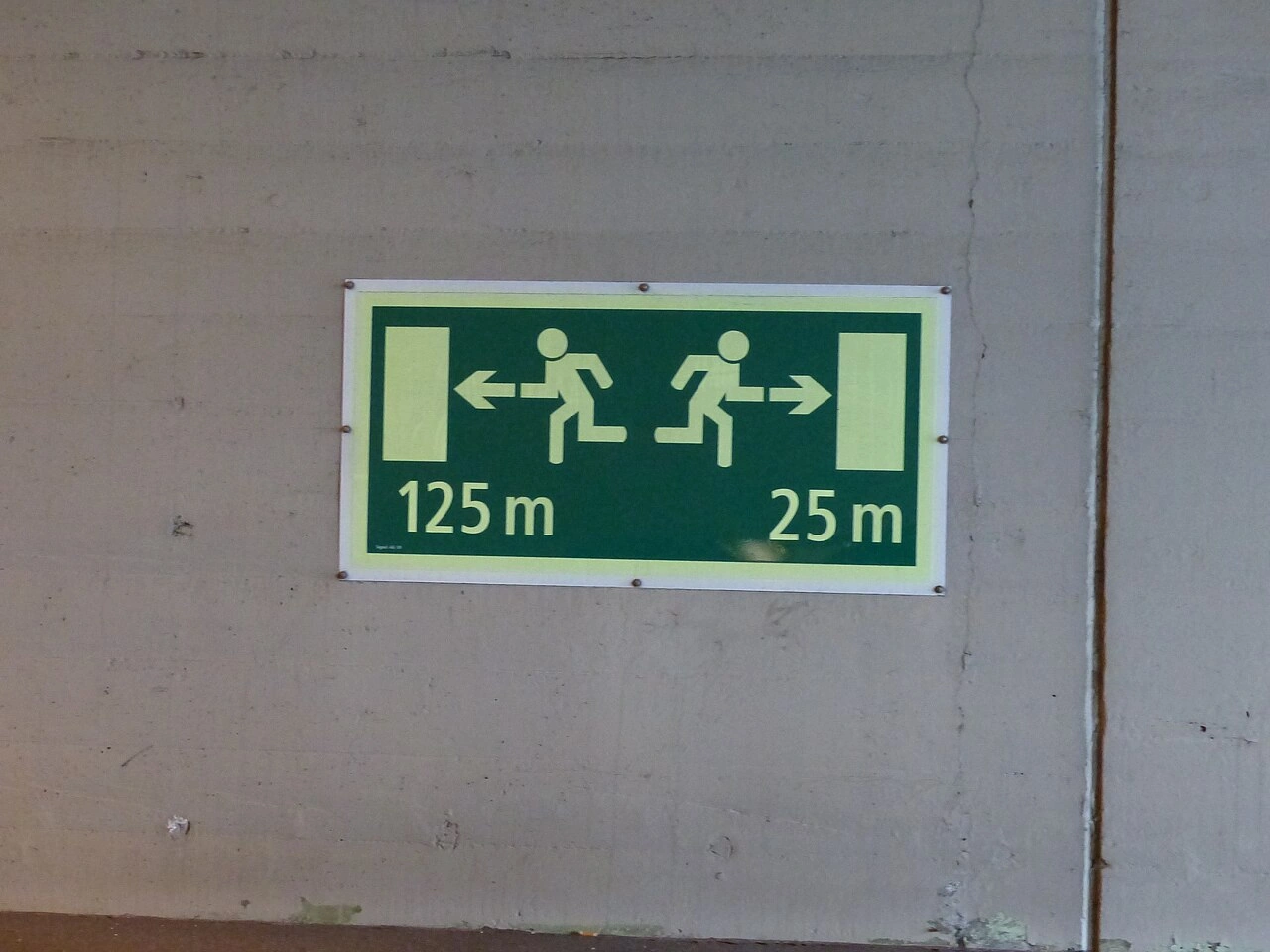
Wikimedia.org • Marc Mongenet • CC BY-SA
Should you take your vehicle through an emergency exit?
No. Tunnel emergency exits are intended for people evacuating on foot. Leave the vehicle when necessary and follow the marked escape route towards safety.
🔗 crisiscenter.be • Belgian National Crisis Centre, tunnel evacuation on foot
🔗 merseytravel.gov.uk • Merseytravel, road-tunnel evacuation instructions
🔗 gov.uk • UK DfT, emergency-exit pedestrian signs and information symbols