

Traffic signsBrussels
 Traffic rules
 Brussels
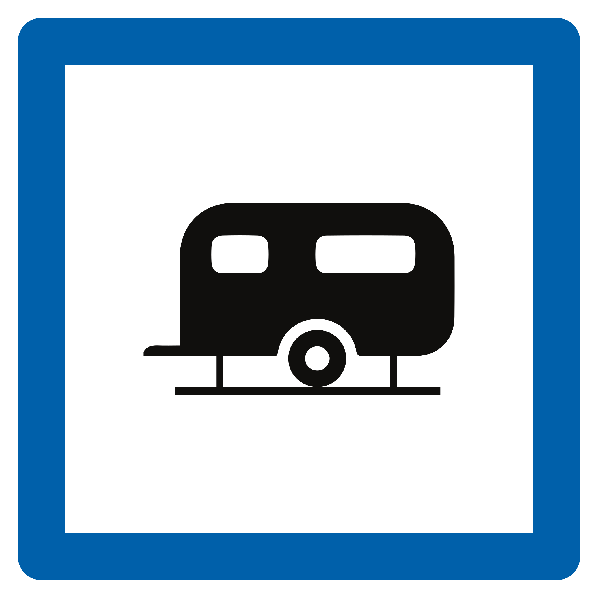
201. What does this traffic sign mean?
This traffic sign indicates a caravan site. The designated area provides parking or accommodation for caravans.
English • Traffic sign F73 • Caravan site. • From 1 June 2027.
Français • Signal routier F73 • Terrain de caravaning. • Dès le 1er juin 2027.
Nederlands • Verkeersbord F73 • Kampeeraanhangwagenterrein. • Vanaf 1 juni 2027.
Sources
Image source: Wegcode.be • Verkeersborden (NL)
🔗 Codedelaroute.be • Signaux routiers (FR)
🔗 Wegcode.be • Sign overview
🔗 Wegcode.be • Original files. Original PNG unmodified.

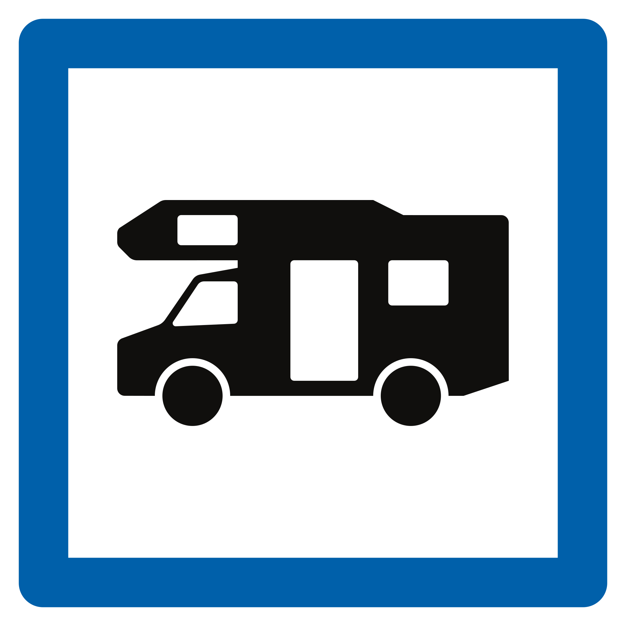
202. What does this traffic sign mean?
This traffic sign indicates a camper site. The designated area provides parking or overnight accommodation for motorhomes and similar recreational vehicles.
English • Traffic sign F74 • Motorhome site. • From 1 June 2027.
Français • Signal routier F74 • Terrain pour autocaravane. • Dès le 1er juin 2027.
Nederlands • Verkeersbord F74 • Kampeerwagenterrein. • Vanaf 1 juni 2027.
Sources
Image source: Wegcode.be • Verkeersborden (NL)
🔗 Codedelaroute.be • Signaux routiers (FR)
🔗 Wegcode.be • Sign overview
🔗 Wegcode.be • Original files. Original PNG unmodified.

203. What does this traffic sign mean?
This traffic sign indicates an information point. Information about the local area, destinations or available services can be obtained there.
English • Traffic sign F77 • Tourist information point. • From 1 June 2027.
Français • Signal routier F77 • Point d’information touristique. • Dès le 1er juin 2027.
Nederlands • Verkeersbord F77 • Trefpunt voor toeristische informatie. • Vanaf 1 juni 2027.
Sources
SVG source: Wegcode.be • Verkeersborden (NL)
🔗 Codedelaroute.be • Signaux routiers (FR)
Wegcode.be • Sign overview
🔗 Wegcode.be • Original files. Original SVG unmodified.
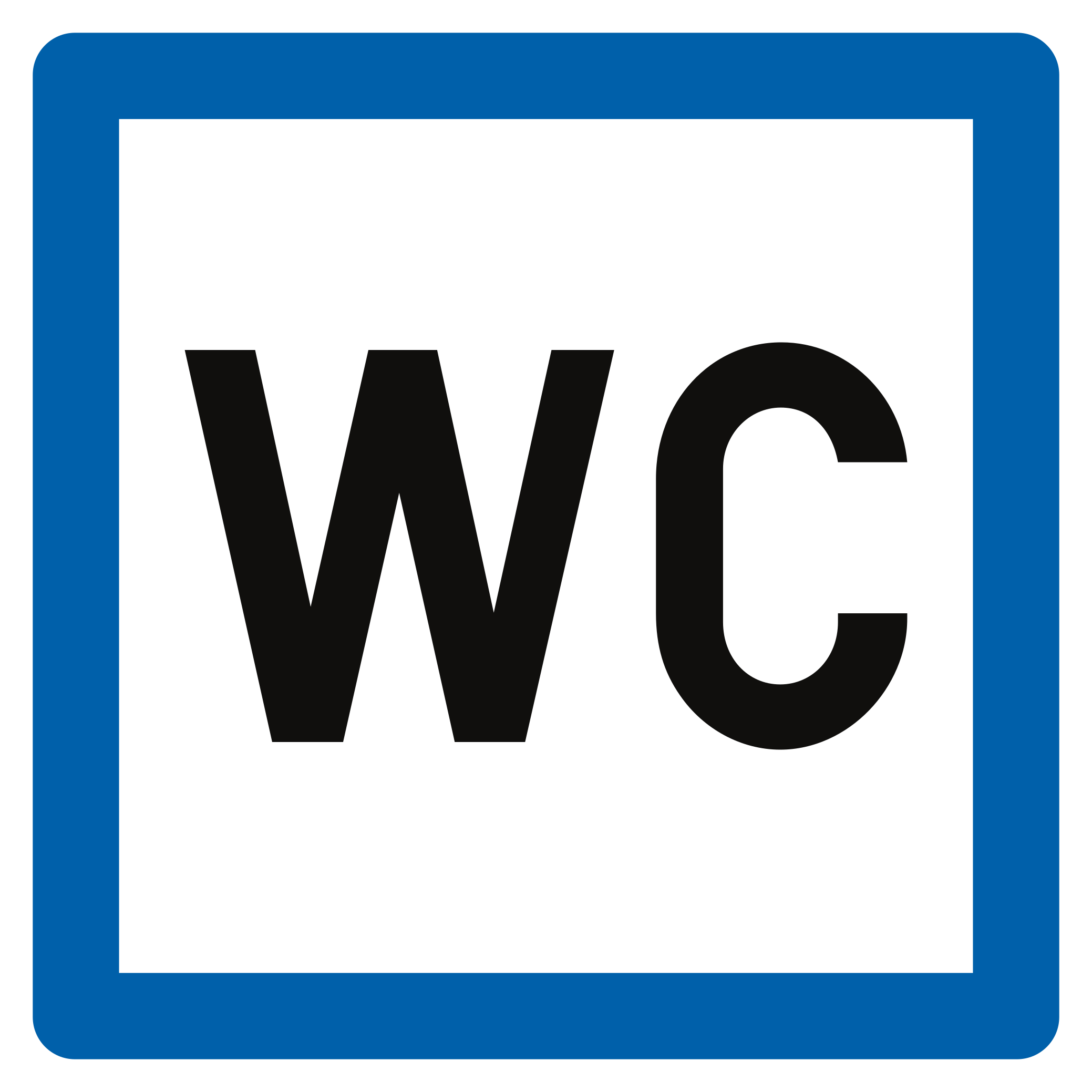
204. What does this traffic sign mean?
This traffic sign indicates a public toilet. Toilet facilities available for public use are located at or near the indicated place.
English • Traffic sign F78 • Toilet. • From 1 June 2027.
Français • Signal routier F78 • Toilette. • Dès le 1er juin 2027.
Nederlands • Verkeersbord F78 • Toilet. • Vanaf 1 juni 2027.
Sources

205. What does this traffic sign mean?
This traffic sign indicates the location of a telephone available for public use.
English • Traffic sign F63 • Telephone. • From 1 June 2027.
Français • Signal routier F63 • Téléphone. • Dès le 1er juin 2027.
Nederlands • Verkeersbord F63 • Telefoon. • Vanaf 1 juni 2027.
Sources
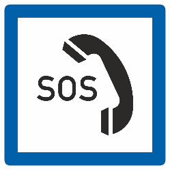
206. What does this traffic sign mean?
This traffic sign indicates the location of an emergency telephone. The telephone provides a direct means of requesting assistance in an emergency.
English • Traffic sign F64 • Emergency telephone. • From 1 June 2027.
Français • Signal routier F64 • Téléphone d’appel d’urgence. • Dès le 1er juin 2027.
Nederlands • Verkeersbord F64 • Noodtelefoon. • Vanaf 1 juni 2027.
Sources
Image source: Wegcode.be • Verkeersborden (NL)
🔗 Codedelaroute.be • Signaux routiers (FR)
🔗 Wegcode.be • Sign overview
🔗 Wegcode.be • Original files. Original PNG unmodified.

207. What does this traffic sign mean?
This traffic sign indicates a viewpoint. A viewpoint is a designated location offering a view of the surrounding landscape or another place of interest.
English • Traffic sign F79 • Viewpoint. • From 1 June 2027.
Français • Signal routier F79 • Point de vue. • Dès le 1er juin 2027.
Nederlands • Verkeersbord F79 • Uitzichtpunt. • Vanaf 1 juni 2027.
Sources
Image source: Wegcode.be • Verkeersborden (NL)
🔗 Codedelaroute.be • Signaux routiers (FR)
🔗 Wegcode.be • Sign overview
🔗 Wegcode.be • Original files. Original PNG unmodified.
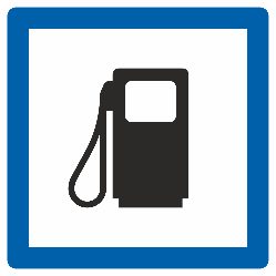
208. What does this traffic sign mean?
This traffic sign indicates a petrol station. Fuel for motor vehicles is available at the indicated location. The available fuel types may be shown on the sign or accompanying information.
English • Traffic sign F65a • Fuel supply. The type of fuel may be indicated on the sign or on a supplementary plate. • From 1 June 2027.
Français • Signal routier F65a • Distribution de carburant. Le type du carburant peut être indiqué sur le signal ou sur un panneau additionnel. • Dès le 1er juin 2027.
Nederlands • Verkeersbord F65a • Tankstation. Het type brandstof kan aangeduid zijn op het verkeersbord of op een onderbord. • Vanaf 1 juni 2027.
Sources
Image source: Wegcode.be • Verkeersborden (NL)
🔗 Codedelaroute.be • Signaux routiers (FR)
🔗 Wegcode.be • Sign overview
🔗 Wegcode.be • Original files. Original PNG unmodified.
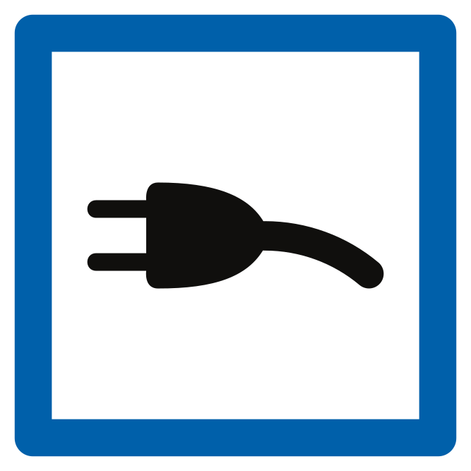
209. What does this traffic sign mean?
This traffic sign indicates a charging station. Electric vehicles can be recharged at the indicated location. Follow any parking, charging or access conditions that apply.
English • Traffic sign F65b • Electric charging point. • From 1 June 2027.
Français • Signal routier F65b • Borne de recharge électrique. • Dès le 1er juin 2027.
Nederlands • Verkeersbord F65b • Elektrische laadpaal. • Vanaf 1 juni 2027.
Sources
Image source: Wegcode.be • Verkeersborden (NL)
🔗 Codedelaroute.be • Signaux routiers (FR)
🔗 Wegcode.be • Sign overview
🔗 Wegcode.be • Original files. Original PNG unmodified.
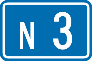
210. What does this traffic sign mean?
This traffic sign indicates an ordinary road number. The number identifies the road or route and can be used to follow directions and route signs.
English • Traffic sign F23a • Ordinary road number. • From 1 June 2027.
Français • Signal routier F23a • Numéro d’une route ordinaire. • Dès le 1er juin 2027.
Nederlands • Verkeersbord F23a • Nummer van een gewone weg. • Vanaf 1 juni 2027.
Sources
Image source: Wegcode.be • Verkeersborden (NL)
🔗 Codedelaroute.be • Signaux routiers (FR)
🔗 Wegcode.be • Sign overview
🔗 Wegcode.be • Original files. Original PNG unmodified.
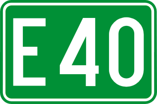
211. What does this traffic sign mean?
This traffic sign indicates an E-route number. E-routes form part of the international European road network and are identified by the letter E followed by a route number.
English • Traffic sign F23c • International route number. • From 1 June 2027.
Français • Signal routier F23c • Numéro d’une route internationale. • Dès le 1er juin 2027.
Nederlands • Verkeersbord F23c • Nummer van een internationale weg. • Vanaf 1 juni 2027.
Sources
Image source: Wegcode.be • Verkeersborden (NL)
🔗 Codedelaroute.be • Signaux routiers (FR)
🔗 Wegcode.be • Sign overview
🔗 Wegcode.be • Original files. Original PNG unmodified.
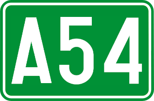
212. What does this traffic sign mean?
This traffic sign indicates a motorway number. The number identifies the motorway and helps road users follow the correct route.
English • Traffic sign F23b • Motorway number. • From 1 June 2027.
Français • Signal routier F23b • Numéro d’une autoroute. • Dès le 1er juin 2027.
Nederlands • Verkeersbord F23b • Nummer van een autosnelweg. • Vanaf 1 juni 2027.
Sources
Image source: Wegcode.be • Verkeersborden (NL)
🔗 Codedelaroute.be • Signaux routiers (FR)
🔗 Wegcode.be • Sign overview
🔗 Wegcode.be • Original files. Original PNG unmodified.
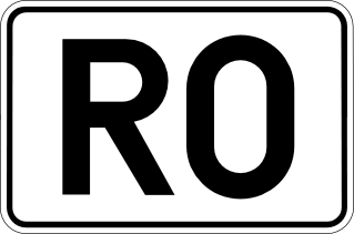
213. What does this traffic sign mean?
This traffic sign indicates a ring road number. The number identifies a route that forms or follows a ring around a city or another area.
English • Traffic sign F23d • Ring-road number. • From 1 June 2027.
Français • Signal routier F23d • Numéro d’un ring. • Dès le 1er juin 2027.
Nederlands • Verkeersbord F23d • Nummer van een ring. • Vanaf 1 juni 2027.
Sources
Image source: Wegcode.be • Verkeersborden (NL)
🔗 Codedelaroute.be • Signaux routiers (FR)
🔗 Wegcode.be • Sign overview
🔗 Wegcode.be • Original files. Original PNG unmodified.
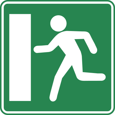
214. What does this traffic sign mean?
This traffic sign indicates an emergency exit. The exit provides an evacuation route to be used when leaving the area in an emergency.
English • Traffic sign F52a • Emergency exit indication. • From 1 June 2027.
Français • Signal routier F52a • Indication d’une issue de secours. • Dès le 1er juin 2027.
Nederlands • Verkeersbord F52a • Aankondiging van een nooduitgang. • Vanaf 1 juni 2027.
Sources
SVG source: Wegcode.be • Verkeersborden (NL)
🔗 Codedelaroute.be • Signaux routiers (FR)
Wegcode.be • Sign overview
🔗 Wegcode.be • Original files. Original SVG unmodified.
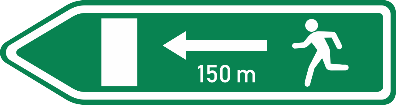
215. What does this traffic sign mean?
This traffic sign indicates the direction to an emergency exit. Follow the indicated direction to reach the evacuation route or emergency exit.
English • Traffic sign F52b • Evacuation route: advance indication of the nearest emergency exit in the indicated direction. • From 1 June 2027.
Français • Signal routier F52b • Voie d’évacuation : annonce de l’issue de secours la plus proche dans la direction indiquée. • Dès le 1er juin 2027.
Nederlands • Verkeersbord F52b • Vluchtroute: aankondiging van de dichtstbijzijnde nooduitgang, in de aangeduide richting. • Vanaf 1 juni 2027.
Sources
Image source: Wegcode.be • Verkeersborden (NL)
🔗 Codedelaroute.be • Signaux routiers (FR)
🔗 Wegcode.be • Sign overview
🔗 Wegcode.be • Original files. Original PNG unmodified.

216. What does this traffic sign mean?
This traffic sign indicates the direction and remaining distance to the named destination.
English • Traffic sign F29 • Direction sign. The distance in kilometres may be shown on the sign. • From 1 June 2027.
Français • Signal routier F29 • Signal de direction. La distance en kilomètres peut être indiquée sur le signal. • Dès le 1er juin 2027.
Nederlands • Verkeersbord F29 • Wegwijzer. De afstand in kilometer kan op de wegwijzer aangeduid zijn. • Vanaf 1 juni 2027.
Sources
Image source: Wegcode.be • Verkeersborden (NL)
🔗 Codedelaroute.be • Signaux routiers (FR)
🔗 Wegcode.be • Sign overview
🔗 Wegcode.be • Original files. Original PNG unmodified.

217. What does this traffic sign mean?
This traffic sign indicates the direction to a motorway and the destination reached by following it.
English • Traffic sign F31 • Direction sign. Route via a motorway. • From 1 June 2027.
Français • Signal routier F31 • Signal de direction. Itinéraire par autoroute. • Dès le 1er juin 2027.
Nederlands • Verkeersbord F31 • Wegwijzer. Reisweg over een autosnelweg. • Vanaf 1 juni 2027.
Sources
Image source: Wegcode.be • Verkeersborden (NL)
🔗 Codedelaroute.be • Signaux routiers (FR)
🔗 Wegcode.be • Sign overview
🔗 Wegcode.be • Original files. Original PNG unmodified.

218. What does this traffic sign mean?
This traffic sign indicates a recommended route for cyclists toward the named destination. Follow the arrow to continue along the suggested cycling route.
English • Traffic sign F34b.1 • Direction sign: recommended route for specified categories of road users. These signs may also have a green background. • From 1 June 2027.
Français • Signal routier F34b.1 • Signal de direction : itinéraire conseillé à des catégories déterminées d’usagers. Ces signaux peuvent aussi avoir un fond vert. • Dès le 1er juin 2027.
Nederlands • Verkeersbord F34b.1 • Wegwijzer: aanbevolen reisweg voor bepaalde categorieën van weggebruikers. Deze borden kunnen ook een groene achtergrond hebben. • Vanaf 1 juni 2027.
Sources
SVG source: Wegcode.be • Verkeersborden (NL)
🔗 Codedelaroute.be • Signaux routiers (FR)
Wegcode.be • Sign overview
🔗 Wegcode.be • Original files. Original SVG unmodified.

219. What does this traffic sign mean?
This traffic sign indicates a recommended route for cyclists to a tourist destination. Follow the arrow to continue along the suggested cycling route.
English • Traffic sign F34c.1 • Direction sign: route to a tourist destination recommended for specified categories of road users. These signs may also have a green background. • From 1 June 2027.
Français • Signal routier F34c.1 • Signal de direction : itinéraire vers une destination touristique, conseillé à des catégories déterminées d’usagers. Ces signaux peuvent aussi avoir un fond vert. • Dès le 1er juin 2027.
Nederlands • Verkeersbord F34c.1 • Wegwijzer: aanbevolen reisweg naar een toeristische bestemming voor bepaalde categorieën van weggebruikers. Deze borden kunnen ook een groene achtergrond hebben. • Vanaf 1 juni 2027.
Sources
SVG source: Wegcode.be • Verkeersborden (NL)
🔗 Codedelaroute.be • Signaux routiers (FR)
Wegcode.be • Sign overview
🔗 Wegcode.be • Original files. Original SVG unmodified.

220. What does this traffic sign mean?
This traffic sign indicates the direction to the named restaurant. Follow the arrow to reach it.
English • Traffic sign F37 • Direction sign: hotel or motel, restaurant, café, campsite, caravan site, motorhome site, youth hostel or picnic area. • From 1 June 2027.
Français • Signal routier F37 • Signal de direction : hôtel ou motel, restaurant, cafétéria, terrain de camping, terrain de caravaning, terrain pour autocaravane, auberge de jeunesse, emplacement pour pique-nique. • Dès le 1er juin 2027.
Nederlands • Verkeersbord F37 • Wegwijzer: hotel of motel, restaurant, drankgelegenheid, kampeerterrein, kampeeraanhangwagenterrein, kampeerwagenterrein, jeugdherberg, picknickplaats. • Vanaf 1 juni 2027.
Sources
Image source: Wegcode.be • Verkeersborden (NL)
🔗 Codedelaroute.be • Signaux routiers (FR)
🔗 Wegcode.be • Sign overview
🔗 Wegcode.be • Original files. Original PNG unmodified.
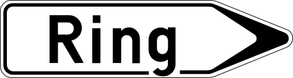
221. What does this traffic sign mean?
This traffic sign indicates the direction to a ring road that routes traffic around a city or town. Follow the arrow to join the ring road.
English • Traffic sign F33a • Direction sign from a distance: airport, trade-fair hall or exhibition centre, port, car ferry, business park or hospital. • From 1 June 2027.
Français • Signal routier F33a • Signal de direction à distance : aéroport, hall de foire ou centre d’exposition, port, car-ferry, parc d’activités économiques, hôpital. • Dès le 1er juin 2027.
Nederlands • Verkeersbord F33a • Wegwijzer op afstand: luchthaven, beurs- of tentoonstellingshal, haven, car-ferry, zone met economische activiteiten, ziekenhuis. • Vanaf 1 juni 2027.
Sources
Image source: Wegcode.be • Verkeersborden (NL)
🔗 Codedelaroute.be • Signaux routiers (FR)
🔗 Wegcode.be • Sign overview
🔗 Wegcode.be • Original files. Original PNG unmodified.

222. What does this traffic sign mean?
This traffic sign indicates the direction to the named river or another tourist attraction associated with it. Follow the arrow to reach the destination.
English • Traffic sign F33b • Direction sign from a distance: tourist valley or watercourse. The distance in kilometres may be shown on the sign. • From 1 June 2027.
Français • Signal routier F33b • Signal de direction à distance : vallée ou cours d’eau touristique. La distance en kilomètres peut être indiquée sur le signal. • Dès le 1er juin 2027.
Nederlands • Verkeersbord F33b • Wegwijzer op afstand: vallei of waterloop van toeristische aard. De afstand in kilometer kan op de wegwijzer aangeduid zijn. • Vanaf 1 juni 2027.
Sources
Image source: Wegcode.be • Verkeersborden (NL)
🔗 Codedelaroute.be • Signaux routiers (FR)
🔗 Wegcode.be • Sign overview
🔗 Wegcode.be • Original files. Original PNG unmodified.

223. What does this traffic sign mean?
This traffic sign indicates the river or other watercourse being crossed. It is an information sign and does not impose a traffic rule.
English • Traffic sign F44 • Watercourse. • From 1 June 2027.
Français • Signal routier F44 • Cours d’eau. • Dès le 1er juin 2027.
Nederlands • Verkeersbord F44 • Waterloop. • Vanaf 1 juni 2027.
Sources
Image source: Wegcode.be • Verkeersborden (NL)
🔗 Codedelaroute.be • Signaux routiers (FR)
🔗 Wegcode.be • Sign overview
🔗 Wegcode.be • Original files. Original PNG unmodified.

224. What does this traffic sign mean?
This traffic sign indicates the direction to a nearby railway station. Follow the arrow to reach the station serving the named location.
English • Traffic sign F34a • Direction sign near public facilities and establishments or those serving the public interest, such as a railway station, hospital, town hall or municipal offices, or post office. • From 1 June 2027.
Français • Signal routier F34a • Signal de direction à proximité d’équipements et établissements publics ou d’intérêt général, par exemple une gare de chemin de fer, un hôpital, un hôtel de ville ou maison communale, un bureau de poste. • Dès le 1er juin 2027.
Nederlands • Verkeersbord F34a • Wegwijzer in de nabijheid van inrichtingen en etablissementen die openbaar zijn of van algemeen belang, bijvoorbeeld een treinstation, een ziekenhuis, een stadhuis of gemeentehuis, een postkantoor. • Vanaf 1 juni 2027.
Sources
Image source: Wegcode.be • Verkeersborden (NL)
🔗 Codedelaroute.be • Signaux routiers (FR)
🔗 Wegcode.be • Sign overview
🔗 Wegcode.be • Original files. Original PNG unmodified.
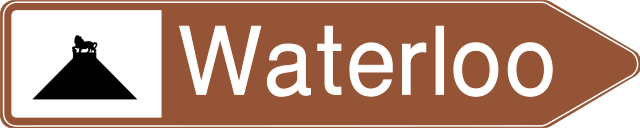
225. What does this traffic sign mean?
This traffic sign indicates the direction to the named tourist attraction or place of interest. The symbol may identify the type of attraction or a well-known landmark.
English • Traffic sign F33c • Direction sign from a distance: sports centre, stadium or indoor sports hall, historic monument, ruins, monastery or abbey, cultural park, leisure park or amusement park, notable monument or site, nature park, tourist information point or viewpoint. • From 1 June 2027.
Français • Signal routier F33c • Signal de direction à distance : centre sportif ou stade ou hall omnisport, monument historique, ruines, monastère ou abbaye, parc culturel ou parc de loisirs ou parc d’attractions, monument ou site remarquable, parc naturel, point d’information touristique, point de vue. • Dès le 1er juin 2027.
Nederlands • Verkeersbord F33c • Wegwijzer op afstand: sportcentrum of stadium of omnisporthal, historisch monument, ruïnes, klooster of abdij, cultureel park of recreatie- of pretpark, monument of merkwaardig landschap, natuurpark, trefpunt voor toeristische informatie, uitkijkpunt. • Vanaf 1 juni 2027.
Sources
Image source: Wegcode.be • Verkeersborden (NL)
🔗 Codedelaroute.be • Signaux routiers (FR)
🔗 Wegcode.be • Sign overview
🔗 Wegcode.be • Original files. Original PNG unmodified.
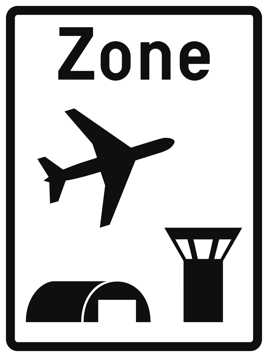
226. What does this traffic sign mean?
This traffic sign indicates the start of an airport zone. Special traffic rules or access conditions may apply within the zone. Follow the applicable traffic signs and any instructions given by authorised personnel.
English • Traffic sign R21 • Beginning of an airport zone. The applicable maximum speed may be displayed for information at the bottom right. • From 1 June 2027.
Français • Signal routier R21 • Début d’une zone aéroportuaire. La vitesse maximale qui s’y applique peut être indiquée à titre informatif sur le signal en bas à droite. • Dès le 1er juin 2027.
Nederlands • Verkeersbord R21 • Begin van een luchthavengebied. De maximale snelheid die er geldt, kan rechtsonder als aanwijzing op het verkeersbord aangeduid zijn. • Vanaf 1 juni 2027.
Sources
Image source: Wegcode.be • Verkeersborden (NL)
🔗 Codedelaroute.be • Signaux routiers (FR)
🔗 Wegcode.be • Sign overview
🔗 Wegcode.be • Original files. Original PNG unmodified.
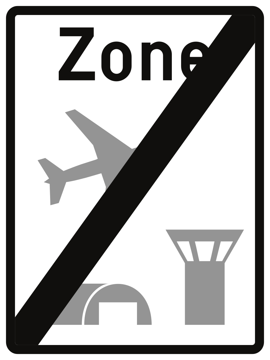
227. What does this traffic sign mean?
This traffic sign indicates the end of the airport zone. Special rules associated with the airport zone end at this point. Other traffic rules or separately indicated restrictions may still apply.
English • Traffic sign R23 • End of an airport zone. • From 1 June 2027.
Français • Signal routier R23 • Fin d’une zone aéroportuaire. • Dès le 1er juin 2027.
Nederlands • Verkeersbord R23 • Einde van een luchthavengebied. • Vanaf 1 juni 2027.
Sources
Image source: Wegcode.be • Verkeersborden (NL)
🔗 Codedelaroute.be • Signaux routiers (FR)
🔗 Wegcode.be • Sign overview
🔗 Wegcode.be • Original files. Original PNG unmodified.
