


Traffic signsFrance
 Traffic rules
 France
 Priority signs
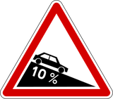 Warning signs
 Prohibitory signs
 Mandatory signs
 Information signs
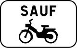 Additional signs
An additional sign is a traffic sign placed directly below another sign to provide extra information or clarify how the main sign should be understood. It can specify conditions such as distance, time periods, road users affected, directions, or special circumstances. Additional signs do not create new rules by themselves but modify, limit, or explain the meaning of the sign above them so drivers can apply the rule correctly in that specific situation.
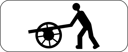

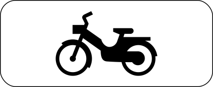


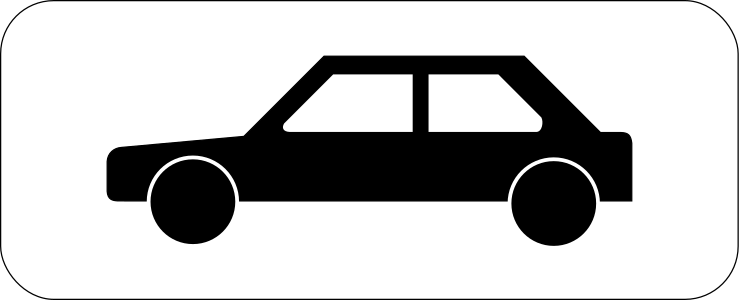

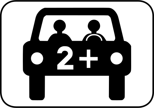


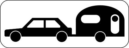
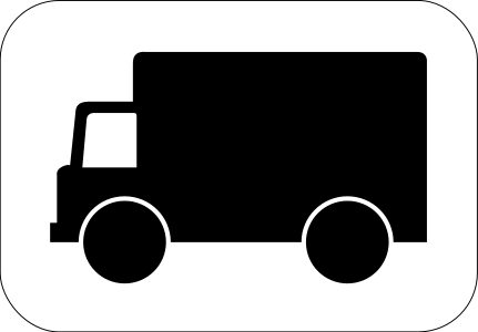
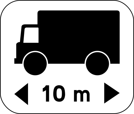
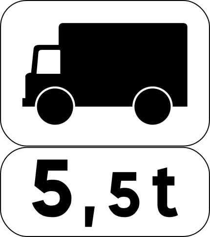
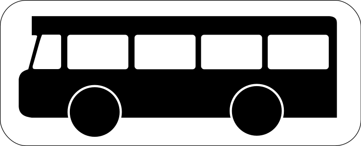


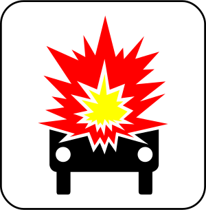


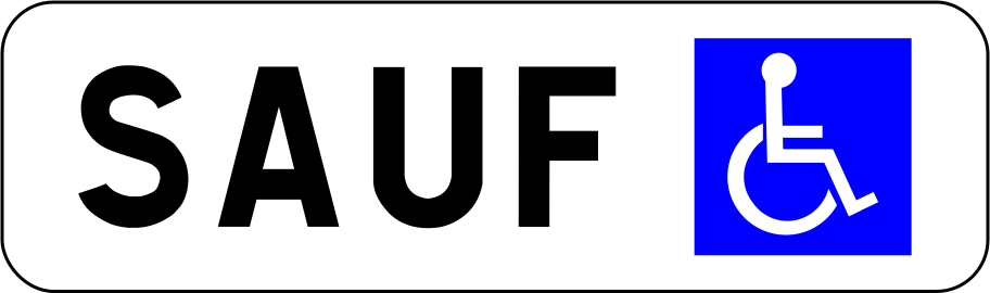
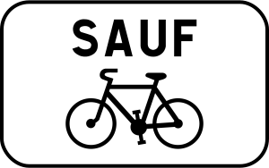

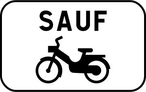

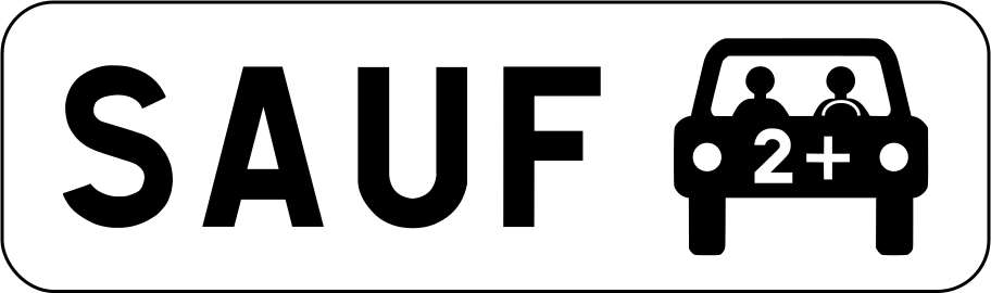
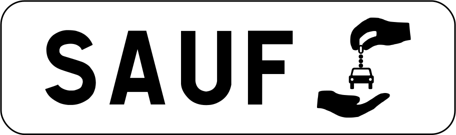
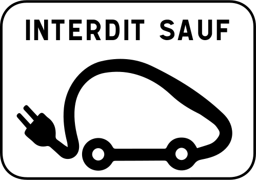
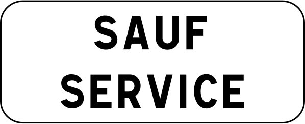










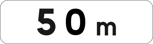
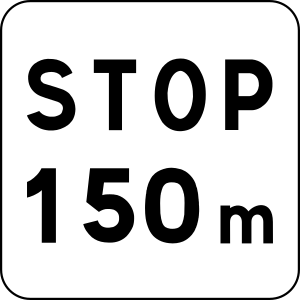
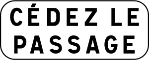
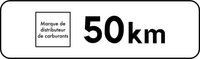
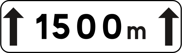
































Why must I read a supplementary plate?
It can qualify the main sign by identifying an exception, a time period or the distance to a restriction. Read the complete assembly rather than applying only the main symbol.

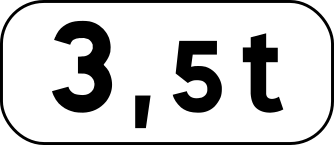
51. Indicated mass
This supplementary sign shows an indicated vehicle mass. Read it together with the main traffic sign to determine how the mass value affects the applicable rule or restriction.
English • Supplementary plate M4f • Indicates vehicles, articulated vehicles, double road trains or vehicle combinations whose maximum authorised laden mass or maximum authorised combination mass exceeds the value shown. Inscription: 3.5 t.
Français • Panonceau M4f • Désigne les véhicules, véhicules articulés, trains doubles ou ensembles de véhicules dont le poids total autorisé en charge ou le poids total roulant autorisé excède le nombre indiqué. Inscription : 3,5 t.
Sources
🔗 Commons.wikimedia.org
🔗 Equipementsdelaroute.cerema.fr • Arrêté du 24 novembre 1967
© Pyrog et les contributeurs Wikimedia • CC BY-SA 4.0 • SVG original non modifié.
Image via Commons.wikimedia.org
Pyrog • CC BY-SA 4.0 • Source revision 2025-03-17. Wikimedia original unmodified.
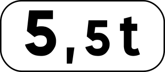
52. Indicated mass
This supplementary sign shows an indicated vehicle mass. Read it together with the main traffic sign to determine how the mass value affects the applicable rule or restriction.
English • Supplementary plate M4f • Indicates vehicles, articulated vehicles, double road trains or vehicle combinations whose maximum authorised laden mass or maximum authorised combination mass exceeds the value shown. Inscription: 5.5 t.
Français • Panonceau M4f • Désigne les véhicules, véhicules articulés, trains doubles ou ensembles de véhicules dont le poids total autorisé en charge ou le poids total roulant autorisé excède le nombre indiqué. Inscription : 5,5 t.
Sources
🔗 Commons.wikimedia.org
🔗 Equipementsdelaroute.cerema.fr • Arrêté du 24 novembre 1967
© Chabe01 et les contributeurs Wikimedia • CC BY-SA 4.0 • SVG original non modifié.
Image via Commons.wikimedia.org
Chabe01 • CC BY-SA 4.0 • Source revision 2019-10-03. Wikimedia original unmodified.
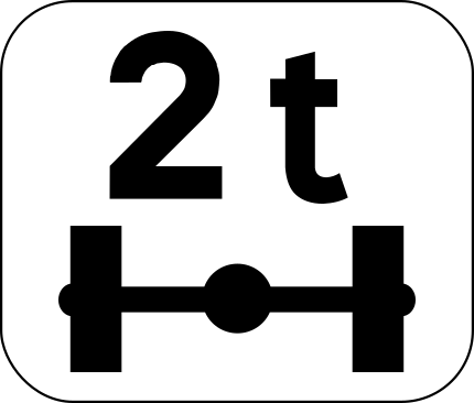
53. Indicated axle load
This supplementary sign shows an indicated axle load. Read it together with the main traffic sign to determine the applicable axle-load restriction.
English • Supplementary plate M4r • Indicates vehicles with an axle load exceeding the value shown. Inscription: 2 t.
Français • Panonceau M4r • Désigne les véhicules pesant sur un essieu plus que le nombre indiqué. Inscription : 2 t.
Sources
🔗 Commons.wikimedia.org
🔗 Equipementsdelaroute.cerema.fr • Arrêté du 24 novembre 1967
© Chabe01 et les contributeurs Wikimedia • CC BY-SA 4.0 • SVG original non modifié.
Image via Commons.wikimedia.org
Chabe01 • CC BY-SA 4.0 • Source revision 2019-10-03. Wikimedia original unmodified.
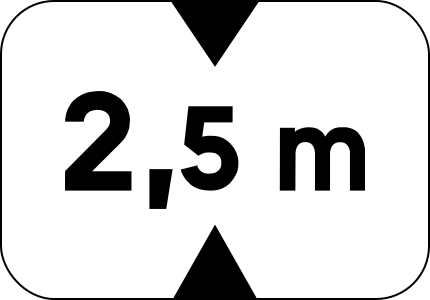
54. Indicated height
This supplementary sign shows an indicated vehicle height. Read it together with the main traffic sign to determine how the height value affects the applicable rule or restriction.
English • Supplementary plate M4v • Indicates vehicles higher than the value shown, including their load. Inscription: 2.5 m.
Français • Panonceau M4v • Désigne les véhicules dont la hauteur, chargement compris, est supérieure au nombre indiqué. Inscription : 2,5 m.
Sources
🔗 Commons.wikimedia.org
🔗 Equipementsdelaroute.cerema.fr • Arrêté du 24 novembre 1967
© Chabe01 et les contributeurs Wikimedia • CC BY-SA 4.0 • SVG original non modifié.
Image via Commons.wikimedia.org
Chabe01 • CC BY-SA 4.0 • Source revision 2019-10-03. Wikimedia original unmodified.
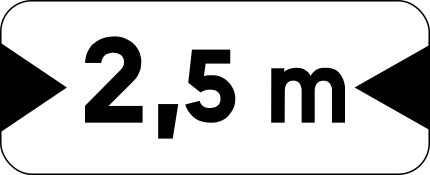
55. Indicated width
This supplementary sign shows an indicated vehicle width. Read it together with the main traffic sign to determine how the width value affects the applicable rule or restriction.
English • Supplementary plate M4u • Indicates vehicles wider than the value shown, including their load. Inscription: 2.5 m.
Français • Panonceau M4u • Désigne les véhicules dont la largeur, chargement compris, est supérieure au nombre indiqué. Inscription : 2,5 m.
Sources
🔗 Commons.wikimedia.org
🔗 Equipementsdelaroute.cerema.fr • Arrêté du 24 novembre 1967
© Chabe01 et les contributeurs Wikimedia • CC BY-SA 4.0 • SVG original non modifié.
Image via Commons.wikimedia.org
Chabe01 • CC BY-SA 4.0 • Source revision 2019-10-03. Wikimedia original unmodified.
56. Junction shape
This supplementary sign shows the shape or layout of the upcoming junction.
English • Supplementary plate M7 • Diagram of the approaching junction showing the priority branches with a thick line. The vertical branch in the lower half represents the road on which the plate is installed.
Français • Panonceau M7 • Il représente par un schéma l'intersection qui va être abordée et indique par un trait large les branches prioritaires. La branche verticale dans la moitié inférieure du panonceau représente la route sur laquelle il est implanté.
Sources
🔗 Commons.wikimedia.org
🔗 Equipementsdelaroute.cerema.fr • Arrêté du 24 novembre 1967 Source : Mathgb • CC0 1.0 • SVG original non modifié.
Image via Commons.wikimedia.org
Mathgb • CC0 • Source revision 2014-02-15. Wikimedia original unmodified.
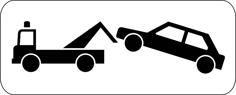
57. Illegally parked vehicles may be towed
This supplementary sign warns that illegally parked vehicles may be towed away.
English • Supplementary plate M6a • Stopping or parking constitutes an obstruction under article R. 417-10 of the Highway Code or a serious obstruction under article R. 417-11. This plate may accompany sign B6a1, B6b1 or B6d and indicates that an offending vehicle may be impounded.
Français • Panonceau M6a • Indique que l'arrêt ou le stationnement est gênant au sens de l'article R. 417-10 du code de la route ou très gênant au sens de l'article R. 417-11 du code de la route. Il peut compléter le panneau B6a1, B6b1 ou B6d et indique qu'un véhicule en infraction est susceptible d'une mise en fourrière.
Sources
🔗 Commons.wikimedia.org
🔗 Equipementsdelaroute.cerema.fr • Arrêté du 24 novembre 1967
© Paris 16 et les contributeurs Wikimedia • CC BY-SA 4.0 • SVG original non modifié.
Image via Commons.wikimedia.org
Paris 16 • CC BY-SA 4.0 • Source revision 2017-08-19. Wikimedia original unmodified.
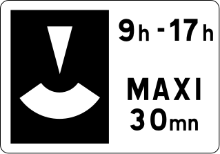
58. Disc parking, maximum 2 hours
This supplementary sign indicates that a parking disc must be used and parking is limited to a maximum of 2 hours.
English • Supplementary plate M6c • Indicates the maximum parking duration controlled by parking discs and the period during which the measure applies. Inscription: 9 h–17 h — MAXIMUM 30 min.
Français • Panonceau M6c • Indique la durée limite maximum du stationnement avec contrôle par disque, ainsi que les limites de la période d'application de la mesure. Inscription : 9 h–17 h — MAXI 30 mn.
Sources
🔗 Commons.wikimedia.org
🔗 Equipementsdelaroute.cerema.fr • Arrêté du 24 novembre 1967
© Roulex 45 et les contributeurs Wikimedia • CC BY-SA 3.0 • SVG original non modifié.
Image via Commons.wikimedia.org
Roulex 45 • CC BY-SA 3.0 • Source revision 2025-03-16. Wikimedia original unmodified.
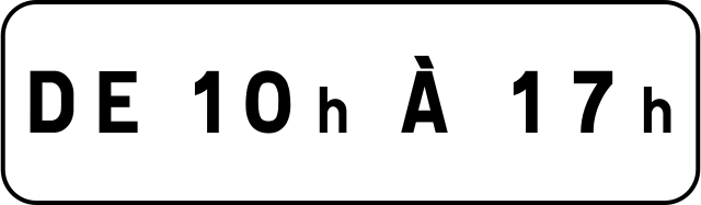
59. During the time shown
This supplementary sign indicates that the main traffic sign applies during the time shown.
English • Supplementary plate M11b1 • Indicates the period during which the requirement or information applies. Inscription: FROM 10 h TO 17 h.
Français • Panonceau M11b1 • Indiquant la période durant laquelle la prescription ou l'indication s'applique. Inscription : DE 10 h À 17 h.
Sources
🔗 Commons.wikimedia.org
🔗 Equipementsdelaroute.cerema.fr • Arrêté du 24 novembre 1967 Source : Roulex 45 • Domaine public • SVG original non modifié.
Image via Commons.wikimedia.org
Roulex 45 self-made from source above • Public domain • Source revision 2025-03-17. Wikimedia original unmodified.
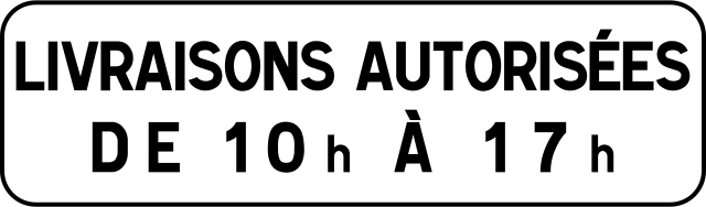
60. Deliveries allowed during the time shown
This supplementary sign indicates that deliveries are allowed during the time shown.
English • Supplementary plate M11b2 • Indicates specific requirements in a pedestrian area, a residential area or a 30 km/h zone. Inscription: DELIVERIES PERMITTED FROM 10 h TO 17 h.
Français • Panonceau M11b2 • Indiquant les prescriptions particulières qui s'appliquent dans une aire piétonne ou une zone de rencontre ou une zone 30. Inscription : LIVRAISONS AUTORISÉES DE 10 h À 17 h.
Sources
🔗 Commons.wikimedia.org
🔗 Equipementsdelaroute.cerema.fr • Arrêté du 24 novembre 1967 Source : Roulex 45 • Domaine public • SVG original non modifié.
Image via Commons.wikimedia.org
Roulex 45 self-made from source above • Public domain • Source revision 2025-03-17. Wikimedia original unmodified.
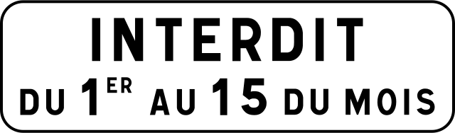
61. Prohibited from the 1st to the 15th
This supplementary sign indicates that the prohibition applies from the 1st to the 15th of each month.
English • Supplementary plate M6b • Parking is on one side only, alternating twice monthly. Inscription: PROHIBITED FROM THE 1ST TO THE 15TH OF THE MONTH.
Français • Panonceau M6b • Indique que le stationnement est unilatéral à alternance semi-mensuelle. Inscription : INTERDIT DU 1ER AU 15 DU MOIS.
Sources
🔗 Commons.wikimedia.org
🔗 Equipementsdelaroute.cerema.fr • Arrêté du 24 novembre 1967
© Chabe01 et les contributeurs Wikimedia • CC BY-SA 4.0 • SVG original non modifié.
Image via Commons.wikimedia.org
Chabe01 • CC BY-SA 4.0 • Source revision 2019-10-04. Wikimedia original unmodified.
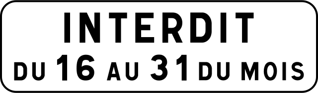
62. Prohibited from the 16th to month-end
This supplementary sign indicates that the prohibition applies from the 16th to the last day of each month.
English • Supplementary plate M6b • Parking is on one side only, alternating twice monthly. Inscription: PROHIBITED FROM THE 16TH TO THE 31ST OF THE MONTH.
Français • Panonceau M6b • Indique que le stationnement est unilatéral à alternance semi-mensuelle. Inscription : INTERDIT DU 16 AU 31 DU MOIS.
Sources
🔗 Commons.wikimedia.org
🔗 Equipementsdelaroute.cerema.fr • Arrêté du 24 novembre 1967
© Chabe01 et les contributeurs Wikimedia • CC BY-SA 4.0 • SVG original non modifié.
Image via Commons.wikimedia.org
Chabe01 • CC BY-SA 4.0 • Source revision 2019-10-04. Wikimedia original unmodified.
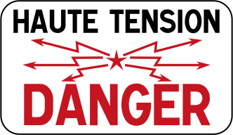
63. High voltage
This supplementary sign indicates a high-voltage electrical hazard associated with the situation shown by the main traffic sign.
English • Supplementary plate M9z • Various information given by an inscription. Inscription: HIGH VOLTAGE — DANGER.
Français • Panonceau M9z • Donnant des indications diverses par inscriptions. Inscription : HAUTE TENSION — DANGER.
Sources
🔗 Commons.wikimedia.org
🔗 Equipementsdelaroute.cerema.fr • Arrêté du 24 novembre 1967
© Mathgb et les contributeurs Wikimedia • CC BY-SA 3.0 • SVG original non modifié.
Image via Commons.wikimedia.org
Mathgb • CC BY-SA 3.0 • Source revision 2014-10-06. Wikimedia original unmodified.
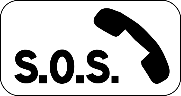
64. Emergency telephone
This supplementary sign indicates that an emergency telephone is available at or near the location indicated by the main traffic sign.
English • Supplementary plate M9e • The emergency stopping place has an emergency call point.
Français • Panonceau M9e • Indiquant que l'emplacement d'arrêt d'urgence est doté d'un poste d'appel d'urgence.
Sources
🔗 Commons.wikimedia.org
🔗 Equipementsdelaroute.cerema.fr • Arrêté du 24 novembre 1967 Source : Mathgb • CC0 1.0 • SVG original non modifié.
Image via Commons.wikimedia.org
Mathgb • CC0 • Source revision 2020-07-09. Wikimedia original unmodified.
65. Steep ascent
This supplementary sign indicates that the main traffic sign relates to a steep ascent.
English • Supplementary plate M9j2 • Risk of colliding with slow vehicles on an uphill section.
Français • Panonceau M9j2 • Indiquant, dans une montée, le risque de heurt de véhicules lents.
Sources
🔗 Commons.wikimedia.org
🔗 Equipementsdelaroute.cerema.fr • Arrêté du 24 novembre 1967
© Roulex 45 et les contributeurs Wikimedia • CC BY-SA 3.0 • SVG original non modifié.
Image via Commons.wikimedia.org
Roulex 45 • CC BY-SA 3.0 • Source revision 2008-05-18. Wikimedia original unmodified.
66. Steep descent
This supplementary sign indicates that the main traffic sign relates to a steep descent.
English • Supplementary plate M9j1 • Risk of colliding with slow vehicles on a downhill section.
Français • Panonceau M9j1 • Indiquant, dans une descente, le risque de heurt de véhicules lents.
Sources
🔗 Commons.wikimedia.org
🔗 Equipementsdelaroute.cerema.fr • Arrêté du 24 novembre 1967
© Roulex 45 et les contributeurs Wikimedia • CC BY-SA 3.0 • SVG original non modifié.
Image via Commons.wikimedia.org
Roulex 45 • CC BY-SA 3.0 • Source revision 2008-05-18. Wikimedia original unmodified.
67. Speed bump
This supplementary sign warns of a speed bump.
English • Supplementary plate M9d • The pedestrian crossing is raised.
Français • Panonceau M9d • Indiquant que le passage pour piétons est surélevé.
Sources
🔗 Commons.wikimedia.org
🔗 Equipementsdelaroute.cerema.fr • Arrêté du 24 novembre 1967 Source : Mathgb • CC0 1.0 • SVG original non modifié.
Image via Commons.wikimedia.org
Mathgb • CC0 • Source revision 2014-02-15. Wikimedia original unmodified.
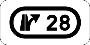
68. Exit number
This supplementary sign gives the number of the indicated exit.
English • Supplementary plate M10b • Indicates an interchange number. Inscription: 28.
Français • Panonceau M10b • Indiquant le numéro d'un échangeur. Inscription : 28.
Sources
🔗 Commons.wikimedia.org
🔗 Equipementsdelaroute.cerema.fr • Arrêté du 24 novembre 1967 Source : Mathgb • CC0 1.0 • SVG original non modifié.
Image via Commons.wikimedia.org
Mathgb • CC0 • Source revision 2014-02-15. Wikimedia original unmodified.
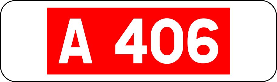
69. Motorway number
This supplementary sign gives the number of the indicated motorway.
English • Supplementary plate M10a • Indicates a road or motorway number. Inscription: A 406.
Français • Panonceau M10a • Indiquant le numéro d'une route ou d'une autoroute. Inscription : A 406.
Sources
🔗 Commons.wikimedia.org
🔗 Equipementsdelaroute.cerema.fr • Arrêté du 24 novembre 1967 Source : Chabe01 • Domaine public • SVG original non modifié.
Image via Commons.wikimedia.org
Chabe01 self-made from source above • Public domain • Source revision 2020-07-09. Wikimedia original unmodified.
70. Motorway number and ring road
This supplementary sign identifies the motorway number and indicates that the route forms part of a ring road.
English • Supplementary plate M10c2 • Indicates access to a ring road. Inscription: A 104.
Français • Panonceau M10c2 • Indiquant l'accès à une rocade. Inscription : A 104.
Sources
🔗 Commons.wikimedia.org
🔗 Equipementsdelaroute.cerema.fr • Arrêté du 24 novembre 1967 Source : Roulex 45 • Domaine public • SVG original non modifié.
Image via Commons.wikimedia.org
Roulex 45 self-made from source above • Public domain • Source revision 2020-07-09. Wikimedia original unmodified.
71. Ring road
This supplementary sign indicates that the route shown by the main traffic sign is a ring road.
English • Supplementary plate M10c3 • Indicates access to a ring road. Inscription: ring road.
Français • Panonceau M10c3 • Indiquant l'accès à une rocade. Inscription : périphérique.
Sources
🔗 Commons.wikimedia.org
🔗 Equipementsdelaroute.cerema.fr • Arrêté du 24 novembre 1967 Source : Roulex 45 • Domaine public • SVG original non modifié.
Image via Commons.wikimedia.org
Roulex 45 self-made from source above • Public domain • Source revision 2012-02-02. Wikimedia original unmodified.
72. Narrow roadway
This supplementary sign warns that the roadway ahead is narrow.
English • Supplementary plate KM9 • Additional information accompanying a temporary AK danger sign. Inscription: ROAD NARROWS.
Français • Panonceau KM9 • Indications diverses complétant un panneau temporaire de danger AK. Inscription : CHAUSSÉE RÉTRÉCIE.
Sources
🔗 Commons.wikimedia.org
🔗 Equipementsdelaroute.cerema.fr • Arrêté du 24 novembre 1967
© Mathgb et les contributeurs Wikimedia • CC BY-SA 3.0 • SVG original non modifié.
Image via Commons.wikimedia.org
Mathgb • CC BY-SA 3.0 • Source revision 2014-02-15. Wikimedia original unmodified.
73. Single-file traffic
This supplementary sign indicates that vehicles must proceed in a single line.
English • Supplementary plate KM9 • Additional information accompanying a temporary AK danger sign. Inscription: SINGLE LANE.
Français • Panonceau KM9 • Indications diverses complétant un panneau temporaire de danger AK. Inscription : VOIE UNIQUE.
Sources
🔗 Commons.wikimedia.org
🔗 Equipementsdelaroute.cerema.fr • Arrêté du 24 novembre 1967
© Mathgb et les contributeurs Wikimedia • CC BY-SA 3.0 • SVG original non modifié.
Image via Commons.wikimedia.org
Mathgb • CC BY-SA 3.0 • Source revision 2014-02-15. Wikimedia original unmodified.
74. Reminder
This supplementary sign indicates that the main traffic sign repeats a rule or restriction already in force.
English • Supplementary plate M9z • Various information given by an inscription. Inscription: REMINDER.
Français • Panonceau M9z • Donnant des indications diverses par inscriptions. Inscription : RAPPEL.
Sources
🔗 Commons.wikimedia.org
🔗 Equipementsdelaroute.cerema.fr • Arrêté du 24 novembre 1967
© Pyrog et les contributeurs Wikimedia • CC BY-SA 4.0 • SVG original non modifié.
Image via Commons.wikimedia.org
Pyrog • CC BY-SA 4.0 • Source revision 2025-03-19. Wikimedia original unmodified.
75. Scanning
This supplementary sign reminds road users to scan the road and surroundings for potential hazards.
English • Supplementary plate KM9 • Additional information accompanying a temporary AK danger sign. Inscription: ROAD SWEEPING.
Français • Panonceau KM9 • Indications diverses complétant un panneau temporaire de danger AK. Inscription : BALAYAGE.
Sources
🔗 Commons.wikimedia.org
🔗 Equipementsdelaroute.cerema.fr • Arrêté du 24 novembre 1967
© Mathgb et les contributeurs Wikimedia • CC BY-SA 3.0 • SVG original non modifié.
Image via Commons.wikimedia.org
Mathgb • CC BY-SA 3.0 • Source revision 2014-02-15. Wikimedia original unmodified.
76. Danger
This supplementary sign warns of a general or unspecified danger associated with the main traffic sign.
English • Supplementary plate KM9 • Additional information accompanying a temporary AK danger sign. Inscription: DANGER.
Français • Panonceau KM9 • Indications diverses complétant un panneau temporaire de danger AK. Inscription : DANGER.
Sources
🔗 Commons.wikimedia.org
🔗 Equipementsdelaroute.cerema.fr • Arrêté du 24 novembre 1967
© Mathgb et les contributeurs Wikimedia • CC BY-SA 3.0 • SVG original non modifié.
Image via Commons.wikimedia.org
Mathgb • CC BY-SA 3.0 • Source revision 2014-02-15. Wikimedia original unmodified.
77. Accident
This supplementary sign warns of an accident or accident scene ahead.
English • Supplementary plate KM9 • Additional information accompanying a temporary AK danger sign. Inscription: ACCIDENT.
Français • Panonceau KM9 • Indications diverses complétant un panneau temporaire de danger AK. Inscription : ACCIDENT.
Sources
🔗 Commons.wikimedia.org
🔗 Equipementsdelaroute.cerema.fr • Arrêté du 24 novembre 1967
© Mathgb et les contributeurs Wikimedia • CC BY-SA 3.0 • SVG original non modifié.
Image via Commons.wikimedia.org
Mathgb • CC BY-SA 3.0 • Source revision 2014-02-15. Wikimedia original unmodified.
78. Damaged roadway
This supplementary sign warns of a damaged or uneven road surface.
English • Supplementary plate KM9 • Additional information accompanying a temporary AK danger sign. Inscription: UNEVEN ROAD SURFACE.
Français • Panonceau KM9 • Indications diverses complétant un panneau temporaire de danger AK. Inscription : CHAUSSÉE DÉFORMÉE.
Sources
🔗 Commons.wikimedia.org
🔗 Equipementsdelaroute.cerema.fr • Arrêté du 24 novembre 1967
© Mathgb et les contributeurs Wikimedia • CC BY-SA 3.0 • SVG original non modifié.
Image via Commons.wikimedia.org
Mathgb • CC BY-SA 3.0 • Source revision 2014-02-15. Wikimedia original unmodified.
79. Soft verge
This supplementary sign warns that the verge beside the roadway is soft or unstable.
English • Supplementary plate KM9 • Additional information accompanying a temporary AK danger sign. Inscription: SOFT SHOULDERS.
Français • Panonceau KM9 • Indications diverses complétant un panneau temporaire de danger AK. Inscription : ACCOTEMENTS NON STABILISÉS.
Sources
🔗 Commons.wikimedia.org
🔗 Equipementsdelaroute.cerema.fr • Arrêté du 24 novembre 1967
© Mathgb et les contributeurs Wikimedia • CC BY-SA 3.0 • SVG original non modifié.
Image via Commons.wikimedia.org
Mathgb • CC BY-SA 3.0 • Source revision 2014-02-15. Wikimedia original unmodified.
80. Grit
This supplementary sign warns that the road surface may be covered with loose grit.
English • Supplementary plate KM9 • Additional information accompanying a temporary AK danger sign. Inscription: LOOSE CHIPPINGS.
Français • Panonceau KM9 • Indications diverses complétant un panneau temporaire de danger AK. Inscription : GRAVILLONS.
Sources
🔗 Commons.wikimedia.org
🔗 Equipementsdelaroute.cerema.fr • Arrêté du 24 novembre 1967
© Mathgb et les contributeurs Wikimedia • CC BY-SA 3.0 • SVG original non modifié.
Image via Commons.wikimedia.org
Mathgb • CC BY-SA 3.0 • Source revision 2014-02-15. Wikimedia original unmodified.
81. Mud
This supplementary sign warns of mud on the road surface, which may reduce traction.
English • Supplementary plate KM9 • Additional information accompanying a temporary AK danger sign. Inscription: MUD.
Français • Panonceau KM9 • Indications diverses complétant un panneau temporaire de danger AK. Inscription : BOUE.
Sources
🔗 Commons.wikimedia.org
🔗 Equipementsdelaroute.cerema.fr • Arrêté du 24 novembre 1967
© Mathgb et les contributeurs Wikimedia • CC BY-SA 3.0 • SVG original non modifié.
Image via Commons.wikimedia.org
Mathgb • CC BY-SA 3.0 • Source revision 2014-02-15. Wikimedia original unmodified.
82. New road surface
This supplementary sign indicates that the road ahead has a newly laid or recently repaired surface.
English • Supplementary plate KM9 • Additional information accompanying a temporary AK danger sign. Inscription: TARRING.
Français • Panonceau KM9 • Indications diverses complétant un panneau temporaire de danger AK. Inscription : GOUDRONNAGE.
Sources
🔗 Commons.wikimedia.org
🔗 Equipementsdelaroute.cerema.fr • Arrêté du 24 novembre 1967
© Mathgb et les contributeurs Wikimedia • CC BY-SA 3.0 • SVG original non modifié.
Image via Commons.wikimedia.org
Mathgb • CC BY-SA 3.0 • Source revision 2014-02-15. Wikimedia original unmodified.
83. Road markings
This supplementary sign indicates that the main traffic sign relates to road markings.
English • Supplementary plate KM9 • Additional information accompanying a temporary AK danger sign. Inscription: ROAD MARKING.
Français • Panonceau KM9 • Indications diverses complétant un panneau temporaire de danger AK. Inscription : MARQUAGE.
Sources
🔗 Commons.wikimedia.org
🔗 Equipementsdelaroute.cerema.fr • Arrêté du 24 novembre 1967
© Mathgb et les contributeurs Wikimedia • CC BY-SA 3.0 • SVG original non modifié.
Image via Commons.wikimedia.org
Mathgb • CC BY-SA 3.0 • Source revision 2014-02-15. Wikimedia original unmodified.
84. Black ice
This supplementary sign warns of a risk of black ice on the road surface.
English • Supplementary plate KM9 • Additional information accompanying a temporary AK danger sign. Inscription: ICE.
Français • Panonceau KM9 • Indications diverses complétant un panneau temporaire de danger AK. Inscription : VERGLAS.
Sources
🔗 Commons.wikimedia.org
🔗 Equipementsdelaroute.cerema.fr • Arrêté du 24 novembre 1967
© Mathgb et les contributeurs Wikimedia • CC BY-SA 3.0 • SVG original non modifié.
Image via Commons.wikimedia.org
Mathgb • CC BY-SA 3.0 • Source revision 2014-02-15. Wikimedia original unmodified.
85. Slippery road
This supplementary sign warns of a slippery road surface.
English • Supplementary plate KM9 • Additional information accompanying a temporary AK danger sign. Inscription: SLIPPERY ROAD.
Français • Panonceau KM9 • Indications diverses complétant un panneau temporaire de danger AK. Inscription : ROUTE GLISSANTE.
Sources
🔗 Commons.wikimedia.org
🔗 Equipementsdelaroute.cerema.fr • Arrêté du 24 novembre 1967
© Mathgb et les contributeurs Wikimedia • CC BY-SA 3.0 • SVG original non modifié.
Image via Commons.wikimedia.org
Mathgb • CC BY-SA 3.0 • Source revision 2014-02-15. Wikimedia original unmodified.
86. High tide or flooding
This supplementary sign warns that the road may be flooded or submerged during high tide or high water.
English • Supplementary plate KM9 • Additional information accompanying a temporary AK danger sign. Inscription: FLOODING.
Français • Panonceau KM9 • Indications diverses complétant un panneau temporaire de danger AK. Inscription : INONDATION.
Sources
🔗 Commons.wikimedia.org
🔗 Equipementsdelaroute.cerema.fr • Arrêté du 24 novembre 1967
© Mathgb et les contributeurs Wikimedia • CC BY-SA 3.0 • SVG original non modifié.
Image via Commons.wikimedia.org
Mathgb • CC BY-SA 3.0 • Source revision 2014-02-15. Wikimedia original unmodified.
87. Falling rocks
This supplementary sign warns of a risk of falling rocks or debris on the road.
English • Supplementary plate KM9 • Additional information accompanying a temporary AK danger sign. Inscription: FALLING ROCKS.
Français • Panonceau KM9 • Indications diverses complétant un panneau temporaire de danger AK. Inscription : CHUTES DE PIERRES.
Sources
🔗 Commons.wikimedia.org
🔗 Equipementsdelaroute.cerema.fr • Arrêté du 24 novembre 1967
© Mathgb et les contributeurs Wikimedia • CC BY-SA 3.0 • SVG original non modifié.
Image via Commons.wikimedia.org
Mathgb • CC BY-SA 3.0 • Source revision 2014-02-15. Wikimedia original unmodified.
88. Landslide
This supplementary sign warns of a risk of landslides or earth and debris on the road.
English • Supplementary plate KM9 • Additional information accompanying a temporary AK danger sign. Inscription: SUBSIDENCE.
Français • Panonceau KM9 • Indications diverses complétant un panneau temporaire de danger AK. Inscription : AFFAISSEMENT.
Sources
🔗 Commons.wikimedia.org
🔗 Equipementsdelaroute.cerema.fr • Arrêté du 24 novembre 1967
© Mathgb et les contributeurs Wikimedia • CC BY-SA 3.0 • SVG original non modifié.
Image via Commons.wikimedia.org
Mathgb • CC BY-SA 3.0 • Source revision 2014-02-15. Wikimedia original unmodified.
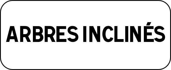
89. Leaning trees
This supplementary sign warns that trees lean or extend over the roadway and may reduce vertical clearance.
English • Supplementary plate M9z • Various information given by an inscription. Inscription: LEANING TREES.
Français • Panonceau M9z • Donnant des indications diverses par inscriptions. Inscription : ARBRES INCLINÉS.
Sources
🔗 Commons.wikimedia.org
🔗 Equipementsdelaroute.cerema.fr • Arrêté du 24 novembre 1967
© Paris 16 et les contributeurs Wikimedia • CC BY-SA 4.0 • SVG original non modifié.
Image via Commons.wikimedia.org
Paris 16 • CC BY-SA 4.0 • Source revision 2017-08-20. Wikimedia original unmodified.
90. Logging
This supplementary sign warns of logging operations or timber-transport vehicles on the road ahead.
English • Supplementary plate KM9 • Additional information accompanying a temporary AK danger sign. Inscription: TIMBER EXTRACTION.
Français • Panonceau KM9 • Indications diverses complétant un panneau temporaire de danger AK. Inscription : DÉBARDAGE.
Sources
🔗 Commons.wikimedia.org
🔗 Equipementsdelaroute.cerema.fr • Arrêté du 24 novembre 1967
© Mathgb et les contributeurs Wikimedia • CC BY-SA 3.0 • SVG original non modifié.
Image via Commons.wikimedia.org
Mathgb • CC BY-SA 3.0 • Source revision 2014-02-15. Wikimedia original unmodified.
91. Mowing
This supplementary sign warns that mowing or grass-cutting operations are taking place beside or within the roadway.
English • Supplementary plate KM9 • Additional information accompanying a temporary AK danger sign. Inscription: MOWING.
Français • Panonceau KM9 • Indications diverses complétant un panneau temporaire de danger AK. Inscription : FAUCHAGE.
Sources
🔗 Commons.wikimedia.org
🔗 Equipementsdelaroute.cerema.fr • Arrêté du 24 novembre 1967
© Mathgb et les contributeurs Wikimedia • CC BY-SA 3.0 • SVG original non modifié.
Image via Commons.wikimedia.org
Mathgb • CC BY-SA 3.0 • Source revision 2014-02-15. Wikimedia original unmodified.
92. Pruning
This supplementary sign warns that tree-pruning work is taking place near the roadway.
English • Supplementary plate KM9 • Additional information accompanying a temporary AK danger sign. Inscription: TREE PRUNING.
Français • Panonceau KM9 • Indications diverses complétant un panneau temporaire de danger AK. Inscription : ÉLAGAGE.
Sources
🔗 Commons.wikimedia.org
🔗 Equipementsdelaroute.cerema.fr • Arrêté du 24 novembre 1967
© Mathgb et les contributeurs Wikimedia • CC BY-SA 3.0 • SVG original non modifié.
Image via Commons.wikimedia.org
Mathgb • CC BY-SA 3.0 • Source revision 2014-02-15. Wikimedia original unmodified.
93. Construction site
This supplementary sign warns of a construction site or roadworks ahead.
English • Supplementary plate KM9 • Additional information accompanying a temporary AK danger sign. Inscription: MOBILE ROADWORKS.
Français • Panonceau KM9 • Indications diverses complétant un panneau temporaire de danger AK. Inscription : CHANTIER MOBILE.
Sources
🔗 Commons.wikimedia.org
🔗 Equipementsdelaroute.cerema.fr • Arrêté du 24 novembre 1967
© Mathgb et les contributeurs Wikimedia • CC BY-SA 3.0 • SVG original non modifié.
Image via Commons.wikimedia.org
Mathgb • CC BY-SA 3.0 • Source revision 2014-02-15. Wikimedia original unmodified.
94. Construction traffic
This supplementary sign warns that construction vehicles may enter, leave or travel along the road.
English • Supplementary plate KM9 • Additional information accompanying a temporary AK danger sign. Inscription: MACHINERY CROSSING.
Français • Panonceau KM9 • Indications diverses complétant un panneau temporaire de danger AK. Inscription : PASSAGE D’ENGINS.
Sources
🔗 Commons.wikimedia.org
🔗 Equipementsdelaroute.cerema.fr • Arrêté du 24 novembre 1967
© Mathgb et les contributeurs Wikimedia • CC BY-SA 3.0 • SVG original non modifié.
Image via Commons.wikimedia.org
Mathgb • CC BY-SA 3.0 • Source revision 2014-02-15. Wikimedia original unmodified.
95. Construction site exit
This supplementary sign warns of an exit used by vehicles leaving a construction site.
English • Supplementary plate KM9 • Additional information accompanying a temporary AK danger sign. Inscription: CONSTRUCTION SITE EXIT.
Français • Panonceau KM9 • Indications diverses complétant un panneau temporaire de danger AK. Inscription : SORTIE DE CHANTIER.
Sources
🔗 Commons.wikimedia.org
🔗 Equipementsdelaroute.cerema.fr • Arrêté du 24 novembre 1967
© Mathgb et les contributeurs Wikimedia • CC BY-SA 3.0 • SVG original non modifié.
Image via Commons.wikimedia.org
Mathgb • CC BY-SA 3.0 • Source revision 2014-02-15. Wikimedia original unmodified.
96. Truck exit
This supplementary sign warns of an exit used by trucks or other heavy vehicles.
English • Supplementary plate KM9 • Additional information accompanying a temporary AK danger sign. Inscription: LORRIES EXITING.
Français • Panonceau KM9 • Indications diverses complétant un panneau temporaire de danger AK. Inscription : SORTIE DE CAMIONS.
Sources
🔗 Commons.wikimedia.org
🔗 Equipementsdelaroute.cerema.fr • Arrêté du 24 novembre 1967
© Mathgb et les contributeurs Wikimedia • CC BY-SA 3.0 • SVG original non modifié.
Image via Commons.wikimedia.org
Mathgb • CC BY-SA 3.0 • Source revision 2014-02-15. Wikimedia original unmodified.
97. Blasting work
This supplementary sign warns that blasting operations are taking place nearby.
English • Supplementary plate KM9 • Additional information accompanying a temporary AK danger sign. Inscription: BLASTING.
Français • Panonceau KM9 • Indications diverses complétant un panneau temporaire de danger AK. Inscription : TIR DE MINES.
Sources
🔗 Commons.wikimedia.org
🔗 Equipementsdelaroute.cerema.fr • Arrêté du 24 novembre 1967
© Mathgb et les contributeurs Wikimedia • CC BY-SA 3.0 • SVG original non modifié.
Image via Commons.wikimedia.org
Mathgb • CC BY-SA 3.0 • Source revision 2014-02-15. Wikimedia original unmodified.
98. Tunnel category D
This supplementary sign indicates that the main traffic sign applies to vehicles carrying dangerous goods for which access to category D road tunnels is prohibited under ADR.
English • Supplementary plate M11c1 • Indicates a tunnel's category, according to the dangerous goods permitted, by a letter from B to E. Inscription: D.
Français • Panonceau M11c1 • Indiquant par la lettre qu'il porte, comprise entre B et E, la catégorie d'un tunnel définie en fonction des marchandises dangereuses autorisées à y circuler. Inscription : D.
Sources
🔗 Commons.wikimedia.org
🔗 Equipementsdelaroute.cerema.fr • Arrêté du 24 novembre 1967
© Roulex 45 ; Bertrand GRONDIN et les contributeurs Wikimedia • CC BY-SA 3.0 • SVG original non modifié.
Image via Commons.wikimedia.org
🔗 Commons.wikimedia.org • E43.svg: Roulex 45
🔗 Commons.wikimedia.org • E44.svg: Roulex 45 derivative work: Bertrand GRONDIN (talk) • CC BY-SA 3.0
Source revision 2009-08-09. Wikimedia original unmodified.
