


Traffic signsFrance
 Traffic rules
 France
 Priority signs
 Warning signs
 Prohibitory signs
 Mandatory signs
 Information signs
 Additional signs
Traffic signs
A traffic sign is a standardised visual symbol placed along roads to guide, warn, or regulate drivers, cyclists, and pedestrians. These signs provide essential information about road conditions, rules, directions, and potential hazards, helping to ensure safety and smooth traffic flow. They come in various shapes and colours—such as triangular warning signs, circular prohibitory or mandatory signs, and rectangular information signs—each designed for quick recognition and clear understanding.
How are traffic signs grouped in France?
The national catalogue distinguishes danger, priority, prohibitions, obligations, indications, services and direction guidance. Category codes help identify the function.
Is a temporary speed limit at roadworks binding in France?
Where an authorised temporary regulatory speed limit is in force, you must obey it. A roadworks warning alone should not be mistaken for a new numerical limit, but conditions may require driving more slowly.
🔗 legifrance.gouv.fr • French Road Code — R411-25, R412-30, R413-1, R413-17; 1967 order articles 3–5

251. Mopeds allowed
This supplementary sign indicates that mopeds are allowed where the main traffic sign would otherwise restrict their access or use. The moped categories covered depend on the applicable local rules.
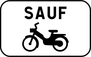
English • Supplementary plate M9z • Various information given by an inscription. Inscription: EXCEPT (mopeds).
Français • Panonceau M9z • Donnant des indications diverses par inscriptions. Inscription : SAUF (cyclomoteurs).
Sources
🔗 Commons.wikimedia.org
🔗 Equipementsdelaroute.cerema.fr • Arrêté du 24 novembre 1967
© Chabe01 et les contributeurs Wikimedia • CC BY-SA 4.0 • SVG original non modifié.
Image via Commons.wikimedia.org
Chabe01 • CC BY-SA 4.0 • Source revision 2019-10-04. Wikimedia original unmodified.
252. Mopeds allowed
This supplementary sign indicates that mopeds are allowed where the main traffic sign would otherwise restrict their access or use. The moped categories covered depend on the applicable local rules.

English • Supplementary plate M9z • Various information given by an inscription. Inscription: PROHIBITED EXCEPT (mopeds).
Français • Panonceau M9z • Donnant des indications diverses par inscriptions. Inscription : INTERDIT SAUF (cyclomoteurs).
Sources
🔗 Commons.wikimedia.org
🔗 Equipementsdelaroute.cerema.fr • Arrêté du 24 novembre 1967
© Chabe01 et les contributeurs Wikimedia • CC BY-SA 4.0 • SVG original non modifié.
Image via Commons.wikimedia.org
Chabe01 • CC BY-SA 4.0 • Source revision 2019-10-04. Wikimedia original unmodified.
253. Carpooling allowed
This supplementary sign indicates that vehicles used for carpooling are allowed where the main traffic sign would otherwise restrict access or use. Any required number of occupants depends on the applicable local rules.
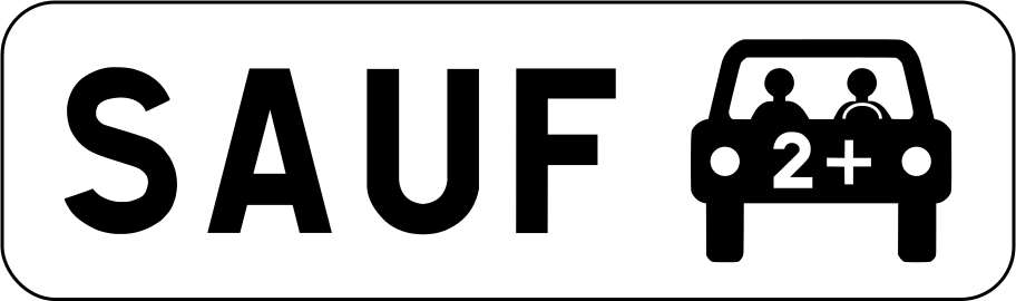
English • Supplementary plate M6k2 • Stopping or parking permitted only for vehicles used by people carpooling.
Français • Panonceau M6k2 • Signale que l'arrêt ou le stationnement n'est autorisé que pour les véhicules des usagers pratiquant le covoiturage.
Sources
🔗 Commons.wikimedia.org
🔗 Equipementsdelaroute.cerema.fr • Arrêté du 24 novembre 1967 Source : Chabe01 • Domaine public • SVG original non modifié.
Image via Commons.wikimedia.org
Chabe01 self-made from source above • Public domain • Source revision 2020-07-09. Wikimedia original unmodified.
254. Carsharing allowed
This supplementary sign indicates that carsharing vehicles are allowed where the main traffic sign would otherwise restrict their access or use. The qualifying vehicles or services depend on the applicable local rules.

English • Supplementary plate M6j • Stopping or parking reserved for vehicles bearing the ‘autopartage’ car-sharing label.
Français • Panonceau M6j • Signale que l'arrêt ou le stationnement est réservé aux véhicules bénéficiant du label "autopartage".
Sources
🔗 Commons.wikimedia.org
🔗 Equipementsdelaroute.cerema.fr • Arrêté du 24 novembre 1967 Source : Chabe01 • Domaine public • SVG original non modifié.
Image via Commons.wikimedia.org
Chabe01 self-made from source above • Public domain • Source revision 2020-07-09. Wikimedia original unmodified.
255. Electric vehicles allowed while charging
This supplementary sign indicates that electric vehicles are allowed while charging where the main traffic sign would otherwise impose a restriction. The exception applies only under the charging conditions indicated or required by the applicable local rules.
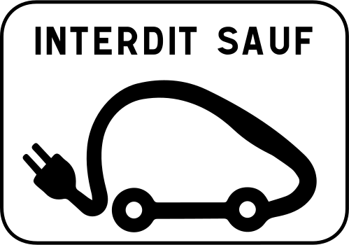
English • Supplementary plate M6i • Parking reserved for electric vehicles while their batteries are charging.
Français • Panonceau M6i • Signale que le stationnement est réservé aux véhicules électriques pendant la durée de recharge de leurs accumulateurs.
Sources
🔗 Commons.wikimedia.org
🔗 Equipementsdelaroute.cerema.fr • Arrêté du 24 novembre 1967
© Paris 16 et les contributeurs Wikimedia • CC BY-SA 4.0 • SVG original non modifié.
Image via Commons.wikimedia.org
Paris 16 • CC BY-SA 4.0 • Source revision 2025-03-16. Wikimedia original unmodified.
256. Service vehicles allowed
This supplementary sign indicates that service vehicles are allowed where the main traffic sign would otherwise restrict their access or use. The vehicles qualifying as service vehicles depend on the applicable local rules.
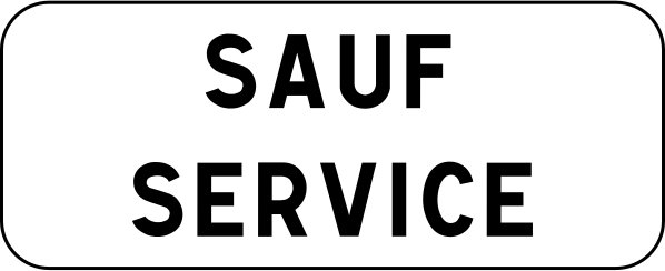
English • Supplementary plate M9z • Various information given by an inscription. Inscription: EXCEPT SERVICE VEHICLES.
Français • Panonceau M9z • Donnant des indications diverses par inscriptions. Inscription : SAUF SERVICE.
Sources
🔗 Commons.wikimedia.org
🔗 Equipementsdelaroute.cerema.fr • Arrêté du 24 novembre 1967
© Giacgiac21 et les contributeurs Wikimedia • CC BY-SA 4.0 • SVG original non modifié.
Image via Commons.wikimedia.org
Giacgiac21 • CC BY-SA 4.0 • Source revision 2023-05-20. Wikimedia original unmodified.
257. To the left
This supplementary sign indicates that the main traffic sign applies in the direction shown by the arrow, to the left.

English • Supplementary plate M3b • Indicates the direction to follow and, where applicable, the distance to reach the service shown on the sign.
Français • Panonceau M3b • Indique la direction à suivre, et éventuellement sur quelle distance, pour rencontrer le service indiqué par le panneau.
Sources
🔗 Commons.wikimedia.org
🔗 Equipementsdelaroute.cerema.fr • Arrêté du 24 novembre 1967 Source : Mathgb • CC0 1.0 • SVG original non modifié.
Image via Commons.wikimedia.org
Mathgb • CC0 • Source revision 2014-02-15. Wikimedia original unmodified.
258. To the left or right
This supplementary sign indicates that the main traffic sign applies in both directions shown by the arrows, to the left and right.

English • Supplementary plate M8f • The section to which the requirement applies extends in the direction or directions shown by the arrow or arrows.
Français • Panonceau M8f • Indiquant que la section sur laquelle s'applique la prescription s'étend dans le sens ou les sens indiqués par la ou les flèches.
Sources
🔗 Commons.wikimedia.org
🔗 Equipementsdelaroute.cerema.fr • Arrêté du 24 novembre 1967 Source : Mathgb • CC0 1.0 • SVG original non modifié.
Image via Commons.wikimedia.org
Mathgb • CC0 • Source revision 2014-02-15. Wikimedia original unmodified.
259. To the right
This supplementary sign indicates that the main traffic sign applies in the direction shown by the arrow, to the right.

English • Supplementary plate M3b • Indicates the direction to follow and, where applicable, the distance to reach the service shown on the sign.
Français • Panonceau M3b • Indique la direction à suivre, et éventuellement sur quelle distance, pour rencontrer le service indiqué par le panneau.
Sources
🔗 Commons.wikimedia.org
🔗 Equipementsdelaroute.cerema.fr • Arrêté du 24 novembre 1967 Source : Mathgb • CC0 1.0 • SVG original non modifié.
Image via Commons.wikimedia.org
Mathgb • CC0 • Source revision 2014-02-15. Wikimedia original unmodified.
260. Start of regulation for metres
This supplementary sign indicates that the regulation shown by the main traffic sign starts here and applies for the indicated distance.

English • Supplementary plate M8a • The section to which the requirement applies extends beyond the sign (beginning of the section). Inscription: 50 m.
Français • Panonceau M8a • Indiquant que la section sur laquelle s'applique la prescription s'étend après le panneau (c'est le début de la section). Inscription : 50 m.
Sources
🔗 Commons.wikimedia.org
🔗 Equipementsdelaroute.cerema.fr • Arrêté du 24 novembre 1967 Source : Mathgb • CC0 1.0 • SVG original non modifié.
Image via Commons.wikimedia.org
Mathgb • CC0 • Source revision 2025-03-21. Wikimedia original unmodified.
261. Start of regulation
This supplementary sign indicates the start of the regulation shown by the main traffic sign. The regulation begins at this point.

English • Supplementary plate M8a • The section to which the requirement applies extends beyond the sign (beginning of the section).
Français • Panonceau M8a • Indiquant que la section sur laquelle s'applique la prescription s'étend après le panneau (c'est le début de la section).
Sources
🔗 Commons.wikimedia.org
🔗 Equipementsdelaroute.cerema.fr • Arrêté du 24 novembre 1967 Source : Mathgb • CC0 1.0 • SVG original non modifié.
Image via Commons.wikimedia.org
Mathgb • CC0 • Source revision 2014-02-15. Wikimedia original unmodified.
262. Continuation of regulation
This supplementary sign indicates the continuation or reminder of the regulation shown by the main traffic sign.

English • Supplementary plate M8c • The section to which the requirement applies extends on both sides of the sign (reminder).
Français • Panonceau M8c • Indiquant que la section sur laquelle s'applique la prescription s'étend de part et d'autre du panneau (c'est un rappel).
Sources
🔗 Commons.wikimedia.org
🔗 Equipementsdelaroute.cerema.fr • Arrêté du 24 novembre 1967
© Chabe01 et les contributeurs Wikimedia • CC BY-SA 4.0 • SVG original non modifié.
Image via Commons.wikimedia.org
Chabe01 • CC BY-SA 4.0 • Source revision 2019-10-04. Wikimedia original unmodified.
263. End of regulation
This supplementary sign indicates the end of the regulation shown by the main traffic sign. The regulation ends at this point.

English • Supplementary plate M8b • The section to which the requirement applies lies before the sign (end of the section).
Français • Panonceau M8b • Indiquant que la section sur laquelle s'applique la prescription s'étend avant le panneau (c'est la fin de la section).
Sources
🔗 Commons.wikimedia.org
🔗 Equipementsdelaroute.cerema.fr • Arrêté du 24 novembre 1967 Source : Mathgb • CC0 1.0 • SVG original non modifié.
Image via Commons.wikimedia.org
Mathgb • CC0 • Source revision 2014-02-15. Wikimedia original unmodified.
264. Exit on the left
This supplementary sign indicates that the main traffic sign refers to an exit on the left of a road divided into traffic lanes.

English • Supplementary plate M3a • Indicates the position of the road to which the accompanying sign applies.
Français • Panonceau M3a • Indique la position de la voie concernée par le panneau qu'il complète.
Sources
🔗 Commons.wikimedia.org
🔗 Equipementsdelaroute.cerema.fr • Arrêté du 24 novembre 1967 Source : Gouvernement français • Domaine public • SVG original non modifié.
Image via Commons.wikimedia.org
Government of France • Public domain • Source revision 2014-05-11. Wikimedia original unmodified.
265. Applies to the indicated lane
This supplementary sign indicates that the main traffic sign applies specifically to the indicated traffic lane.

English • Supplementary plate M3d • The accompanying sign applies to the lane above which it is installed.
Français • Panonceau M3d • Indique que le panneau qu'il complète se rapporte à la voie au-dessus de laquelle il est implanté.
Sources
🔗 Commons.wikimedia.org
🔗 Equipementsdelaroute.cerema.fr • Arrêté du 24 novembre 1967
© Chabe01 et les contributeurs Wikimedia • CC BY-SA 4.0 • SVG original non modifié.
Image via Commons.wikimedia.org
Chabe01 • CC BY-SA 4.0 • Source revision 2019-10-04. Wikimedia original unmodified.
266. Exit on the right
This supplementary sign indicates that the main traffic sign refers to an exit on the right of a road divided into traffic lanes.

English • Supplementary plate M3a • Indicates the position of the road to which the accompanying sign applies.
Français • Panonceau M3a • Indique la position de la voie concernée par le panneau qu'il complète.
Sources
🔗 Commons.wikimedia.org
🔗 Equipementsdelaroute.cerema.fr • Arrêté du 24 novembre 1967 Source : Gouvernement français • Domaine public • SVG original non modifié.
Image via Commons.wikimedia.org
Government of France • Public domain • Source revision 2014-05-11. Wikimedia original unmodified.
267. metres ahead
This supplementary sign indicates the distance from the main traffic sign to the point where the indicated danger, regulation or information begins. The distance is shown in metres.

English • Supplementary plate M1 • Indicates the distance from the sign to the start of the hazard, the regulated area or the point referred to by the information. Inscription: 50 m.
Français • Panonceau M1 • Indique la longueur de la section comprise entre le signal et le début du passage dangereux ou de la zone où s'applique la réglementation ou du point qui fait l'objet de l'indication. Inscription : 50 m.
Sources
🔗 Commons.wikimedia.org
🔗 Equipementsdelaroute.cerema.fr • Arrêté du 24 novembre 1967, annexe Source : Mathgb • CC0 1.0 • SVG original non modifié.
Image via Commons.wikimedia.org
Mathgb • CC0 • Source revision 2025-03-16. Wikimedia original unmodified.
268. Stop metres ahead
This supplementary sign announces a STOP sign at the indicated distance ahead. The displayed value shows the distance to the upcoming STOP sign.
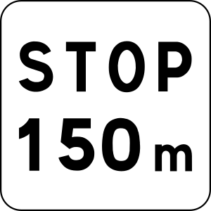
English • Supplementary plate M5 • Indicates the distance from the sign to the point where the driver must stop and give way. Inscription: STOP 150 m.
Français • Panonceau M5 • Il indique la distance comprise entre le signal et l'endroit où le conducteur doit marquer l'arrêt et céder le passage. Inscription : STOP 150 m.
Sources
🔗 Commons.wikimedia.org
🔗 Equipementsdelaroute.cerema.fr • Arrêté du 24 novembre 1967
© Chabe01 et les contributeurs Wikimedia • CC BY-SA 4.0 • SVG original non modifié.
Image via Commons.wikimedia.org
Chabe01 • CC BY-SA 4.0 • Source revision 2019-10-04. Wikimedia original unmodified.
269. Give way
This supplementary sign displays the instruction Give Way as additional information to the main traffic sign. It must be interpreted together with the main sign.
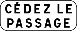
English • Supplementary plate M9c • Bearing the inscription ‘Give way’.
Français • Panonceau M9c • Portant l'inscription " Cédez le passage ".
Sources
🔗 Commons.wikimedia.org
🔗 Equipementsdelaroute.cerema.fr • Arrêté du 24 novembre 1967
© Chabe01 et les contributeurs Wikimedia • CC BY-SA 4.0 • SVG original non modifié.
Image via Commons.wikimedia.org
Chabe01 • CC BY-SA 4.0 • Source revision 2019-10-04. Wikimedia original unmodified.
270. Next petrol station kilometres ahead
This supplementary sign indicates the distance to the next petrol station. The displayed value shows the distance in kilometres.
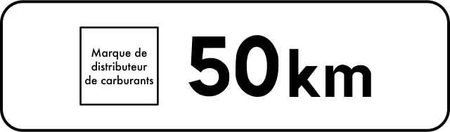
English • Supplementary plate M1a • Plate M1a indicates the fuel supplier's brand and the remaining distance to the next fuel station in a service area on a motorway or a dual carriageway without direct access to adjoining properties. Inscription: Fuel supplier brand — 50 km.
Français • Panonceau M1a • Le panonceau M1a indique la marque du distributeur de carburant et la distance restant à parcourir jusqu'au prochain poste de distribution de carburant situé sur une aire de service d'autoroute ou de route à chaussées séparées sans accès riverain. Inscription : Marque de distributeur de carburants — 50 km.
Sources
🔗 Commons.wikimedia.org
🔗 Equipementsdelaroute.cerema.fr • Arrêté du 24 novembre 1967
© Chabe01 et les contributeurs Wikimedia • CC BY-SA 4.0 • SVG original non modifié.
Image via Commons.wikimedia.org
Chabe01 • CC BY-SA 4.0 • Source revision 2025-03-16. Wikimedia original unmodified.
271. For metres
This supplementary sign indicates the length of the section to which the main traffic sign applies. The length is shown in metres.
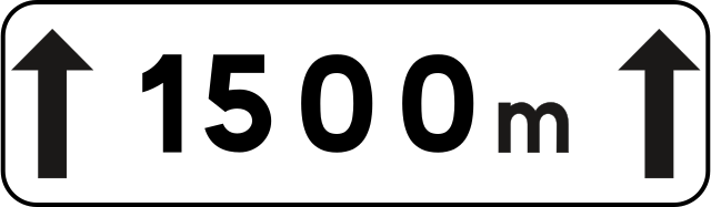
English • Supplementary plate M2 • Indicates the length of the hazardous section, regulated section or section referred to by the information. Inscription: 1500 m.
Français • Panonceau M2 • Indique la longueur de la section dangereuse ou soumise à réglementation ou visée par l'indication. Inscription : 1500 m.
Sources
🔗 Commons.wikimedia.org
🔗 Equipementsdelaroute.cerema.fr • Arrêté du 24 novembre 1967, annexe
© Pyrog et les contributeurs Wikimedia • CC BY-SA 4.0 • SVG original non modifié.
Image via Commons.wikimedia.org
Pyrog • CC BY-SA 4.0 • Source revision 2025-03-16. Wikimedia original unmodified.
272. Indicated mass
This supplementary sign shows an indicated vehicle mass. Read it together with the main traffic sign to determine how the mass value affects the applicable rule or restriction.

English • Supplementary plate M4f • Indicates vehicles, articulated vehicles, double road trains or vehicle combinations whose maximum authorised laden mass or maximum authorised combination mass exceeds the value shown. Inscription: 3.5 t.
Français • Panonceau M4f • Désigne les véhicules, véhicules articulés, trains doubles ou ensembles de véhicules dont le poids total autorisé en charge ou le poids total roulant autorisé excède le nombre indiqué. Inscription : 3,5 t.
Sources
🔗 Commons.wikimedia.org
🔗 Equipementsdelaroute.cerema.fr • Arrêté du 24 novembre 1967
© Pyrog et les contributeurs Wikimedia • CC BY-SA 4.0 • SVG original non modifié.
Image via Commons.wikimedia.org
Pyrog • CC BY-SA 4.0 • Source revision 2025-03-17. Wikimedia original unmodified.
273. Indicated mass
This supplementary sign shows an indicated vehicle mass. Read it together with the main traffic sign to determine how the mass value affects the applicable rule or restriction.

English • Supplementary plate M4f • Indicates vehicles, articulated vehicles, double road trains or vehicle combinations whose maximum authorised laden mass or maximum authorised combination mass exceeds the value shown. Inscription: 5.5 t.
Français • Panonceau M4f • Désigne les véhicules, véhicules articulés, trains doubles ou ensembles de véhicules dont le poids total autorisé en charge ou le poids total roulant autorisé excède le nombre indiqué. Inscription : 5,5 t.
Sources
🔗 Commons.wikimedia.org
🔗 Equipementsdelaroute.cerema.fr • Arrêté du 24 novembre 1967
© Chabe01 et les contributeurs Wikimedia • CC BY-SA 4.0 • SVG original non modifié.
Image via Commons.wikimedia.org
Chabe01 • CC BY-SA 4.0 • Source revision 2019-10-03. Wikimedia original unmodified.
274. Indicated axle load
This supplementary sign shows an indicated axle load. Read it together with the main traffic sign to determine the applicable axle-load restriction.
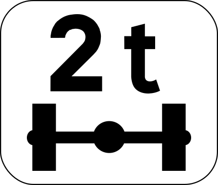
English • Supplementary plate M4r • Indicates vehicles with an axle load exceeding the value shown. Inscription: 2 t.
Français • Panonceau M4r • Désigne les véhicules pesant sur un essieu plus que le nombre indiqué. Inscription : 2 t.
Sources
🔗 Commons.wikimedia.org
🔗 Equipementsdelaroute.cerema.fr • Arrêté du 24 novembre 1967
© Chabe01 et les contributeurs Wikimedia • CC BY-SA 4.0 • SVG original non modifié.
Image via Commons.wikimedia.org
Chabe01 • CC BY-SA 4.0 • Source revision 2019-10-03. Wikimedia original unmodified.
275. Indicated height
This supplementary sign shows an indicated vehicle height. Read it together with the main traffic sign to determine how the height value affects the applicable rule or restriction.
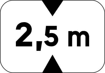
English • Supplementary plate M4v • Indicates vehicles higher than the value shown, including their load. Inscription: 2.5 m.
Français • Panonceau M4v • Désigne les véhicules dont la hauteur, chargement compris, est supérieure au nombre indiqué. Inscription : 2,5 m.
Sources
🔗 Commons.wikimedia.org
🔗 Equipementsdelaroute.cerema.fr • Arrêté du 24 novembre 1967
© Chabe01 et les contributeurs Wikimedia • CC BY-SA 4.0 • SVG original non modifié.
Image via Commons.wikimedia.org
Chabe01 • CC BY-SA 4.0 • Source revision 2019-10-03. Wikimedia original unmodified.
276. Indicated width
This supplementary sign shows an indicated vehicle width. Read it together with the main traffic sign to determine how the width value affects the applicable rule or restriction.
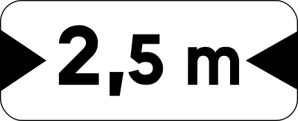
English • Supplementary plate M4u • Indicates vehicles wider than the value shown, including their load. Inscription: 2.5 m.
Français • Panonceau M4u • Désigne les véhicules dont la largeur, chargement compris, est supérieure au nombre indiqué. Inscription : 2,5 m.
Sources
🔗 Commons.wikimedia.org
🔗 Equipementsdelaroute.cerema.fr • Arrêté du 24 novembre 1967
© Chabe01 et les contributeurs Wikimedia • CC BY-SA 4.0 • SVG original non modifié.
Image via Commons.wikimedia.org
Chabe01 • CC BY-SA 4.0 • Source revision 2019-10-03. Wikimedia original unmodified.
277. Junction shape
This supplementary sign shows the shape or layout of the upcoming junction.

English • Supplementary plate M7 • Diagram of the approaching junction showing the priority branches with a thick line. The vertical branch in the lower half represents the road on which the plate is installed.
Français • Panonceau M7 • Il représente par un schéma l'intersection qui va être abordée et indique par un trait large les branches prioritaires. La branche verticale dans la moitié inférieure du panonceau représente la route sur laquelle il est implanté.
Sources
🔗 Commons.wikimedia.org
🔗 Equipementsdelaroute.cerema.fr • Arrêté du 24 novembre 1967 Source : Mathgb • CC0 1.0 • SVG original non modifié.
Image via Commons.wikimedia.org
Mathgb • CC0 • Source revision 2014-02-15. Wikimedia original unmodified.
278. Illegally parked vehicles may be towed
This supplementary sign warns that illegally parked vehicles may be towed away.
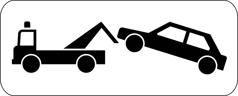
English • Supplementary plate M6a • Stopping or parking constitutes an obstruction under article R. 417-10 of the Highway Code or a serious obstruction under article R. 417-11. This plate may accompany sign B6a1, B6b1 or B6d and indicates that an offending vehicle may be impounded.
Français • Panonceau M6a • Indique que l'arrêt ou le stationnement est gênant au sens de l'article R. 417-10 du code de la route ou très gênant au sens de l'article R. 417-11 du code de la route. Il peut compléter le panneau B6a1, B6b1 ou B6d et indique qu'un véhicule en infraction est susceptible d'une mise en fourrière.
Sources
🔗 Commons.wikimedia.org
🔗 Equipementsdelaroute.cerema.fr • Arrêté du 24 novembre 1967
© Paris 16 et les contributeurs Wikimedia • CC BY-SA 4.0 • SVG original non modifié.
Image via Commons.wikimedia.org
Paris 16 • CC BY-SA 4.0 • Source revision 2017-08-19. Wikimedia original unmodified.
279. Disc parking, maximum 2 hours
This supplementary sign indicates that a parking disc must be used and parking is limited to a maximum of 2 hours.
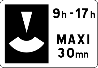
English • Supplementary plate M6c • Indicates the maximum parking duration controlled by parking discs and the period during which the measure applies. Inscription: 9 h–17 h — MAXIMUM 30 min.
Français • Panonceau M6c • Indique la durée limite maximum du stationnement avec contrôle par disque, ainsi que les limites de la période d'application de la mesure. Inscription : 9 h–17 h — MAXI 30 mn.
Sources
🔗 Commons.wikimedia.org
🔗 Equipementsdelaroute.cerema.fr • Arrêté du 24 novembre 1967
© Roulex 45 et les contributeurs Wikimedia • CC BY-SA 3.0 • SVG original non modifié.
Image via Commons.wikimedia.org
Roulex 45 • CC BY-SA 3.0 • Source revision 2025-03-16. Wikimedia original unmodified.
280. During the time shown
This supplementary sign indicates that the main traffic sign applies during the time shown.
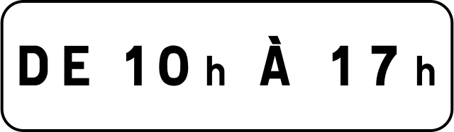
English • Supplementary plate M11b1 • Indicates the period during which the requirement or information applies. Inscription: FROM 10 h TO 17 h.
Français • Panonceau M11b1 • Indiquant la période durant laquelle la prescription ou l'indication s'applique. Inscription : DE 10 h À 17 h.
Sources
🔗 Commons.wikimedia.org
🔗 Equipementsdelaroute.cerema.fr • Arrêté du 24 novembre 1967 Source : Roulex 45 • Domaine public • SVG original non modifié.
Image via Commons.wikimedia.org
Roulex 45 self-made from source above • Public domain • Source revision 2025-03-17. Wikimedia original unmodified.
281. Deliveries allowed during the time shown
This supplementary sign indicates that deliveries are allowed during the time shown.
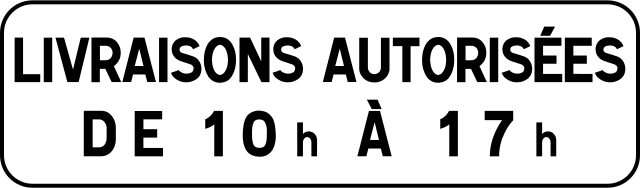
English • Supplementary plate M11b2 • Indicates specific requirements in a pedestrian area, a residential area or a 30 km/h zone. Inscription: DELIVERIES PERMITTED FROM 10 h TO 17 h.
Français • Panonceau M11b2 • Indiquant les prescriptions particulières qui s'appliquent dans une aire piétonne ou une zone de rencontre ou une zone 30. Inscription : LIVRAISONS AUTORISÉES DE 10 h À 17 h.
Sources
🔗 Commons.wikimedia.org
🔗 Equipementsdelaroute.cerema.fr • Arrêté du 24 novembre 1967 Source : Roulex 45 • Domaine public • SVG original non modifié.
Image via Commons.wikimedia.org
Roulex 45 self-made from source above • Public domain • Source revision 2025-03-17. Wikimedia original unmodified.
282. Prohibited from the 1st to the 15th
This supplementary sign indicates that the prohibition applies from the 1st to the 15th of each month.
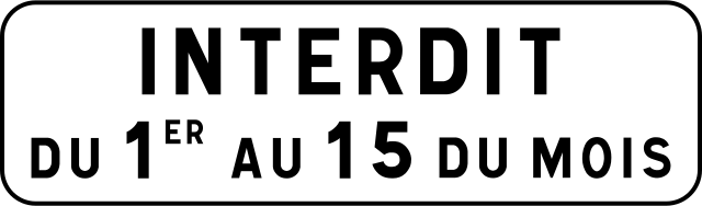
English • Supplementary plate M6b • Parking is on one side only, alternating twice monthly. Inscription: PROHIBITED FROM THE 1ST TO THE 15TH OF THE MONTH.
Français • Panonceau M6b • Indique que le stationnement est unilatéral à alternance semi-mensuelle. Inscription : INTERDIT DU 1ER AU 15 DU MOIS.
Sources
🔗 Commons.wikimedia.org
🔗 Equipementsdelaroute.cerema.fr • Arrêté du 24 novembre 1967
© Chabe01 et les contributeurs Wikimedia • CC BY-SA 4.0 • SVG original non modifié.
Image via Commons.wikimedia.org
Chabe01 • CC BY-SA 4.0 • Source revision 2019-10-04. Wikimedia original unmodified.
283. Prohibited from the 16th to month-end
This supplementary sign indicates that the prohibition applies from the 16th to the last day of each month.
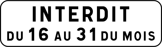
English • Supplementary plate M6b • Parking is on one side only, alternating twice monthly. Inscription: PROHIBITED FROM THE 16TH TO THE 31ST OF THE MONTH.
Français • Panonceau M6b • Indique que le stationnement est unilatéral à alternance semi-mensuelle. Inscription : INTERDIT DU 16 AU 31 DU MOIS.
Sources
🔗 Commons.wikimedia.org
🔗 Equipementsdelaroute.cerema.fr • Arrêté du 24 novembre 1967
© Chabe01 et les contributeurs Wikimedia • CC BY-SA 4.0 • SVG original non modifié.
Image via Commons.wikimedia.org
Chabe01 • CC BY-SA 4.0 • Source revision 2019-10-04. Wikimedia original unmodified.
284. High voltage
This supplementary sign indicates a high-voltage electrical hazard associated with the situation shown by the main traffic sign.
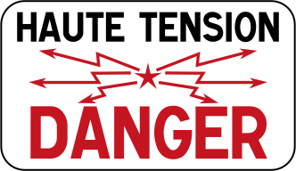
English • Supplementary plate M9z • Various information given by an inscription. Inscription: HIGH VOLTAGE — DANGER.
Français • Panonceau M9z • Donnant des indications diverses par inscriptions. Inscription : HAUTE TENSION — DANGER.
Sources
🔗 Commons.wikimedia.org
🔗 Equipementsdelaroute.cerema.fr • Arrêté du 24 novembre 1967
© Mathgb et les contributeurs Wikimedia • CC BY-SA 3.0 • SVG original non modifié.
Image via Commons.wikimedia.org
Mathgb • CC BY-SA 3.0 • Source revision 2014-10-06. Wikimedia original unmodified.
285. Emergency telephone
This supplementary sign indicates that an emergency telephone is available at or near the location indicated by the main traffic sign.

English • Supplementary plate M9e • The emergency stopping place has an emergency call point.
Français • Panonceau M9e • Indiquant que l'emplacement d'arrêt d'urgence est doté d'un poste d'appel d'urgence.
Sources
🔗 Commons.wikimedia.org
🔗 Equipementsdelaroute.cerema.fr • Arrêté du 24 novembre 1967 Source : Mathgb • CC0 1.0 • SVG original non modifié.
Image via Commons.wikimedia.org
Mathgb • CC0 • Source revision 2020-07-09. Wikimedia original unmodified.
286. Steep ascent
This supplementary sign indicates that the main traffic sign relates to a steep ascent.

English • Supplementary plate M9j2 • Risk of colliding with slow vehicles on an uphill section.
Français • Panonceau M9j2 • Indiquant, dans une montée, le risque de heurt de véhicules lents.
Sources
🔗 Commons.wikimedia.org
🔗 Equipementsdelaroute.cerema.fr • Arrêté du 24 novembre 1967
© Roulex 45 et les contributeurs Wikimedia • CC BY-SA 3.0 • SVG original non modifié.
Image via Commons.wikimedia.org
Roulex 45 • CC BY-SA 3.0 • Source revision 2008-05-18. Wikimedia original unmodified.
287. Steep descent
This supplementary sign indicates that the main traffic sign relates to a steep descent.

English • Supplementary plate M9j1 • Risk of colliding with slow vehicles on a downhill section.
Français • Panonceau M9j1 • Indiquant, dans une descente, le risque de heurt de véhicules lents.
Sources
🔗 Commons.wikimedia.org
🔗 Equipementsdelaroute.cerema.fr • Arrêté du 24 novembre 1967
© Roulex 45 et les contributeurs Wikimedia • CC BY-SA 3.0 • SVG original non modifié.
Image via Commons.wikimedia.org
Roulex 45 • CC BY-SA 3.0 • Source revision 2008-05-18. Wikimedia original unmodified.
288. Speed bump
This supplementary sign warns of a speed bump.

English • Supplementary plate M9d • The pedestrian crossing is raised.
Français • Panonceau M9d • Indiquant que le passage pour piétons est surélevé.
Sources
🔗 Commons.wikimedia.org
🔗 Equipementsdelaroute.cerema.fr • Arrêté du 24 novembre 1967 Source : Mathgb • CC0 1.0 • SVG original non modifié.
Image via Commons.wikimedia.org
Mathgb • CC0 • Source revision 2014-02-15. Wikimedia original unmodified.
289. Exit number
This supplementary sign gives the number of the indicated exit.

English • Supplementary plate M10b • Indicates an interchange number. Inscription: 28.
Français • Panonceau M10b • Indiquant le numéro d'un échangeur. Inscription : 28.
Sources
🔗 Commons.wikimedia.org
🔗 Equipementsdelaroute.cerema.fr • Arrêté du 24 novembre 1967 Source : Mathgb • CC0 1.0 • SVG original non modifié.
Image via Commons.wikimedia.org
Mathgb • CC0 • Source revision 2014-02-15. Wikimedia original unmodified.
290. Motorway number
This supplementary sign gives the number of the indicated motorway.
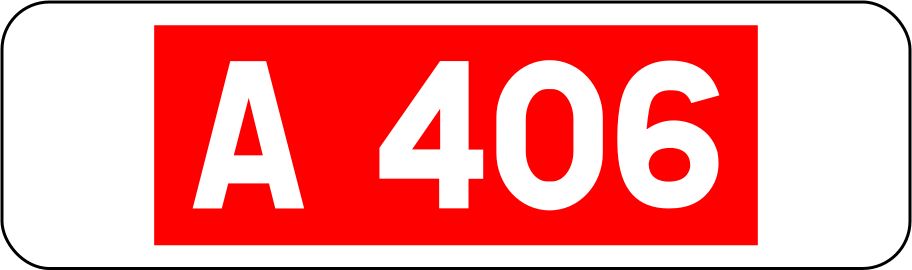
English • Supplementary plate M10a • Indicates a road or motorway number. Inscription: A 406.
Français • Panonceau M10a • Indiquant le numéro d'une route ou d'une autoroute. Inscription : A 406.
Sources
🔗 Commons.wikimedia.org
🔗 Equipementsdelaroute.cerema.fr • Arrêté du 24 novembre 1967 Source : Chabe01 • Domaine public • SVG original non modifié.
Image via Commons.wikimedia.org
Chabe01 self-made from source above • Public domain • Source revision 2020-07-09. Wikimedia original unmodified.
291. Motorway number and ring road
This supplementary sign identifies the motorway number and indicates that the route forms part of a ring road.

English • Supplementary plate M10c2 • Indicates access to a ring road. Inscription: A 104.
Français • Panonceau M10c2 • Indiquant l'accès à une rocade. Inscription : A 104.
Sources
🔗 Commons.wikimedia.org
🔗 Equipementsdelaroute.cerema.fr • Arrêté du 24 novembre 1967 Source : Roulex 45 • Domaine public • SVG original non modifié.
Image via Commons.wikimedia.org
Roulex 45 self-made from source above • Public domain • Source revision 2020-07-09. Wikimedia original unmodified.
292. Ring road
This supplementary sign indicates that the route shown by the main traffic sign is a ring road.

English • Supplementary plate M10c3 • Indicates access to a ring road. Inscription: ring road.
Français • Panonceau M10c3 • Indiquant l'accès à une rocade. Inscription : périphérique.
Sources
🔗 Commons.wikimedia.org
🔗 Equipementsdelaroute.cerema.fr • Arrêté du 24 novembre 1967 Source : Roulex 45 • Domaine public • SVG original non modifié.
Image via Commons.wikimedia.org
Roulex 45 self-made from source above • Public domain • Source revision 2012-02-02. Wikimedia original unmodified.
293. Narrow roadway
This supplementary sign warns that the roadway ahead is narrow.

English • Supplementary plate KM9 • Additional information accompanying a temporary AK danger sign. Inscription: ROAD NARROWS.
Français • Panonceau KM9 • Indications diverses complétant un panneau temporaire de danger AK. Inscription : CHAUSSÉE RÉTRÉCIE.
Sources
🔗 Commons.wikimedia.org
🔗 Equipementsdelaroute.cerema.fr • Arrêté du 24 novembre 1967
© Mathgb et les contributeurs Wikimedia • CC BY-SA 3.0 • SVG original non modifié.
Image via Commons.wikimedia.org
Mathgb • CC BY-SA 3.0 • Source revision 2014-02-15. Wikimedia original unmodified.
294. Single-file traffic
This supplementary sign indicates that vehicles must proceed in a single line.

English • Supplementary plate KM9 • Additional information accompanying a temporary AK danger sign. Inscription: SINGLE LANE.
Français • Panonceau KM9 • Indications diverses complétant un panneau temporaire de danger AK. Inscription : VOIE UNIQUE.
Sources
🔗 Commons.wikimedia.org
🔗 Equipementsdelaroute.cerema.fr • Arrêté du 24 novembre 1967
© Mathgb et les contributeurs Wikimedia • CC BY-SA 3.0 • SVG original non modifié.
Image via Commons.wikimedia.org
Mathgb • CC BY-SA 3.0 • Source revision 2014-02-15. Wikimedia original unmodified.
295. Reminder
This supplementary sign indicates that the main traffic sign repeats a rule or restriction already in force.

English • Supplementary plate M9z • Various information given by an inscription. Inscription: REMINDER.
Français • Panonceau M9z • Donnant des indications diverses par inscriptions. Inscription : RAPPEL.
Sources
🔗 Commons.wikimedia.org
🔗 Equipementsdelaroute.cerema.fr • Arrêté du 24 novembre 1967
© Pyrog et les contributeurs Wikimedia • CC BY-SA 4.0 • SVG original non modifié.
Image via Commons.wikimedia.org
Pyrog • CC BY-SA 4.0 • Source revision 2025-03-19. Wikimedia original unmodified.
296. Scanning
This supplementary sign reminds road users to scan the road and surroundings for potential hazards.

English • Supplementary plate KM9 • Additional information accompanying a temporary AK danger sign. Inscription: ROAD SWEEPING.
Français • Panonceau KM9 • Indications diverses complétant un panneau temporaire de danger AK. Inscription : BALAYAGE.
Sources
🔗 Commons.wikimedia.org
🔗 Equipementsdelaroute.cerema.fr • Arrêté du 24 novembre 1967
© Mathgb et les contributeurs Wikimedia • CC BY-SA 3.0 • SVG original non modifié.
Image via Commons.wikimedia.org
Mathgb • CC BY-SA 3.0 • Source revision 2014-02-15. Wikimedia original unmodified.
297. Danger
This supplementary sign warns of a general or unspecified danger associated with the main traffic sign.

English • Supplementary plate KM9 • Additional information accompanying a temporary AK danger sign. Inscription: DANGER.
Français • Panonceau KM9 • Indications diverses complétant un panneau temporaire de danger AK. Inscription : DANGER.
Sources
🔗 Commons.wikimedia.org
🔗 Equipementsdelaroute.cerema.fr • Arrêté du 24 novembre 1967
© Mathgb et les contributeurs Wikimedia • CC BY-SA 3.0 • SVG original non modifié.
Image via Commons.wikimedia.org
Mathgb • CC BY-SA 3.0 • Source revision 2014-02-15. Wikimedia original unmodified.
298. Accident
This supplementary sign warns of an accident or accident scene ahead.

English • Supplementary plate KM9 • Additional information accompanying a temporary AK danger sign. Inscription: ACCIDENT.
Français • Panonceau KM9 • Indications diverses complétant un panneau temporaire de danger AK. Inscription : ACCIDENT.
Sources
🔗 Commons.wikimedia.org
🔗 Equipementsdelaroute.cerema.fr • Arrêté du 24 novembre 1967
© Mathgb et les contributeurs Wikimedia • CC BY-SA 3.0 • SVG original non modifié.
Image via Commons.wikimedia.org
Mathgb • CC BY-SA 3.0 • Source revision 2014-02-15. Wikimedia original unmodified.
299. Damaged roadway
This supplementary sign warns of a damaged or uneven road surface.

English • Supplementary plate KM9 • Additional information accompanying a temporary AK danger sign. Inscription: UNEVEN ROAD SURFACE.
Français • Panonceau KM9 • Indications diverses complétant un panneau temporaire de danger AK. Inscription : CHAUSSÉE DÉFORMÉE.
Sources
🔗 Commons.wikimedia.org
🔗 Equipementsdelaroute.cerema.fr • Arrêté du 24 novembre 1967
© Mathgb et les contributeurs Wikimedia • CC BY-SA 3.0 • SVG original non modifié.
Image via Commons.wikimedia.org
Mathgb • CC BY-SA 3.0 • Source revision 2014-02-15. Wikimedia original unmodified.
300. Soft verge
This supplementary sign warns that the verge beside the roadway is soft or unstable.

English • Supplementary plate KM9 • Additional information accompanying a temporary AK danger sign. Inscription: SOFT SHOULDERS.
Français • Panonceau KM9 • Indications diverses complétant un panneau temporaire de danger AK. Inscription : ACCOTEMENTS NON STABILISÉS.
Sources
🔗 Commons.wikimedia.org
🔗 Equipementsdelaroute.cerema.fr • Arrêté du 24 novembre 1967
© Mathgb et les contributeurs Wikimedia • CC BY-SA 3.0 • SVG original non modifié.
Image via Commons.wikimedia.org
Mathgb • CC BY-SA 3.0 • Source revision 2014-02-15. Wikimedia original unmodified.