


Traffic rulesSweden
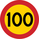 Traffic rules
 Sweden
1. Sweden
Sweden occupies the eastern side of the Scandinavian Peninsula in Northern Europe, bordering Norway and Finland and linked to Denmark by the Öresund connection. Traffic drives on the right. Its long north-south extent produces very different driving conditions, from busy roads around Stockholm, Gothenburg and Malmö to sparsely populated forest roads in the north. Snow, ice, long periods of winter darkness and encounters with moose, deer and reindeer can all be important considerations. Swedish is the principal language used for written road information, while Sweden's distinctive warning signs use the familiar triangular European form with a yellow background rather than the white background common in many other European countries.
Sweden has no nationwide motorway vignette. Most roads can be used without a road-use charge, although congestion taxes apply in Stockholm and Gothenburg and separate infrastructure charges apply to certain bridges. Winter rules are particularly important: passenger cars and other light vehicles must use winter tyres from 1 December to 31 March when winter road conditions exist. Studded tyres are normally permitted from 1 October to 15 April, although local streets can prohibit them. Vehicle lights must also be used during daytime driving throughout the year.
AI-generated by Traffic-rules.com • WCIT • CC BY-SA
Which side of the road do you drive on in Sweden?
Drive on the right-hand side of the road and normally overtake on the left.
What is the emergency number in Sweden?
Call 112 for urgent emergency assistance, including police, ambulance, fire and rescue services.
What is the alcohol limit for driving in Sweden?
The drink-driving threshold is 0.2‰ (0.2 g/l) in blood, corresponding to 0.10 mg of alcohol per litre of exhaled air. Because the threshold is low, the safest approach is not to drink alcohol before driving.
What is the general speed limit in built-up areas in Sweden?
The statutory base limit in a built-up area is 50 km/h. However, many urban streets are signed at 30 or 40 km/h, so always follow the posted limit.
What is the general speed limit outside built-up areas in Sweden?
The statutory base limit outside built-up areas is 70 km/h where no other limit has been established. Many main roads are instead specifically signed at 80, 90, 100 or 110 km/h.
What is the motorway speed limit in Sweden?
The general motorway maximum is 110 km/h, but designated motorway sections may have a signed maximum of 120 km/h.
Which vehicles are allowed on Swedish motorways?
Motorways are restricted to motor vehicles and combinations that are designed and permitted to travel at least 40 km/h. Class I mopeds are specifically prohibited, as are pedestrians, bicycles and other road users not permitted on motorways.
Do you need a motorway vignette in Sweden?
No. Sweden has no nationwide motorway vignette for passenger cars. However, congestion taxes and certain bridge infrastructure charges can apply.
Does Sweden charge a congestion tax?
Yes. Stockholm and Gothenburg have congestion-tax systems during specified times. The tax also applies to vehicles registered outside Sweden.
Are there other road tolls in Sweden?
Yes. Although there is no general motorway toll system for passenger cars, infrastructure charges apply to certain bridges, including bridges at Motala, Sundsvall and Skurubron.
Must you use headlights during the daytime in Sweden?
Yes. Vehicle lighting must be used while driving on the road. During normal daylight, daytime running lights or permitted equivalent lighting may be used instead of dipped headlights.
Are winter tyres mandatory in Sweden?
Yes. From 1 December to 31 March, passenger cars and other covered light vehicles must use winter tyres or equivalent equipment whenever winter road conditions exist. Winter conditions mean snow, ice, slush or frost on any part of the road.
Do Sweden's winter-tyre rules apply to foreign cars?
Yes. The Swedish winter-tyre requirements apply to vehicles registered in Sweden and abroad.
When can studded tyres be used in Sweden?
Studded tyres are normally permitted from 1 October to 15 April. They may also be used outside that period when winter road conditions exist or are expected.
Can studded tyres be prohibited on individual streets in Sweden?
Yes. Municipalities may impose local bans on vehicles using studded tyres on particular roads or road sections, so drivers should obey local signs even during the normal studded-tyre season.
Are seat belts compulsory in Sweden?
Yes. Everyone travelling in a vehicle equipped with seat belts must normally use the available seat belt.
When must children use a child restraint in Sweden?
Children shorter than 135 cm must use an appropriate child seat, booster cushion or other approved child-restraint system instead of or together with the vehicle's seat belt.
Are motorcycle helmets compulsory in Sweden?
Yes. Motorcycle riders must normally wear a protective helmet. Helmet requirements also apply to passengers, subject to limited exceptions for certain enclosed vehicles.
Must children wear a bicycle helmet in Sweden?
Yes. Children and young people under 15 years old must wear a helmet when cycling or when being carried on a bicycle.
Can you use a mobile phone while driving in Sweden?
You must not use a mobile phone or other communication equipment in a way that negatively affects your driving, and you must not hold the device in your hand while driving.
Does priority from the right apply in Sweden?
Yes. Where two vehicle paths cross and no other priority rule applies, a driver must normally give way to traffic approaching from the right.
Who has priority at a roundabout in Sweden?
A driver entering a roundabout must give way to vehicles already circulating on it.
Do pedestrians have priority at crossings in Sweden?
At an uncontrolled pedestrian crossing, drivers must give way to pedestrians who have entered or are just about to enter the crossing. Pedestrians must still take account of the distance and speed of approaching vehicles.
Can you overtake at an uncontrolled pedestrian crossing in Sweden?
No. A vehicle or tram must not normally be overtaken immediately before or on an uncontrolled pedestrian crossing.
How much space must you leave when overtaking a cyclist in Sweden?
Swedish law requires a safe lateral distance when overtaking, but it does not prescribe one universal numerical distance such as 1.5 metres. The clearance must be sufficient for the circumstances.
Must drivers let buses leave bus stops in Sweden?
On a road where the maximum speed is 50 km/h or lower, a driver approaching a bus that signals its intention to leave a stop must slow down and allow the bus to move out, stopping if necessary.
What should you do if you collide with wildlife in Sweden?
A collision involving wildlife or reindeer must be taken seriously. Call 112 and report the collision, warn other traffic and mark the location so that the animal can be located if it has left the road.
What safety equipment must a car carry in Sweden?
A car must carry an approved warning triangle. If the vehicle becomes immobilised in a hazardous position, the triangle must be used where required to warn approaching traffic. A reflective vest is sensible to carry but is not generally mandatory equipment for an ordinary passenger car.

2. Motorway
A motorway is a road specially designed and signposted for motor traffic. Motorways normally have separate carriageways for opposing traffic, controlled access through designated entrances and exits, no direct access to neighbouring properties, and no level crossings with other roads, railways or paths.
Special traffic rules apply on motorways. The permitted road users, speed limits, lane rules, tolls and emergency procedures vary between countries, so drivers must follow the local traffic signs and regulations.
Wikimedia.org • Bahnfrend • CC BY-SA
How can you recognise a motorway?
A motorway is normally identified by a special motorway sign at its entrance. It commonly has separate carriageways, controlled entrances and exits, and no ordinary intersections or direct access to neighbouring properties.
Who may use a motorway?
Motorways are primarily intended for motor vehicles capable of travelling safely at motorway speeds. Pedestrians, cyclists, animals and certain slow vehicles are generally prohibited, but the exact access requirements differ between countries.
What is the speed limit on a motorway?
There is no universal motorway speed limit. The applicable limit depends on the country, road section, vehicle category and driving conditions. Posted or variable speed-limit signs may replace the general national limit.
How should you enter a motorway?
Use the entrance or acceleration lane to observe motorway traffic and adjust your speed where possible. Enter only when there is a safe gap and follow the local priority and merging rules.
How should you leave a motorway?
Move into the correct lane in good time and signal when required. Enter the exit or deceleration lane before reducing your speed, unless traffic, signs or road conditions require you to slow down earlier.
Which lane should you use on a motorway?
Follow the local keep-left or keep-right rule and any lane-direction signs. Lanes closer to the centre of the motorway are commonly used for overtaking, but lane-use rules differ between countries and vehicle categories.
Can you stop on a motorway?
Voluntary stopping and parking are normally permitted only in designated parking or service areas. Drivers may still have to stop because of congestion, an emergency or another unavoidable situation.
Can you reverse or make a U-turn on a motorway?
Reversing, making a U-turn and driving against the direction of traffic are generally prohibited. If you miss an exit, continue to the next suitable exit.
What should you do if your vehicle breaks down?
Move the vehicle out of the traffic lanes when this can be done safely, activate the hazard warning lights and follow the local breakdown procedures. Leave the vehicle safely, keep away from moving traffic and use a warning triangle or safety vest where required by local law.
What is the difference between a motorway and an expressway?
A motorway normally has the highest level of access control and is governed by specific motorway rules. An expressway may have similar characteristics but may permit different road users or contain lower-standard junctions. The legal distinction varies between countries.
3. Residential area
A residential area is a street or group of streets where housing and access to local properties are the main functions. Drivers should expect pedestrians, cyclists, children, parked vehicles and vehicles entering or leaving driveways.
Some countries identify particular residential areas with traffic signs and apply special low-speed and residential-area rules. The speed limit, pedestrian rights, parking rules and permitted road users therefore depend on local signs and regulations.
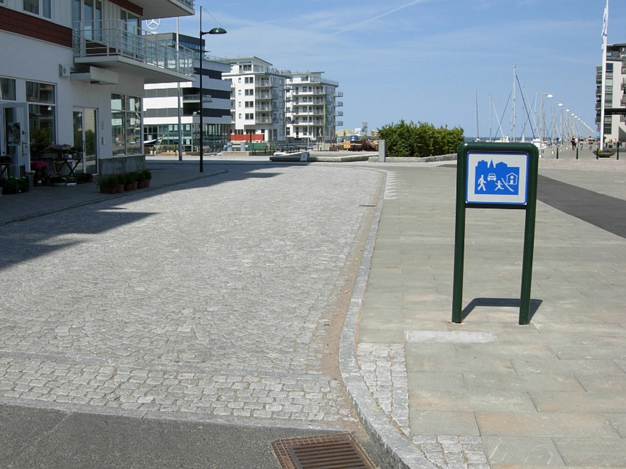
Wikimedia.org • Allan Akbar • CC0
How can you recognise a residential area?
A residential area commonly contains homes, driveways, parked vehicles and local streets. It may also have special entrance signs, traffic-calming measures or shared road space, but its appearance and legal status differ between countries.
Is a residential area the same as a built-up area?
Not necessarily. A built-up area may include residential, commercial and industrial streets. A residential area is primarily associated with housing and local access and may form only one part of a larger built-up area.
Is every residential neighbourhood a legally designated residential zone?
No. In many countries, special residential-zone rules apply only where an official entrance sign is displayed. An ordinary neighbourhood may remain subject to the normal rules for the surrounding road or built-up area.
What is the speed limit in a residential area?
There is no universal residential-area speed limit. Some countries apply a very low limit in signposted residential or shared-space zones, while ordinary residential streets may follow the general built-up-area limit or a posted zone limit.
Do pedestrians have priority in a residential area?
The rights of pedestrians depend on the country and the type of residential area. In some signposted shared-space zones, pedestrians may use the whole road and drivers must give them special consideration. On ordinary residential streets, the normal pedestrian and crossing rules may apply.
May children play in a residential area?
Playing may be expressly permitted in certain legally designated residential or shared-space zones. This is not automatically allowed on every residential street. Drivers should nevertheless remain especially alert for children, who may enter the road unexpectedly.
Which road users may enter a residential area?
Residential areas are normally accessible to local motor traffic, cyclists and pedestrians, but additional signs may restrict certain vehicles or through traffic. A residential area is therefore not necessarily a pedestrian-only zone.
How should you drive in a residential area?
Drive at a speed that allows you to stop safely, watch both sides of the road and expect pedestrians, cyclists, children, pets and vehicles emerging from entrances. Leave enough space and avoid unnecessary acceleration, noise or aggressive overtaking.
May you overtake in a residential area?
Overtaking is not universally prohibited, but it may be restricted by local law, signs or road design. Even where it is permitted, drivers should not overtake when the limited space or presence of vulnerable road users makes it unsafe.
Where may you park in a residential area?
Follow the local parking signs, markings and general parking rules. Do not block entrances, pavements, crossings, sight lines or the passage of other road users. Special residential zones may permit parking only in designated spaces.
What is the difference between a residential area and a pedestrian zone?
Motor vehicles are normally still permitted in a residential area, although they may be subject to strict speed and parking rules. In a pedestrian zone, vehicle access is generally prohibited or limited to specific users, purposes or times.
4. Built-up area
A built-up area is an area containing concentrated buildings, streets and regular local activity. Drivers should expect more pedestrians, cyclists, intersections, parked vehicles, public transport and vehicles entering or leaving properties.
Many countries apply special traffic rules and lower default speed limits within built-up areas. The area may be identified by entrance and exit signs, street lighting or other legal criteria, so drivers must follow local signs and regulations.
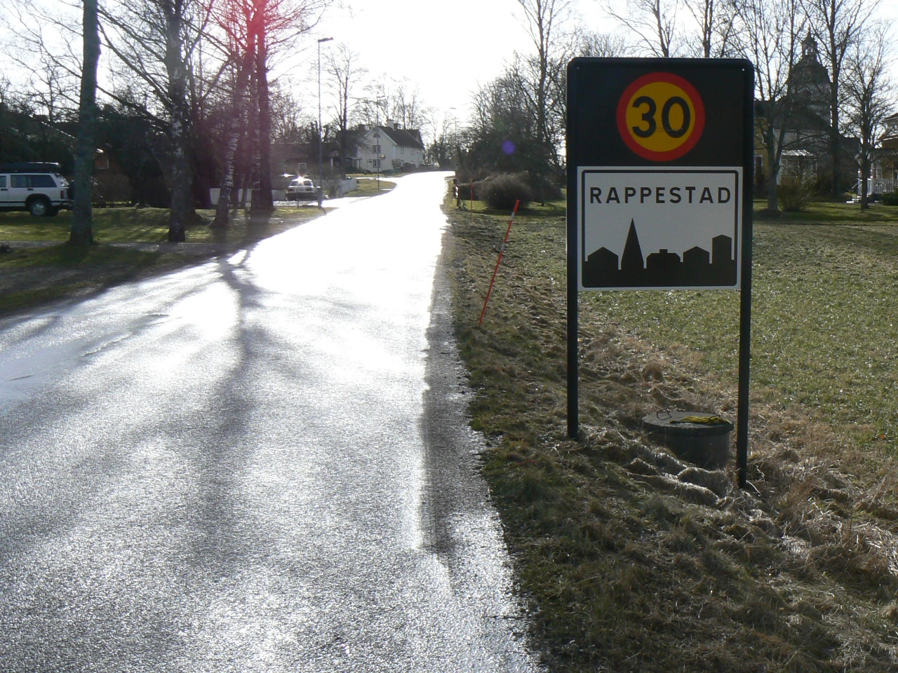
Wikimedia.org • CC0
How can you recognise a built-up area?
A built-up area commonly contains closely spaced buildings, local streets, intersections, pavements, pedestrians and regular access to properties. Some countries use official entrance and exit signs, while others define built-up roads through street lighting or other legal criteria.
Is a built-up area the same as a town or city?
Not necessarily. A legally defined built-up area may cover only part of a town or may include several connected settlements. Administrative boundaries and traffic-law boundaries do not always coincide.
Is a built-up area the same as a residential area?
No. A built-up area may contain residential, commercial, industrial and public streets. A residential area is mainly associated with housing and may form only one part of a built-up area.
How does a built-up area begin and end?
In many countries, the area begins and ends at official traffic signs. In others, road lighting, development or another legal definition determines whether a road is inside a built-up area. Drivers should not rely only on the appearance of the surroundings.
What is the speed limit in a built-up area?
There is no universal built-up-area speed limit. The default limit differs between countries and regions, and traffic signs may impose a lower or higher limit on a particular road or throughout a zone.
Does the built-up-area speed limit apply on every road?
The general limit normally applies unless a traffic sign, road category or special rule establishes another limit. Major urban roads may have a higher signed limit, while residential streets, school areas and city centres may have lower limits.
Does a speed-limit sign remain valid after an intersection?
This depends on local law and the type of sign. A local speed restriction may end at the next intersection in some countries, while a zonal speed limit normally continues until an end-of-zone sign.
Do pedestrians have priority throughout a built-up area?
No. Pedestrians do not automatically have priority everywhere merely because they are in a built-up area. Their priority depends on crossings, traffic signals, shared-space rules and local law. Drivers must nevertheless remain especially alert for pedestrians.
How should you drive in a built-up area?
Adjust your speed, watch both sides of the road and expect frequent changes in traffic. Be prepared for pedestrians crossing, cyclists changing position, buses leaving stops, opening vehicle doors and vehicles emerging from side roads or driveways.
Are parking rules different in a built-up area?
Some countries apply additional stopping and parking restrictions inside built-up areas. Drivers must follow signs, markings and local rules and must not obstruct pavements, crossings, entrances, cycle facilities or visibility at intersections.
What is the difference between a built-up area and a speed zone?
A built-up area is a broader traffic-law area that may contain many different roads and activities. A speed zone imposes a particular maximum speed throughout the signed zone and may be located inside or outside a built-up area.
When do the built-up-area rules end?
The rules end at the legally defined boundary, which may be indicated by an end-of-built-up-area sign. After that point, the rules and default speed limits for roads outside built-up areas normally apply.
5. Speed limit
A speed limit is the maximum legal speed permitted on a road, lane or within a designated area. It may be established by general traffic law or indicated by fixed, variable or temporary traffic signs.
A speed limit is a maximum, not a target speed. Drivers must travel more slowly whenever traffic, visibility, weather, road conditions, vulnerable road users or the condition of the vehicle make the maximum permitted speed unsafe.
Wikimedia.org • Holger.Ellgaard • CC BY-SA
What is a speed limit?
A speed limit is the maximum legal speed permitted on a road, lane or within a designated area. It does not require drivers to travel at that speed.
How can you recognise a speed limit?
A speed limit is commonly displayed as a number on a regulatory traffic sign. General limits may also apply automatically because of the country, road category, vehicle type or surrounding area, even when no speed-limit sign is present.
Is the speed limit a recommended driving speed?
No. It is the highest speed legally permitted under suitable conditions. Drivers must reduce their speed whenever travelling at the limit would be unsafe.
Can you drive more slowly than the speed limit?
Yes. Drivers should travel more slowly when required by traffic, weather, visibility, road conditions or nearby vulnerable road users. Driving unnecessarily slowly may nevertheless be prohibited when it obstructs normal traffic.
Does the same speed limit apply to every vehicle?
Not always. Lower limits may apply to heavy vehicles, buses, vehicles towing trailers, novice drivers or other vehicle categories. The lowest applicable limit must be respected.
What is a default speed limit?
A default speed limit applies automatically to a particular road type or area when no traffic sign indicates another limit. Examples include general limits for motorways, built-up areas or roads outside built-up areas.
Does a posted speed limit replace the default limit?
Usually, yes. A legally placed speed-limit sign normally introduces another maximum speed, although lower vehicle-specific or special-road limits may continue to apply.
When does a speed-limit sign take effect?
A speed restriction normally begins at the location of the sign. Drivers should reduce their speed before passing the sign so that they are already travelling within the limit when it takes effect.
When does a speed limit end?
A signed limit may end at an intersection, an end-of-limit sign, another speed-limit sign or the beginning or end of a legally defined area. The exact rule differs between countries.
Does an intersection end a speed limit?
This depends on local law. An ordinary speed restriction may end at an intersection in some countries, while a zonal speed limit normally continues across intersections until an end-of-zone sign.
What is a speed zone?
A speed zone is an area in which the displayed maximum speed applies throughout all included roads. The limit normally remains in force until the corresponding end-of-zone sign.
What is a variable speed limit?
A variable speed limit is displayed on an electronic or changeable sign and may be adjusted according to congestion, weather, incidents or roadworks. When activated, it has the same legal importance as another applicable regulatory speed sign.
Can different lanes have different speed limits?
Yes. Signs positioned above individual lanes may impose different limits on those lanes. Drivers must observe the limit applying to the lane they use.
Can a temporary speed limit apply?
Yes. Temporary limits may be introduced near roadworks, collisions, hazards or special events. Drivers must follow the temporary traffic signs and instructions that are legally in force.
May you exceed the speed limit while overtaking?
No. Overtaking does not normally permit a driver to exceed the applicable maximum speed. The manoeuvre must be completed safely while respecting the speed limit.
Do poor conditions change the legal speed limit?
Some countries impose specific lower limits in rain, snow or other conditions. Even where the numerical limit does not change, drivers must reduce their speed sufficiently for the conditions.
6. Bike path
A bike path is a part of a road or a separate route intended primarily or exclusively for people riding bicycles. It may be physically separated from motor traffic, marked on the road surface or identified by traffic signs.
Bike paths may be one-way, two-way or shared with other road users. The permitted users, direction of travel, priority rules and obligation to use the path depend on local traffic signs and regulations.
Wikimedia.org • W.carter • CC BY-SA
How can you recognise a bike path?
A bike path may be identified by a bicycle traffic sign, bicycle symbols, coloured surfacing or road markings. It may run beside the carriageway or follow a completely separate route.
Is a bike path the same as a bike lane?
Not always. A bike lane is normally marked directly on or beside the carriageway, while a bike path may be physically separated from motor traffic. The terminology and legal distinction vary between countries.
Must cyclists use a bike path?
This depends on local law and the signs displayed. Some bike paths are mandatory, while others are optional. Cyclists may also be permitted to leave a path to turn, overtake or avoid an obstruction.
Can a bike path carry traffic in both directions?
Yes. Some bike paths are two-way, but others may be used only in the direction indicated by signs, markings or their position beside the road. Cyclists should not assume that every path permits travel in both directions.
May pedestrians use a bike path?
Pedestrians may use a bike path where it is designated as a shared-use path or where local law permits it. On a cycle-only path, pedestrians may be prohibited or permitted only when no suitable pedestrian facility is available.
May mopeds or speed pedelecs use a bike path?
This depends on the country, vehicle category, road speed and traffic signs. Some bike paths permit or require certain mopeds or speed pedelecs, while others are reserved exclusively for ordinary bicycles.
May motor vehicles use a bike path?
Normally not. Motor vehicles may cross a bike path to enter another road or property where this is permitted, but they must follow the applicable priority rules and must not endanger path users.
Who has priority where a vehicle crosses a bike path?
Priority depends on the road layout, signs, signals and local law. Drivers crossing a continuous bike path commonly have to give way to its users, but cyclists approaching a separate cycle crossing may not automatically have priority before entering it.
Does a cyclist always have priority at a cycle crossing?
No. A marked cycle crossing does not universally give an approaching cyclist priority. Cyclists should enter cautiously and observe approaching traffic unless signs, signals or local rules clearly give them priority.
Is there a speed limit on a bike path?
Some countries or local authorities impose specific limits, particularly on shared paths. Even without a posted limit, cyclists must travel at a safe and considerate speed for the width, visibility and number of other users.
May you stop or park on a bike path?
Normally not. Stopping or parking on a bike path can force cyclists into motor traffic and may be expressly prohibited by law.
What should cyclists do when passing pedestrians?
Reduce speed, give a clear warning where appropriate and leave sufficient space. Pedestrians may change direction unexpectedly, especially on a shared path.
What should cyclists do when a bike path is blocked?
Slow down and check surrounding traffic before leaving the path. Avoid the obstruction safely and return to the bike path when permitted and practical.
Can cyclists ride side by side on a bike path?
This depends on local law and the available width. Even where riding side by side is permitted, cyclists must not block, endanger or unnecessarily hinder other path users.
What is the difference between a bike path and a shared-use path?
A bike path is intended primarily or exclusively for cycling. A shared-use path is legally intended for cyclists together with pedestrians or other indicated road users, who must use the space considerately.
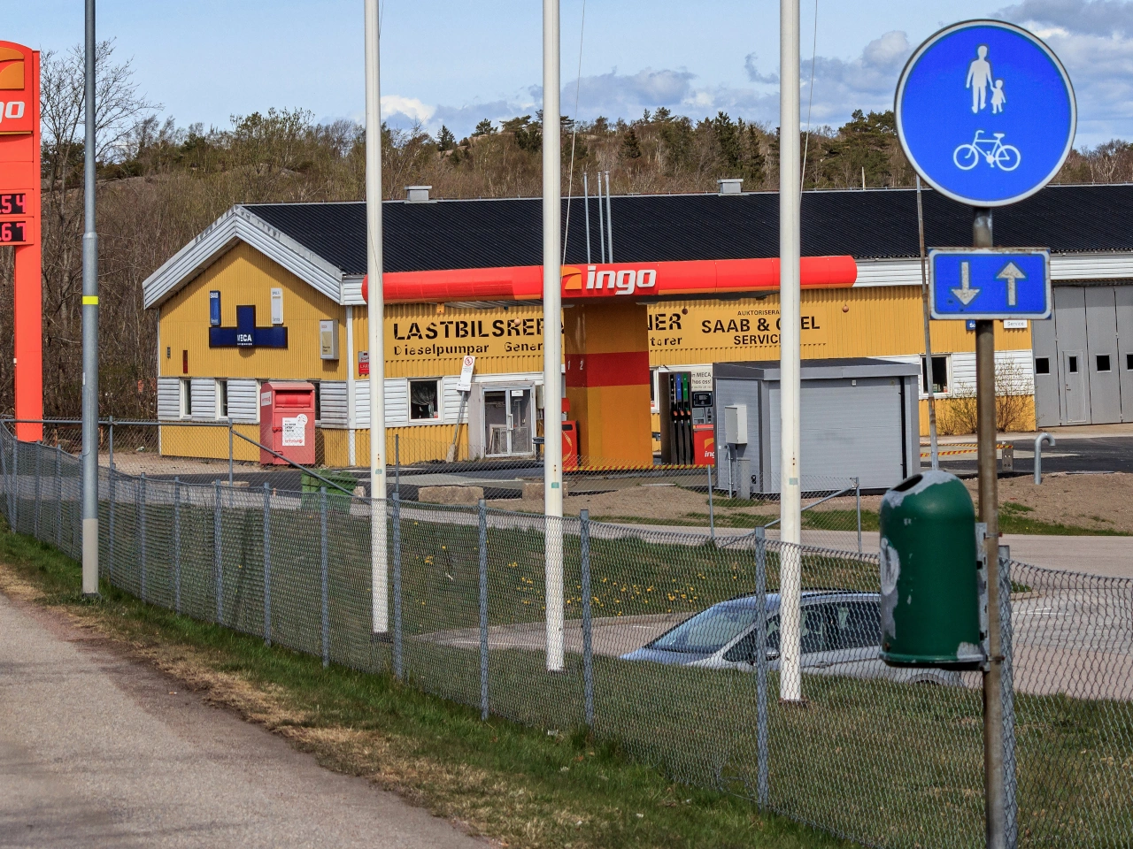
7. Shared-use path
A shared-use path is a path or part of a road intended for use by both pedestrians and cyclists. Unlike facilities where pedestrians and cyclists have clearly separated sections, users of a shared-use path normally travel within the same general space.
Because users may travel at very different speeds, cyclists should approach pedestrians carefully, adapt their speed and leave sufficient space when passing. The permitted users, priority rules and any speed restrictions depend on the local traffic signs and regulations.
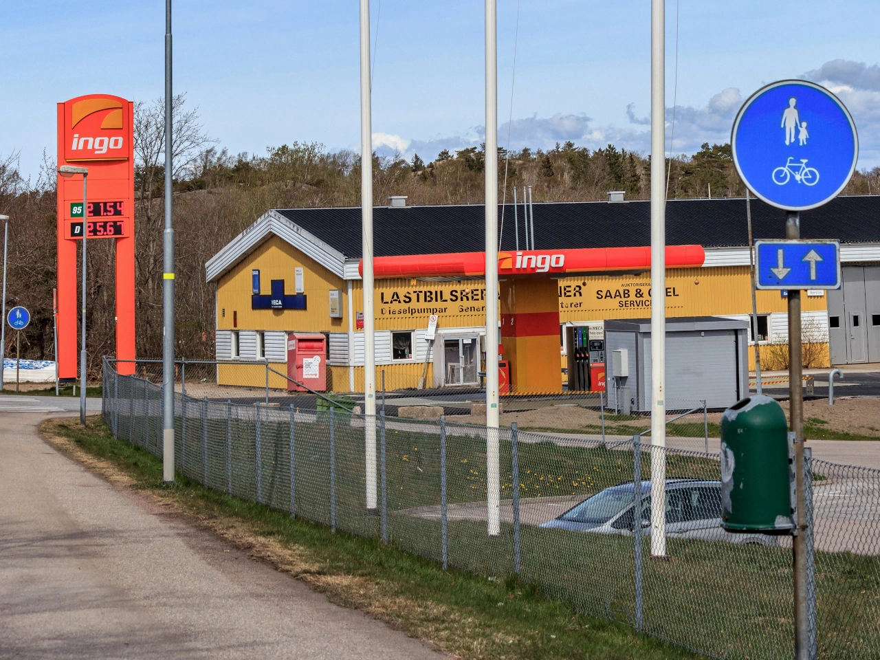
What is a shared-use path?
A shared-use path is a path or part of a road intended to be used by both pedestrians and cyclists.
Is a shared-use path the same as a cycle path?
Not necessarily. A cycle path is primarily intended for cyclists, while a shared-use path is specifically intended to accommodate pedestrians and cyclists together.
Do pedestrians and cyclists have separate sides on a shared-use path?
Not always. On a genuinely shared path, both categories may use the same space. Other facilities may divide pedestrians and cyclists into separate sections using signs, markings or physical separation.
Should cyclists slow down near pedestrians?
Yes. Cyclists should adapt their speed when approaching or passing pedestrians and leave sufficient space to avoid creating danger or discomfort.
Can cyclists ring a bell before passing pedestrians?
Yes, where appropriate. An audible warning can help alert pedestrians before a cyclist passes, but it should be used considerately and does not give the cyclist priority.
Do cyclists automatically have priority over pedestrians?
No. The applicable priority and conduct rules depend on local law. On a shared facility, cyclists should expect pedestrians to move within the available space.
Can mopeds use a shared-use path?
This depends on the signs and local vehicle classifications. Some shared facilities are limited to pedestrians and bicycles, while others also permit specified moped categories.
Can speed pedelecs use a shared-use path?
This depends on local law. Because speed pedelecs can travel substantially faster than ordinary bicycles, some countries or facilities exclude them from pedestrian-and-cycle shared paths.
Can motor vehicles use a shared-use path?
Normally no. Motor vehicles may use such a path only where a specific exception or local rule permits access, for example for maintenance or emergency purposes.
Can a shared-use path cross a roadway?
Yes. At crossings, pedestrians and cyclists must follow the applicable traffic lights, priority signs, road markings and crossing rules.
Can a shared-use path be two-way?
Yes. Many shared-use paths carry pedestrians and cyclists travelling in both directions. Users should therefore remain alert for approaching traffic from ahead as well as users travelling in the same direction.
What should cyclists do when a shared-use path is crowded?
Reduce speed and be prepared to stop. Crowded conditions may make normal cycling speed unsafe even when no specific lower speed limit is posted.
8. Toll road
A toll road is a road, motorway, bridge, tunnel or other route for which users must pay a charge. The toll may apply to all vehicles or only to particular vehicle categories, and the amount can depend on factors such as distance travelled, vehicle type, weight or emissions.
Tolls may be collected at toll booths, electronically or through a vignette or distance-based charging system. Drivers should check the applicable payment rules before using a toll road, especially when travelling in another country.
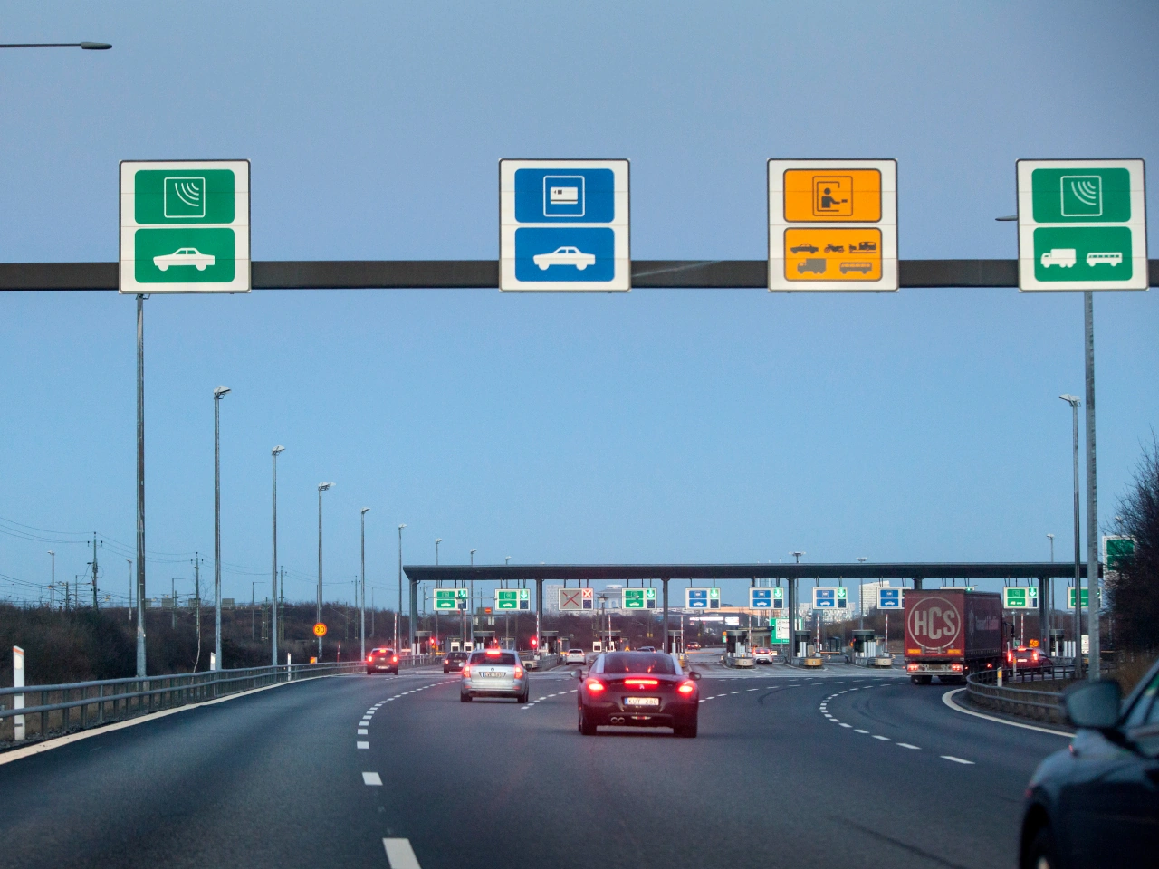
Wikimedia.org • News Oresund • CC BY
What is a toll road?
A toll road is a road or section of road for which a charge must be paid to use it. Tolls may also apply to particular bridges, tunnels or other road infrastructure.
How are road tolls paid?
Depending on the country, tolls may be paid at a toll booth, through an electronic toll system, vignette or distance-based charging system.
Do all vehicles pay the same toll?
Not necessarily. Toll rates can vary according to vehicle type, size, weight, emissions, distance travelled or the particular road being used.
9. Quay
A quay is a constructed area beside a river, canal, harbour or other body of water, commonly used for loading, unloading, mooring vessels or providing waterside access. A road may run alongside the water or lead directly towards the quay edge.
In road traffic, a quay warning indicates a risk that a vehicle could leave the road and enter the water. Drivers should reduce speed, observe the road layout carefully and keep a safe distance from the waterside edge.
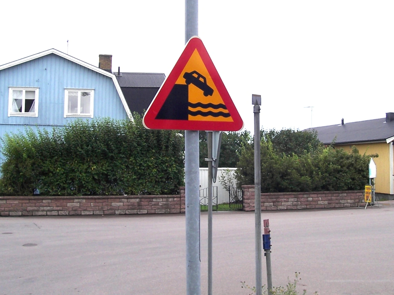
Wikimedia.org • Palickap • CC BY-SA
What is a quay?
A quay is a constructed waterside platform or road area beside a river, canal, harbour or other navigable water. It may be used by ships, vehicles, workers, pedestrians and loading equipment.
What does a quay warning sign mean?
It warns that the road approaches or leads onto a quay, riverbank or waterside edge where a vehicle could enter the water.
Does the sign mean that the road ends at the water?
It may. The road may lead directly towards the water, turn sharply near it or continue alongside an insufficiently protected edge. Drivers must observe the actual road layout.
How should you approach a quay?
Reduce speed early, remain in full control and watch for the road edge, barriers, bends, workers, pedestrians and moving equipment. Avoid sudden steering or braking close to the water.
Is there a universal speed limit near a quay?
No. Drivers must follow the posted or general speed limit and reduce their speed further when the road is narrow, wet, poorly lit or close to an unprotected edge.
Does a quay warning sign impose a prohibition?
No. It normally warns of danger rather than prohibiting access. Additional signs, gates or local rules may restrict particular vehicles or activities.
Does the sign change priority?
No. Drivers must continue to follow traffic lights, priority signs and the normal priority rules.
May you stop or park on a quay?
This depends on local signs and regulations. Do not stop or park where the vehicle could create danger, obstruct traffic, interfere with loading operations or block emergency access.
Should you park close to the water’s edge?
Only in a clearly authorised and suitable place. Leave sufficient space from the edge, apply the parking brake securely and follow any wheel-positioning or local parking instructions.
May you overtake near a quay?
Overtaking may be legal, but it should be avoided when the road is narrow, visibility is limited or the manoeuvre would bring the vehicle close to the waterside edge.
Why can quay surfaces be slippery?
Water, algae, mud, ice, fuel, oil or material from loading operations may reduce grip. Painted markings, rails and metal surfaces may also become especially slippery when wet.
What other hazards may be present on a quay?
Drivers may encounter pedestrians, cyclists, dock workers, cranes, forklifts, railway tracks, mooring equipment, reversing trucks and unsecured edges.
Why should large vehicles take extra care?
Large vehicles need more space to turn and may have limited visibility close to the cab or trailer. Soft edges, narrow roads and nearby equipment can make manoeuvring more difficult.
May pedestrians walk on a quay?
Pedestrian access depends on local rules. Where pedestrians are permitted, drivers should expect them to move between vehicles, vessels, buildings and loading areas.
Should you reverse near a quay edge?
Reverse only when necessary and when the route is clearly visible. Use a guide where available and never rely solely on mirrors or cameras when the vehicle could approach the water.
What should you do in darkness or poor visibility?
Reduce speed, use the required lights and look carefully for reflectors, barriers, road edges and people. Water and dark surroundings can make the boundary of the road difficult to recognise.
What should you do if a barrier is open or missing?
Do not assume that the route is safe. Slow down, identify the road boundary and follow signs or instructions from authorised personnel.
What should you do if a vehicle enters the water?
Leave the vehicle as quickly and safely as possible, help passengers where possible and contact the emergency services. Do not re-enter the water or vehicle to recover belongings.
10. Slope
A slope is a section of road that rises or descends noticeably. A steep slope can affect vehicle speed, braking distance, traction, visibility and the ability of heavy or low-powered vehicles to maintain a steady speed.
Warning signs may indicate a steep ascent or dangerous descent and may show the gradient as a percentage. Drivers should adjust their speed early, select a suitable gear and remain prepared for slow vehicles, bends and changing road conditions.
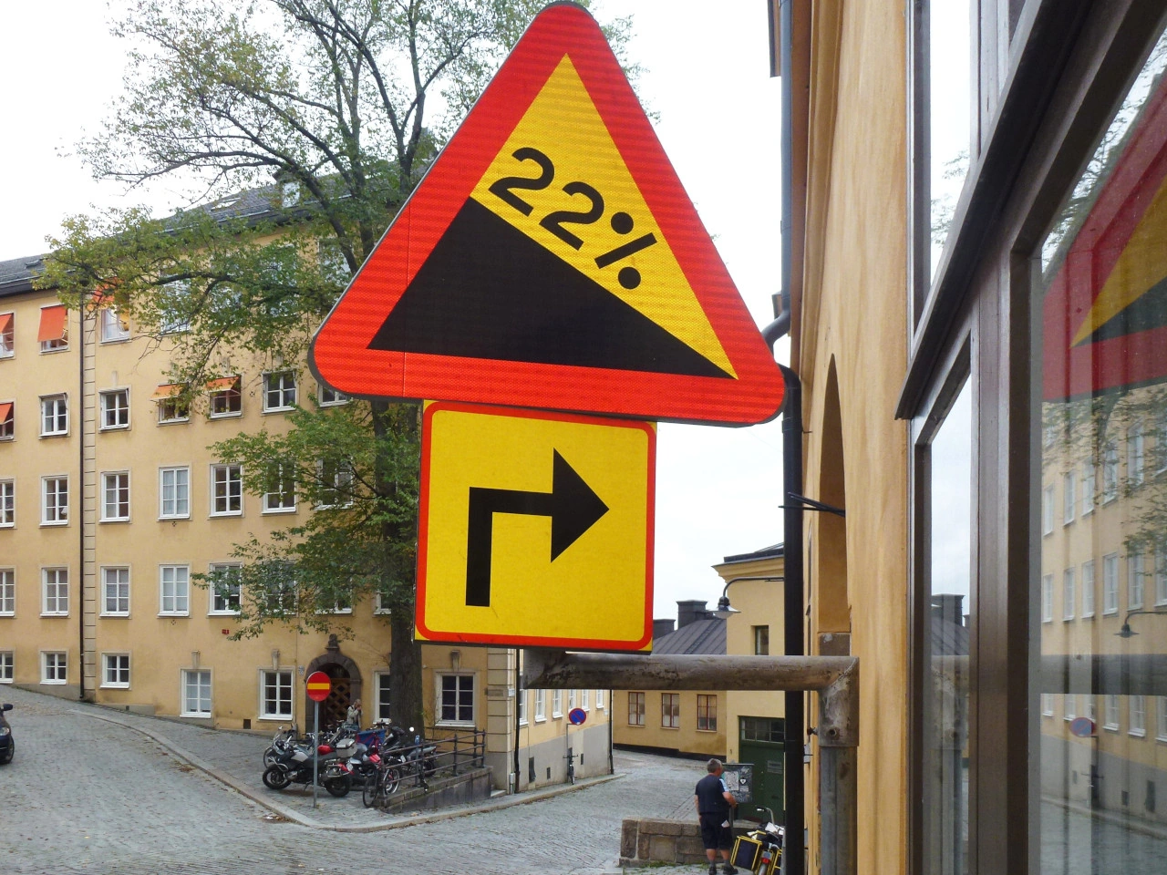
Wikimedia.org • Holger.Ellgaard • CC BY-SA
What is a road slope?
A road slope is a section of road that rises or descends over a particular distance. It may also be called a gradient, incline or decline.
How can you recognise a steep slope?
A steep slope may be indicated by a warning sign showing an ascending or descending road. The sign may also display the gradient as a percentage.
What does a gradient of 10% mean?
A gradient of 10% means that the road rises or falls approximately 10 metres for every 100 metres travelled horizontally. It does not mean that the road is inclined at 10 degrees.
What is the difference between an ascent and a descent?
An ascent rises in the direction of travel, while a descent falls in the direction of travel. The same section of road is therefore an ascent in one direction and a descent in the other.
Does a slope warning sign impose a speed limit?
Not normally. It warns of a hazard rather than setting a numerical limit. Drivers must still respect the applicable speed limit and reduce their speed further when necessary.
How should you approach a steep descent?
Reduce speed before the descent, select a suitable gear and maintain a safe following distance. Avoid allowing the vehicle to gain excessive speed.
Which gear should you use when descending?
Use a gear that provides sufficient engine braking and helps keep the vehicle at a controlled speed. The appropriate gear depends on the vehicle, gradient and road conditions.
Should you coast downhill in neutral?
No. Coasting reduces engine braking and may make it harder to control the vehicle’s speed. Keep the transmission engaged while descending.
Why should you avoid continuous heavy braking?
Continuous braking on a long descent can cause the brakes to become excessively hot and lose effectiveness. Select a suitable gear, control speed early and use the brakes progressively when needed.
What is brake fade?
Brake fade is a reduction in braking performance caused by excessive heat. It can occur when the brakes are used continuously during a long or steep descent.
How should you drive uphill?
Select a suitable gear before the engine begins to struggle and maintain a steady speed where possible. Be prepared for heavy or low-powered vehicles travelling slowly ahead.
May a vehicle lose speed on a steep ascent?
Yes. Heavy vehicles, vehicles towing trailers and low-powered vehicles may slow considerably. Other drivers should maintain a safe distance and avoid impatient manoeuvres.
May you overtake near the top of a slope?
Do not overtake when the crest prevents you from seeing far enough ahead. Overtaking near a hilltop may also be expressly prohibited by local law, signs or road markings.
Why is visibility limited near the crest of a slope?
The road surface itself may hide approaching traffic, stopped vehicles, pedestrians or other hazards beyond the crest.
Who has priority on a narrow slope?
Some countries give priority to uphill traffic, while others rely on signs or ordinary obstruction rules. Drivers must follow local law and cooperate when passing is difficult.
How should you meet another vehicle on a narrow slope?
Reduce speed and use a passing place where available. The driver who can reverse or move aside more safely should cooperate, subject to any applicable priority signs or local rules.
How do rain, snow or ice affect a slope?
They reduce traction and make acceleration, braking and steering more difficult. Increase the following distance, use smooth controls and reduce speed before entering the slope.
Why are cyclists vulnerable on slopes?
Cyclists may travel slowly and move less steadily when climbing, while they may reach high speeds when descending. Drivers should leave sufficient space and avoid overtaking without a clear view.
How should you park on a slope?
Use the parking brake, select the appropriate gear or parking position and follow local rules concerning wheel position. Make sure the vehicle cannot roll into traffic.
Can a slope affect towing?
Yes. A trailer increases the load on the engine and brakes and may affect stability. Drivers should use a suitable gear, maintain additional distance and avoid excessive speed.
11. Bus stop
A bus stop is a designated place where buses stop to allow passengers to board or leave. It may be identified by a sign, shelter, raised platform, road marking or other public-transport infrastructure and can be located beside the road or in a specially constructed stopping area.
Drivers approaching a bus stop should watch carefully for buses, pedestrians and passengers crossing or entering the roadway. Parking or stopping restrictions may apply around bus stops to keep the area accessible and visible.
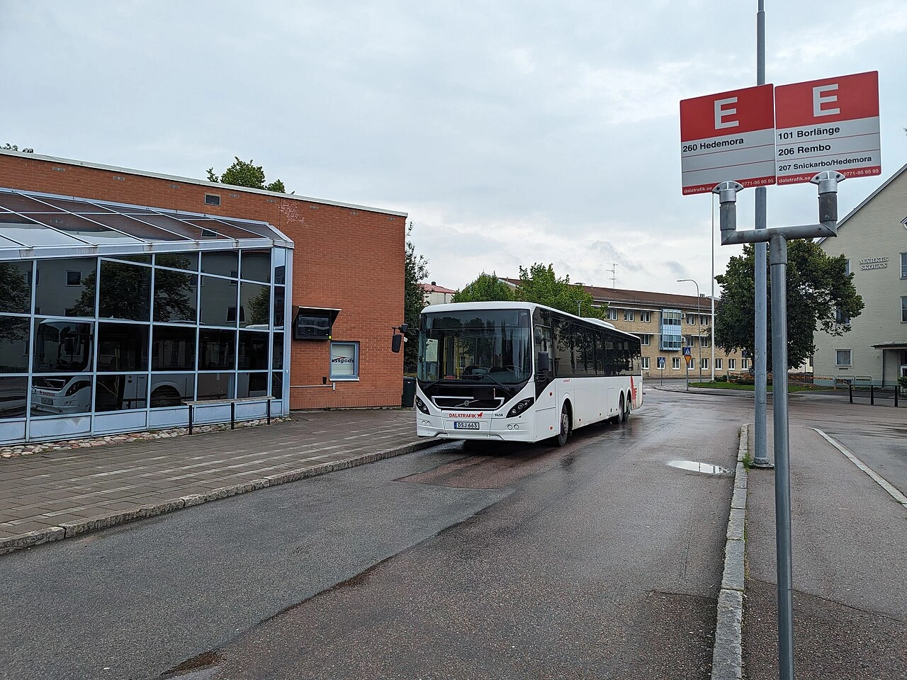
Wikimedia.org • AleWi • CC BY-SA
What is a bus stop?
A bus stop is a designated location where buses stop so that passengers can board or leave the vehicle.
What should you watch for near a bus stop?
Watch for buses entering or leaving the stop, passengers near the roadway and pedestrians who may cross the road.
Can you park at a bus stop?
Parking or stopping at or near a bus stop is often restricted or prohibited so that buses can reach the stop safely. The exact restrictions depend on local traffic rules.
12. Stop sign
A stop sign requires drivers to bring their vehicle to a complete stop and give way before entering or crossing the road ahead. The stop must be made at the stop line or another legally prescribed position.
After stopping, the driver may continue only when this can be done safely and without interfering with traffic that has priority. The sign does not create priority for the driver who has stopped.
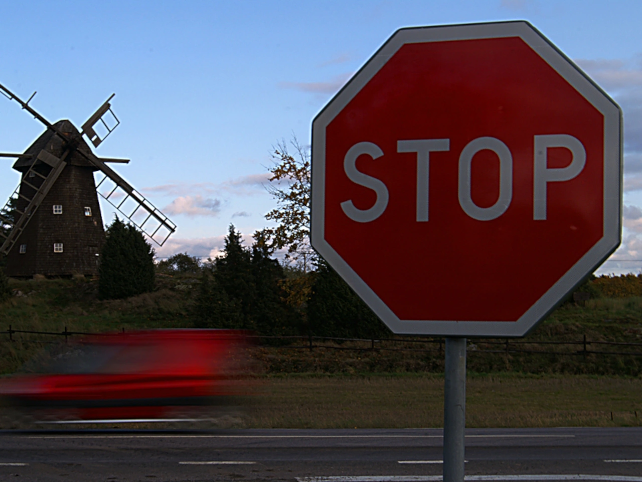
Wikimedia.org • Milan Nykodym • CC BY-SA
What does a stop sign mean?
A stop sign requires a driver to come to a complete stop and give way before proceeding.
How can you recognise a stop sign?
A stop sign is commonly a red octagonal sign displaying the word STOP. Some countries use another legally recognised design, so drivers must learn the signs used locally.
Must you stop when no other traffic is visible?
Yes. The obligation to stop applies even when the road appears completely clear.
What is a complete stop?
A complete stop means that the vehicle has ceased moving entirely. Merely slowing down or allowing the vehicle to continue rolling does not satisfy the requirement.
Where should you stop?
Stop before the stop line where one is provided. Without a line, stop at the legally prescribed position before entering the intersection, crossing or priority road.
May you stop beyond the stop line?
No. The required first stop must be made before the line. If visibility is limited, move forward cautiously after stopping and stop again where necessary before proceeding.
Must every vehicle in a queue stop separately?
Yes. Each driver must make an individual complete stop. Following another vehicle through without stopping is not permitted.
Does stopping give you priority?
No. After stopping, you must continue to give way to all road users who have priority.
Who must you give way to?
Give way to traffic on the road being entered or crossed and to pedestrians, cyclists or other road users who have priority under the applicable rules.
What is the difference between a stop sign and a give-way sign?
A stop sign always requires a complete stop. A give-way sign requires the driver to yield but normally allows continued movement when the road is clearly free.
May you turn after stopping?
Yes. After stopping and giving way, you may turn in any direction permitted by signs, signals, lane arrows and road markings.
May you turn right at a red traffic light after stopping?
This depends entirely on local law and traffic signs. A stop sign does not by itself permit a turn against a red light.
Does a stop sign impose a speed limit?
No. It imposes a stopping and yielding obligation. The normal posted or general speed limit remains applicable before and after the intersection.
Does a stop sign apply to cyclists?
In many countries, cyclists are drivers and must stop unless a specific sign or local rule provides an exception.
What happens at an all-way stop?
The order in which drivers may proceed depends on local rules, commonly involving arrival order, vehicle position and turning direction. Drivers should communicate cautiously and never assume another driver will yield.
What if two vehicles stop at the same time?
Apply the local priority rule and proceed only when the intentions of the other driver are clear. Avoid forcing the other vehicle to brake or change direction.
Do traffic lights override a stop sign?
Where functioning traffic lights control the same movement, they commonly take precedence over the stop sign. Local rules determine what applies when the lights are switched off or flashing.
Do instructions from a police officer override a stop sign?
Yes. Instructions from an authorised traffic officer normally take precedence over traffic signs and ordinary priority rules.
Can a temporary stop sign be legally binding?
Yes. A correctly placed temporary stop sign at roadworks, an event or another temporary traffic arrangement must be obeyed.
What should you do when the stop sign is partly hidden?
If you recognise that a stop sign applies, reduce speed and obey it. Report damaged, obscured or missing signs to the responsible road authority where appropriate.
13. Give way
A give-way sign requires drivers to allow traffic with priority to proceed before entering, crossing or joining a road. Drivers must reduce speed, observe approaching traffic and stop when necessary.
Unlike a stop sign, a give-way sign does not always require a complete stop. The driver may continue without stopping only when the route is clearly safe and no road user with priority is forced to change speed or direction.
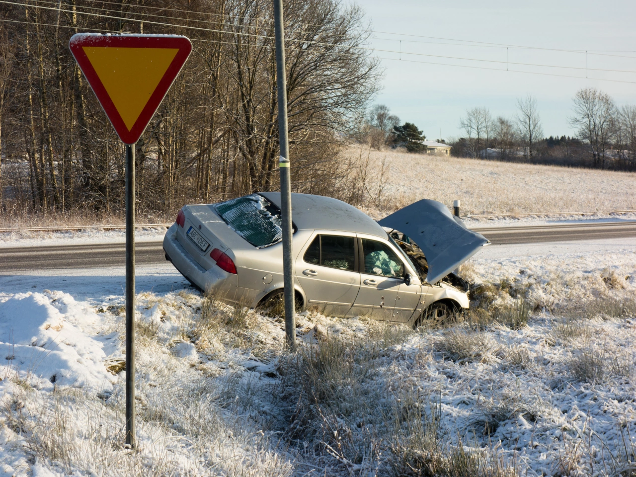
Wikimedia.org • W.carter • CC0
What does a give-way sign mean?
A give-way sign requires drivers to allow traffic with priority to proceed first. The driver must slow down and stop when necessary.
How can you recognise a give-way sign?
It is commonly an inverted triangular sign with a red border and a light-coloured centre. In some countries, it is called a yield sign.
Must you always stop at a give-way sign?
No. You must stop only when necessary to give way or obtain a sufficiently clear view. You may continue slowly when the road is clearly free.
What does giving way mean?
Giving way means allowing another road user to continue without being forced to brake, accelerate, stop or change direction because of your movement.
Where should you stop when necessary?
Stop before the give-way line where one is provided. Without a line, stop before entering the intersection or priority road at a position where you can observe traffic safely.
May you cross the give-way line before stopping?
You may move beyond the line only when this does not interfere with traffic that has priority. Where visibility is limited, first slow or stop at the line and then move forward cautiously.
What is the difference between give way and stop?
A stop sign always requires a complete stop. A give-way sign permits the driver to continue without stopping when the road is clearly free and it is safe to proceed.
Does slowing down satisfy the give-way requirement?
Only when slowing down is sufficient to let all priority traffic proceed safely. If another road user would be hindered, the driver must slow further or stop.
Who must you give way to?
Give way to traffic travelling on the road being entered or crossed and to any pedestrians, cyclists or other road users who have priority under the applicable rules.
Does giving way apply only to vehicles approaching from one direction?
No. Check every direction from which lawful traffic may approach, including cycle paths, one-way roads with authorised contraflow traffic and separate carriageways.
Does a give-way sign give the other road permanent priority?
The sign determines priority at the particular location. The priority arrangement at later intersections may be different unless the road is separately identified as a priority road.
Does giving way give you priority afterwards?
No. You may proceed only when it is safe. Another driver’s hesitation or courtesy does not remove your responsibility to avoid danger.
Must every vehicle in a queue give way separately?
Yes. Each driver must observe the road and make an individual decision. You may not follow another vehicle through without checking that the way remains clear.
Does a give-way sign apply to cyclists?
Normally, yes. Cyclists are generally treated as drivers and must obey the sign unless a supplementary sign or local rule provides otherwise.
Can a give-way sign apply only to cyclists?
Yes. Some countries use supplementary signs or path-specific signs to require cyclists to give way while other traffic follows a different priority arrangement.
Does a give-way sign change the speed limit?
No. It regulates priority rather than speed. Drivers must still approach slowly enough to observe traffic and stop when necessary.
Does a give-way sign change turning rules?
No. Drivers must still obey traffic lights, lane arrows, mandatory-direction signs and turning prohibitions.
How does give way work at a roundabout?
Many roundabout entrances have give-way signs requiring entering traffic to yield to vehicles already circulating. Drivers must follow the actual signs because roundabout priority rules differ between countries.
Do traffic lights override a give-way sign?
Functioning traffic lights commonly take precedence over priority signs controlling the same movement. The give-way sign may apply again when the lights are switched off or flashing, depending on local law.
Do police instructions override a give-way sign?
Yes. Instructions from an authorised traffic officer normally take precedence over traffic signs and ordinary priority rules.
What should you do when visibility is limited?
Reduce speed substantially and stop when necessary. Move forward cautiously only after giving way and checking that the road can be entered without danger.
14. Roundabout
A roundabout is a circular road arrangement in which traffic travels around a central island in one designated direction. Vehicles enter and leave through connecting roads, and traffic signs or local rules determine who has priority.
Drivers should reduce speed, choose a suitable lane, observe all road users and signal as required when leaving. The direction of travel, entry priority, lane use and rules for cyclists and pedestrians depend on local traffic signs and regulations.
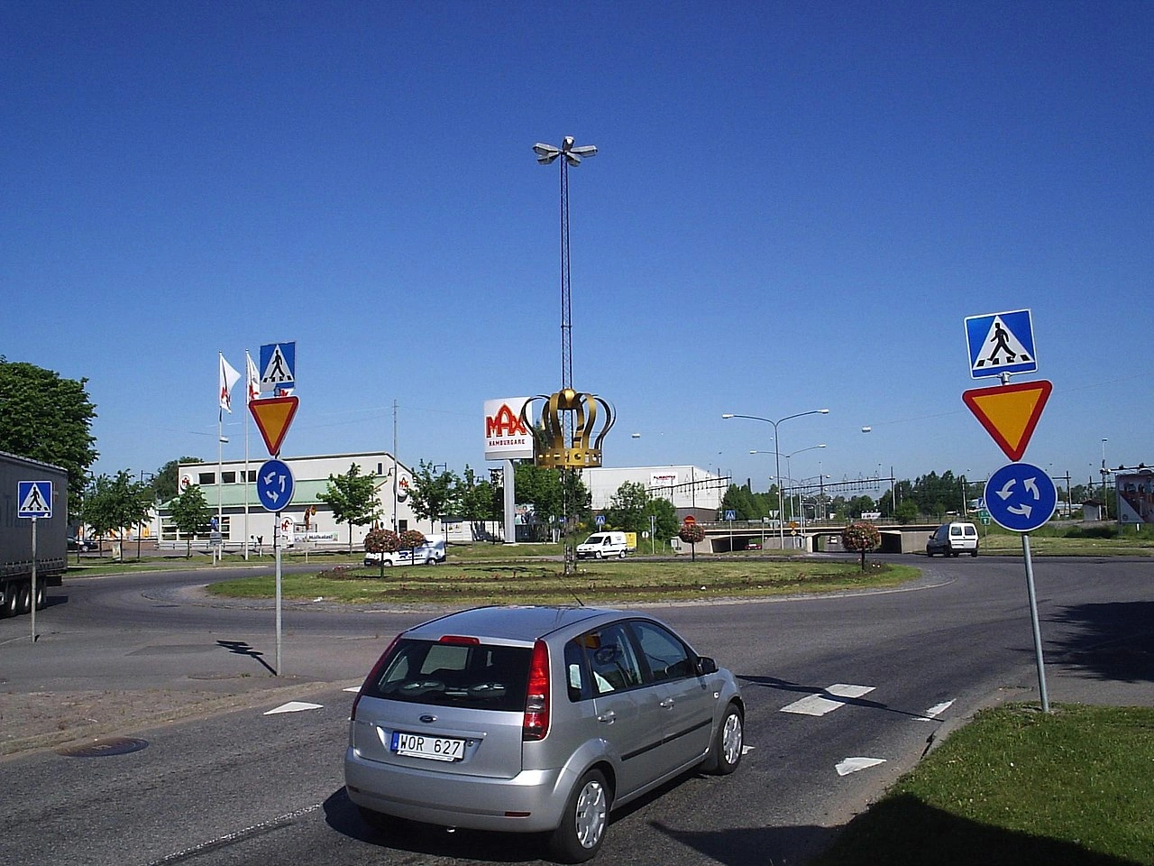
Wikimedia.org • Harri Blomberg • CC BY-SA
What is a roundabout?
A roundabout is a circular road arrangement where traffic travels in one direction around a central island before leaving through the chosen exit.
How can you recognise a roundabout?
A roundabout is normally identified by a circular-direction sign, a central island and entry roads controlled by signs, markings or local priority rules.
Which direction does traffic travel around a roundabout?
The direction depends on the country’s driving side. Traffic normally travels anticlockwise in right-hand-traffic countries and clockwise in left-hand-traffic countries.
Who has priority at a roundabout?
Priority differs between countries and roundabout designs. Entering traffic commonly gives way to traffic already circulating, but drivers must always follow the actual priority signs and signals.
Must you stop before entering a roundabout?
Not always. Stop when required by a stop sign, traffic light or approaching priority traffic. Otherwise, reduce speed and enter only when there is a safe gap.
Does a roundabout always have a give-way sign?
No. The sign arrangement depends on local law. Some circular intersections use ordinary priority rules or traffic lights instead.
How should you approach a roundabout?
Reduce speed, observe the signs and markings, choose the appropriate lane and check for pedestrians, cyclists and circulating traffic.
Which lane should you choose?
Follow the lane arrows and destination signs. As a general guide, use the lane appropriate for your exit, but exact lane-selection rules differ between countries and roundabout layouts.
May you use an inner lane?
Yes, where the road layout and local rules permit it. Before leaving, change lanes safely and give way to road users already travelling in the lane you wish to enter.
Do you need to signal when entering?
This depends on local law. Some countries require a signal for particular exits, while others require no signal when entering.
Do you need to signal when leaving?
Usually, yes. Signal in the direction of the exit early enough to inform other road users, but not so early that your intention becomes misleading.
Does signalling give you priority?
No. A direction indicator communicates your intention but does not permit you to force another road user to brake or change direction.
May you change lanes on a roundabout?
Only when the lane markings permit it and the manoeuvre can be completed safely. Check mirrors and blind spots, signal where required and give way to traffic already in the target lane.
What should you do if you miss your exit?
Continue around the roundabout and approach the exit again. Do not stop, reverse or cut suddenly across another lane.
May you drive over the central island?
Normally not. Some small roundabouts have a mountable central section intended only for vehicles that cannot otherwise negotiate the road safely.
Do cyclists have priority at a roundabout?
Priority depends on whether cyclists use the carriageway, a continuing bike path or a separate cycle crossing. Drivers and cyclists must follow the signs, markings and local priority rules.
What should drivers check before leaving?
Check mirrors and blind spots for cyclists, mopeds, motorcycles and vehicles beside you. Also check for pedestrians crossing the exit road.
Do pedestrians have priority at roundabout exits?
Pedestrian priority depends on crossings and local law. Drivers should approach exits slowly and be prepared to yield to pedestrians crossing or about to cross.
Does a roundabout have a special speed limit?
Not universally. The posted or general road limit applies, but drivers must travel slowly enough to negotiate the roundabout safely.
May you overtake on a roundabout?
Passing another vehicle may be permitted on a multilane roundabout, but drivers must remain within their lane and avoid unsafe lane changes. Local overtaking restrictions may apply.
May you stop or park on a roundabout?
Follow local signs and parking rules. Stopping or parking on the circulating roadway is commonly prohibited or unsafe because it obstructs traffic and reduces visibility.
Is every circular intersection a roundabout?
No. A circular junction may be governed by traffic lights, ordinary priority rules or another road design. Its legal status depends on its signs and local definition.
15. Pedestrian crossing
A pedestrian crossing is a designated place where pedestrians may cross a road. It is commonly indicated by road markings, traffic signs, signals or a combination of these measures.
Drivers must approach with appropriate caution and give way when required by local law. Pedestrians must also observe approaching traffic and follow any pedestrian signals or instructions from authorised traffic controllers.
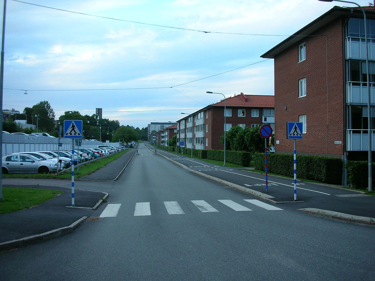
Wikimedia.org • DavidIvar • CC0
What is a pedestrian crossing?
A pedestrian crossing is a designated place for pedestrians to cross a road. It may be controlled by traffic lights or operate without signals.
How can you recognise a pedestrian crossing?
It may be indicated by white road markings, traffic signs, flashing lights, pedestrian signals or a raised crossing. Its appearance varies between countries.
Is a pedestrian crossing the same as a zebra crossing?
A zebra crossing is a type of pedestrian crossing marked by broad contrasting stripes or rectangles. Not every pedestrian crossing uses this design.
Do pedestrians always have priority?
Not universally. Priority depends on local law, traffic signals and whether the pedestrian is already crossing or clearly preparing to cross.
Must drivers stop for pedestrians waiting beside the crossing?
This depends on local law. In many countries, drivers must give way when a pedestrian is clearly intending or preparing to enter the crossing.
How should drivers approach a pedestrian crossing?
Reduce speed, observe both sides of the road and be prepared to stop. Pay particular attention to children, older people and persons with limited mobility.
May you enter a crossing when traffic is congested?
No. Do not enter when traffic ahead may force you to stop on the crossing and block pedestrians.
Where should you stop for a pedestrian?
Stop before the crossing or before the applicable stop line. Leave the crossing completely clear.
May you overtake near a pedestrian crossing?
Overtaking may be prohibited, particularly when another vehicle has stopped or slowed for the crossing. Even where no specific prohibition applies, overtaking is unsafe when pedestrians may be hidden from view.
May you stop or park on a pedestrian crossing?
Normally not. Stopping or parking on or immediately before a crossing can obstruct pedestrians and hide them from approaching drivers.
Does a pedestrian crossing impose a speed limit?
Not by itself. Drivers must respect the applicable speed limit and reduce their speed further when necessary to stop safely.
Do traffic lights change the priority rules?
Yes. Drivers and pedestrians must follow the signals applying to them. Drivers must still allow pedestrians who lawfully started crossing to finish safely.
May pedestrians cross when their signal is red?
No. Pedestrians must wait when the pedestrian signal prohibits them from entering the road.
What if the pedestrian signal changes while someone is crossing?
A pedestrian who entered lawfully should continue at a normal pace. Drivers must allow the crossing to be completed safely.
May cyclists ride across a pedestrian crossing?
This depends on local law. In many countries, a person riding a bicycle is treated as a driver and does not receive pedestrian priority. A cyclist walking beside the bicycle is normally treated as a pedestrian.
Is a pedestrian crossing also a cycle crossing?
Not automatically. A separate cycle crossing, cycle path or combined crossing may be indicated by additional markings or signs.
Must pedestrians use a nearby crossing?
Some countries require pedestrians to use a crossing when one is located within a specified distance. Other countries allow crossing elsewhere when it can be done safely.
May pedestrians remain standing on the crossing?
No. Pedestrians should cross without unnecessary delay and should not obstruct traffic by stopping or lingering on the road.
Does a raised pedestrian crossing change priority?
The raised surface itself does not necessarily determine priority. Drivers and pedestrians must follow the crossing markings, signs, signals and local rules.
What should drivers check when turning across a crossing?
Check for pedestrians approaching from both sides and give way where required. Turning drivers should not focus only on motor traffic.
What should pedestrians do before crossing?
Observe approaching traffic, make sure drivers have sufficient time to react and cross carefully. Priority does not remove the need to avoid stepping into the path of a vehicle that cannot stop safely.
16. Railway crossing
A railway crossing, also called a level crossing or railroad crossing, is a place where a road or path crosses railway tracks at the same level. It may be protected by barriers, warning lights, bells, traffic signs or a combination of these measures.
Road users must approach carefully and never enter when a train is approaching, warning signals are active or the exit is blocked. They should cross promptly and must never stop, wait or become trapped on the tracks.
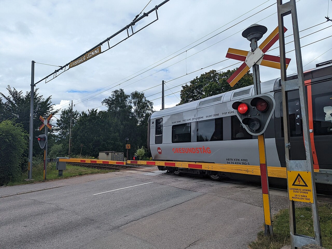
Wikimedia.org • AleWi • CC BY-SA
What is a railway crossing?
A railway crossing is a place where a road or path crosses railway tracks at the same level.
What is another name for a railway crossing?
It may also be called a level crossing or, particularly in North America, a railroad crossing.
How can you recognise a railway crossing?
It may be indicated by warning signs, crossbuck signs, barriers, flashing lights, bells or road markings. The design differs between countries.
What is the difference between a crossing with and without barriers?
A protected crossing uses full or partial barriers to block road traffic when a train approaches. A crossing without barriers relies on signs, lights, bells or the road user’s own observation.
Must you always stop at a railway crossing?
Not necessarily. You must stop when required by lights, barriers, signs, an approaching train or an authorised person. At an unprotected crossing, slow down and proceed only after checking that no train is approaching.
What do flashing red lights mean?
Flashing red lights mean stop and do not enter the crossing. Remain stopped until the signal permits you to continue.
May you cross while a barrier is moving?
No. Do not enter while a barrier is lowering, rising or closed. Wait until the crossing is fully open and all prohibiting signals have stopped.
May you drive around a closed barrier?
No. Never drive, cycle or walk around or underneath a closed or moving barrier.
What does a warning bell mean?
A warning bell or audible signal normally means that the crossing is closing or that a train is approaching. Do not enter the crossing while it is sounding.
What does a flashing white light mean?
In some countries, a flashing white light indicates that the crossing equipment is operating and road users may pass when the route is clear. Its exact meaning depends on local law.
What should you do at a crossing without lights or barriers?
Reduce speed, look and listen carefully in both directions and cross only after making sure that no train or other rail vehicle is approaching.
May you cross immediately after a train has passed?
Not automatically. Another train may approach on a second track. Wait until all warning signals stop and the crossing is fully open.
What if traffic ahead is blocking the exit?
Do not enter the crossing unless there is enough room beyond the tracks for your entire vehicle. Never rely on traffic moving before a train arrives.
May you wait on the tracks?
No. Railway tracks must always remain clear. Do not stop because of congestion, traffic lights or another obstruction beyond the crossing.
May you overtake at a railway crossing?
Overtaking is often prohibited or restricted because another vehicle can obstruct the view of an approaching train or warning signal. Follow local signs and overtaking rules.
May you stop or park on a railway crossing?
No. Stopping or parking on the tracks creates an immediate and potentially fatal danger.
Do the crossing signals apply to pedestrians and cyclists?
Yes. Pedestrians and cyclists must obey barriers, lights, bells and authorised personnel in the same way as other road users.
Should cyclists ride across the tracks at an angle?
Where possible, cross the rails at an angle close to 90 degrees. Rails can trap a bicycle wheel, especially when they are wet or cross the road diagonally.
What should drivers of long vehicles check?
Make sure the entire vehicle and any trailer can clear the crossing without stopping. Consider the available space, road gradient, turning room and traffic beyond the tracks.
What should drivers of high vehicles check?
Observe all height restrictions and warning signs. Electrified railway lines may have overhead equipment that can be struck by an excessively high vehicle or load.
What should you do if the signals appear defective?
Treat the crossing with extreme caution. Do not assume that no train is approaching merely because the lights or barriers are not operating.
What should you do if your vehicle becomes stuck on the tracks?
Evacuate everyone immediately, move well away from the railway and contact the emergency services or railway operator. Do not remain in the vehicle or return for belongings.
Is a railway crossing the same as tram tracks in the road?
Not always. A railway crossing normally crosses tracks that are separate from the carriageway, while tram or street-running railway tracks may form part of the road itself.
17. Crossing animals
An animals-crossing warning indicates a place or road section where wild animals, livestock or ridden animals may enter or cross the road. Animals may appear suddenly, move unpredictably or be difficult to see in darkness, vegetation or poor weather.
Drivers should reduce speed, scan both sides of the road and remain prepared to stop. The warning sign does not itself give animals priority or impose a numerical speed limit, but drivers must avoid frightening, endangering or colliding with them.
Wikimedia.org • Michal Klajban • CC BY-SA
What does an animals-crossing sign mean?
It warns that animals may enter or cross the road in the area ahead.
Which animals may the sign refer to?
Depending on the symbol and local conditions, it may refer to deer, cattle, horses, sheep, goats, wild boar or other animals.
How can you recognise an animals-crossing sign?
It is commonly a triangular warning sign displaying the silhouette of an animal. The species shown may indicate the type of animal most likely to be encountered.
Does the sign mean animals are always present?
No. It indicates an increased likelihood of animals crossing, not that animals will be present every time.
Does the sign impose a speed limit?
No. The normal posted or general speed limit remains applicable, but drivers must reduce speed when necessary to react safely.
Do animals have priority because of the sign?
No automatic priority is created by the warning sign. Drivers must nevertheless avoid danger and allow animals already on the road to pass safely.
How should you approach an animal-crossing area?
Reduce speed, increase your following distance and scan the road, verges, fields and vegetation for movement or reflected eyes.
When are wild animals most likely to appear?
Animal activity is often greater around dawn, dusk and darkness, although animals may cross at any time.
Why should you expect more than one animal?
Many animals travel in groups. When one animal crosses, others may follow immediately from the same direction.
Should you sound the horn?
Avoid unnecessary horn use or engine revving because it may frighten an animal and make its movement less predictable. Use a warning only when reasonably necessary to prevent danger.
Should you use full-beam headlights?
Use the appropriate lights without dazzling other road users. When an animal is visible, reduce speed and avoid relying on full beam to make it move away.
What should you do when an animal is on the road?
Slow down smoothly, stop when necessary and allow it enough time and space to leave. Avoid sudden acceleration or aggressive steering.
Should you swerve to avoid an animal?
Avoid an uncontrolled swerve that could cause a collision with another vehicle, tree, barrier, cyclist or pedestrian. Brake firmly while maintaining control and steer only when a safe escape path is clearly available.
How should you pass livestock?
Pass only when the animals and their handlers have sufficient space. Drive slowly, avoid noise and be prepared for an animal to change direction unexpectedly.
How should you pass a horse and rider?
Reduce speed, leave a large lateral distance and pass quietly. Avoid sounding the horn, accelerating sharply or passing when oncoming traffic prevents sufficient clearance.
Must you follow instructions from an animal handler?
Follow lawful instructions from an authorised person and cooperate with handlers controlling animals on or across the road.
May you overtake near an animal crossing?
The warning sign does not necessarily prohibit overtaking, but overtaking should be avoided when animals, limited visibility or approaching traffic make the manoeuvre unsafe.
What if an animal appears behind another vehicle?
Maintain enough following distance to see beyond the vehicle ahead. Be prepared for it to brake suddenly when an animal enters the road.
What should motorcyclists and cyclists do?
Reduce speed, keep both hands firmly in control and avoid sudden movements. Animals may react unexpectedly to quiet or fast-approaching two-wheeled vehicles.
What should you do after hitting an animal?
Stop safely, activate the hazard warning lights and check for injured people. Contact the emergency services or police when necessary and do not approach a wounded wild animal, which may defend itself.
Should you move an injured or dead wild animal?
Normally not. Keep a safe distance and allow the police, wildlife authorities or an animal-rescue service to handle it.
Can animals be present without a warning sign?
Yes. Drivers remain responsible for observing the road and adjusting their speed even where no animal warning sign is displayed.
18. Roadworks
Roadworks are construction, maintenance, repair or inspection activities carried out on or beside a road. They may temporarily change the road layout, lane widths, speed limits, priority, permitted directions and facilities for pedestrians or cyclists.
Drivers must follow the temporary signs, traffic lights, barriers, road markings and instructions from authorised personnel. They should reduce speed, increase their following distance and remain prepared for narrow lanes, stopped traffic, workers, machinery and sudden changes in the route.
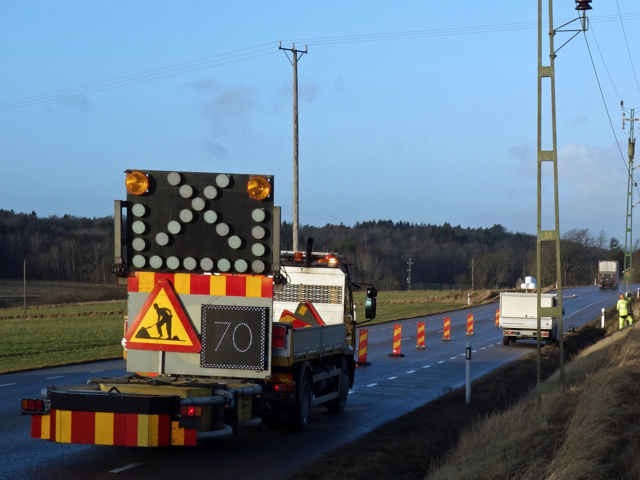
Wikimedia.org • W.carter • CC BY-SA
What are roadworks?
Roadworks are construction, maintenance, repair or inspection activities carried out on or beside a road.
How can you recognise roadworks?
They may be indicated by a roadworks warning sign, cones, barriers, temporary markings, flashing lights, machinery or workers.
Does a roadworks sign impose a speed limit?
No, not by itself. A separate temporary or permanent speed-limit sign establishes the legal maximum speed.
Must you drive below the speed limit?
Yes, when necessary. Narrow lanes, workers, machinery, poor surfaces, congestion or limited visibility may require a substantially lower speed.
Are temporary traffic signs legally binding?
Yes. Correctly installed temporary signs must be obeyed for as long as they are in force.
Which road markings should you follow?
Follow the temporary markings that guide traffic through the works. Local law determines how they take priority over older permanent markings.
Must you obey temporary traffic lights?
Yes. Stop at the line or signal when required and do not proceed until the applicable light permits it.
Must you obey road workers directing traffic?
Obey instructions from workers or controllers who are legally authorised to regulate traffic. Their signals may temporarily replace the ordinary traffic arrangement.
What should you do when a lane closes?
Observe the signs and lane arrows, check mirrors and blind spots and merge safely into the continuing lane.
What is zipper merging?
Zipper merging means that vehicles in an ending or blocked lane merge alternately with vehicles in the continuing lane near the narrowing during congested traffic.
Should you merge early?
This depends on local law and traffic conditions. Where zipper merging applies during congestion, use both lanes and merge near the narrowing. In flowing traffic, change lanes when a safe gap is available.
Who has priority when your lane is obstructed?
Without another traffic control, the driver whose route is obstructed commonly has to yield before moving into the path of approaching or adjacent traffic.
Can temporary lights control alternating traffic?
Yes. Temporary signals may allow only one direction at a time through a narrow section.
May you enter when the exit is blocked?
No. Do not enter a narrow section, intersection or temporary crossing when congestion may leave you stopped inside it.
May you move cones or barriers?
No. Do not move, pass around or ignore traffic-control equipment unless an authorised person instructs you to do so.
May you overtake in roadworks?
Only when signs and markings permit it and sufficient width and visibility remain. Overtaking is often unsafe in narrow or shifted lanes.
May you stop or park in roadworks?
Only where temporary and permanent signs permit it. Do not obstruct workers, machinery, emergency access or temporary pedestrian and cycle routes.
What should you watch for near workers?
Expect workers to enter the road, machinery to move or reverse and vehicles to leave the worksite. Reduce speed and leave generous space.
What should cyclists do at roadworks?
Follow the signed temporary cycle route or lane. Check surrounding traffic carefully before leaving a closed or obstructed bike path.
What should pedestrians do?
Use the designated temporary walkway or crossing and follow barriers, signs, signals and instructions from authorised personnel.
Why should you increase your following distance?
Traffic may brake suddenly because of queues, lane changes, machinery, debris or changing signals. Additional distance provides more time to react.
What should you do if your vehicle breaks down in roadworks?
Move to the safest available location where possible, activate the hazard warning lights and contact assistance. Avoid standing in a live or narrow traffic lane.
Do ordinary traffic rules still apply?
Yes. Rules concerning safe speed, following distance, signalling, priority and vulnerable road users continue to apply unless a lawful temporary arrangement changes them.
19. Height limit
A height limit prohibits vehicles whose total height exceeds the value shown from entering or passing a road section, bridge, tunnel, gateway or other structure. The vehicle’s height includes its load and any equipment attached above it.
Drivers of high vehicles must know their exact height, observe advance warnings and use an alternative route when necessary. They should never rely only on visual judgement or attempt to pass beneath a structure when safe clearance is uncertain.
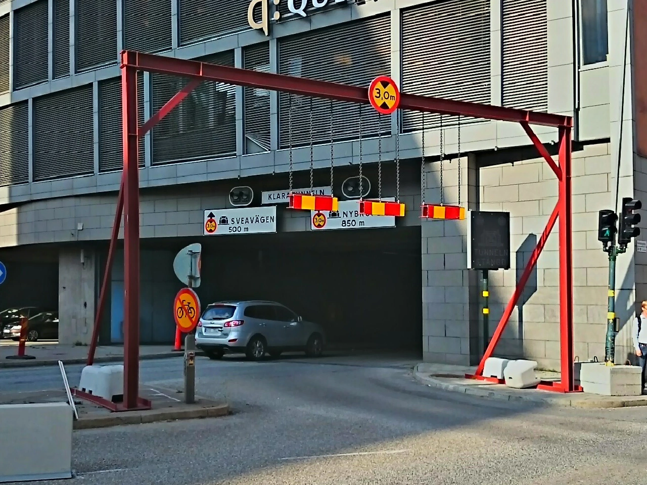
Wikimedia.org • GulanSthlm • CC BY-SA
What does a height-limit sign mean?
It prohibits vehicles whose total height exceeds the displayed value from continuing beyond the sign.
How can you recognise a height-limit sign?
It is commonly a circular regulatory sign showing a height in metres, feet or another local unit between vertical arrows.
What is included in the vehicle’s total height?
The height includes the vehicle, its load and any attached equipment, such as roof boxes, bicycles, machinery, antennas or raised loading equipment.
Does the limit apply to trailers?
Yes. Every part of a vehicle combination must fit beneath the restriction, including the towing vehicle, trailer and load.
Does the sign show the exact physical clearance?
Not necessarily. Road authorities may display a lower value than the measured clearance to provide a safety margin.
May a vehicle exactly as high as the displayed value pass?
The legal wording commonly prohibits vehicles higher than the displayed value, but drivers should not attempt to pass without a practical safety margin. Measurement errors, movement and road conditions can reduce the available clearance.
How can a vehicle’s height change?
Loading, tyre pressure, suspension settings, raised equipment, replacement tyres and road movement can alter the vehicle’s total height.
Can air suspension affect the height?
Yes. The vehicle may rise or lower depending on its suspension mode, speed and load. Use the maximum travelling height when planning the route.
Can the clearance vary between lanes?
Yes. An arched bridge, tunnel roof or overhead structure may provide different clearance in each lane. Follow lane-specific signs and markings.
Can the clearance vary across the width of one lane?
Yes. Clearance may be lower near the edge of an arch or where the road slopes sideways. Remain within the authorised marked path.
Can resurfacing reduce the available clearance?
Yes. A new road surface can raise the road level and reduce the space beneath a bridge or structure.
Can snow, water or road debris affect clearance?
Yes. Material on the road can raise the vehicle or restrict the usable route. Flooding may also conceal the road surface or another hazard.
Where are height restrictions commonly found?
They are common at bridges, tunnels, car parks, loading areas, gateways, railway structures and roads with overhead equipment.
Is a height-limit sign a warning or a prohibition?
It is normally a prohibition. A vehicle that exceeds the displayed height may not pass.
Does a height-limit sign impose a speed limit?
No. The applicable road or posted speed limit remains in force, although drivers should approach cautiously.
Does the sign change priority?
No. Traffic lights, priority signs and ordinary priority rules remain applicable.
Can a height restriction be announced in advance?
Yes. An advance sign may show the restriction and the distance to it so that high vehicles can choose another route.
What should you do when your vehicle is too high?
Do not continue. Stop where safe and follow the signed diversion or another suitable route. Do not reverse into traffic without assistance.
Should you rely on a navigation system?
No. Navigation may contain outdated or incomplete vehicle restrictions. Traffic signs and the actual road conditions always take precedence.
Should professional drivers know their vehicle’s height?
Yes. Drivers of trucks, buses, motorhomes and vehicles carrying roof loads should know and, where useful, display the vehicle’s maximum travelling height inside the cab.
What should you do when uncertain about your height?
Stop before the restriction in a safe place and verify the vehicle’s height. Choose another route when safe clearance cannot be confirmed.
May you move into another lane with greater clearance?
Only when signs and markings permit it and the manoeuvre can be completed safely. Do not cross a closed lane, continuous line or opposing traffic merely to gain clearance.
May you lower or remove equipment to pass?
Only in a safe place and when the equipment can be secured correctly afterwards. Never stop beneath the structure or in a live lane to alter the vehicle.
What should you do if your vehicle strikes a bridge?
Stop immediately where safe, activate the hazard warning lights and contact the emergency services or police. Do not continue because the vehicle, load or structure may be unstable.
Should traffic continue beneath a struck bridge?
No, when damage may have occurred. Keep away from the structure and follow instructions from the police, road authority or railway operator.
20. Selective barriers
Selective barriers are physical access-control devices that allow certain road users or authorised vehicles to pass while restricting other traffic. They may include fixed, removable, folding or retractable bollards, gates, barriers and width-filtering installations.
The permitted users are determined by traffic signs, access conditions and local regulations, not by the barrier alone. Drivers should approach slowly, verify that they are authorised and wait until any moving barrier is fully open or retracted before continuing.
Wikimedia.org • AleWi • CC0
What is a selective barrier?
A selective barrier is a physical access-control device that blocks some traffic while allowing specified road users or authorised vehicles to pass.
What types of selective barriers exist?
Common examples include fixed bollards, removable posts, folding posts, retractable bollards, gates, rising barriers and width-filtering installations.
Why are selective barriers used?
They may prevent through traffic, protect pedestrian or cycling routes, control access to restricted areas or allow only residents, public transport, deliveries or emergency services to enter.
Does the barrier itself determine who may pass?
Not normally. The permitted users are determined by traffic signs, permits, access systems and local regulations.
May cyclists pass through a selective barrier?
Only when cycling is permitted and sufficient safe space is provided. Cyclists must follow the signs applying to the road or path.
May pedestrians pass through?
Pedestrians may pass where pedestrian access is permitted and a safe route is available. They should not walk beneath a moving gate or through a vehicle-only opening.
May motorcycles pass between bollards?
Only when motorcycles are legally permitted beyond the barrier and the opening is intended for them. Being physically able to fit through does not create permission.
May emergency vehicles pass?
Emergency vehicles may have keys, remote controls, automatic recognition or another authorised method of opening the barrier. Other road users must keep the access clear.
May residents or delivery vehicles enter?
They may enter only when local access rules, permits or traffic signs authorise them. Permission may apply only during specified hours.
What is a retractable bollard?
A retractable bollard is a post that can rise from or lower into the road surface to control vehicle access.
How may a retractable bollard be activated?
It may operate through a badge, remote control, access code, number-plate recognition, timer, control centre or automatic detection system.
When may you drive over a retractable bollard?
Only after confirming that you are authorised and the bollard is fully lowered. Do not move merely because another vehicle has activated it.
May you follow another authorised vehicle through?
No, unless your own access is also authorised and the system clearly permits it. The barrier may rise immediately after the first vehicle.
What do warning lights near a barrier mean?
Red lights normally require road users to stop, while another signal may indicate when passage is permitted. Follow the displayed signals and local instructions.
What should you do when the barrier is moving?
Stop at a safe distance and wait until it has completed its movement. Never drive, cycle or walk beneath a moving gate or across a rising bollard.
What if the barrier appears to be stuck?
Do not force, move or drive around it. Use the intercom or contact the operator, road authority or emergency service indicated at the location.
May you move a removable bollard yourself?
No, unless you are specifically authorised. Removing or repositioning access-control equipment may create danger and allow prohibited traffic to enter.
Does a lowered bollard mean everyone may enter?
No. Traffic signs and access restrictions remain applicable even when the physical barrier is temporarily open or lowered.
Does an open gate cancel a no-entry sign?
No. An open physical barrier does not cancel a regulatory traffic sign.
Does a selective barrier impose a speed limit?
Not by itself. Drivers must follow the applicable speed limit and approach slowly enough to stop before the installation.
Does it change priority?
No. Traffic lights, priority signs and ordinary priority rules remain applicable unless another traffic arrangement indicates otherwise.
May you stop or park in front of a selective barrier?
Do not stop or park where the vehicle would block authorised access, emergency services, pedestrians or cyclists.
Why are bollards dangerous for cyclists and motorcyclists?
They may be difficult to see, especially in darkness, congestion or poor weather. A collision can cause a rider to fall into nearby traffic or other obstacles.
How should cyclists approach bollards?
Reduce speed, identify the intended opening and pass through in a straight and controlled line. Avoid overtaking another cyclist at the barrier.
What should drivers do when leaving a restricted area?
Approach slowly, wait for the access system to respond and check for pedestrians and cyclists before crossing their route.
What if your vehicle strikes a barrier?
Stop safely, activate the hazard warning lights where appropriate and report the collision. Do not continue if the vehicle, barrier or access system may be damaged.
21. Traffic lights
Traffic lights use coloured lights, arrows or symbols to regulate when road users may proceed, must prepare to stop or must remain stopped. Separate signals may apply to particular directions, lanes, pedestrians, cyclists or public-transport vehicles.
A green light permits movement only when the route is clear and the movement is otherwise legal. Road users must still follow priority rules, turning restrictions, lane markings and instructions from authorised traffic controllers.
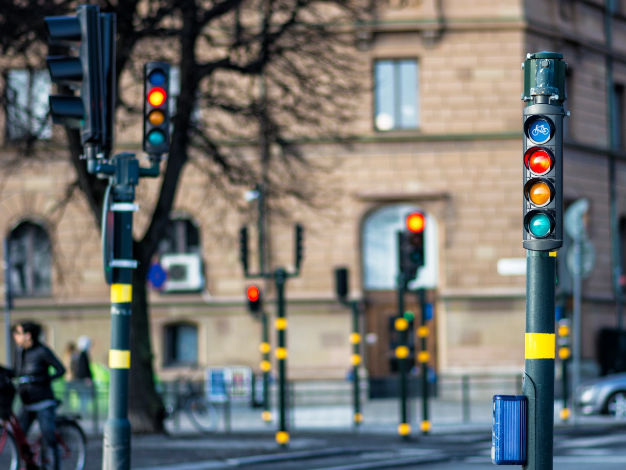
Wikimedia.org • Ekaterina Kuzmina • CC BY-SA
What are traffic lights?
Traffic lights are signals that use coloured lights, arrows or road-user symbols to regulate traffic movements.
What does a red traffic light mean?
A red light requires road users to stop before the stop line or signal and remain stopped until movement is permitted.
What does a steady amber light mean?
A steady amber light normally requires drivers to stop unless they are already too close to stop safely. It warns that the signal is changing to red.
What does a green traffic light mean?
A green light permits road users to pass the signal, but only when the route is clear and the intended movement is otherwise legal.
Does green mean that you have priority over everyone?
No. You may still have to give way to pedestrians, cyclists, oncoming traffic or other road users when turning or following a conditional arrow.
May you enter a blocked intersection on green?
No. Do not enter when congestion is likely to leave you stopped inside the intersection and obstructing crossing traffic.
Where should you stop at a red light?
Stop before the stop line. When no stop line is provided, stop before the traffic light or at another legally prescribed position.
May you cross the stop line and then stop?
No. The required stop must normally be completed before the stop line. Do not stop on a pedestrian or cycle crossing.
What if the light changes to amber while you are approaching?
Stop when this can be done safely. Continue only when you are already too close to stop without creating danger.
Should you accelerate to pass an amber light?
No. Do not accelerate to avoid stopping. Maintain control and stop unless doing so safely is no longer possible.
What do arrow-shaped traffic lights mean?
They have the same general meaning as circular lights, but the prohibition or permission applies only to the direction shown by the arrow.
What does a green arrow displayed with a red light mean?
It may permit travel in the indicated direction while other movements remain prohibited. Drivers may still have to give way to conflicting traffic and pedestrians.
Does a green arrow override a no-turn sign?
Not universally. Drivers must follow the complete local sign arrangement. A traffic signal does not necessarily cancel a separate regulatory prohibition.
May you turn right on red?
Only where local law or a specific sign or signal expressly permits it. There is no universal right to turn on red.
What does a flashing amber light mean?
It warns of a potential hazard and normally allows cautious passage. The ordinary priority arrangement remains applicable.
What should you do when the normal lights are flashing amber?
Reduce speed, observe the intersection carefully and follow the applicable priority signs or default priority rules.
What does a flashing red light mean?
Its meaning depends on local law. At railway crossings and some movable bridges, flashing red lights normally require road users to stop.
What do lane-control signals mean?
A red cross normally closes the lane, a green downward arrow opens it and an amber diagonal arrow instructs drivers to leave the lane in the indicated direction.
May you continue beneath a red lane-control cross?
No. Move out of the lane safely before reaching the red cross unless an authorised person or emergency rule directs otherwise.
What does an amber diagonal lane arrow mean?
It warns that the lane is closing or unavailable ahead. Drivers must move into the adjacent lane indicated by the arrow when safe.
Can separate lights apply to cyclists?
Yes. A signal displaying a bicycle symbol applies to the road users legally covered by that signal rather than to general motor traffic.
Can separate lights apply to pedestrians?
Yes. Pedestrian lights normally use red and green human figures to indicate whether pedestrians may begin crossing.
What does a flashing green pedestrian light mean?
It normally warns that the crossing period is about to end. Pedestrians who have not started should wait for the next green signal.
What if the pedestrian signal changes while someone is crossing?
A person who entered lawfully should continue without unnecessary delay. Turning drivers must allow the crossing to be completed safely.
Can buses and trams have separate traffic lights?
Yes. Public-transport signals may use bars, circles, triangles or other symbols that apply only to authorised service vehicles.
Do functioning traffic lights override priority signs?
They commonly replace the priority arrangement at that location. Priority signs may apply again when the normal signals are inactive or flashing.
Do instructions from a police officer override traffic lights?
Yes. Instructions from an authorised traffic controller normally take precedence over lights, signs, markings and ordinary rules.
What should you do when the lights are not working?
Reduce speed and follow the priority signs, temporary signals, authorised personnel or default priority rules that apply.
May you clear an intersection after the light turns red?
Yes, when you entered lawfully and must leave the intersection. Complete the movement cautiously without endangering other road users.
Does a green light impose a minimum speed?
No. Drivers may proceed but must continue at a safe and legal speed.
May you use a handheld phone while waiting at red?
This depends on local law. In many countries, a driver temporarily stopped in traffic is still considered to be driving and may not use a handheld device.
22. Pedestrian lights
Pedestrian lights are traffic signals that regulate when pedestrians may begin crossing a road. They normally display a red standing figure to prohibit starting and a green walking figure to permit crossing.
A flashing signal or countdown may warn that the permitted crossing period is ending. Pedestrians should cross without unnecessary delay, while turning drivers must remain alert and allow pedestrians who entered lawfully to finish crossing safely.
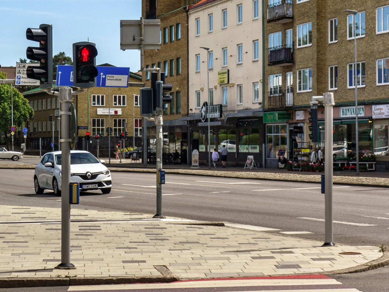
Wikimedia.org • W.carter • CC BY-SA
What are pedestrian lights?
Pedestrian lights are traffic signals that indicate when pedestrians may begin crossing a road.
How can you recognise pedestrian lights?
They commonly display a red standing person and a green walking person. Their design may vary between countries.
What does the red pedestrian light mean?
It means that pedestrians must not begin crossing.
What does the green pedestrian light mean?
It means that pedestrians may begin crossing, provided they still observe the road and cross without unnecessary delay.
Does green guarantee that no vehicle will cross your path?
No. Turning vehicles, emergency vehicles or traffic following another authorised signal may still cross the pedestrian route. Pedestrians should remain attentive.
What does a flashing green pedestrian light mean?
It normally warns that the permitted crossing period is about to end. Pedestrians who have not started should consider waiting for the next green signal.
What does a flashing red pedestrian light mean?
Its meaning varies between countries. It commonly means that pedestrians must not begin crossing, while those already on the road should finish without delay.
What does a countdown display mean?
A countdown may show approximately how much time remains before the signal changes. It does not remove the duty to cross cautiously.
May you begin crossing when the countdown is nearly finished?
Begin only when there is enough time to cross safely and without stopping unnecessarily on the road. Waiting for the next green phase may be safer.
What if the signal changes to red while you are crossing?
Continue crossing at a normal pace towards the nearest safe side. Do not turn back suddenly, stop unnecessarily or run into another traffic stream.
Must drivers allow pedestrians to finish crossing?
Yes. Drivers should allow pedestrians who entered lawfully to complete the crossing safely, even when vehicle traffic receives permission to proceed.
May turning drivers cross during the pedestrian green phase?
Some signal systems permit turning vehicles and pedestrians at the same time. Turning drivers must give way where required and must not endanger pedestrians.
What is a conflict-free pedestrian phase?
It is a signal phase during which conflicting vehicle movements are stopped so pedestrians can cross without permitted traffic turning across their route.
What is an all-pedestrian phase?
It is a phase in which pedestrians may cross several or all approaches while vehicle traffic is stopped. Diagonal crossing is permitted only when the signals and markings allow it.
What do arrows around a pedestrian symbol mean?
They may indicate that the same pedestrian signal applies simultaneously to several crossing directions. The exact meaning depends on local law.
What should pedestrians do before stepping onto the road?
Check that approaching and turning vehicles are stopping and that the route is clear. A green signal does not make a collision impossible.
Must pedestrians cross without delay?
Yes. They should proceed at a normal pace and should not linger, stop unnecessarily or obstruct traffic on the crossing.
What if there are no pedestrian lights?
Pedestrians may have to follow the traffic lights controlling vehicles, an authorised officer or the ordinary pedestrian-crossing rules.
What is a pedestrian push button?
A push button normally registers a request for a pedestrian crossing phase. Pressing it does not itself permit crossing; pedestrians must wait for the appropriate signal.
Does repeatedly pressing the button make the signal change faster?
Normally not. Once the request has been registered, additional presses usually have no effect.
What are audible pedestrian signals?
Audible signals use sounds to help pedestrians with visual impairments identify when crossing is permitted or when the signal is changing.
What are tactile pedestrian signals?
Tactile signals may use a vibrating button, rotating cone or raised markings to provide crossing information to pedestrians with visual impairments.
Do pedestrian lights apply to cyclists?
Not normally. A cyclist riding a bicycle must follow the applicable cycle or vehicle signal unless a combined pedestrian-and-cycle signal applies.
What if a cyclist walks beside the bicycle?
A person walking beside a bicycle is normally treated as a pedestrian and follows the pedestrian signal.
What are combined pedestrian-and-cycle lights?
They display pedestrian and bicycle symbols and apply to the road users indicated by those symbols.
May pedestrians cross when an authorised officer signals them to wait?
No. Instructions from an authorised traffic controller normally take precedence over pedestrian lights.
What should you do when the pedestrian lights are not working?
Cross only according to the functioning vehicle signals, priority rules and instructions from authorised personnel. Proceed cautiously and take approaching traffic into account.
23. Traffic mirror
A traffic mirror is a convex mirror installed near an intersection, driveway, bend or other location with restricted visibility. Its curved surface provides a wider view of approaching road users than an ordinary flat mirror.
A traffic mirror is only a visibility aid. It may distort distance, speed and direction and may be affected by darkness, weather, dirt or damage. Drivers must continue to observe the road directly, obey all priority rules and proceed only when it is safe.
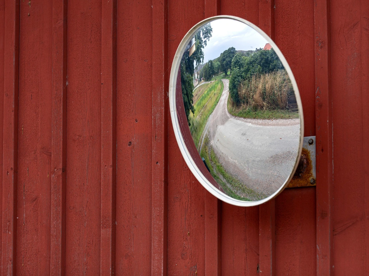
Wikimedia.org • Manfred Werner • CC BY-SA
What is a traffic mirror?
A traffic mirror is a convex roadside mirror that helps road users see around an obstruction or into a road with limited visibility.
Where are traffic mirrors commonly installed?
They may be placed near intersections, narrow roads, bends, car-park exits, private driveways, tunnels or other locations where buildings, vegetation or road geometry obstruct the view.
Why is the mirror curved?
A convex surface provides a wider field of view than a flat mirror, allowing more of the approaching road to be seen.
Does a traffic mirror show an exact image?
No. The reflected image is distorted, and objects normally appear smaller and farther away than they really are.
Can you accurately judge speed in a traffic mirror?
Not reliably. The curved image makes it difficult to estimate how fast another road user is approaching.
Can you accurately judge distance in the mirror?
No. Distance can appear greater than it really is, so an approaching vehicle may reach the intersection sooner than expected.
Can the mirror create a blind area?
Yes. Its position and viewing angle may leave parts of the road outside the reflected image. Small cyclists, motorcycles or pedestrians may also be difficult to notice.
Does a traffic mirror give you priority?
No. It does not change priority. Drivers must continue to follow stop signs, give-way signs, traffic lights and the ordinary priority rules.
Does seeing an empty mirror mean the road is clear?
No. Another road user may be outside the reflected area, hidden by glare or too small to notice. Always check the road directly before proceeding.
Must you still stop at a stop sign?
Yes. The mirror does not replace the mandatory complete stop. Stop at the prescribed position, then use direct observation and the mirror as additional information.
Must you still give way?
Yes. You may proceed only when traffic with priority can continue without being forced to brake, stop or change direction.
How should you use a traffic mirror?
Approach slowly, stop when required and scan the mirror for movement. Then look directly in both directions and continue only after confirming that the road is clear.
Should you look only at the mirror?
No. Alternate between the mirror and direct observation. The mirror should supplement rather than replace normal checks.
Can rain affect a traffic mirror?
Yes. Rain, water droplets and spray may blur or partially obscure the reflected image.
Can frost or condensation affect it?
Yes. Dew, condensation, frost, ice or snow may make the mirror difficult or impossible to use.
Can sunlight cause problems?
Yes. Sunlight may create glare or reflections that hide approaching road users.
Can headlights be misleading at night?
Yes. Reflected headlights may make it difficult to determine the exact direction, distance or speed of an approaching vehicle.
Can the mirror move out of position?
Yes. Wind, impacts, vandalism, vibration or temperature changes may alter its orientation and make the reflected view inaccurate.
What if the mirror is dirty or damaged?
Do not rely on it. Proceed with additional caution and report the defect to the responsible road authority or property owner.
Does a traffic mirror impose a speed limit?
No. The applicable road or posted speed limit remains in force, but restricted visibility normally requires a lower approach speed.
Does it require drivers to sound the horn?
No. Use the horn only where local law permits it and a warning is reasonably necessary to prevent danger.
Can pedestrians and cyclists use the mirror?
Yes. It may help them observe approaching traffic, but they must also look directly and follow the applicable crossing and priority rules.
Can a private individual install a traffic mirror?
A mirror may generally be installed on private property with the owner’s permission, subject to local rules. Installing one on, above or beside a public road normally requires permission from the road authority.
Should a mirror replace better road design?
No. Removing vegetation, relocating parking, improving the intersection layout or changing traffic circulation may provide a safer and more reliable solution.
24. Cycling route
A cycling route is a planned or signposted route intended to guide cyclists between places or through a particular area. It may follow cycle paths, quiet streets, shared roads, greenways or other routes considered suitable for cycling.
A cycling route does not necessarily give cyclists exclusive use of the road or path and should not be confused with a cycle path or cycle lane. The traffic rules, priority rules and permitted road users depend on the individual roads and paths that form the route and on the local signs and regulations.
Wikimedia.org • Pieter Kuiper • CC0
How can you recognise a cycling route?
Cycling routes are commonly indicated by direction signs, bicycle symbols, route numbers, colours or destination markers. The design of the signs and route-numbering system varies between countries and regions.
Do cyclists have to follow a cycling route?
Usually not. A cycling-route sign normally provides direction or route guidance rather than imposing a mandatory direction. However, separate mandatory traffic signs may require cyclists to use a particular cycle path or direction.
Is a cycling route the same as a cycle path?
No. A cycle path is a specific part of a road or separate path intended for cyclists under local traffic rules. A cycling route is an entire itinerary and may include cycle paths, ordinary roads, cycle streets and other types of infrastructure.
Are cycling routes reserved for cyclists?
Not necessarily. Many cycling routes use roads and paths that are also open to motor vehicles, pedestrians or other road users. Access is determined by the signs and rules applying to each individual section.
Do cyclists have priority on a cycling route?
Not automatically. Being on a designated cycling route does not normally change the priority rules. Cyclists must continue to obey traffic lights, give-way and stop signs, crossing rules and other applicable traffic regulations.
Does a cycling route always have cycle paths?
No. A route may combine dedicated cycle infrastructure with quiet streets, shared roads, rural roads and other suitable connections. The quality and level of separation from motor traffic can therefore change along the route.
Can a cycling route cross busy roads?
Yes. A cycling route may cross or temporarily follow busy roads. At such locations, cyclists must follow the crossing, priority and traffic-light rules indicated by local signs and markings.
Can other vehicles use roads forming part of a cycling route?
Yes, unless access is restricted by separate traffic signs or regulations. A cycling-route designation by itself does not normally prohibit cars, motorcycles or other vehicles from using an otherwise public road.
Can cycling routes be recreational or long-distance routes?
Yes. Cycling routes may be designed for daily travel, tourism or recreation. Some form part of regional, national or international networks and may be identified by route names or numbers.
What should you do when a cycling-route sign conflicts with a traffic sign?
Always follow the official traffic signs, signals and road markings. A route marker provides navigation and does not override a prohibition, mandatory direction, road closure or other traffic regulation.
25. Parking
Parking means leaving a vehicle stationary at a place for a period of time rather than stopping only briefly because of traffic conditions or another immediate necessity. Many countries distinguish parking from a short stop made to pick up or drop off passengers or to load or unload goods, although the exact legal definition varies.
Parking may be permitted, restricted, reserved, time-limited or prohibited by traffic signs, road markings, parking zones and local regulations. Drivers must park without creating a danger or unnecessary obstruction and must comply with any conditions concerning payment, permits, vehicle categories or maximum parking duration.
Wikimedia.org • Riiga • CC BY-SA
What is the difference between parking and stopping?
Parking generally means leaving a vehicle stationary for longer than a brief stop required for passengers, loading or unloading. A vehicle stopped because of traffic lights, congestion, an emergency or another traffic condition is normally not considered parked. The precise legal definitions vary between countries.
How can you tell where parking is allowed?
Look for parking signs, prohibition signs, road markings and parking-zone signs. Local rules may also permit parking along certain roads even when individual parking spaces are not marked.
Can you park anywhere if there is no sign prohibiting parking?
No. General traffic rules can prohibit parking even when no specific prohibition sign is present. Common examples include locations where a parked vehicle would obstruct visibility, crossings, intersections, cycle facilities or the movement of other traffic.
Can you park on a pavement or sidewalk?
Parking on a pavement or sidewalk is prohibited or restricted in many countries unless signs or markings specifically allow it. Vehicles must not force pedestrians into the roadway or block an accessible pedestrian route.
Can you park near a pedestrian crossing?
Parking on or close to a pedestrian crossing is generally restricted because a vehicle can hide pedestrians from approaching drivers. The required clearance distance varies between countries.
Can you park close to an intersection?
Many countries prohibit parking within a specified distance of an intersection because parked vehicles can reduce visibility and obstruct turning traffic. Follow the local distance requirements and any signs or markings.
What does a parking sign mean?
A parking sign identifies a place or area where parking is permitted or regulated. Additional signs or panels may specify time limits, payment requirements, vehicle categories, permits or particular parking arrangements.
How does paid parking work?
Where parking is subject to payment, drivers must follow the instructions displayed locally. Payment may be made through a parking meter, ticket machine, mobile application or another authorised system. The permitted duration and charging periods vary by location.
Who may use an accessible parking space?
Spaces marked for people with disabilities are reserved for vehicles displaying or registered with the required disability parking permit. Eligibility, permit display requirements and parking privileges depend on national and local law.
Can you leave a vehicle parked for an unlimited time?
Not necessarily. Local rules may impose a maximum parking duration, even where parking is otherwise permitted. Different limits may apply to abandoned, commercial, heavy or recreational vehicles.