

Here you can study for the exam. Look up keywords and learn definitions about all kind of subjects.
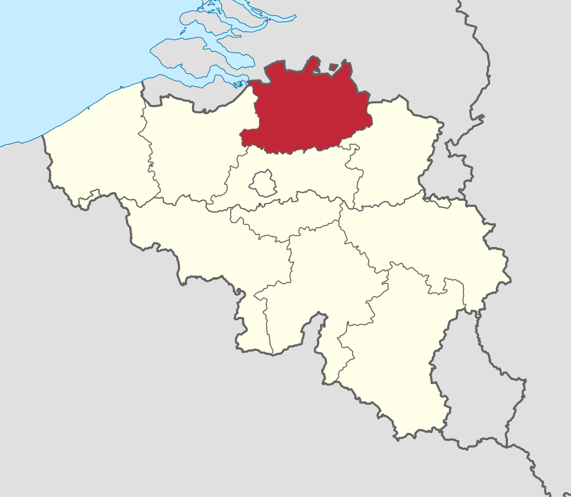
Antwerp Province (Dutch: Provincie Antwerpen [ˈɑntʋɛrpə(n)] , French: Province d'Anvers, German: Provinz Antwerpen), between 1815 and 1830 known as Central Brabant (Dutch: Midden-Brabant, French: Brabant-Central, German: Mittel-Brabant), is the northernmost province both of the Flemish Region, also called Flanders, and of Belgium. It borders on the North Brabant province of the Netherlands to the north and the Belgian provinces of Limburg, Flemish Brabant and East Flanders. Its capital is Antwerp, which includes the Port of Antwerp, the second-largest seaport in Europe. It has an area of 2,876 km2 (1,110 sq mi), and with over 1.85 million inhabitants as of January 2019, is the country's most populous province. The province consists of three arrondissements: Antwerp, Mechelen and Turnhout. The eastern part of the province comprises the main part of the Campine region. (Source: Wikipedia.org, CC BY-SA)
Brussels (French: Bruxelles [bʁysɛl] or [bʁyksɛl] ; Dutch: Brussel [ˈbrʏsəl] ), officially the Brussels-Capital Region (French: Région de Bruxelles-Capitale; Dutch: Brussels Hoofdstedelijk Gewest), is a region of Belgium comprising 19 municipalities, including the City of Brussels, which is the capital of Belgium. The Brussels-Capital Region is located in the central portion of the country and is a part of both the French Community of Belgium and the Flemish Community, but is separate from the Flemish Region (within which it forms an enclave) and the Walloon Region. (Source: Wikipedia.org, CC BY-SA)
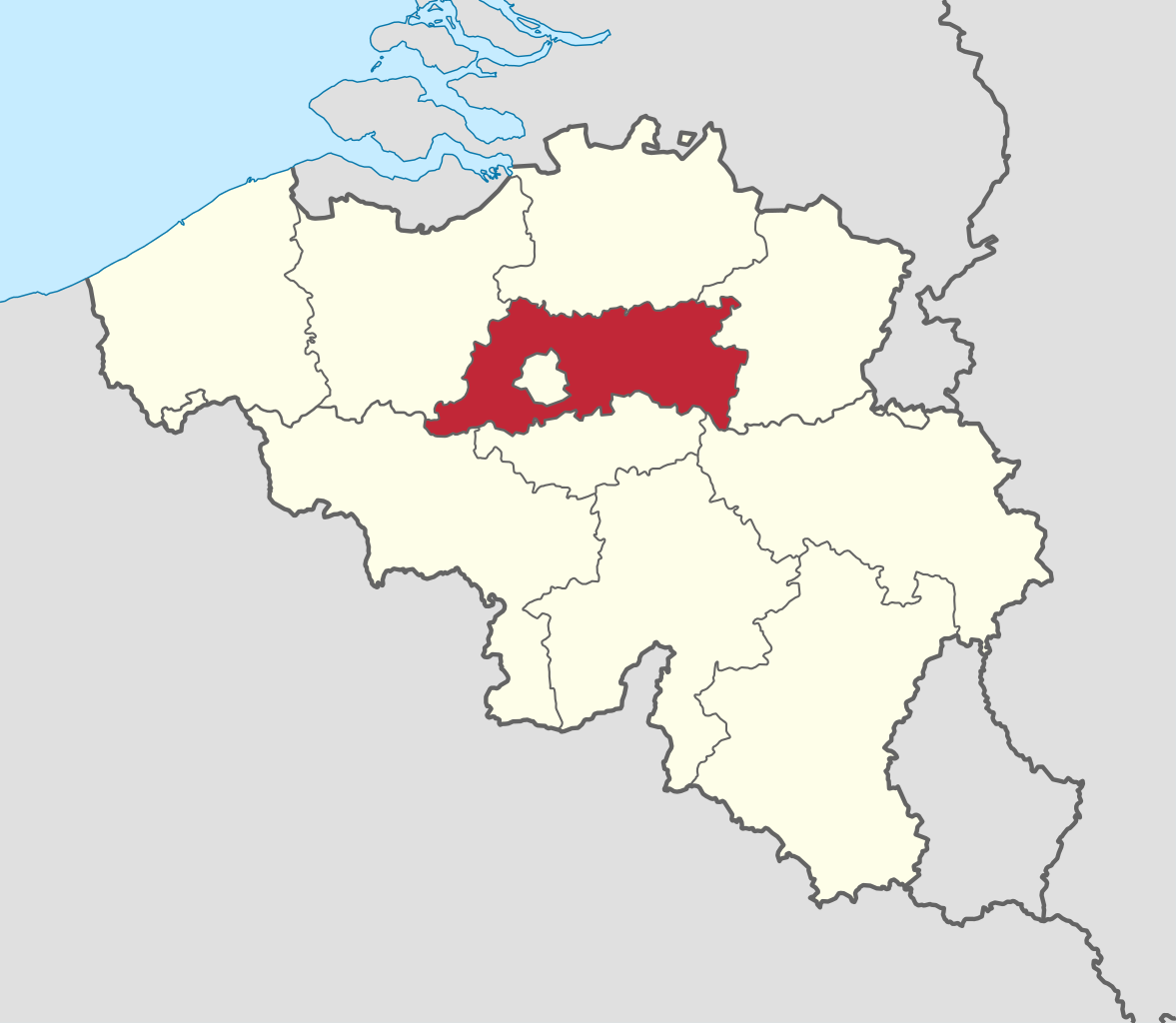
East Flanders (Dutch: Oost-Vlaanderen [ˌoːst ˈflaːndərə(n)] , French: (Province de) Flandre-Orientale [flɑ̃dʁ ɔʁjɑ̃tal], German: Ostflandern [ˈɔstˌflandɐn]) is a province of Belgium. It borders (clockwise from the North) the Dutch province of Zeeland and the Flemish province of Antwerp, Flemish Brabant, Hainaut and West Flanders. It has an area of 3,007 km2 (1,161 sq mi), divided into six administrative districts containing 60 municipalities, and a population of 1,515,064 as of January 2019. The capital is Ghent, home to the Ghent University and the Port of Ghent. (Source: Wikipedia.org, CC BY-SA)
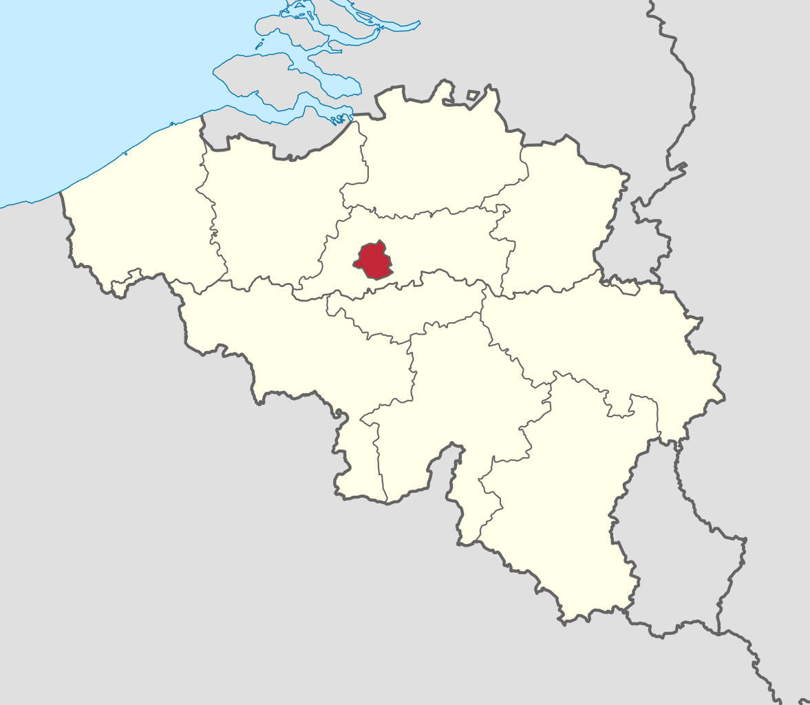
Flemish Brabant (Dutch: Vlaams-Brabant [ˌvlaːmz ˈbraːbɑnt] ; French: Brabant flamand [bʁabɑ̃ flamɑ̃] ) is a province of Flanders, one of the three regions of Belgium. It borders on (clockwise from the North) the Belgian provinces of Antwerp, Limburg, Liège, Walloon Brabant, Hainaut and East Flanders. Flemish Brabant also surrounds the Brussels-Capital Region. Its capital is Leuven. It has an area of 2,118 km2 (818 sq mi) which is divided into two administrative districts (arrondissementen in Dutch) containing 65 municipalities. As of January 2019, Flemish Brabant has a population of 1,146,175. (Source: Wikipedia.org, CC BY-SA)
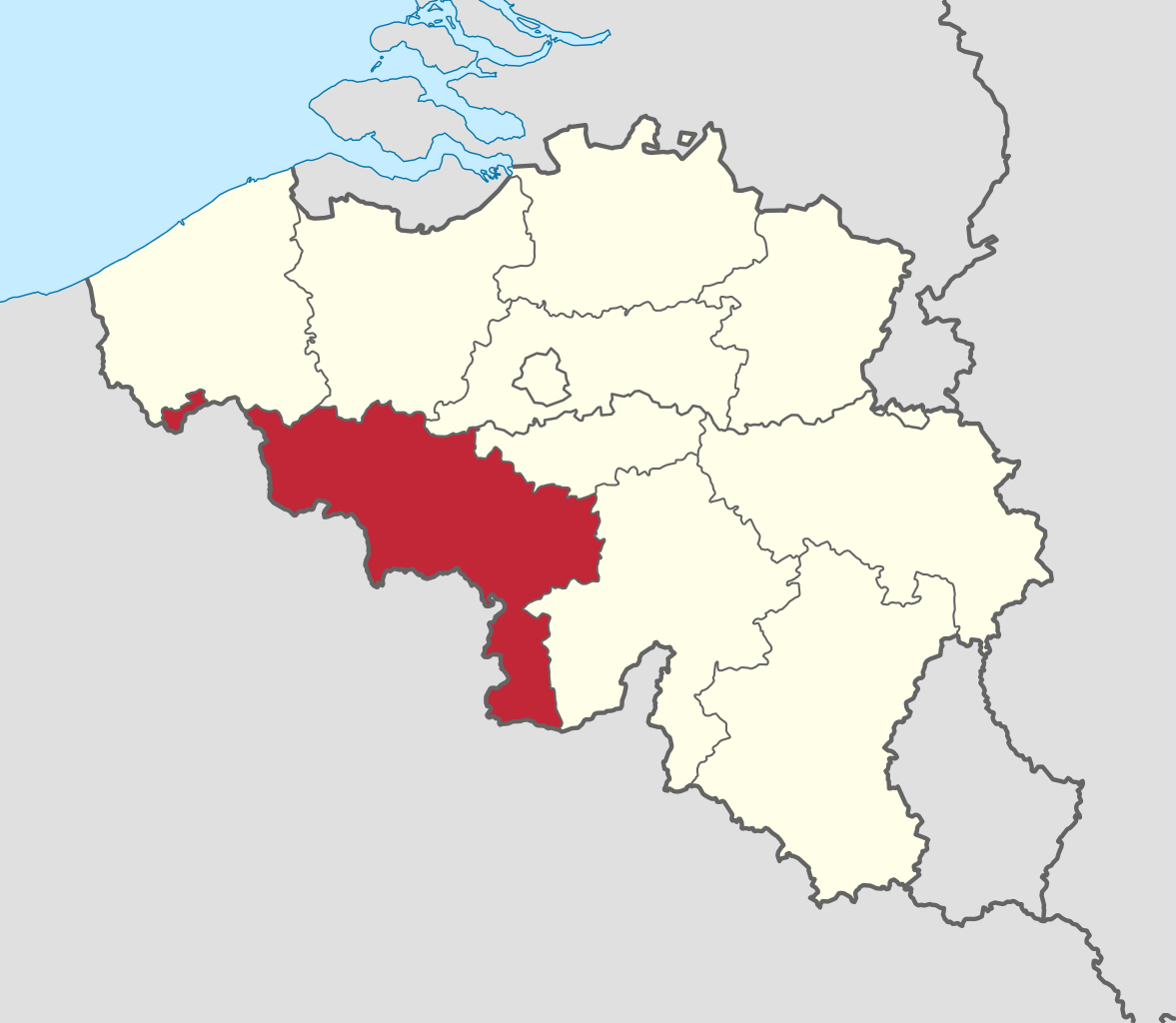
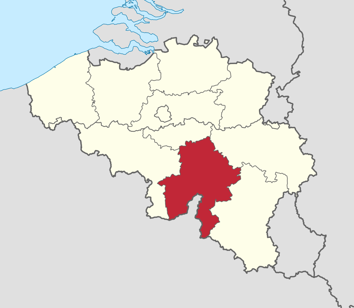
Hainaut (/eɪˈnoʊ/, also US: /heɪˈ-, ɛˈ-/, UK: /ˈ(h)eɪnoʊ/, French: [ɛno]; Dutch: Henegouwen [ˈɦeːnəɣʌuə(n)] ; Walloon: Hinnot; Picard: Hénau), historically also known as Heynowes in English, is a province of Wallonia and Belgium. To its south lies the French department of Nord, while within Belgium it borders (clockwise from the north) on the Flemish provinces of West Flanders, East Flanders, Flemish Brabant and the Walloon provinces of Walloon Brabant and Namur. Its capital is Mons (Dutch: Bergen) and the most populous city is Charleroi, the province's urban, economic and cultural hub, the financial capital of Hainaut and the fifth largest city in the country by population. Hainaut has an area of 3,831 km2 (1,479 sq mi) and as of January 2019 a population of 1,344,241. Another notable city is Tournai (Dutch Doornik) on the Scheldt river, one of the oldest cities in Belgium and the first capital of the Frankish Empire. (Source: Wikipedia.org, CC BY-SA)
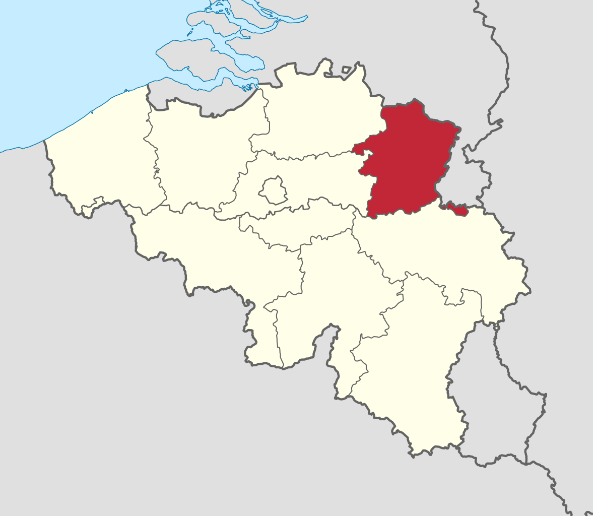
Limburg (Dutch: Limburg, pronounced [ˈlɪmbʏr(ə)x] ; Limburgish: Limburg [ˈlɪm˦ˌbɵʀ˦(ə)ç] or Wes-Limburg [wæsˈlɪm˦ˌbɵʀ˦(ə)ç]; French: Limbourg, pronounced [lɛ̃buʁ] ) is a province in Belgium. It is the easternmost of the five Dutch-speaking provinces that together form the Region of Flanders, one of the three main political and cultural sub-divisions of modern-day Belgium. Limburg is located west of the Meuse (Dutch: Maas), which separates it from the similarly-named Dutch province of Limburg. To the south it shares a border with the French-speaking province of Liège, with which it also has historical ties. To the north and west are the old territories of the Duchy of Brabant. Today these are the Flemish provinces of Flemish Brabant and Antwerp to the west, and the Dutch province of North Brabant to the north. (Source: Wikipedia.org, CC BY-SA)
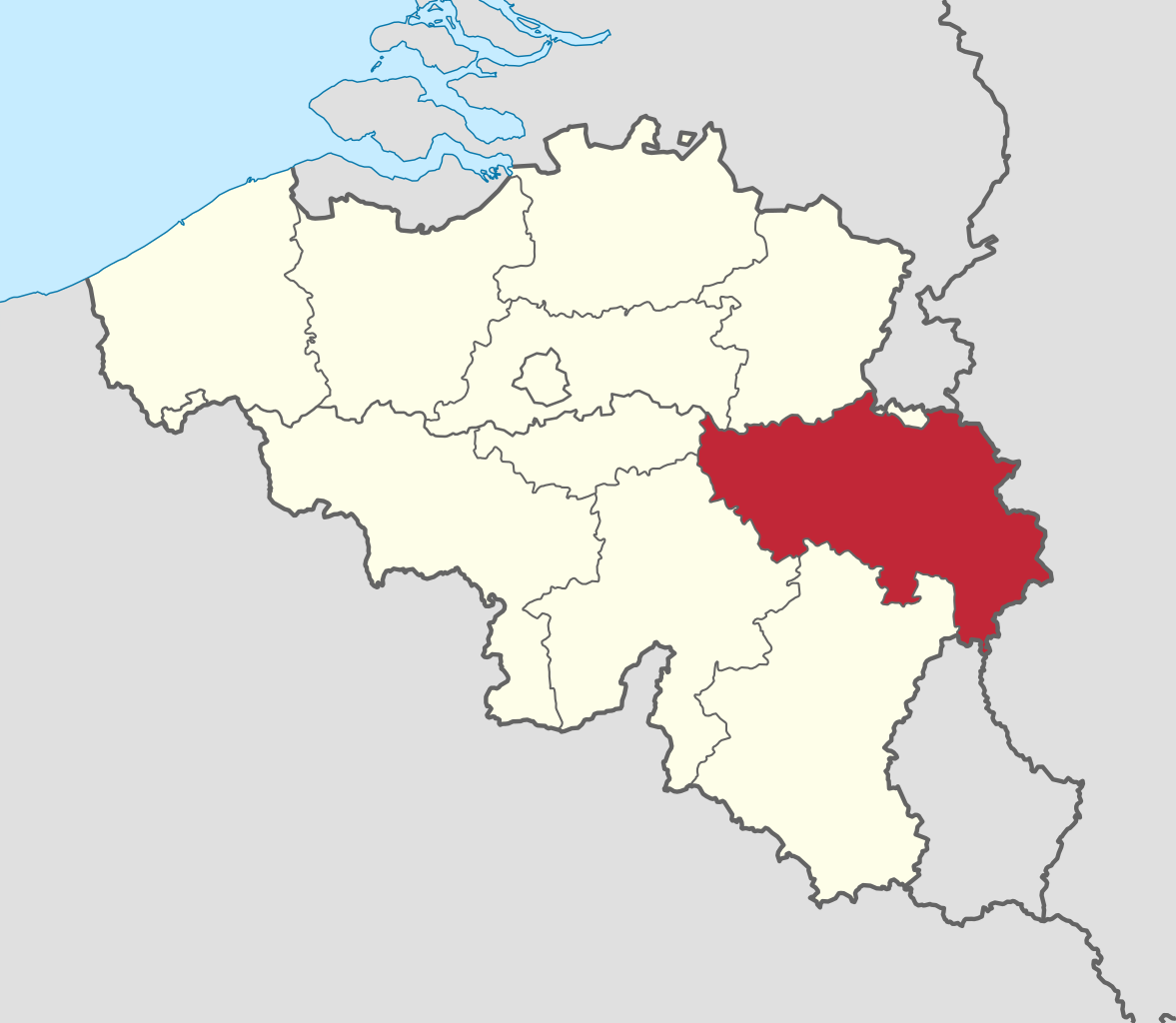
Liège (French: [ljɛʒ] ; Walloon: Lîdje [liːtʃ]; Dutch: Luik [lœyk] ; German: Lüttich [ˈlʏtɪç] ) is the easternmost province of the Wallonia region of Belgium. Liège Province is the only Belgian province that has borders with three countries. It borders (clockwise from the north) the Dutch province of Limburg, the German states of North Rhine-Westphalia and Rhineland-Palatinate, the Luxembourgish canton of Clervaux, the Belgian Walloon (French-speaking) provinces of Luxembourg, Namur and Walloon Brabant and the Belgian Flemish (Dutch-speaking) provinces of Flemish Brabant and Limburg. (Source: Wikipedia.org, CC BY-SA)
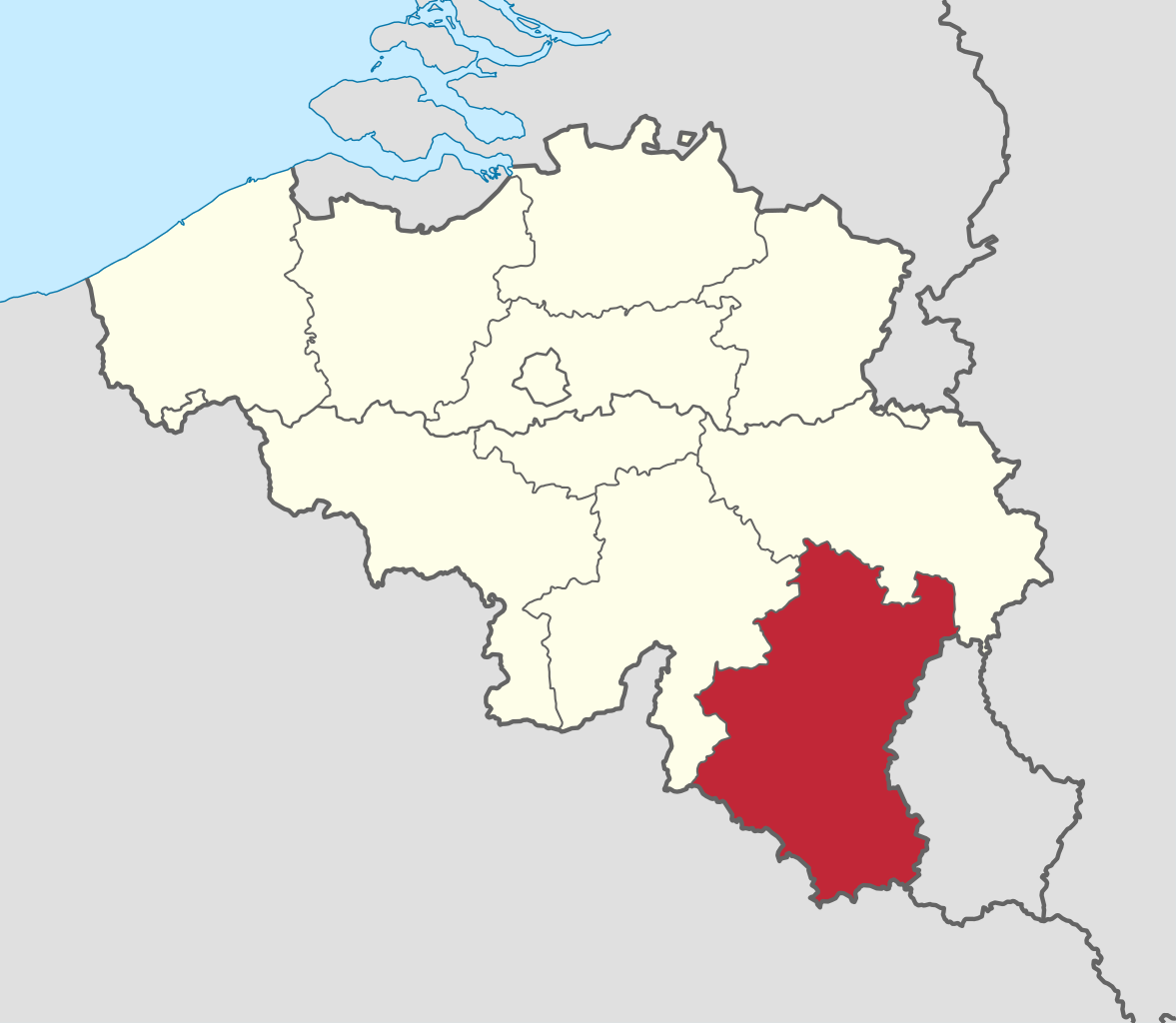
Luxembourg (French: Luxembourg [lyksɑ̃buʁ] ; Dutch: Luxemburg [ˈlyksəmˌbʏr(ə)x] ; German: Luxemburg [ˈlʊksm̩bʊʁk] ; Luxembourgish: Lëtzebuerg [ˈlətsəbuəɕ] ; Walloon: Lussimbork), also called Belgian Luxembourg, is the southernmost province of Wallonia and of Belgium. It borders on the country of Luxembourg to the east, the French departments of Ardennes, Meuse and Meurthe-et-Moselle to the south and southwest, and the Walloon provinces of Namur and Liège to the north. Its capital and largest city is Arlon, in the south-east of the province. It has an area of 4,459 km2 (1,722 sq mi), making it the largest Belgian province. With around 285,000 residents, it is also the least populated province, with a density of 64/km2 (170/sq mi), making it a relatively sparsely settled part of a very densely populated region, as well as the lowest density in Belgium. (Source: Wikipedia.org, CC BY-SA)
Namur (French pronunciation: [namyʁ] ; Dutch: Namen [ˈnaːmə(n)] ; Walloon: Nameur) is a province of Wallonia, one of the three regions of Belgium. It borders (clockwise from the West) on the Walloon provinces of Hainaut, Walloon Brabant, Liège and Luxembourg in Belgium, and the French department of Ardennes. Its capital and largest city is the city of Namur. As of January 2019, the province of Namur has a population of 494,325. (Source: Wikipedia.org, CC BY-SA)
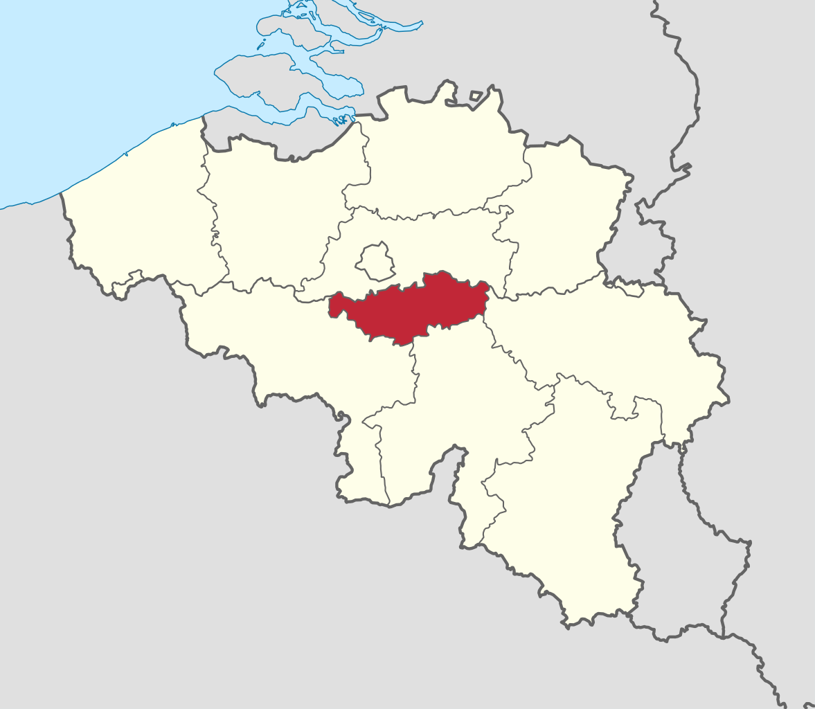
Walloon Brabant (French: Brabant wallon [bʁabɑ̃ walɔ̃] ; Dutch: Waals-Brabant [ˌʋaːlz ˈbraːbɑnt] ; Walloon: Roman Payis) is a province located in Belgium's French-speaking region of Wallonia. It borders on (clockwise from the North) the province of Flemish Brabant (Flemish Region) and the provinces of Liège, Namur and Hainaut. Walloon Brabant's capital and largest city is Wavre. The provincial population was recorded at 403,599 as of January 2019, giving a population density of 368/km2 (950/sq mi). (Source: Wikipedia.org, CC BY-SA)
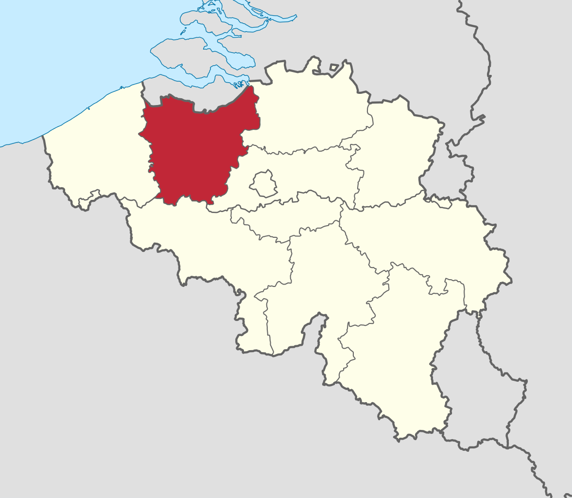
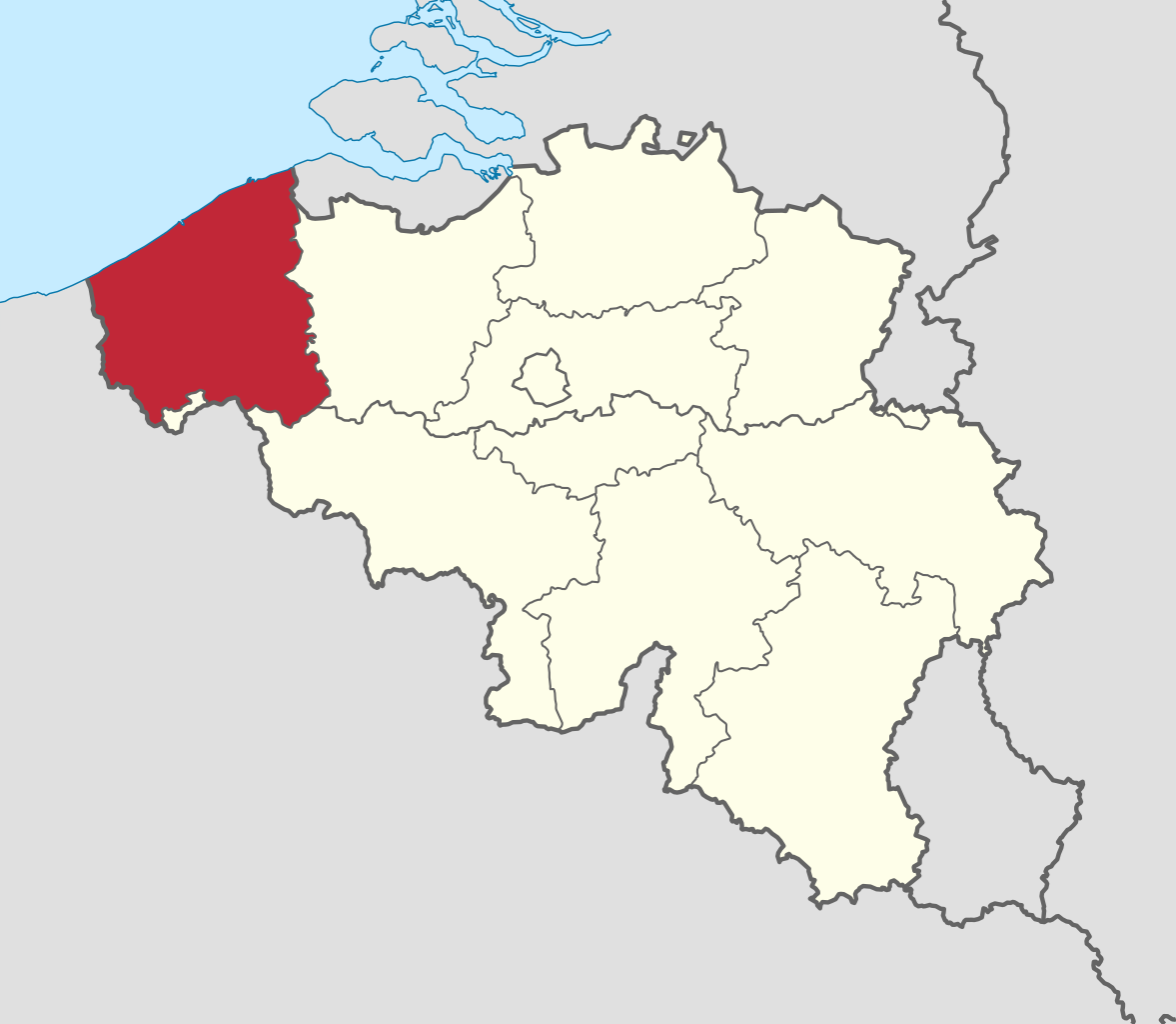
West Flanders (Dutch: West-Vlaanderen [ˌʋɛst ˈflaːndərə(n)] ; West Flemish: West Vloandern; French: (Province de) Flandre-Occidentale [flɑ̃dʁ ɔksidɑ̃tal]; German: Westflandern [ˈvɛstˌflandɐn] ) is the westernmost province of the Flemish Region, in Belgium. It is the only coastal Belgian province, facing the North Sea to the northwest. It has land borders with the Dutch province of Zeeland to the northeast, the Flemish province of East Flanders to the east, the Walloon province of Hainaut in the south and the French department of Nord to the west. Its capital is Bruges (Brugge). Other important cities are Kortrijk in the south and Ostend (Oostende) on the coast, Roeselare and Ypres (Ieper). The province has an area of 3,197 km2 (1,234 sq mi) which is divided into eight administrative districts (arrondissementen) containing 64 municipalities. As of January 2019, West Flanders has a population of 1,195,796. (Source: Wikipedia.org, CC BY-SA)

Help us promote traffic rules on the internet, together we can make the public road safer for everyone. Post a comment or share on social media!
Hello, sorry but this is wrong, in Italy motorway (autostrada) has the same sign but is green instead an expressway (that in Italy should be called super-strada) have that sign with blue
 -1
-1
Dass "Gesenkter Balken" Abblendlicht bedeutet, habe ich nicht gewusst. Ansonsten Danke für die Möglichkeit zu üben.
0
This driving license community sounds really helpful for learning Spanish traffic rules! It reminds me of how I use the pixel flow guide (https://www.pixel-flow-level.com) website when I get stuck on tricky puzzle games - having clear instructions makes learning so much easier.
0
Hey, I appreciate y'all posting the road signs on this website. I plan to study abroad over there in Austria (areas would most likely be Graz, or Vienna) for college, and then still plan so far on wanting to move to Austria or Germany (more so Austria) during or after my study abroad program (With dual citizenship through ancestry with The Czech Republic (assuming it will apply). I just wanted to say thanks for your time making this website possible, and I appreciate this to help me study for a possible driving exam for me (if move to Austria), and every citizen of your country.
I want to get the greek driving license, so should i study from here and thats it for the oral exam ? thanks a lot
Complete solutions and walkthroughs for all Brain Test game levels. Get step-by-step guides and video tutorials to solve every tricky puzzle.https://braintest.games/
-1
According to Article 14 this diagram is incorrect. You stay in the inside lane unless you are coming off at the FIRST exit only.
3
Aerial Silks, Aerial Yoga Hammock all in over 46 colors. Of No-low and Low-medium Stretch Silks. Aerial Lyra, Hardware and more! Build your response time with Aerials www.aerialsusa.com
1
Speedlimit signs in Norway are not just at the start of the speedlimit. Every speedlimit sign exept 50 and 80 are also placed with a specific distance between eachother as a reminding. If there is no speedlimit sign for a while, you are either in a 50 or 80 area, depending on the road and amout of houses/buildings
2
Most of these DOES NOT exist on the official Greek test. //Someone that not only practiced it in Greece, but also scraped sites that had the official test (1:1 copy to the official one) in order to build a better learning site than existing ones (still a work in progress).
-2
I think the wording is a bit unlucky. "Warning for cyclists" is wrong. It's a "Warning OF cyclists FOR everybody". I think all those "Warning for X" signs should be "Warning of X" or "Warning against X". And then it's not really as specific as some of them are described. E.g. there's one that says "Warning for deer", which should be "Warning against wildlife crossing". It's not deer, it could be warthogs or boars or foxes as well.
Traffic signs in Portugal follow European standards, using clear symbols and colors. They regulate speed, directions, and warnings https://bomcondutor.com.pt/ . Understanding them is essential for safe driving and avoiding fines or accidents.
1
This is a solid breakdown. But honestly, road safety starts with knowing the basics. Check this out for some cool tech related to it—might be worth a look: https://www.ainanobanana.pro
1
Driving tips are crucial, but people often forget the fun side of road trips. A good way to unwind is to play games while waiting in traffic, like maybe this cute puzzle game. <a href="https://chiikawapuzzle.art"; target="_blank">chiikawa puzzle</a>
-1
Super useful for reviewing the driving code in Japan! I hope it will help me remember all the signs. Good luck to everyone taking the exam and play the https://sprunkiretake.io
-1
This looks useful for studying! I hope it helps me not panic on the day of the exam. Fingers crossed for https://buzzcut.style!
0
Lot of info here, but I gotta say, knowing the right tire pressure is a game changer. Keeps your ride smooth and safe—check out this tool for some handy pixel art that might spark your creative side too. https://www.wplace.pro
0
To sum-up: A-3 and A-4 are wrong - the sign only tells you the direction of the first curve, the second one can be whatever A-6d and A-6e are not about sharpness, but about the incoming roads being one-way towards the road you're currently on A-18a is not about cattle specifically, but about farm animals or domesticated animals A-18b is not limited to deer, but any wild animals that might suddenly appear on the road, like elk or boars B-32a is literally "border control", but may also have different variations with different text meaning in general "stop here until you're explicitly allowed to go" All that info can be found on wikipedia.
2
A-4 also wrong. It means "dangerous curves — first to the left", the second one can be either left or right. It doesn't specify.
0
Wrong. This is A-6d, which "entry of the one-way road from the right". Nothing about sharpness. See: https://en.wikipedia.org/wiki/Road_signs_in_Poland
The questions are pretty good, but unfortunately there's no variety at all. Would be nice if there were questions about things other than the signs, which are arguably one of the easiest parts of traffic rules
3
If you don’t wear a seatbelt, you’re just asking for trouble. Plus, knowing how to handle slippery roads is crucial, or you’ll end up in a ditch. For those who enjoy homegrown food, check this out for some cool garden-to-table ideas. https://www.growagardenrecipes.pro
1
Look, safety on the road is no joke. All that talk about seatbelts and tire pressure? Spot on. But hey, if you're into photography too, check out this neat tool for some cool filters. Could make your car pics pop a bit more, ya know? https://www.digitalcamerafilter.art
0


More community