

Here you can study for the exam. Look up keywords and learn definitions about all kind of subjects.
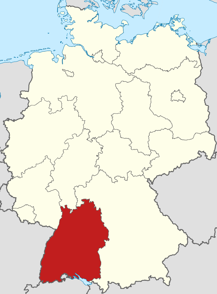
Baden-Württemberg (/ˌbɑːdən ˈvɜːrtəmbɜːrɡ/; German: [ˌbaːdn̩ ˈvʏʁtəmbɛʁk] ), commonly shortened to BW or BaWü, is a German state (Land) in Southwest Germany, east of the Rhine, which forms the southern part of Germany's western border with France. With more than 11.07 million inhabitants as of 2019 across a total area of nearly 35,752 km2 (13,804 sq mi), it is the third-largest German state by both area (behind Bavaria and Lower Saxony) and population (behind North Rhine-Westphalia and Bavaria). As a federated state, Baden-Württemberg is a partly-sovereign parliamentary republic. The largest city in Baden-Württemberg is the state capital of Stuttgart, followed by Mannheim and Karlsruhe. Other major cities are Freiburg im Breisgau, Heidelberg, Heilbronn, Pforzheim, Reutlingen, Tübingen, and Ulm. (Source: Wikipedia.org, CC BY-SA)
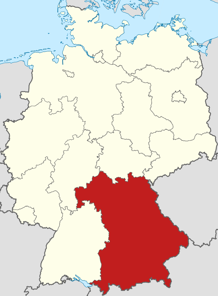
Bavaria (/bəˈvɛəriə/ bə-VAIR-ee-ə; German: Bayern [ˈbaɪɐn] ), officially the Free State of Bavaria (German: Freistaat Bayern [ˈfʁaɪʃtaːt ˈbaɪɐn] ; Bavarian: Freistoot Bayern), is a state in the south-east of Germany. With an area of 70,550.19 km2 (27,239.58 sq mi), Bavaria is the largest German state by land area, comprising roughly a fifth of the total land area of Germany. With over 13 million inhabitants, it is the second largest German state in terms of population only to North Rhine-Westphalia, but due to its large size its population density is below the German average. Bavaria's main cities are Munich (its capital and largest city, which is also the third largest city in Germany), Nuremberg, and Augsburg. (Source: Wikipedia.org, CC BY-SA)
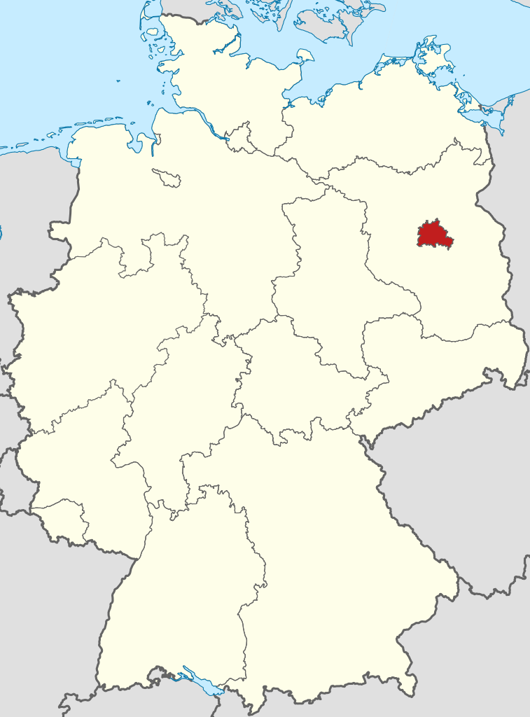
Berlin (/bɜːrˈlɪn/ bur-LIN, German: [bɛʁˈliːn] ) is the capital and largest city of Germany by both area and population. Its more than 3.85 million inhabitants make it the European Union's most populous city, according to population within city limits. One of Germany's sixteen constituent states, Berlin is surrounded by the State of Brandenburg and contiguous with Potsdam, Brandenburg's capital. Berlin's urban area, which has a population of around 4.5 million, is the second most populous urban area in Germany after the Ruhr. The Berlin-Brandenburg capital region has around 6.2 million inhabitants and is Germany's third-largest metropolitan region after the Rhine-Ruhr and Rhine-Main regions. (Source: Wikipedia.org, CC BY-SA)
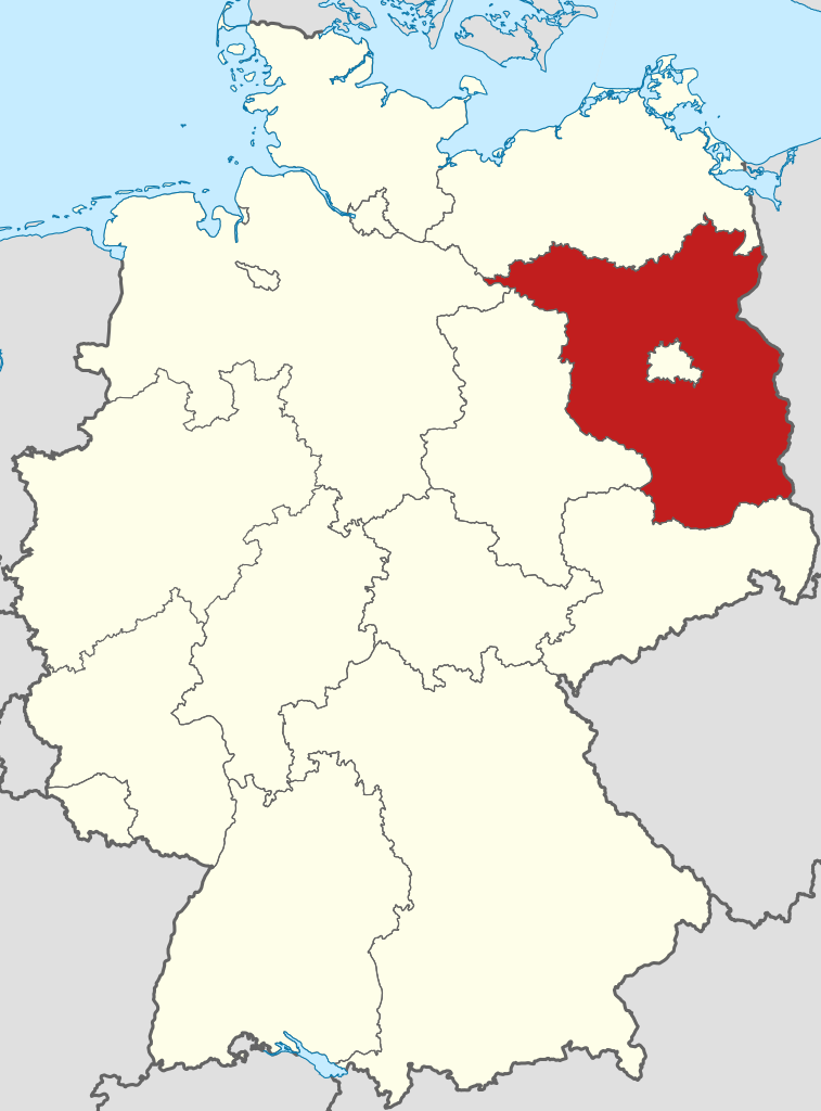
Brandenburg ([ˈbʁandn̩bʊʁk] ; Low German: Brannenborg; Lower Sorbian: Bramborska [ˈbrambɔrska]), officially the State of Brandenburg (German: Land Brandenburg; Low German: Land Brannenborg; Lower Sorbian: Kraj Bramborska), is a state in the northeast of Germany bordering the states of Mecklenburg-Vorpommern, Lower Saxony, Saxony-Anhalt, and Saxony, as well as the country of Poland. With an area of 29,480 square kilometres (11,382 square miles) and a population of 2.5 million residents, it is the fifth-largest German state by area and the tenth-most populous. Potsdam is the state capital and largest city, and other major towns are Cottbus, Brandenburg an der Havel and Frankfurt (Oder). (Source: Wikipedia.org, CC BY-SA)
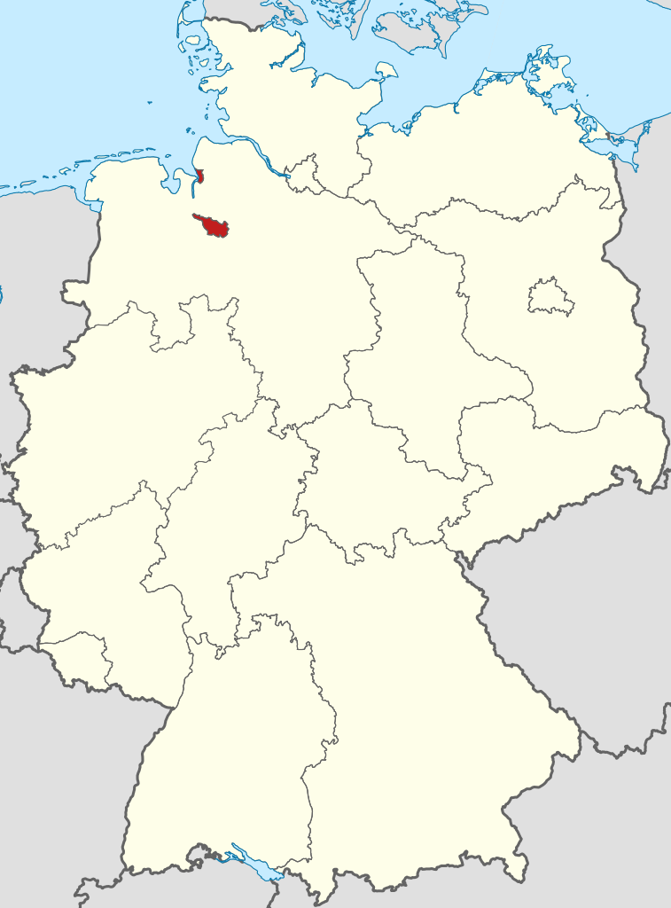
Bremen (German: [ˈbʁeːmən] ), officially the Free Hanseatic City of Bremen (German: Freie Hansestadt Bremen; Low German: Free Hansestadt Bremen), is the smallest and least populous of Germany's 16 states. It is informally called Land Bremen ('State of Bremen'), although the term is sometimes used in official contexts. The state consists of the city of Bremen and its seaport exclave, Bremerhaven, surrounded by the larger state of Lower Saxony in northern Germany. (Source: Wikipedia.org, CC BY-SA)
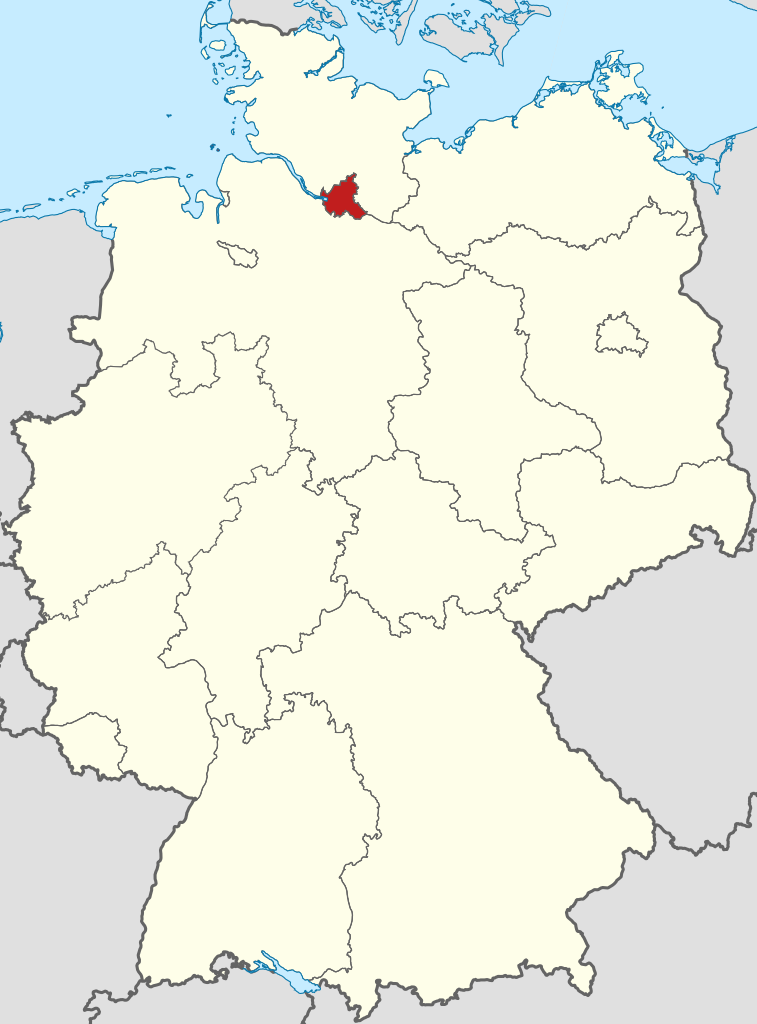
Hamburg (German: [ˈhambʊʁk] , locally also [ˈhambʊɪ̯ç] ; Low Saxon: Hamborg [ˈhambɔːç] ),[citation needed] officially the Free and Hanseatic City of Hamburg (German: Freie und Hansestadt Hamburg; Low Saxon: Friee un Hansestadt Hamborg), is the second-largest city in Germany after Berlin, as well as the overall 8th-largest city and largest non-capital city within the European Union with a population of over 1.9 million. Hamburg's urban area has a population of around 2.5 million and is part of the Hamburg Metropolitan Region, which has a population of over 5.1 million people in total. At the southern tip of the Jutland Peninsula, Hamburg stands on the branching River Elbe at the head of a 110 km (68 mi) estuary down to the North Sea, on the mouth of the Alster and Bille. Hamburg is one of Germany's three city-states alongside Berlin and Bremen, and is surrounded by Schleswig-Holstein to the north and Lower Saxony to the south. The Port of Hamburg is Germany's largest and Europe's third-largest, after Rotterdam and Antwerp. The local dialect is a variant of Low Saxon. (Source: Wikipedia.org, CC BY-SA)
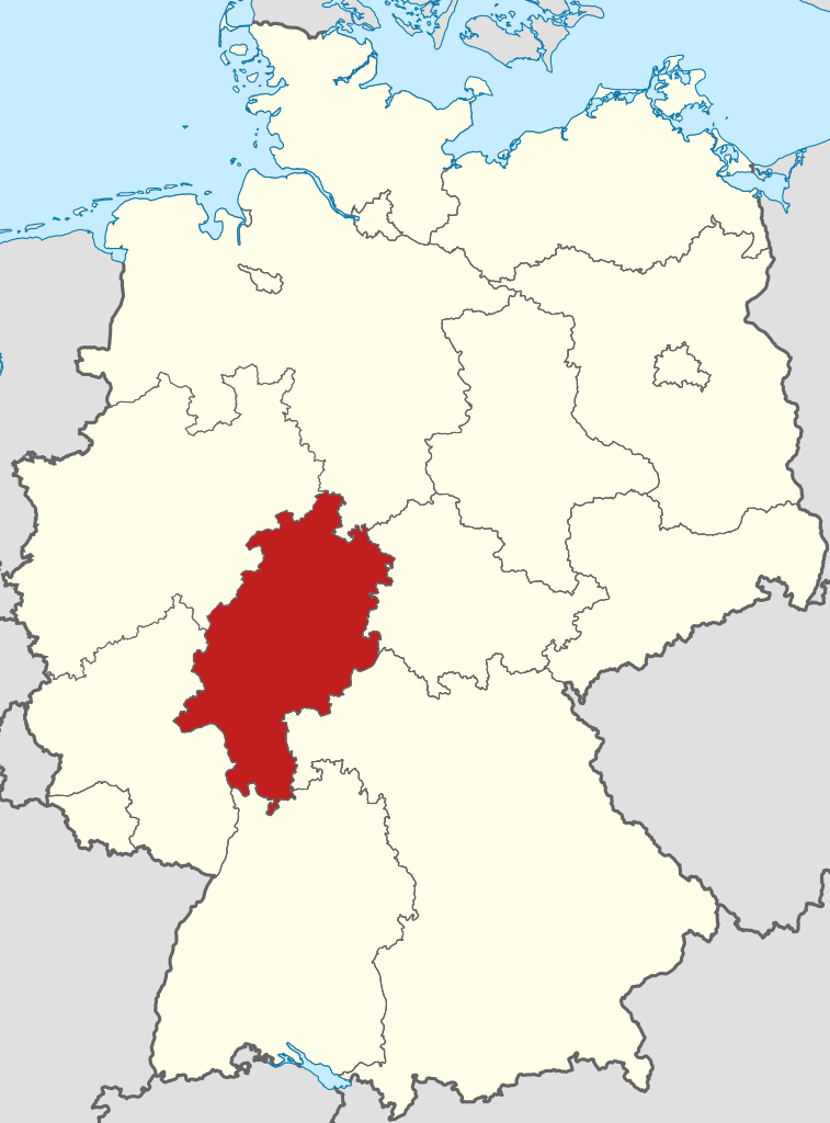
Hesse (/hɛs/, US also /ˈhɛsə, ˈhɛsi/, Hessian dialect: [ˈhɛzə]) or Hessia (UK: /ˈhɛsiə/, US: /ˈhɛʃə/; German: Hessen [ˈhɛsn̩] ), officially the State of Hesse (German: Land Hessen), is a state in Germany. Its capital city is Wiesbaden, and the largest urban area is Frankfurt, which is also the country's principal financial centre. Two other major historic cities are Darmstadt and Kassel. With an area of 21,114.73 square kilometers and a population of over six million, it ranks seventh and fifth, respectively, among the sixteen German states. Frankfurt Rhine-Main, Germany's second-largest metropolitan area (after Rhine-Ruhr), is mainly located in Hesse. (Source: Wikipedia.org, CC BY-SA)
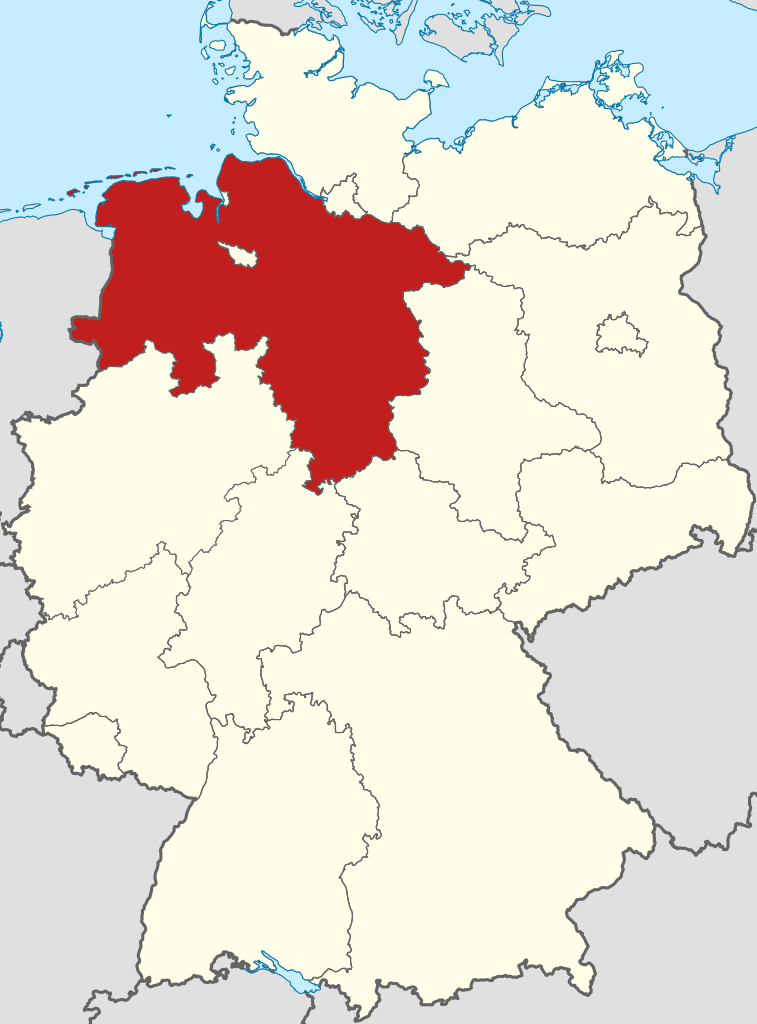
Lower Saxony (German: Niedersachsen [ˈniːdɐzaksn̩] ; Low German: Neddersassen; Saterland Frisian: Läichsaksen) is a German state (Land) in northwestern Germany. It is the second-largest state by land area, with 47,614 km2 (18,384 sq mi), and fourth-largest in population (8 million in 2021) among the 16 Länder federated as the Federal Republic of Germany. In rural areas, Northern Low Saxon and Saterland Frisian are still spoken, albeit in declining numbers. (Source: Wikipedia.org, CC BY-SA)
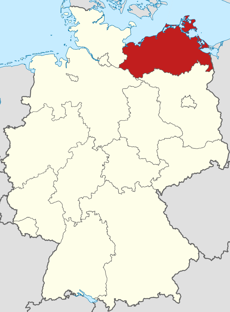
Mecklenburg-Vorpommern (MV; German: [ˌmeːklənbʊʁkˈfoːɐ̯pɔmɐn] or [ˌmɛk-] ; Low German: Mäkelborg-Vörpommern), also known by its anglicized name Mecklenburg–Western Pomerania, is a state in the north-east of Germany. Of the country's sixteen states, Mecklenburg-Vorpommern ranks 14th in population; it covers an area of 23,213 km2 (8,963 sq mi), making it the sixth largest German state in area; and it is 16th in population density. Schwerin is the state capital and Rostock is the largest city. Other major cities include Neubrandenburg, Stralsund, Greifswald, Wismar, and Güstrow. It was named after the two regions of Mecklenburg and Vorpommern, and its name means the 'nearer part of Pomerania', with the rest now lying in Poland.[citation needed] (Source: Wikipedia.org, CC BY-SA)
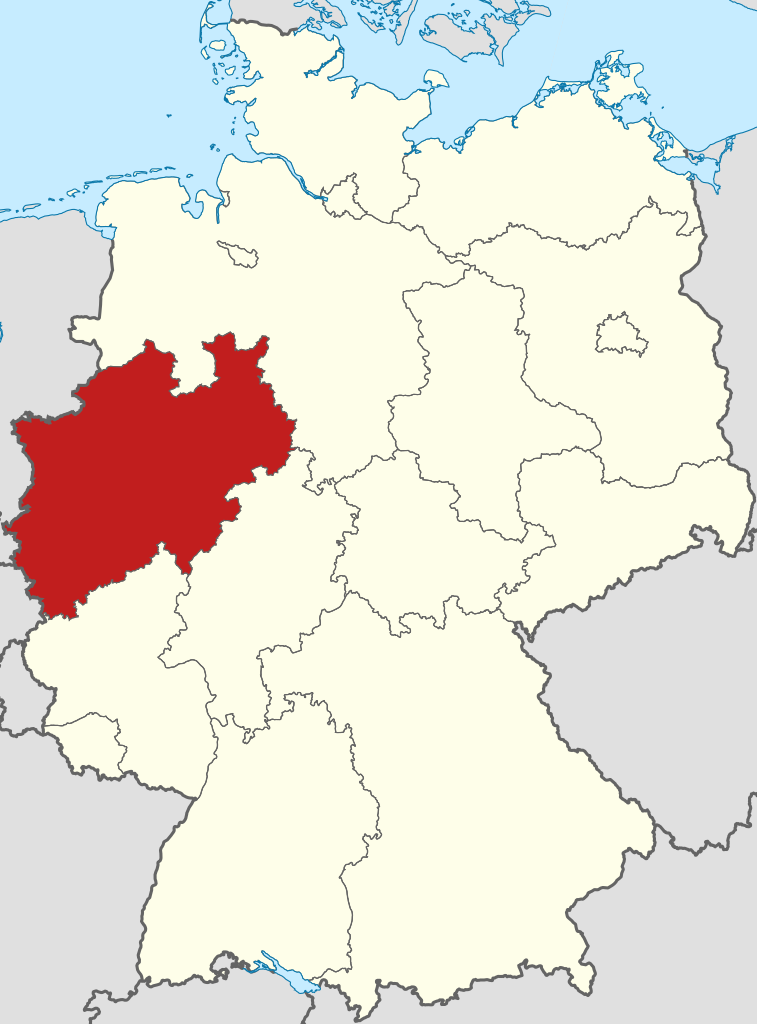
North Rhine-Westphalia (German: Nordrhein-Westfalen, pronounced [ˌnɔʁtʁaɪn vɛstˈfaːlən] ; Limburgish: Noordrien-Wesfale [ˈnoːʀtʀiːn wæsˈfaːlə];[tone?] Low German: Noordrhien-Westfalen; Kölsch: Noodrhing-Wäßßfaale), commonly shortened to NRW (German: [ɛnʔɛʁˈveː] ), is a state (Land) in Western Germany. With more than 18 million inhabitants, it is the most populous state in Germany. Apart from the city-states, it is also the most densely populated state in Germany. Covering an area of 34,084 square kilometres (13,160 sq mi), it is the fourth-largest German state by size. (Source: Wikipedia.org, CC BY-SA)
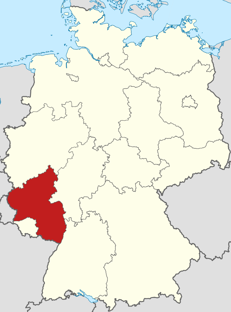
Rhineland-Palatinate (/ˌraɪnlænd pəˈlætɪnɪt, -lənd-/ RYNE-land pə-LAT-in-it, -lənd-, US also /-ɪneɪt/ -in-ayt; German: Rheinland-Pfalz [ˈʁaɪnlant ˈpfalts] ; Luxembourgish: Rheinland-Pfalz [ˈʀɑɪnlɑm ˈpfɑlts]; Palatine German: Rhoilond-Palz) is a western state of Germany. It covers 19,846 km2 (7,663 sq mi) and has about 4.05 million residents. It is the ninth largest and sixth most populous of the sixteen states. Mainz is the capital and largest city. Other cities are Ludwigshafen am Rhein, Koblenz, Trier, Kaiserslautern, Worms and Neuwied. It is bordered by North Rhine-Westphalia, Saarland, Baden-Württemberg and Hesse and by France, Luxembourg and Belgium. (Source: Wikipedia.org, CC BY-SA)
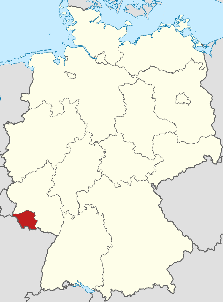
Saarland (German: [ˈzaːɐ̯lant] , Luxembourgish: [ˈzaːlɑnt]; French: Sarre [saʁ]) is a state of Germany in the south west of the country. With an area of 2,570 km2 (990 sq mi) and population of 990,509 in 2018, it is the smallest German state in area apart from the city-states of Berlin, Bremen, and Hamburg, and the smallest in population apart from Bremen. Saarbrücken is the state capital and largest city; other cities include Neunkirchen and Saarlouis. Saarland is mainly surrounded by the department of Moselle (Grand Est) in France to the west and south and the neighboring state of Rhineland-Palatinate in Germany to the north and east; it also shares a small border about 8 kilometres (5 miles) long with the canton of Remich in Luxembourg to the northwest. (Source: Wikipedia.org, CC BY-SA)
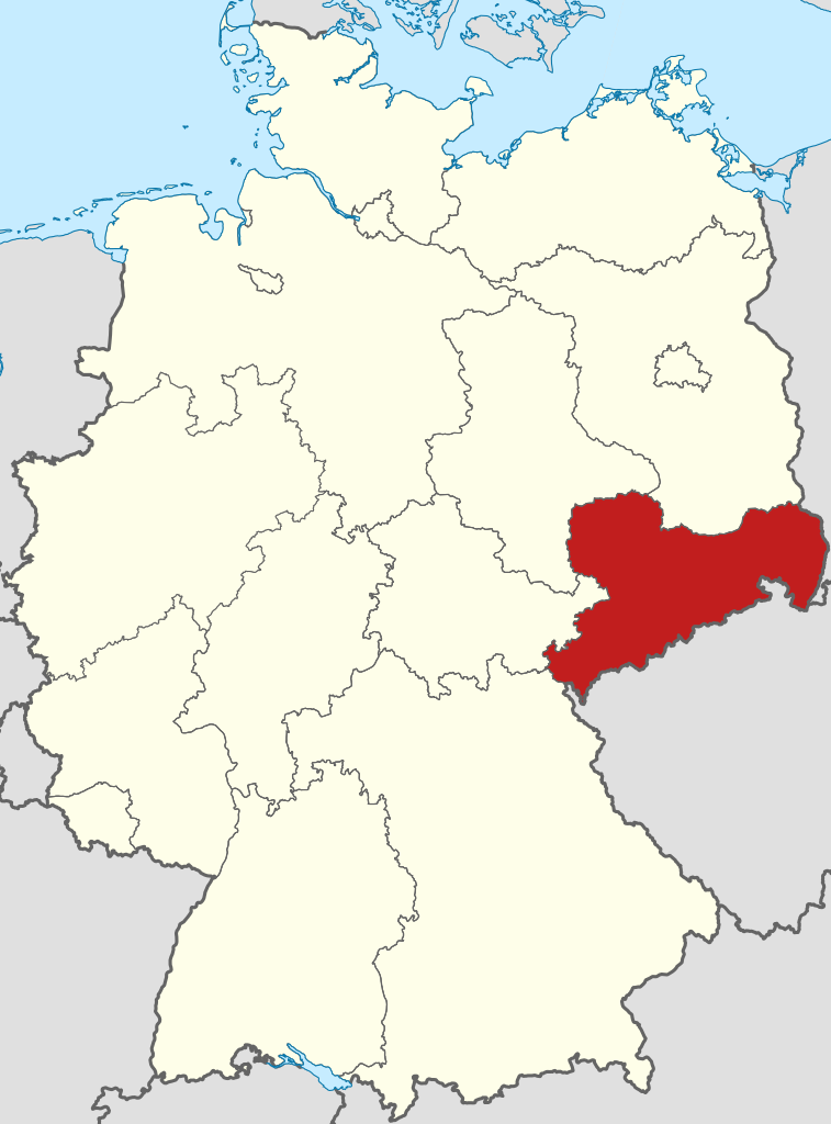
Saxony (German: Sachsen [ˈzaksn̩] ; Upper Saxon: Saggsn; Upper Sorbian: Sakska), officially the Free State of Saxony (German: Freistaat Sachsen [ˈfʁaɪʃtaːt ˈzaksn̩]; Upper Saxon: Freischdaad Saggsn; Upper Sorbian: Swobodny stat Sakska), is a landlocked state of Germany, bordering the states of Brandenburg, Saxony-Anhalt, Thuringia, Bavaria, as well as the countries of Poland and the Czech Republic. Its capital is Dresden, and its largest city is Leipzig. Saxony is the tenth largest of Germany's sixteen states, with an area of 18,413 square kilometres (7,109 sq mi), and the sixth most populous, with more than 4 million inhabitants. (Source: Wikipedia.org, CC BY-SA)
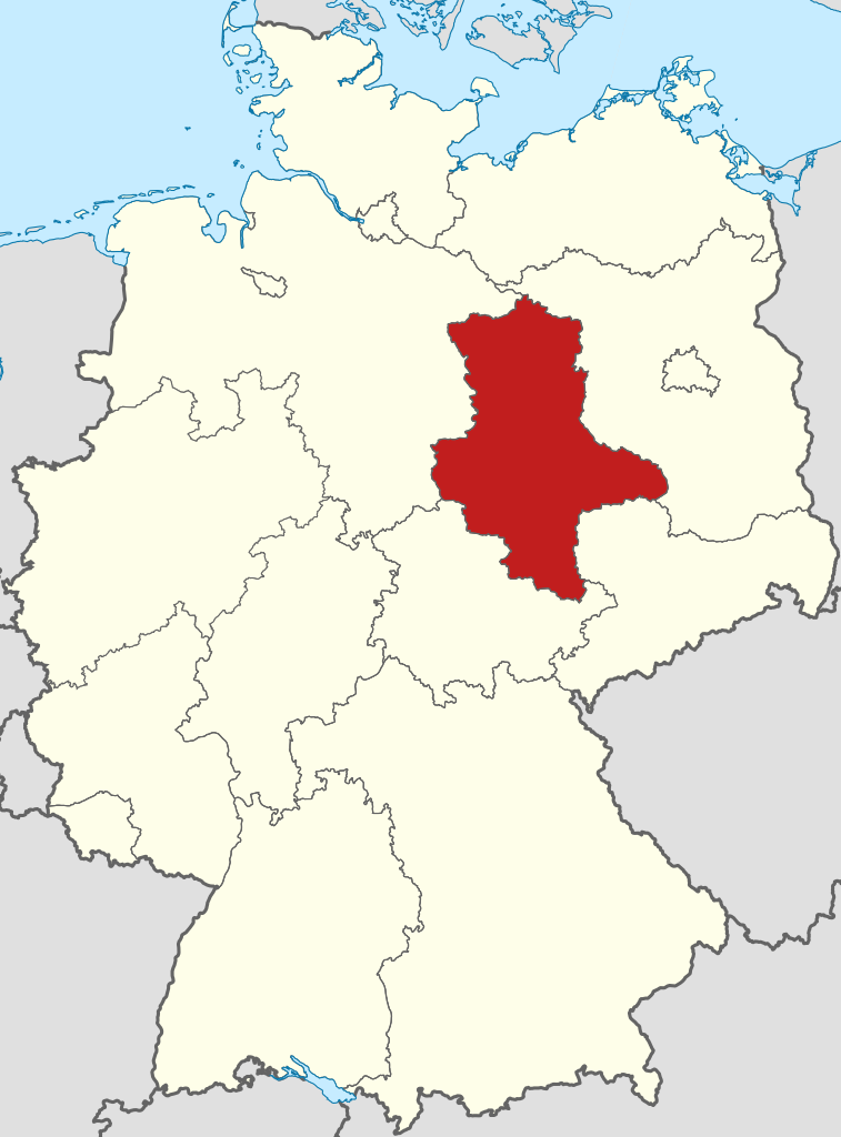
Saxony-Anhalt is a state of Germany, bordering the states of Brandenburg, Saxony, Thuringia and Lower Saxony. It covers an area of 20,451.7 square kilometres (7,896.4 sq mi) and has a population of 2.17 million inhabitants, making it the 8th-largest state in Germany by area and the 11th-largest by population. Its capital is Magdeburg and its largest city is Halle (Saale). The state of Saxony-Anhalt was formed in July 1945 after World War II, when the Soviet army administration in Allied-occupied Germany formed it from the former Prussian Province of Saxony and the Free State of Anhalt. Saxony-Anhalt became part of the German Democratic Republic in 1949, but was dissolved in 1952 during administrative reforms and its territory was divided into the districts of Halle and Magdeburg. Following German reunification the state of Saxony-Anhalt was re-established in 1990 and became one of the new states of the Federal Republic of Germany. (Source: Wikipedia.org, CC BY-SA)
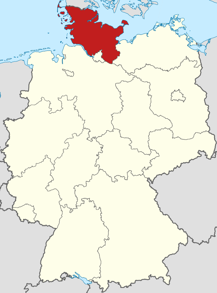
Schleswig-Holstein (pronounced [ˌʃleːsvɪç ˈhɔlʃtaɪn] ; Danish: Slesvig-Holsten; Low German: Sleswig-Holsteen; North Frisian: Slaswik-Holstiinj) is the northernmost of the 16 states of Germany, comprising most of the historical Duchy of Holstein and the southern part of the former Duchy of Schleswig. Its capital city is Kiel; other notable cities are Lübeck and Flensburg. The region is called Slesvig-Holsten in Danish and pronounced [ˌsle̝ːsvi ˈhʌlˌste̝ˀn]. The Low German name is Sleswig-Holsteen, and the North Frisian name is Slaswik-Holstiinj. Historically, the name can also refer to a larger region, containing both present-day Schleswig-Holstein and the former South Jutland County (Northern Schleswig; now part of the Region of Southern Denmark) in Denmark. It covers an area of 15,763 km2 (6,086 sq mi), making it the 5th smallest German federal state by area (including the city-states). (Source: Wikipedia.org, CC BY-SA)
Thuringia (English: /θəˈrɪndʒiə/; German: Thüringen [ˈtyːʁɪŋən] ), officially the Free State of Thuringia (Freistaat Thüringen [ˈfʁaɪʃtaːt ˈtyːʁɪŋən]), is a state of central Germany, covering 16,171 square kilometres (6,244 sq mi), the sixth smallest of the sixteen German states. It has a population of about 2.1 million. Erfurt is the capital and largest city. Other cities are Jena, Gera and Weimar. Thuringia is bordered by Bavaria, Hesse, Lower Saxony, Saxony-Anhalt, and Saxony. It has been known as 'the green heart of Germany' (das grüne Herz Deutschlands) from the late 19th century due to its broad, dense forest. Most of Thuringia is in the Saale drainage basin, a left-bank tributary of the Elbe. (Source: Wikipedia.org, CC BY-SA)

Help us promote traffic rules on the internet, together we can make the public road safer for everyone. Post a comment or share on social media!
Hello, sorry but this is wrong, in Italy motorway (autostrada) has the same sign but is green instead an expressway (that in Italy should be called super-strada) have that sign with blue
 -1
-1
Dass "Gesenkter Balken" Abblendlicht bedeutet, habe ich nicht gewusst. Ansonsten Danke für die Möglichkeit zu üben.
0
This driving license community sounds really helpful for learning Spanish traffic rules! It reminds me of how I use the pixel flow guide (https://www.pixel-flow-level.com) website when I get stuck on tricky puzzle games - having clear instructions makes learning so much easier.
0
Hey, I appreciate y'all posting the road signs on this website. I plan to study abroad over there in Austria (areas would most likely be Graz, or Vienna) for college, and then still plan so far on wanting to move to Austria or Germany (more so Austria) during or after my study abroad program (With dual citizenship through ancestry with The Czech Republic (assuming it will apply). I just wanted to say thanks for your time making this website possible, and I appreciate this to help me study for a possible driving exam for me (if move to Austria), and every citizen of your country.
I want to get the greek driving license, so should i study from here and thats it for the oral exam ? thanks a lot
Complete solutions and walkthroughs for all Brain Test game levels. Get step-by-step guides and video tutorials to solve every tricky puzzle.https://braintest.games/
-1
According to Article 14 this diagram is incorrect. You stay in the inside lane unless you are coming off at the FIRST exit only.
3
Aerial Silks, Aerial Yoga Hammock all in over 46 colors. Of No-low and Low-medium Stretch Silks. Aerial Lyra, Hardware and more! Build your response time with Aerials www.aerialsusa.com
1
Speedlimit signs in Norway are not just at the start of the speedlimit. Every speedlimit sign exept 50 and 80 are also placed with a specific distance between eachother as a reminding. If there is no speedlimit sign for a while, you are either in a 50 or 80 area, depending on the road and amout of houses/buildings
2
Most of these DOES NOT exist on the official Greek test. //Someone that not only practiced it in Greece, but also scraped sites that had the official test (1:1 copy to the official one) in order to build a better learning site than existing ones (still a work in progress).
-2
I think the wording is a bit unlucky. "Warning for cyclists" is wrong. It's a "Warning OF cyclists FOR everybody". I think all those "Warning for X" signs should be "Warning of X" or "Warning against X". And then it's not really as specific as some of them are described. E.g. there's one that says "Warning for deer", which should be "Warning against wildlife crossing". It's not deer, it could be warthogs or boars or foxes as well.
Traffic signs in Portugal follow European standards, using clear symbols and colors. They regulate speed, directions, and warnings https://bomcondutor.com.pt/ . Understanding them is essential for safe driving and avoiding fines or accidents.
1
This is a solid breakdown. But honestly, road safety starts with knowing the basics. Check this out for some cool tech related to it—might be worth a look: https://www.ainanobanana.pro
1
Driving tips are crucial, but people often forget the fun side of road trips. A good way to unwind is to play games while waiting in traffic, like maybe this cute puzzle game. <a href="https://chiikawapuzzle.art"; target="_blank">chiikawa puzzle</a>
-1
Super useful for reviewing the driving code in Japan! I hope it will help me remember all the signs. Good luck to everyone taking the exam and play the https://sprunkiretake.io
-1
This looks useful for studying! I hope it helps me not panic on the day of the exam. Fingers crossed for https://buzzcut.style!
0
Lot of info here, but I gotta say, knowing the right tire pressure is a game changer. Keeps your ride smooth and safe—check out this tool for some handy pixel art that might spark your creative side too. https://www.wplace.pro
0
To sum-up: A-3 and A-4 are wrong - the sign only tells you the direction of the first curve, the second one can be whatever A-6d and A-6e are not about sharpness, but about the incoming roads being one-way towards the road you're currently on A-18a is not about cattle specifically, but about farm animals or domesticated animals A-18b is not limited to deer, but any wild animals that might suddenly appear on the road, like elk or boars B-32a is literally "border control", but may also have different variations with different text meaning in general "stop here until you're explicitly allowed to go" All that info can be found on wikipedia.
2
A-4 also wrong. It means "dangerous curves — first to the left", the second one can be either left or right. It doesn't specify.
0
Wrong. This is A-6d, which "entry of the one-way road from the right". Nothing about sharpness. See: https://en.wikipedia.org/wiki/Road_signs_in_Poland
The questions are pretty good, but unfortunately there's no variety at all. Would be nice if there were questions about things other than the signs, which are arguably one of the easiest parts of traffic rules
3
If you don’t wear a seatbelt, you’re just asking for trouble. Plus, knowing how to handle slippery roads is crucial, or you’ll end up in a ditch. For those who enjoy homegrown food, check this out for some cool garden-to-table ideas. https://www.growagardenrecipes.pro
1
Look, safety on the road is no joke. All that talk about seatbelts and tire pressure? Spot on. But hey, if you're into photography too, check out this neat tool for some cool filters. Could make your car pics pop a bit more, ya know? https://www.digitalcamerafilter.art
0


More community