


Sinais de indicaçãoNoruega
 Regras de trânsito
 Noruega
 Sinais de prioridade
 Sinais de perigo
 Sinais de proibição
 Sinais de obrigação
 Sinais de indicação
 Painéis adicionais
Sinais de indicação
Um sinal de indicação fornece orientação ou informação útil aos utentes da via sem impor, por si só, uma proibição ou um aviso de perigo. Pode informar sobre estacionamento, direções, serviços, configuração da estrada ou início e fim de localidades. O objetivo é ajudar os condutores a orientarem-se através de informação clara e prática.






1. Início de via com prioridade
Este sinal indica o início de uma via com prioridade. Os condutores desta via normalmente têm prioridade sobre o trânsito que entra de vias laterais até que termine a via prioritária, salvo se semáforos, outros sinais ou normas aplicáveis indiquem o contrário.
English • Traffic sign 206 • Priority road. Traffic from side roads or intersecting roads must give way under sign 202 ‘Give way’ or 204 ‘Stop’. Applies until sign 208 ‘End of priority road’, 202 ‘Give way’ or 204 ‘Stop’. In lanes marked with 531 ‘Acceleration lane’, the traffic rules for that lane nevertheless apply.
Norsk bokmål • Skilt 206 • Forkjørsveg. Skiltet angir at kjørende som kommer fra sideveg eller kryssende veg, er pålagt vikeplikt med skilt 202 «Vikeplikt» eller 204 «Stopp». Skiltet gjelder til det blir opphevet med skilt 208 «Slutt på forkjørsveg» eller skilt 202 «Vikeplikt» eller skilt 204 «Stopp». I kjørefelt med skilt 531 «Felt for fartsøkning» gjelder likevel trafikkreglenes bestemmelser om kjøring i slikt felt.
Fontes
🔗 Commons.wikimedia.org
🔗 Lovdata.no • Skiltforskriften § 6
SVG source: Peter J. Acklam converted the original EPS file to PDF with Ghostscript and the PDF file to SVG with Inkscape. • Public domain • Original revision 2014-03-21. Wikimedia original unmodified.
2. Fim de via com prioridade
Este sinal indica o fim da via com prioridade. A partir deste ponto, a via deixa de ter prioridade contínua nos cruzamentos seguintes. Siga os semáforos, sinais de prioridade e regras gerais aplicáveis.
English • Traffic sign 208 • End of priority road.
Norsk bokmål • Skilt 208 • Slutt på forkjørsveg.
Fontes
🔗 Commons.wikimedia.org
🔗 Lovdata.no • Skiltforskriften § 6
SVG source: Peter J. Acklam converted the original EPS file to PDF with Ghostscript and the PDF file to SVG with Inkscape. • Public domain • Original revision 2014-03-21. Wikimedia original unmodified.
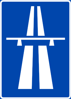
3. Início de autoestrada
Este sinal indica o início de uma autoestrada. A partir deste ponto aplicam-se normas especiais, incluídas restrições de acesso e regras sobre paragem, marcha atrás e outras manobras. Respeite os limites de velocidade, as normas de via e a regulamentação local das autoestradas.
English • Traffic sign 502 • Motorway. Motorway traffic rules apply from this sign until 504 ‘End of motorway’, 503 ‘Expressway’, or the junction between a motorway exit road and a non-motorway road.
Norsk bokmål • Skilt 502 • Motorveg. Skiltet angir at trafikkreglenes bestemmelser om motorveg gjelder fra skiltet og til skilt 504 «Slutt på motorveg», til skilt 503 «Motortrafikkveg» eller til kryss mellom avkjøringsveg fra motorveg og veg som ikke er motorveg.
Fontes
🔗 Commons.wikimedia.org
🔗 Lovdata.no • Skiltforskriften § 12
SVG source: Peter J. Acklam converted the original EPS file to PDF with Ghostscript’s ps2pdf utility and the PDF file to SVG with Inkscape. • Public domain • Original revision 2008-08-04. Wikimedia original unmodified.
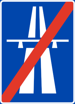
4. Fim de autoestrada
Este sinal indica o fim da autoestrada. As normas especiais de autoestrada terminam neste ponto. Siga os limites de velocidade, condições de acesso e restantes sinais aplicáveis à via posterior.
English • Traffic sign 504 • End of motorway.
Norsk bokmål • Skilt 504 • Slutt på motorveg.
Fontes
🔗 Commons.wikimedia.org
🔗 Lovdata.no • Skiltforskriften § 12
SVG source: Peter J. Acklam converted the original EPS file to PDF with Ghostscript’s ps2pdf utility and the PDF file to SVG with Inkscape. • Public domain • Original revision 2008-08-04. Wikimedia original unmodified.
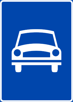
5. Início de via rápida
Este sinal indica o início de uma via rápida. A partir deste ponto aplicam-se as normas de trânsito e condições de acesso aplicáveis às vias rápidas de acordo com a regulamentação local.
English • Traffic sign 503 • Expressway. Expressway traffic rules apply from this sign until 505 ‘End of expressway’, 502 ‘Motorway’, or the junction between an expressway exit road and a road that is not an expressway.
Norsk bokmål • Skilt 503 • Motortrafikkveg. Skiltet angir at trafikkreglenes bestemmelser om motortrafikkveg gjelder fra skiltet og til skilt 505 «Slutt på motortrafikkveg», til skilt 502 «Motorveg» eller til kryss mellom avkjøringsveg fra motortrafikkveg og veg som ikke er motortrafikkveg.
Fontes
🔗 Commons.wikimedia.org
🔗 Lovdata.no • Skiltforskriften § 12
SVG source: Peter J. Acklam converted the original EPS file to PDF with Ghostscript’s ps2pdf utility and the PDF file to SVG with Inkscape. • Public domain • Original revision 2008-08-04. Wikimedia original unmodified.
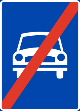
6. Fim de via rápida
Este sinal indica o fim da via rápida. As normas especiais associadas à via rápida terminam neste ponto. Siga as normas e sinais aplicáveis à via posterior.
English • Traffic sign 505 • End of expressway.
Norsk bokmål • Skilt 505 • Slutt på motortrafikkveg.
Fontes
🔗 Commons.wikimedia.org
🔗 Lovdata.no • Skiltforskriften § 12
SVG source: Peter J. Acklam converted the original EPS file to PDF with Ghostscript’s ps2pdf utility and the PDF file to SVG with Inkscape. • Public domain • Original revision 2008-08-04. Wikimedia original unmodified.
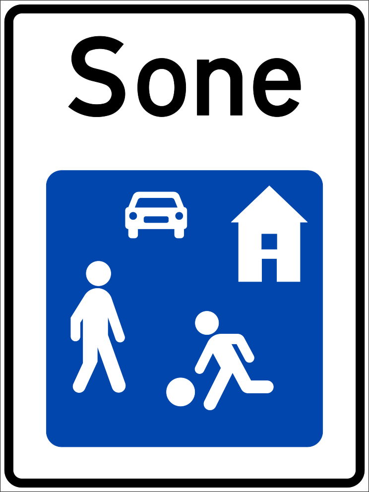
7. Início de zona residencial
Este sinal indica o início de uma zona residencial. Dentro dela aplicam-se normas especiais de acordo com os sinais e a regulamentação local. Estas podem afetar a velocidade, o estacionamento e o uso da via por diferentes utentes.
English • Traffic sign 540 • Residential area. Marks an area governed by the residential-area traffic rules. Obstacles are not separately marked or warned of. Applies until sign 542 ‘End of residential area’.
Norsk bokmål • Skilt 540 • Gatetun. Skiltet angir grense for område hvor trafikkreglenes bestemmelser om gatetun gjelder. Hindringer er ikke særskilt merket eller varslet. Skiltet gjelder til det blir opphevet av skilt 542 «Slutt på gatetun».
Fontes
🔗 Commons.wikimedia.org
🔗 Lovdata.no • Skiltforskriften § 12
SVG source: Peter J. Acklam converted the original EPS file to PDF with Ghostscript’s ps2pdf utility and the PDF file to SVG with Inkscape. • Public domain • Original revision 2008-08-04. Wikimedia original unmodified.
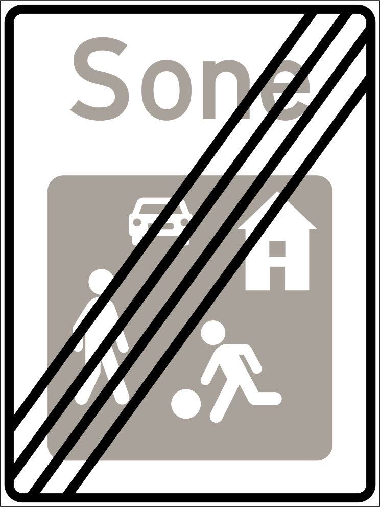
8. Fim de zona residencial
Este sinal indica o fim da zona residencial. As normas especiais associadas à zona residencial terminam neste ponto. Siga os sinais e normas aplicáveis mais adiante.
English • Traffic sign 542 • End of residential area.
Norsk bokmål • Skilt 542 • Slutt på gatetun.
Fontes
🔗 Commons.wikimedia.org
🔗 Lovdata.no • Skiltforskriften § 12
SVG source: Peter J. Acklam converted the original EPS file to PDF with Ghostscript’s ps2pdf utility and the PDF file to SVG with Inkscape. • Public domain • Original revision 2008-08-04. Wikimedia original unmodified.
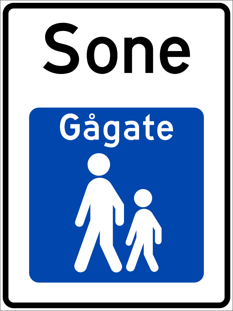
9. Início de zona pedonal
Este sinal indica o início de uma zona pedonal. Os peões são os principais utentes da zona, enquanto o acesso de veículos e outros utentes está sujeito aos sinais e regras locais aplicáveis.
English • Traffic sign 548 • Pedestrian street. Marks an area where motor vehicles other than small electric motor vehicles are prohibited and pedestrian-street traffic rules apply. Applies until sign 550 ‘End of pedestrian street’.
Norsk bokmål • Skilt 548 • Gågate. Skiltet angir grense for område hvor det er forbudt å kjøre motorvogn unntatt liten elektrisk motorvogn og hvor trafikkreglenes bestemmelser om gågate gjelder. Skiltet gjelder til det blir opphevet av skilt 550 «Slutt på gågate».
Fontes
🔗 Commons.wikimedia.org
🔗 Lovdata.no • Skiltforskriften § 12
SVG source: Peter J. Acklam converted the original EPS file to PDF with Ghostscript’s ps2pdf utility and the PDF file to SVG with Inkscape. • Public domain • Original revision 2008-08-04. Wikimedia original unmodified.
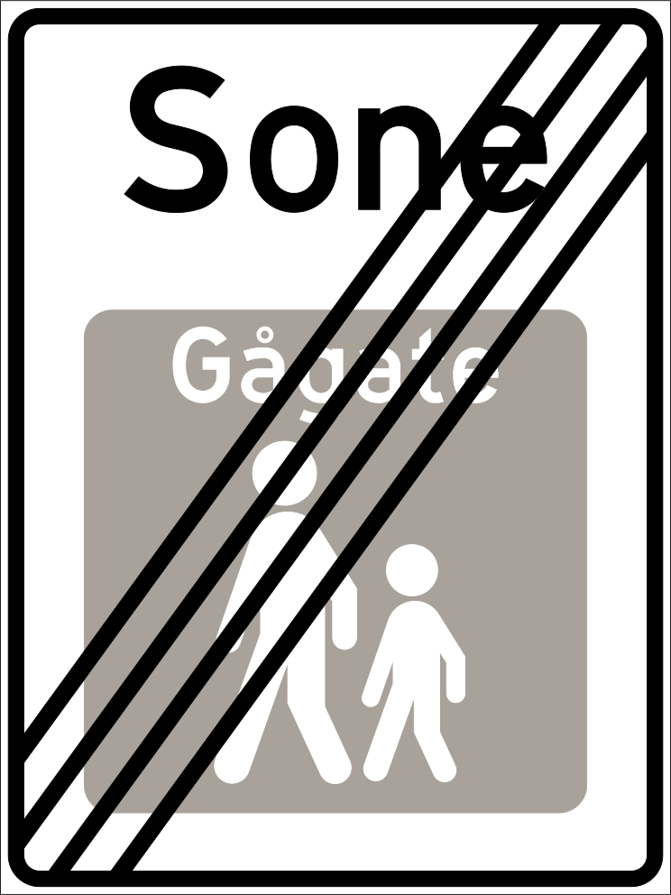
10. Fim de zona pedonal
Este sinal indica o fim da zona pedonal. As normas especiais associadas à zona terminam neste ponto. Siga os sinais e normas aplicáveis mais adiante.
English • Traffic sign 550 • End of pedestrian street.
Norsk bokmål • Skilt 550 • Slutt på gågate.
Fontes
🔗 Commons.wikimedia.org
🔗 Lovdata.no • Skiltforskriften § 12
SVG source: Peter J. Acklam converted the original EPS file to PDF with Ghostscript’s ps2pdf utility and the PDF file to SVG with Inkscape. • Public domain • Original revision 2008-08-04. Wikimedia original unmodified.
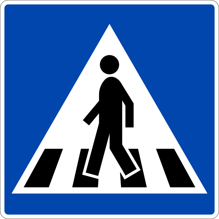
11. Passagem para peões
Este sinal indica uma passagem para peões. Marca um local designado para cruzar a via. A prioridade e as normas de cruzamento dependem dos sinais, semáforos e regulamentação local aplicáveis.
English • Traffic sign 516 • Pedestrian crossing. Marks a pedestrian crossing where the relevant traffic rules apply.
Norsk bokmål • Skilt 516 • Gangfelt. Skiltet angir kryssingssted for gående hvor trafikkreglenes bestemmelser om gangfelt gjelder.
Fontes
🔗 Commons.wikimedia.org
🔗 Lovdata.no • Skiltforskriften § 12
SVG source: Peter J. Acklam converted the original EPS file to PDF with Ghostscript’s ps2pdf utility and the PDF file to SVG with Inkscape. • Public domain • Original revision 2008-08-04. Wikimedia original unmodified.
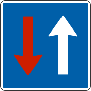
12. Estreitamento: o trânsito contrário deve ceder
Este sinal indica um estreitamento onde o trânsito em sentido contrário deve ceder a passagem.
English • Traffic sign 214 • Oncoming traffic must give way. Oncoming drivers are required to give way by sign 212 ‘Give way to oncoming traffic’.
Norsk bokmål • Skilt 214 • Møtende kjørende har vikeplikt. Skiltet angir at møtende kjørende er pålagt vikeplikt med skilt 212 «Vikeplikt overfor møtende kjørende».
Fontes
🔗 Commons.wikimedia.org
🔗 Lovdata.no • Skiltforskriften § 6
SVG source: Peter J. Acklam converted the original EPS file to PDF with Ghostscript and the PDF file to SVG with Inkscape. • Public domain • Original revision 2013-07-21. Wikimedia original unmodified.
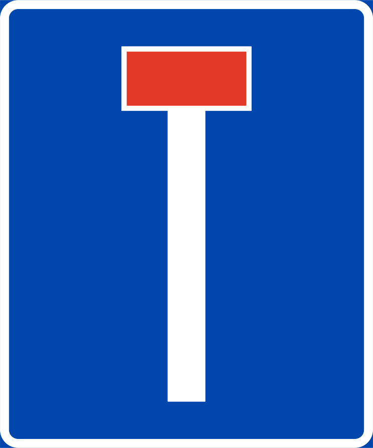
13. Rua sem saída
Este sinal indica uma rua sem saída. A via não tem saída para veículos, embora ainda possa ser possível aceder a propriedades ou outros destinos situados nela.
English • Traffic sign 527.1 • Dead-end road. Indicates that the road is physically closed. The design is adapted to local conditions.
Norsk bokmål • Skilt 527.1 • Blindveg. Skiltet viser at vegen er fysisk stengt. Skiltets utforming tilpasses forholdene på stedet.
Fontes
🔗 Commons.wikimedia.org
🔗 Lovdata.no • Skiltforskriften § 12
SVG source: Peter J. Acklam converted the original EPS file to PDF with Ghostscript’s ps2pdf utility and the PDF file to SVG with Inkscape. • Public domain • Original revision 2008-08-04. Wikimedia original unmodified.
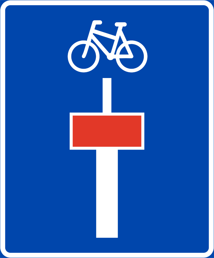
14. Rua sem saída com passagem para ciclistas
Este sinal indica uma rua sem saída com passagem para ciclistas. A via não tem saída para veículos a motor, mas os ciclistas podem continuar para além do sinal.
English • Traffic sign 527.3 • Dead-end road. Closed to car traffic but open to pedestrians and cyclists. The cycle symbol on signs 527.3 and 527.4 may be replaced by a pedestrian symbol if the continuation is intended only for pedestrians.
Norsk bokmål • Skilt 527.3 • Blindveg. Skiltet viser at vegen er stengt for biltrafikk, men åpen for gående og syklende. Sykkelsymbolet på skiltene 527.3 og 527.4 kan erstattes av symbol for gående dersom vegen videre bare er beregnet for gående.
Fontes
🔗 Commons.wikimedia.org
🔗 Lovdata.no • Skiltforskriften § 12
SVG source: Peter J. Acklam converted the original EPS file to PDF with Ghostscript’s ps2pdf utility and the PDF file to SVG with Inkscape. • Public domain • Original revision 2008-08-04. Wikimedia original unmodified.
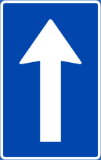
15. Via de sentido único
Este sinal indica uma via de sentido único. Os veículos apenas podem circular na direção permitida, salvo as exceções indicadas por sinais ou regras locais.
English • Traffic sign 526.1 • One-way traffic. Driving is permitted only in the arrow's direction up to the first junction.
Norsk bokmål • Skilt 526.1 • Envegskjøring. Skiltet angir at kjøring bare er tillatt i pilens retning fram til første vegkryss.
Fontes
🔗 Commons.wikimedia.org
🔗 Lovdata.no • Skiltforskriften § 12
SVG source: Peter J. Acklam converted the original EPS file to PDF with Ghostscript’s ps2pdf utility and the PDF file to SVG with Inkscape. • Public domain • Original revision 2008-08-04. Wikimedia original unmodified.
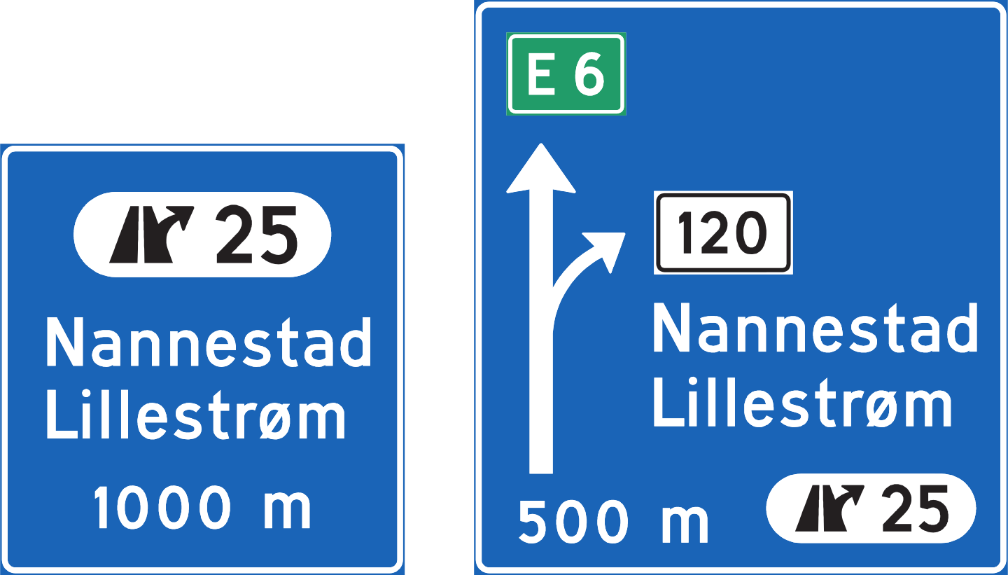
16. Informação sobre a próxima saída
Este sinal fornece informação sobre a próxima saída. Pode mostrar o número de saída, destino, direção ou distância até ela.
English • Traffic sign 705 • Exit direction sign.
Norsk bokmål • Skilt 705 • Avkjøringstavle.
Fontes
🔗 Commons.wikimedia.org
🔗 Lovdata.no • Skiltforskriften § 16
SVG source: Norwegian Public Roads Administration • Public domain • Original revision 2019-07-20. Wikimedia original unmodified.
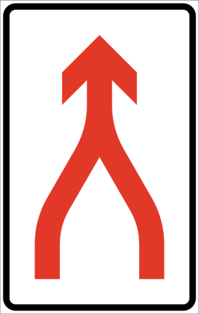
17. Das vias vão a converger
Este sinal indica que das vias de trânsito convergem num. Os condutores devem seguir as marcações rodoviárias e as normas de confluência aplicáveis enquanto as vias convergem.
English • Traffic sign 530 • Merge in turn. Lanes join into one with mutual adjustment under the traffic rules on merging.
Norsk bokmål • Skilt 530 • Sammenfletting. Skiltet angir at kjørefelt føres sammen til ett med gjensidig tilpassing i samsvar med trafikkreglenes bestemmelser (fletting).
Fontes
🔗 Commons.wikimedia.org
🔗 Lovdata.no • Skiltforskriften § 12
SVG source: Peter J. Acklam converted the original EPS file to PDF with Ghostscript’s ps2pdf utility and the PDF file to SVG with Inkscape. • Public domain • Original revision 2008-08-04. Wikimedia original unmodified.
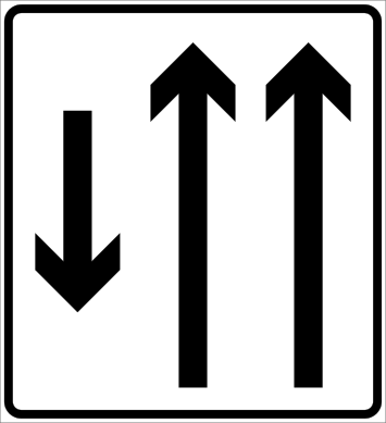
18. Distribuição das vias e sentidos
Este sinal oferece uma visão geral das vias e as respetivas direções. O diagrama mostra como estão dispostos e como continuam, se dividem ou convergem.
English • Traffic sign 538 • Lane allocation. Shows the number of lanes and each lane's direction. Special rules for particular lanes may also be shown.
Norsk bokmål • Skilt 538 • Kjørefeltinndeling. Skiltet angir antall kjørefelt på kjørebanen, og kjøreretningen for de enkelte felt. Spesielle reguleringer som gjelder for enkelte felt, kan være vist på skiltet.
Fontes
🔗 Commons.wikimedia.org
🔗 Lovdata.no • Skiltforskriften § 12
SVG source: Peter J. Acklam converted the original EPS file to PDF with Ghostscript’s ps2pdf utility and the PDF file to SVG with Inkscape. • Public domain • Original revision 2008-07-10. Wikimedia original unmodified.
19. Início de uma nova via
Este sinal indica o início de uma nova via. O traçado mostra onde começa a via adicional e como continuam as vias.
English • Traffic sign 534 • Lane begins.
Norsk bokmål • Skilt 534 • Kjørefelt begynner.
Fontes
🔗 Commons.wikimedia.org
🔗 Lovdata.no • Skiltforskriften § 12
SVG source: Peter J. Acklam converted the original EPS file to PDF with Ghostscript’s ps2pdf utility and the PDF file to SVG with Inkscape. • Public domain • Original revision 2008-07-10. Wikimedia original unmodified.
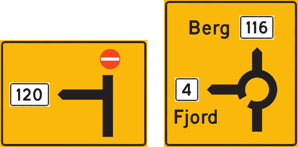
20. Informação sobre os sentidos da rotunda
Este sinal fornece informação sobre as direções numa rotunda. O diagrama mostra as saídas disponíveis e os destinos a que conduzem.
English • Traffic sign 703 • Diagrammatic advance direction sign.
Norsk bokmål • Skilt 703 • Diagramorienteringstavle.
Fontes
🔗 Commons.wikimedia.org
🔗 Lovdata.no • Skiltforskriften § 16
SVG source: Norwegian Public Roads Administration • Public domain • Original revision 2011-08-01. Wikimedia original unmodified.
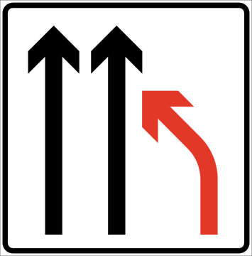
21. Fim de via
Este sinal indica o fim de uma via. O esquema de vias mostra qual termina e como continuam os restantes.
English • Traffic sign 532 • Lane ends. Drivers in the ending lane must change lanes and give way under the traffic rules.
Norsk bokmål • Skilt 532 • Kjørefelt slutter. Kjørende i felt som slutter, skal skifte felt og har vikeplikt i samsvar med trafikkreglenes bestemmelser.
Fontes
🔗 Commons.wikimedia.org
🔗 Lovdata.no • Skiltforskriften § 12
SVG source: Peter J. Acklam converted the original EPS file to PDF with Ghostscript’s ps2pdf utility and the PDF file to SVG with Inkscape. • Public domain • Original revision 2008-08-04. Wikimedia original unmodified.
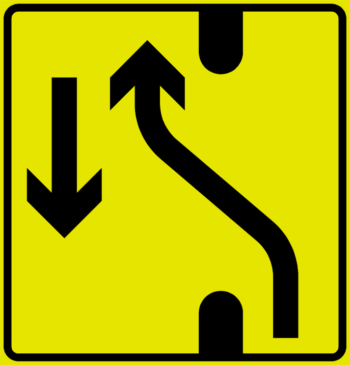
22. Desvio temporário da separador central
Este sinal indica que o trânsito é desviado temporalmente por uma abertura na separador central. Siga a direção indicada e as marcações temporárias durante o desvio.
English • Traffic sign 539 • Changed traffic layout.
Norsk bokmål • Skilt 539 • Endret kjøremønster.
Fontes
🔗 Commons.wikimedia.org
🔗 Lovdata.no • Skiltforskriften § 12
SVG source: Peter J. Acklam converted the original EPS file to PDF with Ghostscript’s ps2pdf utility and the PDF file to SVG with Inkscape. • Public domain • Original revision 2008-08-04. Wikimedia original unmodified.
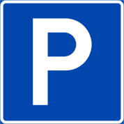
23. Estacionamento permitido
Este sinal indica que está permitido estacionar. Os veículos podem estacionar na zona abrangida pelo sinal de acordo com as condições, restrições ou regras locais indicadas.
English • Traffic sign 552 • Parking. Permitted unless contrary to the traffic rules on stopping or parking. With plate 828 showing the extent, parking in the indicated direction is nevertheless permitted despite those rules. Where a plate reserves parking for particular vehicle or user groups, others must not park. At a separately defined area, such as a car park, the sign applies throughout. Otherwise it applies on its side of the road until the nearest junction or a new sign 552 ‘Parking’, 370 ‘No stopping’, 372 ‘No parking’ or 376 ‘Parking zone’. A miniature sign, with any plate, on a parking meter permits parking under the special paid-parking rules in that bay regardless of the traffic rules on stopping and parking.
Norsk bokmål • Skilt 552 • Parkering. Skiltet angir at parkering er tillatt på stedet, dersom parkeringen ikke er i strid med trafikkreglenes bestemmelser om stans eller parkering. Har skiltet underskilt 828 «Utstrekning av stans- eller parkeringsregulering», er det likevel tillatt å parkere i anvist retning selv om parkeringen er i strid med trafikkreglenes bestemmelser om stans og parkering. Dersom underskilt angir at parkering er forbeholdt bestemte kjøretøy- eller trafikantgrupper, er parkering forbudt for andre. Er skiltet plassert på eller ved særskilt avgrenset område, f.eks. parkeringsplass, gjelder skiltet for hele området. Ellers gjelder skiltet bare på den side av vegen hvor det er satt opp. Skiltet gjelder da fram til nærmeste vegkryss eller til nytt skilt 552 «Parkering», skilt 370 «Stans forbudt», skilt 372 «Parkering forbudt» eller til skilt 376 «Parkeringssone». Dersom miniatyr av skiltet, eventuelt med underskilt, er anbrakt på parkometer, er parkering tillatt i overensstemmelse med særlige regler om avgiftsparkering. Skiltet gjelder da for vedkommende parkeringsfelt uten hensyn til trafikkreglenes bestemmelser om stans og parkering.
Fontes
🔗 Commons.wikimedia.org
🔗 Lovdata.no • Skiltforskriften § 12
SVG source: Peter J. Acklam converted the original EPS file to PDF with Ghostscript’s ps2pdf utility and the PDF file to SVG with Inkscape. • Public domain • Original revision 2008-08-04. Wikimedia original unmodified.
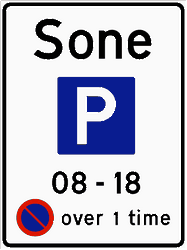
24. Início de parque de estacionamento
Este sinal indica o início de uma zona de estacionamento. As normas de estacionamento indicadas para a zona aplicam-se em toda ela de acordo com os sinais e regulações locais aplicáveis.
English • Traffic sign 376.1 • Parking zone. Marks an area with special stopping or parking rules shown by the symbols and text. Applies until sign 378 ‘End of parking zone’. Different stopping or parking rules may be signposted for particular sections; the zone rules do not apply on those sections.
Norsk bokmål • Skilt 376.1 • Parkeringssone. Skiltet angir grense for område hvor det gjelder særlige bestemmelser om parkering eller stans av kjøretøy. De særlige bestemmelser som gjelder, framgår av symboler og tekst på skiltet. Skiltet gjelder til det blir opphevet av skilt 378 «Slutt på parkeringssone». For bestemte vegstrekninger innenfor området kan det ved skilt være fastsatt avvikende bestemmelser om parkering eller stans. For disse vegstrekninger gjelder ikke soneskiltets bestemmelser.
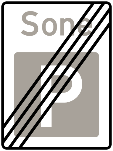
25. Fim de parque de estacionamento
Este sinal indica o fim da zona de estacionamento. As normas associadas a essa zona terminam neste ponto. Podem continuar a aplicar-se outras restrições ou condições.
English • Traffic sign 378.1 • End of parking zone.
Norsk bokmål • Skilt 378.1 • Slutt på parkeringssone.
Fontes
🔗 Commons.wikimedia.org
🔗 Lovdata.no • Skiltforskriften § 8
SVG source: Peter J. Acklam converted the original EPS file to PDF with Ghostscript and the PDF file to SVG with Inkscape. • Public domain • Original revision 2008-08-04. Wikimedia original unmodified.
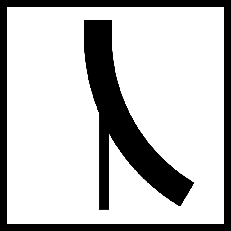
26. Forma do cruzamento
Este sinal mostra a forma ou traçado de um próximo cruzamento. O diagrama indica como estão dispostas a via de aproximação e as vias conectadas.
English • Supplementary plate 822 • Course of the priority road. A junction diagram shows the priority road with a thick line and roads with sign 202 ‘Give way’ or 204 ‘Stop’ with thin lines.
Norsk bokmål • Underskilt 822 • Forløp av forkjørsveg. Underskiltet viser et skjematisk bilde av krysset, hvor tykk strek angir forkjørsveg og tynn strek angir veg hvor skiltene 202 «Vikeplikt» eller 204 «Stopp» er satt opp.
Fontes
🔗 Commons.wikimedia.org
🔗 Lovdata.no • Skiltforskriften § 18
SVG source: Peter J. Acklam converted the original EPS file to PDF with Ghostscript and the PDF file to SVG with Inkscape. • Public domain • Original revision 2008-07-11. Wikimedia original unmodified.
27. Forma do cruzamento
Este sinal mostra a forma ou traçado de um próximo cruzamento. O diagrama indica como estão dispostas a via de aproximação e as vias conectadas.
English • Supplementary plate 822 • Course of the priority road. A junction diagram shows the priority road with a thick line and roads with sign 202 ‘Give way’ or 204 ‘Stop’ with thin lines.
Norsk bokmål • Underskilt 822 • Forløp av forkjørsveg. Underskiltet viser et skjematisk bilde av krysset, hvor tykk strek angir forkjørsveg og tynn strek angir veg hvor skiltene 202 «Vikeplikt» eller 204 «Stopp» er satt opp.
Fontes
🔗 Commons.wikimedia.org
🔗 Lovdata.no • Skiltforskriften § 18
SVG source: Peter J. Acklam converted the original EPS file to PDF with Ghostscript and the PDF file to SVG with Inkscape. • Public domain • Original revision 2008-07-11. Wikimedia original unmodified.
28. Forma do cruzamento
Este sinal mostra a forma ou traçado de um próximo cruzamento. O diagrama indica como estão dispostas a via de aproximação e as vias conectadas.
English • Supplementary plate 822 • Course of the priority road. A junction diagram shows the priority road with a thick line and roads with sign 202 ‘Give way’ or 204 ‘Stop’ with thin lines.
Norsk bokmål • Underskilt 822 • Forløp av forkjørsveg. Underskiltet viser et skjematisk bilde av krysset, hvor tykk strek angir forkjørsveg og tynn strek angir veg hvor skiltene 202 «Vikeplikt» eller 204 «Stopp» er satt opp.
Fontes
🔗 Commons.wikimedia.org
🔗 Lovdata.no • Skiltforskriften § 18
SVG source: Peter J. Acklam converted the original EPS file to PDF with Ghostscript and the PDF file to SVG with Inkscape. • Public domain • Original revision 2008-07-11. Wikimedia original unmodified.
