

Traffic signsPhilippines
 Traffic rules
 Philippines
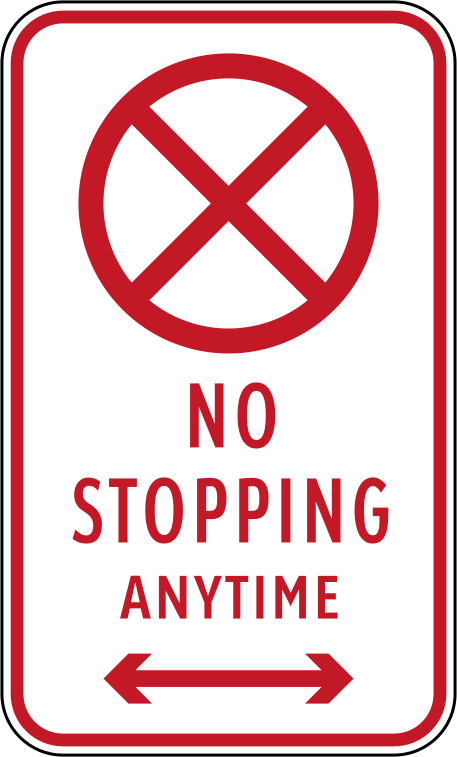
51. What does this traffic sign mean?
This traffic sign indicates that parking and stopping are prohibited. Vehicles may not stop or park voluntarily where the restriction applies, except where an applicable rule provides an exemption or stopping is required by traffic conditions.
English • Traffic sign R5-8 • No stopping at any time. Stopping is prohibited at any time along the section indicated by the arrows.
Filipino • R5-8 • Bawal huminto anumang oras. Bawal huminto sa bahaging ipinapakita ng mga palaso, anumang oras.
Sources
🔗 Commons.wikimedia.org
🔗 Fliphtml5.com • LTO • Road Traffic Signs & Pavement Markings • p. 11 (pampublikong kopya)
🔗 Lto.gov.ph • LTO • opisyal na materyal
🔗 Scribd.com • DPWH • R5-8 (pampublikong kopya)
SVG source: Government of the Philippines - Department of Public Works and Highways derivative work: Fry1989 eh? derivative work: TagaSanPedroAko (Let's talk/Usap tayo) • Public domain • Original revision 2018-09-30. Wikimedia original unmodified.
Artwork verified against Tuktukph.top • official published diagram R5-8.


52. What does this traffic sign mean?
This traffic sign indicates that traffic must pass an obstacle on either the left or the right. Use either permitted side while following the road layout and any accompanying signs or markings.
English • Traffic sign R2-4 • Pass on either side. You may pass the traffic island or obstruction on the left or right, as shown by the arrows.
Filipino • R2-4 • Maaaring dumaan sa alinmang panig. Maaaring daanan ang isla o sagabal sa kaliwa o kanan, ayon sa mga palaso.
Sources
🔗 Commons.wikimedia.org
🔗 Fliphtml5.com • LTO • Road Traffic Signs & Pavement Markings • p. 6 (pampublikong kopya)
🔗 Lto.gov.ph • LTO • opisyal na materyal
🔗 Scribd.com • DPWH • R2-4 (pampublikong kopya)
SVG source: Government of the Philippines - Department of Public Works and Highways derivative work: Photo07 • Public domain • Original revision 2014-05-25. Wikimedia original unmodified.
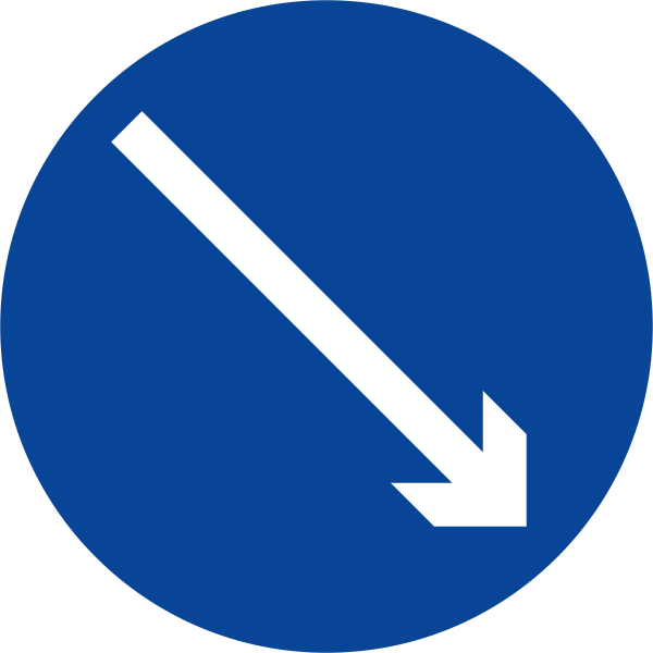
53. What does this traffic sign mean?
This traffic sign indicates that traffic must pass an obstacle on the right. Keep to the right of the obstacle and follow any accompanying signs or road markings.
English • Traffic sign R2-3 • Pass on the right. Pass the traffic island or obstruction on its right, as shown by the arrow.
Filipino • R2-3 • Dumaan sa kanan. Daanan ang isla o sagabal sa kanang panig nito, ayon sa palaso.
Sources
🔗 Commons.wikimedia.org
🔗 Fliphtml5.com • LTO • Road Traffic Signs & Pavement Markings • p. 6 (pampublikong kopya)
🔗 Lto.gov.ph • LTO • opisyal na materyal
🔗 Scribd.com • DPWH • R2-3 (pampublikong kopya)
SVG source: Government of the Philippines - Department of Public Works and Highways derivative work: Fry1989 eh? • Public domain • Original revision 2015-05-14. Wikimedia original unmodified.
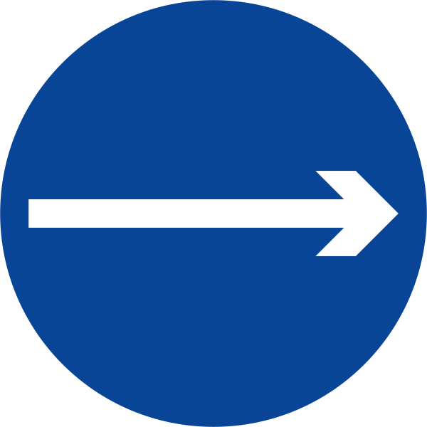
54. What does this traffic sign mean?
This traffic sign indicates a mandatory direction to the right. Traffic must proceed to the right at the sign and may not continue straight ahead or to the left.
English • Traffic sign R2-2 • One-way traffic to the right. Follow the one-way flow of traffic to the right, as shown by the arrow.
Filipino • R2-2 • Isahang direksiyon pakanan. Sundin ang isahang daloy ng trapiko patungo sa kanan, ayon sa palaso.
Sources
🔗 Commons.wikimedia.org
🔗 Fliphtml5.com • LTO • Road Traffic Signs & Pavement Markings • p. 6 (pampublikong kopya)
🔗 Lto.gov.ph • LTO • opisyal na materyal
🔗 Scribd.com • DPWH • R2-2 (pampublikong kopya)
SVG source: Government of the Philippines - Department of Public Works and Highways derivative work: Fry1989 eh? • Public domain • Original revision 2015-04-23. Wikimedia original unmodified.
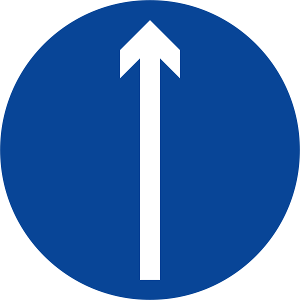
55. What does this traffic sign mean?
This traffic sign indicates that driving straight ahead is mandatory. Traffic must continue straight ahead and may not turn left or right at the location to which the sign applies.
English • Traffic sign R2-1 • Ahead only. Continue straight ahead in the direction of the arrow. Turning is prohibited where this sign applies.
Filipino • R2-1 • Dumiretso lamang. Dumiretso sa direksiyong ipinapakita ng palaso. Bawal lumiko sa lugar na sakop ng karatula.
Sources
🔗 Commons.wikimedia.org
🔗 Fliphtml5.com • LTO • Road Traffic Signs & Pavement Markings • p. 6 (pampublikong kopya)
🔗 Lto.gov.ph • LTO • opisyal na materyal
🔗 Scribd.com • DPWH • R2-1 (pampublikong kopya)
SVG source: Government of the Philippines - Department of Public Works and Highways derivative work: Fry1989 eh? • Public domain • Original revision 2015-04-23. Wikimedia original unmodified.
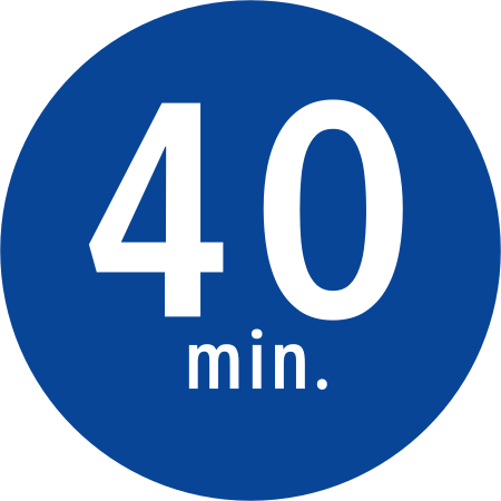
56. What does this traffic sign mean?
This traffic sign indicates the start of a minimum speed. Road users covered by the sign must travel at or above the indicated speed when conditions allow. Driving more slowly may still be necessary because of traffic, weather, road conditions or another safety-related reason.
English • Traffic sign R4-3 • Minimum speed: 40 km/h. This sign indicates a minimum speed of 40 km/h on the section of expressway it covers. Continue to adapt your driving to traffic and safety conditions.
Filipino • R4-3 • Pinakamababang bilis: 40 km/h. Ipinapakita ng karatulang ito ang 40 km/h na pinakamababang bilis sa bahaging sakop nito sa expressway. Iangkop pa rin ang pagmamaneho sa trapiko at kaligtasan.
Sources
🔗 Commons.wikimedia.org
🔗 Fliphtml5.com • LTO • Road Traffic Signs & Pavement Markings • p. 9 (pampublikong kopya)
🔗 Lto.gov.ph • LTO • opisyal na materyal
🔗 Scribd.com • DPWH • R4-3 (pampublikong kopya)
SVG source: Government of the Philippines derivative work: Fry1989 eh? • Public domain • Original revision 2018-10-14. Wikimedia original unmodified.
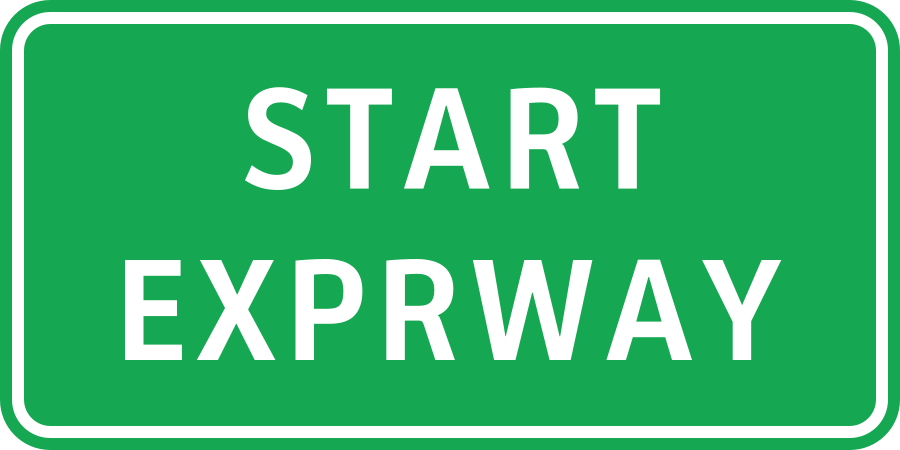
57. What does this traffic sign mean?
This traffic sign indicates the start of an expressway. From this point, the traffic rules and access conditions that apply to expressways take effect according to the applicable local regulations.
English • Traffic sign GE6-2 • Start of an expressway. The expressway begins here. Follow the limits, restrictions and other signs designated for the expressway.
Filipino • GE6-2 • Simula ng expressway. Dito nagsisimula ang expressway. Sundin ang mga limitasyon, pagbabawal at iba pang karatulang nakatalaga sa expressway.
Sources
🔗 Commons.wikimedia.org
🔗 Fliphtml5.com • LTO • Road Traffic Signs & Pavement Markings • p. 31 (pampublikong kopya)
🔗 Lto.gov.ph • LTO • opisyal na materyal
🔗 Scribd.com • DPWH • GE6-2 (pampublikong kopya)
SVG source: Original sign - Department of Public Works and Highways (Philippines) Redrawn sign - TagaSanPedroAko • Public domain • Original revision 2018-10-13. Wikimedia original unmodified.
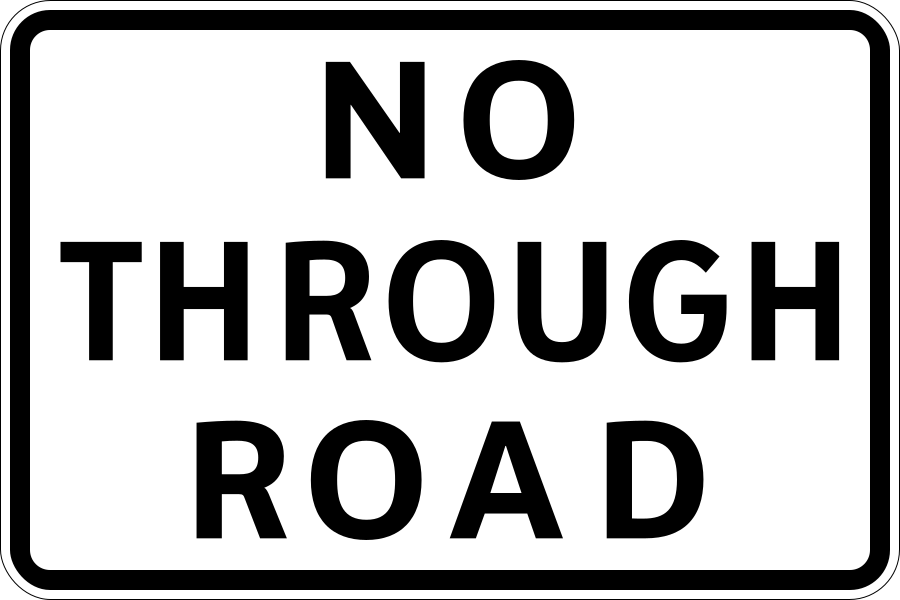
58. What does this traffic sign mean?
This traffic sign indicates a dead end street. The road has no through route for vehicles, although access to properties or other destinations along the road may still be possible.
English • Traffic sign S2-8 • Dead end. This road does not lead to another road for through travel. It may be used to reach destinations along it.
Filipino • S2-8 • Kalsadang walang lagusan. Hindi umaabot ang kalsadang ito sa isa pang kalsada para sa tuloy-tuloy na biyahe. Maaari itong gamitin upang puntahan ang mga lugar na nasa loob nito.
Sources
🔗 Commons.wikimedia.org
🔗 Fliphtml5.com • LTO • Road Traffic Signs & Pavement Markings • p. 33 (pampublikong kopya)
🔗 Lto.gov.ph • LTO • opisyal na materyal
🔗 Scribd.com • DPWH • S2-8 (pampublikong kopya)
SVG source: Government of the Philippines - Department of Public Works and Highways derivative work: Fry1989 eh? • Public domain • Original revision 2020-07-13. Wikimedia original unmodified.
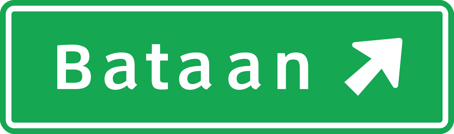
59. What does this traffic sign mean?
This traffic sign gives information about the next exit. It may show the exit number, destination, direction or distance to the exit.
English • Traffic sign G1-2 • Direction to Bataan. The arrow shows the route towards Bataan at the approaching junction. Choose the correct lane early.
Filipino • G1-2 • Direksiyon patungong Bataan. Ipinapakita ng palaso ang direksiyon ng daan patungong Bataan sa papalapit na sangandaan. Piliin nang maaga ang tamang lane.
Sources
🔗 Commons.wikimedia.org
🔗 Fliphtml5.com • LTO • Road Traffic Signs & Pavement Markings • p. 22 (pampublikong kopya)
🔗 Lto.gov.ph • LTO • opisyal na materyal
🔗 Scribd.com • DPWH • G1-2 (pampublikong kopya)
SVG source: Department of Public Works and Highways (Philippines) Sign redrawn by TagaSanPedroAko. • Public domain • Original revision 2015-08-22. Wikimedia original unmodified.
Artwork verified against Tuktukph.top • official published diagram G1-2.
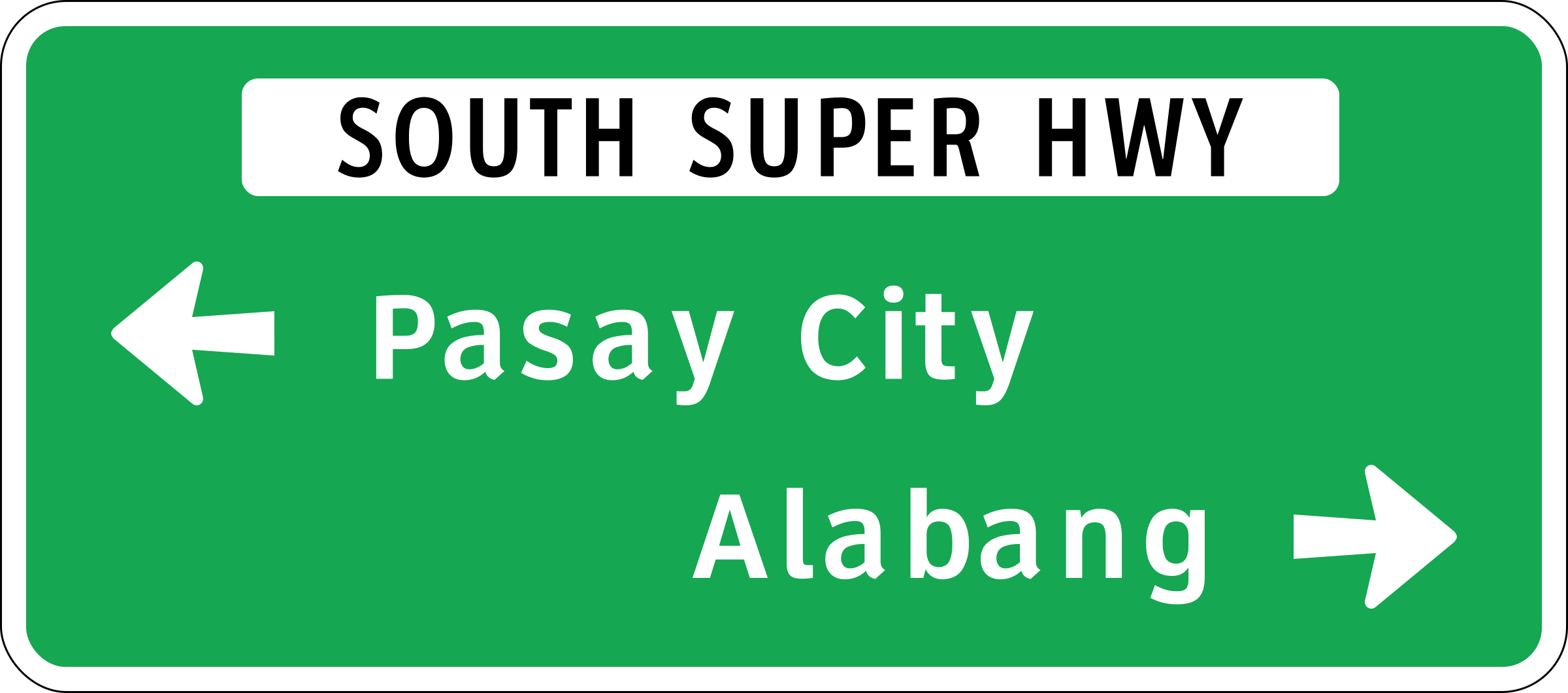
60. What does this traffic sign mean?
This traffic sign gives information about the destination reached via the ramp. The displayed destination indicates where the ramp leads.
English • Traffic sign G1-3 • Directions on South Super Highway. At the approaching junction, the route to Pasay City is to the left and the route to Alabang is to the right, as shown by the arrows.
Filipino • G1-3 • Mga direksiyon sa South Super Highway. Sa papalapit na sangandaan, pakaliwa ang daan patungong Pasay City at pakanan ang daan patungong Alabang, ayon sa mga palaso.
Sources
🔗 Commons.wikimedia.org
🔗 Fliphtml5.com • LTO • Road Traffic Signs & Pavement Markings • p. 22 (pampublikong kopya)
🔗 Lto.gov.ph • LTO • opisyal na materyal
🔗 Scribd.com • DPWH • G1-3 (pampublikong kopya)
SVG source: Original sign: Department of Public Works and Highways Sign redrawn by TagaSanPedroAko, using sign specifications, other than the fonts, which rather used Clearview(via the Roadgeek 2005 road sign fonts) • Public domain • Original revision 2016-01-01. Wikimedia original unmodified.
Artwork verified against Tuktukph.top • official published diagram G1-3.
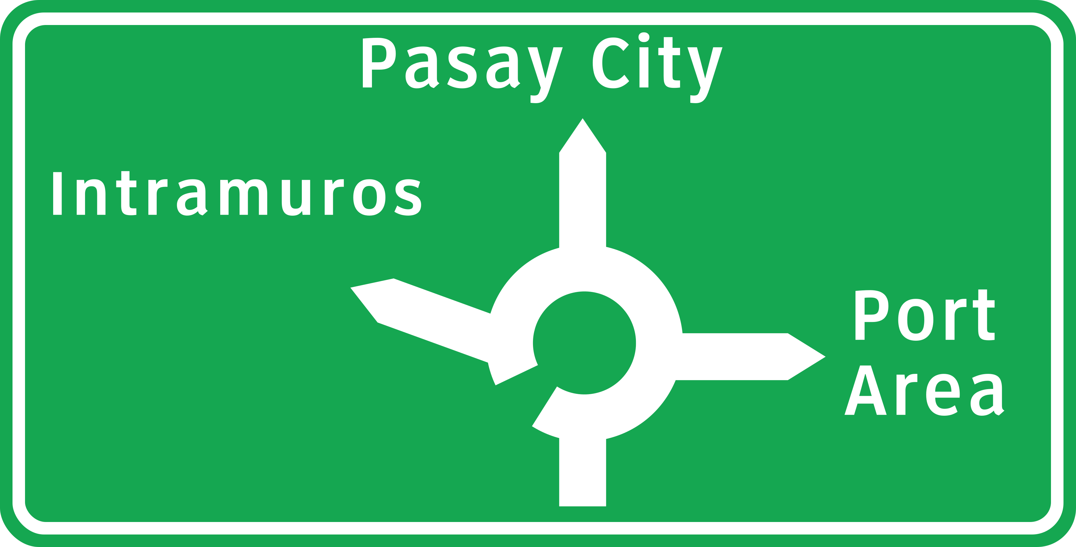
61. What does this traffic sign mean?
This traffic sign gives information about directions at a roundabout. The diagram shows the available exits and the destinations reached from them.
English • Traffic sign G1-5 • Directions at a roundabout. The diagram shows the roundabout exits: straight ahead towards Pasay City, left towards Intramuros and right towards Port Area.
Filipino • G1-5 • Mga direksiyon sa rotonda. Ipinapakita ng diagram ang mga sangay ng rotonda: diretso patungong Pasay City, pakaliwa patungong Intramuros at pakanan patungong Port Area.
Sources
🔗 Commons.wikimedia.org
🔗 Fliphtml5.com • LTO • Road Traffic Signs & Pavement Markings • p. 22 (pampublikong kopya)
🔗 Lto.gov.ph • LTO • opisyal na materyal
🔗 Scribd.com • DPWH • G1-5 (pampublikong kopya)
Image via Commons.wikimedia.org
Diagram:Department of Public Works and Highways (Philippines) Derivative work:TagaSanPedroAko • Public domain • Source revision 2018-10-14. Wikimedia original unmodified.
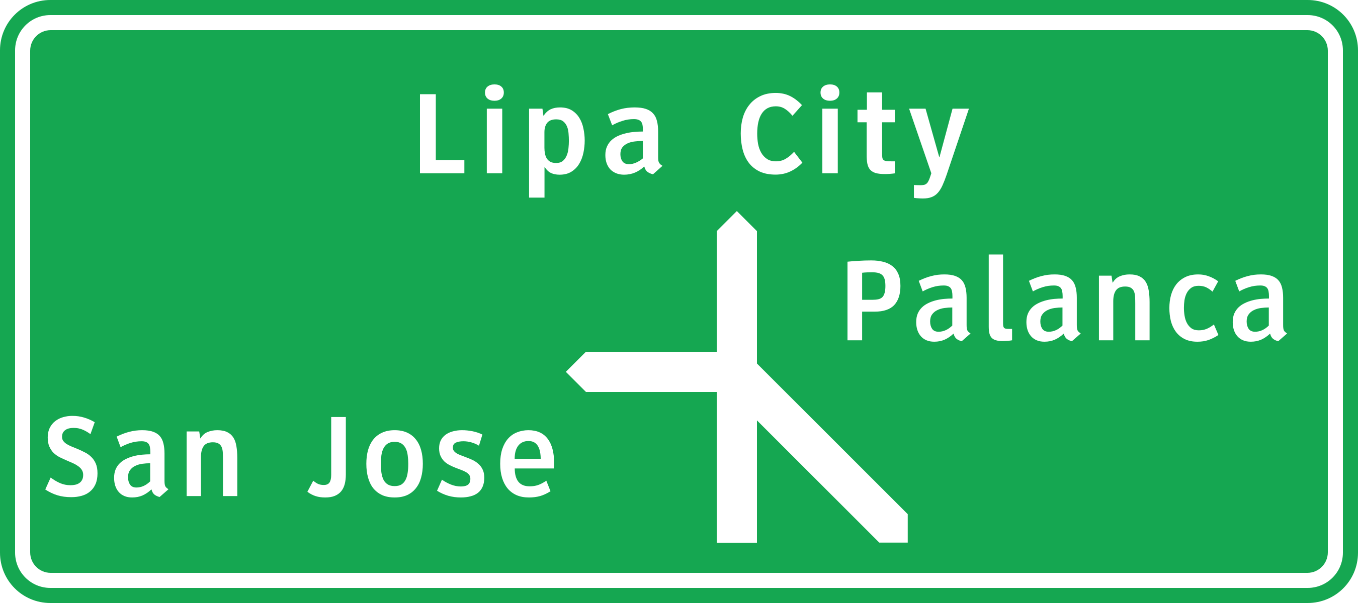
62. What does this traffic sign mean?
This traffic sign shows the junction layout, directions and destinations. The diagram shows how the roads are arranged and which direction leads to each indicated destination or route.
English • Traffic sign G1-4 • Directions at a junction. The diagram shows the branches ahead: straight ahead towards Lipa City, right towards Palanca and diagonally right towards San Jose.
Filipino • G1-4 • Mga direksiyon sa sangandaan. Ipinapakita ng diagram ang mga sangay sa unahan: diretso patungong Lipa City, pakanan patungong Palanca at pahilis sa kanan patungong San Jose.
Sources
🔗 Commons.wikimedia.org
🔗 Fliphtml5.com • LTO • Road Traffic Signs & Pavement Markings • p. 22 (pampublikong kopya)
🔗 Lto.gov.ph • LTO • opisyal na materyal
🔗 Scribd.com • DPWH • G1-4 (pampublikong kopya)
Image via Commons.wikimedia.org
Diagram:Department of Public Works and Highways (Philippines) Derivative work:TagaSanPedroAko • Public domain • Source revision 2018-10-14. Wikimedia original unmodified.
