


位置標識オーストラリア
 交通ルール
交通ルール
 オーストラリア
36. 位置標識
位置標識は、道路上の測定位置を示す路側の基準表示です。通常、その路線の定められた起点からのキロ、マイル、またはより細かい区間を示します。
キロ・ヘクトメートル標は、道路利用者、緊急サービス、道路管理者、保守作業員が正確な道路区間を特定するために役立ちます。速度制限、優先、進入規制を設定するものではありません。
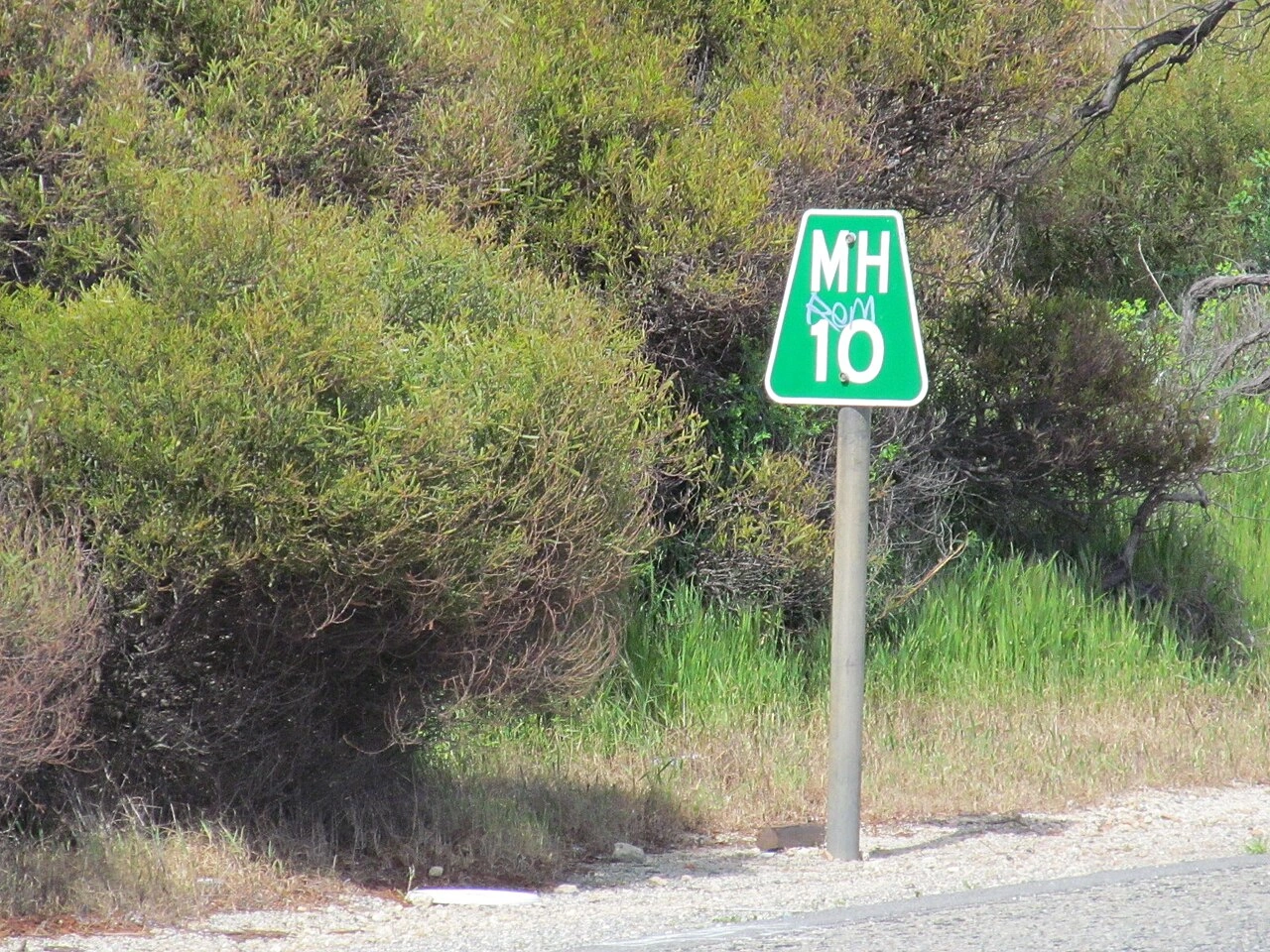
What is a road location marker?
A road location marker is a numbered reference point identifying a measured position along a particular road or route.
What is a kilometre marker?
A kilometre marker indicates the number of kilometres measured from an established starting point on the road.
What is a hectometre marker?
A hectometre marker identifies a position at intervals of 100 metres. One kilometre contains ten hectometres.
What does a marker showing 14.7 mean?
It normally identifies a point approximately 14 kilometres and 700 metres from the route’s reference origin.
Is the marker the distance to the next town?
No. It normally measures the position along the road from a fixed reference origin rather than the remaining distance to a destination.
Where does the kilometre measurement begin?
It begins at a reference point chosen for that road, such as the start of the route, a border, an administrative boundary or another officially defined origin.
Does the numbering always increase in the direction of travel?
No. It increases in the officially defined direction of the route. Drivers travelling in the opposite direction may see the values decrease.
How can you recognise a location marker?
It may appear as a numbered roadside post, small sign, plate, marker attached to a barrier or numbers painted beside the carriageway.
Are kilometre markers used in every country?
Many countries use kilometre markers, while countries using imperial measurements may use mile markers. Designs and intervals differ.
Are hectometre markers always placed every 100 metres?
They are intended to represent 100-metre intervals, but their physical placement and permitted tolerances depend on the road authority and local conditions.
What information should you give during an emergency?
Give the road number, marker value, direction of travel and nearest junction or landmark where possible.
Why is the road number important?
The same kilometre value may occur on many different roads. The road number identifies which route the marker belongs to.
Why is the direction of travel important?
Divided roads have separate carriageways. Reporting the direction helps emergency services approach the correct side without making a long diversion.
Can a marker help locate a breakdown?
Yes. Reporting the nearest marker can help breakdown and emergency services identify the affected road section more accurately.
Can it help report debris or another hazard?
Yes. The marker can help road authorities locate an obstruction, damaged barrier, animal, collision or other dangerous situation.
Is a location marker a traffic sign?
Normally not. It is a reference or identification device rather than a regulatory sign.
Does it impose a speed limit?
No. The applicable speed comes from general traffic rules and regulatory speed signs.
Does it change priority?
No. Traffic lights, priority signs and ordinary intersection rules remain applicable.
Does it mark the beginning of a new road rule?
No. Passing a kilometre or hectometre marker does not normally begin or end a traffic regulation.
Can markers be used for road maintenance?
Yes. Road authorities use reference points to locate signs, barriers, bridges, defects, works and other infrastructure precisely.
Can navigation coordinates replace a location marker?
Coordinates can be useful, but a road reference marker may be easier for road operators and emergency services to connect with the correct carriageway and road section.
What if the marker is damaged or missing?
Use the nearest visible marker together with the road number, direction, junctions and other identifiable features.
Should a driver stop simply to read a marker?
No. Do not stop in a live lane or another prohibited location. A passenger may note the marker, or the driver may read it after stopping somewhere safe during an actual emergency.
Can temporary roadworks change the marker values?
Normally not. Temporary traffic routes may move traffic away from the marker’s usual position, but the official road reference system generally remains unchanged.


