


Information signsItaly
 Traffic rules
 Italy
 Priority signs
 Warning signs
 Prohibitory signs
 Mandatory signs
 Information signs
 Additional signs
Information signs
An information sign identifies a route, destination, facility or regulated road or area. Some carry legal consequences, so apply the actual sign meaning and local traffic code.



Which signs provide information in Italy?
Indication signs provide driving, destination, route, service and facility information.
🔗 aci.gov.it • Italy, Road Code — articles 2–3, 38–39, 141, 145, 154, 176
How can you recognise a built-up area in Italy?
Official entrance and end signs mark the built-up area. The legal definition includes at least 25 buildings and publicly used areas with road access, but drivers should follow the signed boundary rather than count buildings.
🔗 aci.gov.it • Italy, Road Code — articles 2–3, 38–39, 141, 145, 154, 176

1. Start of a priority road
This traffic sign indicates the start of a priority road. Drivers on the priority road normally have priority over traffic entering from side roads until the priority road ends, unless traffic lights, other signs or applicable traffic rules indicate otherwise.
English • Traffic sign II.44 • Priority road. Marks a road section with priority.
Italiano • Figura II.44 • Diritto di precedenza. Indica che il tratto di strada gode del diritto di precedenza.
Sources
🔗 Commons.wikimedia.org (F l a n k e r • CC BY-SA 3.0)
🔗 Normattiva.it • D.P.R. 495/1992 • testo vigente • art. 113, comma 1
🔗 Gazzettaufficiale.it • Gazzetta Ufficiale • Figura II.44 • pagina 258
SVG source: F l a n k e r • CC BY-SA 3.0 • Original revision 2011-02-05. Wikimedia original unmodified.
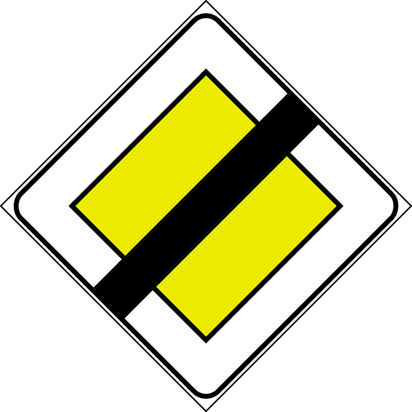
2. End of the priority road
This traffic sign indicates the end of the priority road. The road no longer has continuing priority at subsequent intersections. Follow the applicable traffic lights, priority signs and default priority rules.
English • Traffic sign II.42 • End of priority road. The road no longer has priority. If placed in advance, a supplementary plate gives the distance to where priority ends.
Italiano • Figura II.42 • Fine del diritto di precedenza. Indica che la strada non gode più del diritto di precedenza. Se posto in anticipo, un pannello precisa la distanza dal punto in cui la precedenza termina.
Sources
🔗 Commons.wikimedia.org (F l a n k e r • CC BY-SA 3.0)
🔗 Normattiva.it • D.P.R. 495/1992 • testo vigente • art. 111, comma 1–4
🔗 Gazzettaufficiale.it • Gazzetta Ufficiale • Figura II.42 • pagina 257
SVG source: F l a n k e r • CC BY-SA 3.0 • Original revision 2011-02-05. Wikimedia original unmodified.
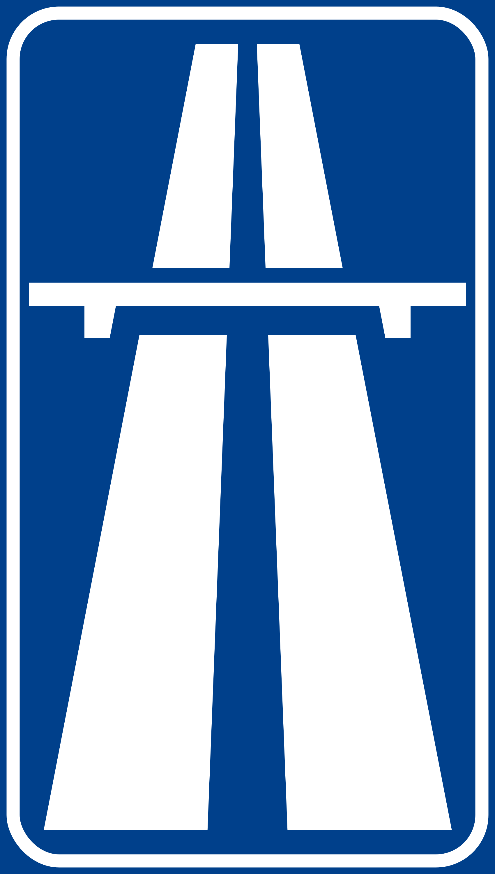
3. Start of a motorway
This traffic sign indicates the start of a motorway. From this point, special motorway rules apply, including restrictions on which road users may enter and on stopping, reversing and other manoeuvres. Follow the applicable speed limits, lane rules and local motorway regulations.
English • Traffic sign II.345 — blue background • Beginning of a principal extra-urban road. The symbol on a blue background marks the beginning of a principal extra-urban road. The same symbol has a green background for a motorway.
Italiano • Figura II.345 — fondo blu • Inizio strada extraurbana principale. Il simbolo con fondo blu indica l’inizio di una strada extraurbana principale. Per l’autostrada lo stesso simbolo ha fondo verde.
Sources
🔗 Commons.wikimedia.org
🔗 Normattiva.it • D.P.R. 495/1992 • testo vigente • art. 135, comma 23
🔗 Gazzettaufficiale.it • Gazzetta Ufficiale • Figura II.345 — fondo blu • pagina 322
SVG source: ColdShine • Public domain • Original revision 2023-09-10. Wikimedia original unmodified.
4. End of the motorway
This traffic sign indicates the end of the motorway. The special motorway rules end at this point. Follow the speed limits, access rules and other traffic signs that apply to the road ahead.
English • Traffic sign II.346 — blue background • End of a principal extra-urban road. The crossed-out symbol on a blue background marks its end. The motorway version has a green background.
Italiano • Figura II.346 — fondo blu • Fine strada extraurbana principale. Il simbolo barrato con fondo blu indica la fine di una strada extraurbana principale. La variante relativa all’autostrada ha fondo verde.
Sources
🔗 Commons.wikimedia.org
🔗 Normattiva.it • D.P.R. 495/1992 • testo vigente • art. 135, comma 23
🔗 Gazzettaufficiale.it • Gazzetta Ufficiale • Figura II.346 — fondo blu • pagina 322
SVG source: ColdShine • Public domain • Original revision 2023-11-23. Wikimedia original unmodified.
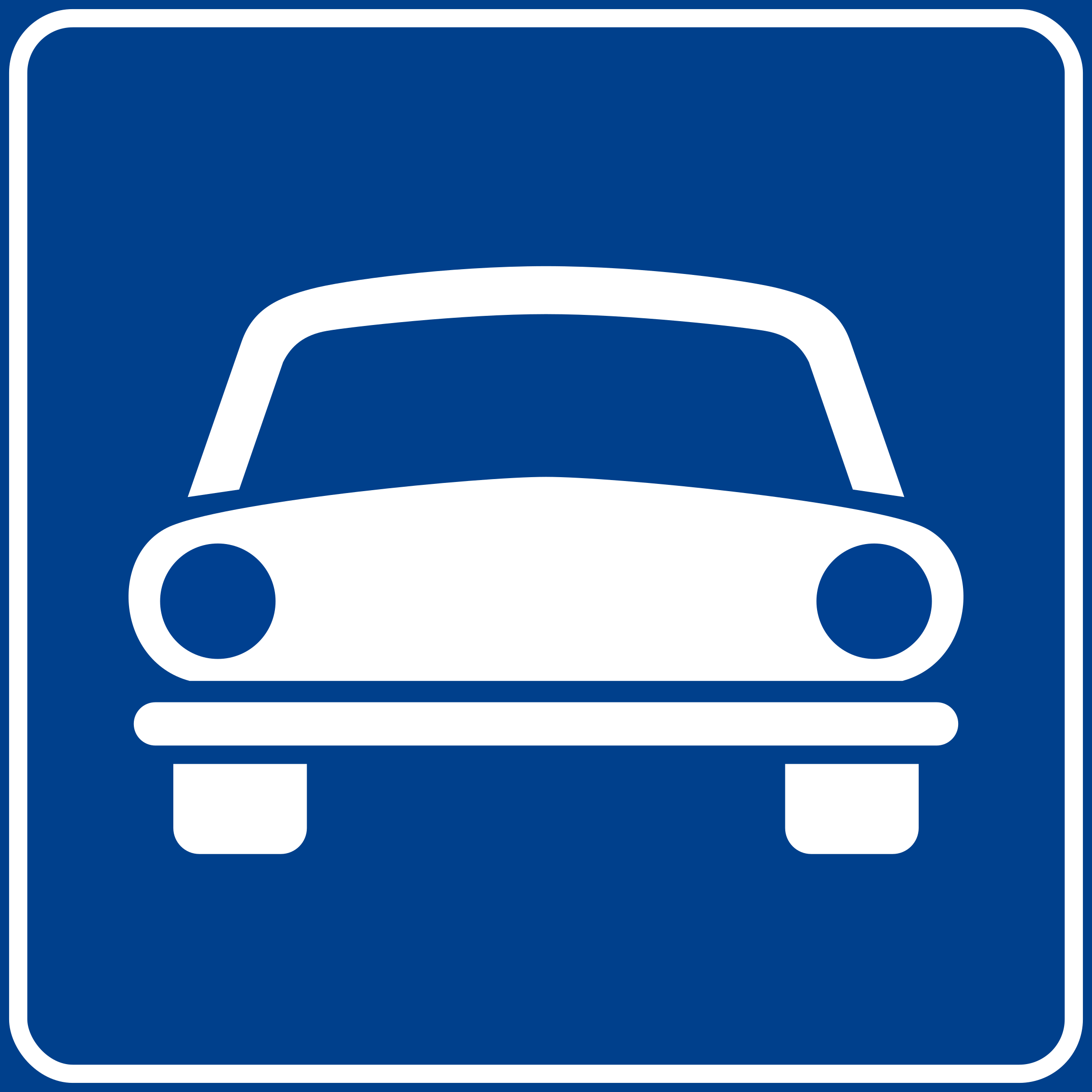
5. Start of an expressway
This traffic sign indicates the start of an expressway. From this point, the traffic rules and access conditions that apply to expressways take effect according to the applicable local regulations.
English • Traffic sign II.314 • Road reserved for motor vehicles. Marks the beginning of a road other than a motorway reserved for motor vehicles, on which the same traffic rules as on motorways apply.
Italiano • Figura II.314 • Strada riservata ai veicoli a motore. Indica l’inizio di una strada diversa dall’autostrada riservata ai veicoli a motore, nella quale si osservano le stesse norme che regolano la circolazione sulle autostrade.
Sources
🔗 Commons.wikimedia.org
🔗 Normattiva.it • D.P.R. 495/1992 • testo vigente • art. 135, comma 9
🔗 Gazzettaufficiale.it • Gazzetta Ufficiale • Figura II.314 • pagina 314
SVG source: F l a n k e r • Public domain • Original revision 2023-06-30. Wikimedia original unmodified.
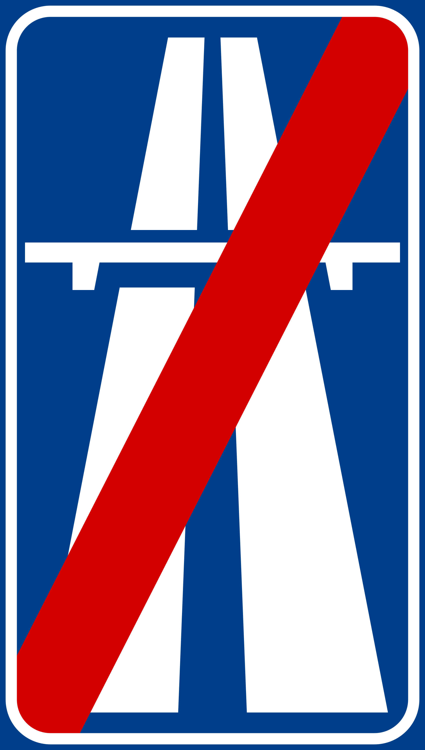
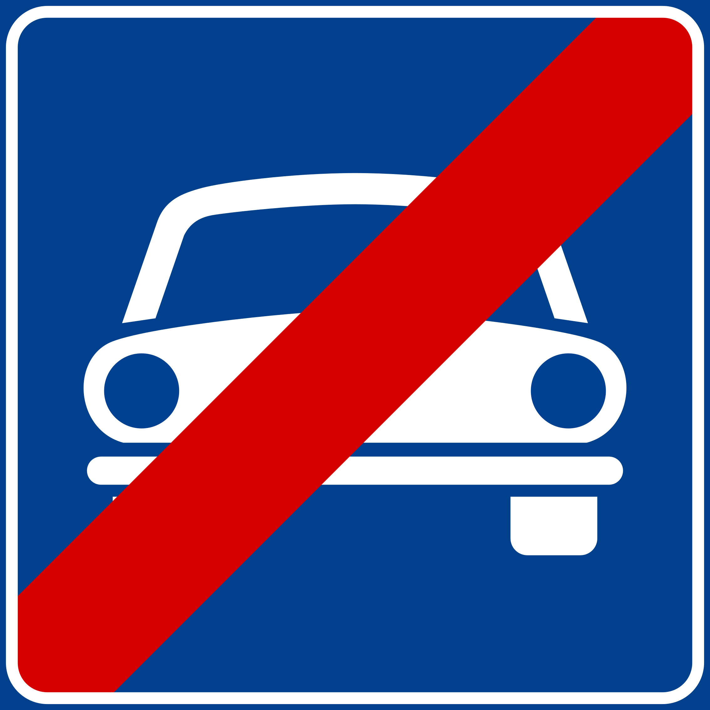
6. End of the expressway
This traffic sign indicates the end of the expressway. The special traffic rules associated with the expressway end at this point. Follow the rules and traffic signs that apply to the road ahead.
English • Traffic sign II.315 • End of road reserved for motor vehicles. Marks the end of the reserved road.
Italiano • Figura II.315 • Fine strada riservata ai veicoli a motore. Indica la fine della strada riservata ai veicoli a motore.
Sources
🔗 Commons.wikimedia.org
🔗 Normattiva.it • D.P.R. 495/1992 • testo vigente • art. 135, comma 9
🔗 Gazzettaufficiale.it • Gazzetta Ufficiale • Figura II.315 • pagina 314
SVG source: F l a n k e r • Public domain • Original revision 2023-06-30. Wikimedia original unmodified.
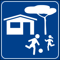
7. Start of a residential area
This traffic sign indicates the start of a residential area. Special traffic rules apply within the area according to the applicable signs and local regulations. These rules may affect speed, parking and how different road users use the road.
English • Traffic sign II.318 • Residential area. Marks the beginning of a residential street or area where particular care is required. Specific traffic rules must be shown on a supplementary plate.
Italiano • Figura II.318 • Zona residenziale. Indica l’inizio di una strada o zona a carattere abitativo e residenziale nella quale occorrono particolari cautele. Le specifiche regole di circolazione devono essere indicate su un pannello integrativo.
Sources
🔗 Commons.wikimedia.org
🔗 Normattiva.it • D.P.R. 495/1992 • testo vigente • art. 135, comma 12
🔗 Gazzettaufficiale.it • Gazzetta Ufficiale • Figura II.318 • pagina 315
Image via Commons.wikimedia.org
F l a n k e r • Public domain • Source revision 2006-11-10. Wikimedia original unmodified.
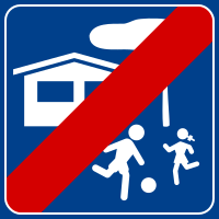
8. End of the residential area
This traffic sign indicates the end of the residential area. The special traffic rules associated with the residential area end at this point. Follow the traffic signs and rules that apply beyond the area.
English • Traffic sign II.319 • End of residential area. Marks the exit from the previously signposted residential area.
Italiano • Figura II.319 • Fine zona residenziale. Indica l’uscita dalla zona residenziale precedentemente segnalata.
Sources
🔗 Commons.wikimedia.org
🔗 Normattiva.it • D.P.R. 495/1992 • testo vigente • art. 135, comma 12
🔗 Gazzettaufficiale.it • Gazzetta Ufficiale • Figura II.319 • pagina 315
Image via Commons.wikimedia.org
F l a n k e r • Public domain • Source revision 2014-03-29. Wikimedia original unmodified.
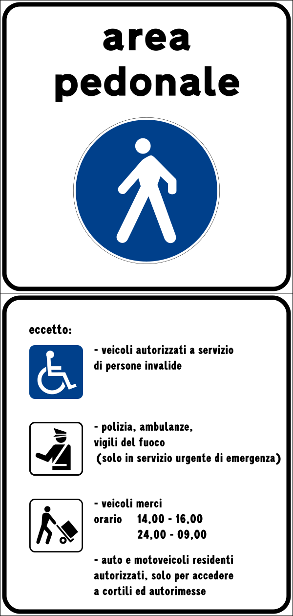
9. Start of a zone for pedestrians
This traffic sign indicates the start of a pedestrian zone. Pedestrians are the principal road users within the zone, while access by vehicles and other road users is subject to the applicable traffic signs and local rules.
English • Traffic sign II.320 • Pedestrian area. Marks the beginning of an area closed to vehicle traffic. Any exemptions, restrictions and exceptions are specified on the supplementary plate and must be read with the sign.
Italiano • Figura II.320 • Area pedonale. Indica l’inizio di una zona interdetta alla circolazione dei veicoli. Eventuali deroghe, limitazioni ed eccezioni sono precisate dal pannello integrativo e vanno lette insieme al segnale.
Sources
🔗 Commons.wikimedia.org
🔗 Normattiva.it • D.P.R. 495/1992 • testo vigente • art. 135, comma 13
🔗 Normattiva.it • Allegati ufficiali aggiornati • Figura II.320
Image via Commons.wikimedia.org
Official design: Ministero dei Lavori Pubblici; vectorisation: Arbalete; incorporated elements by Pav03, Gigillo83 and Earthshaker13 • CC BY-SA 4.0 • Source revision 2024-09-15. Wikimedia original unmodified.
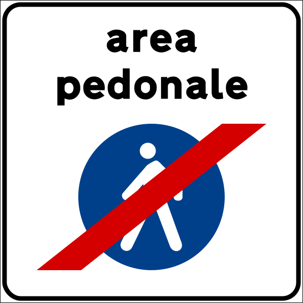
10. End of the zone for pedestrians
This traffic sign indicates the end of the pedestrian zone. The special traffic rules associated with the pedestrian zone end at this point. Follow the traffic signs and rules that apply beyond the zone.
English • Traffic sign II.321 • End of pedestrian area. Marks the exit from the previously signposted pedestrian area.
Italiano • Figura II.321 • Fine area pedonale. Indica l’uscita dall’area pedonale precedentemente segnalata.
Sources
🔗 Commons.wikimedia.org
🔗 Normattiva.it • D.P.R. 495/1992 • testo vigente • art. 135, comma 13
🔗 Normattiva.it • Allegati ufficiali aggiornati • Figura II.321
Image via Commons.wikimedia.org
Official design: Ministero dei Lavori Pubblici; vectorisation: Arbalete; incorporated elements by Pav03 • CC BY-SA 4.0 • Source revision 2024-09-15. Wikimedia original unmodified.
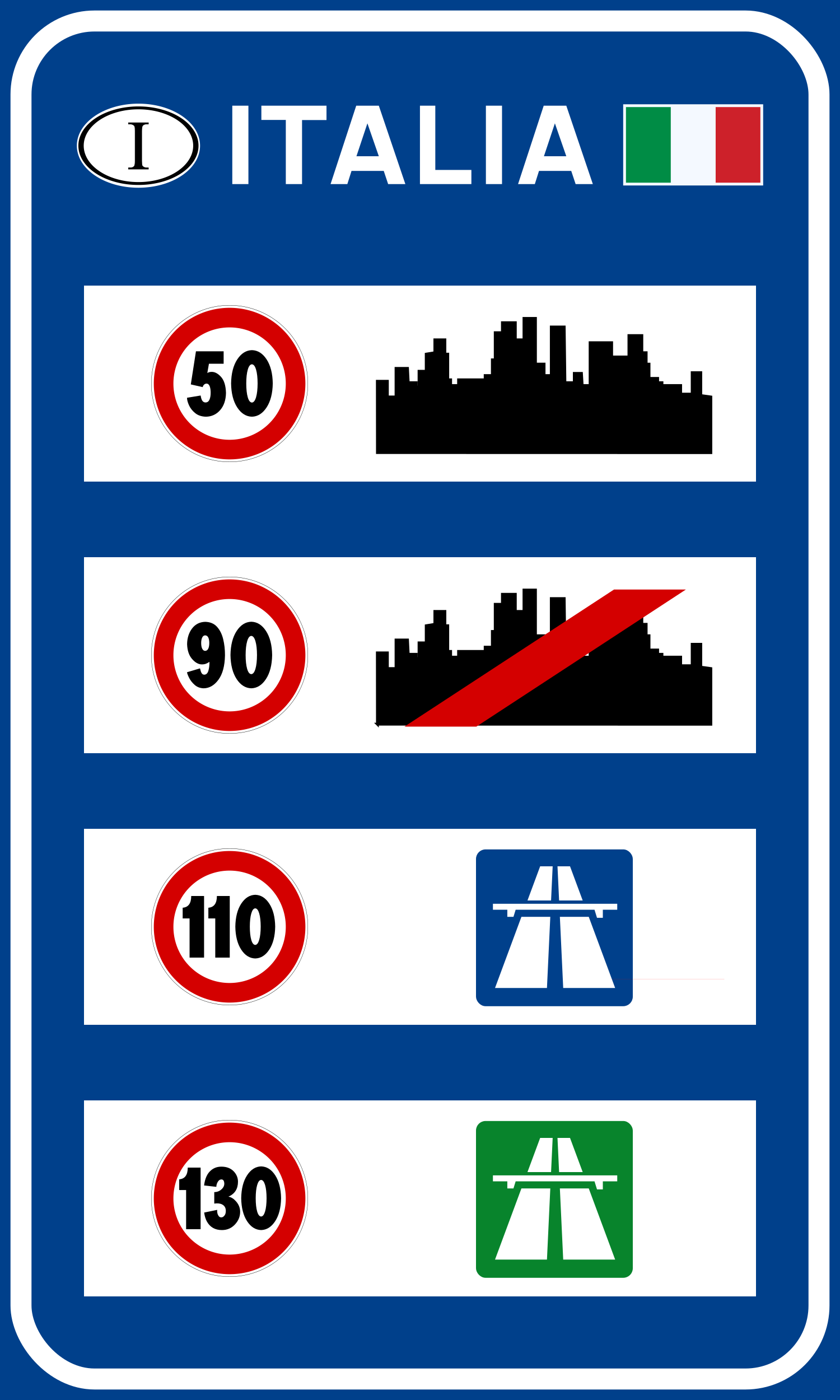
11. National speed limits
This traffic sign indicates the national speed limits. The applicable default maximum speeds depend on the road type, vehicle category and local traffic rules when no different speed limit is indicated.
English • Traffic sign II.352 • General speed limits. Shows Italy's general speed limits in this order: built-up areas, roads outside built-up areas, principal extra-urban roads and motorways. The sign does not override any lower applicable limits.
Italiano • Figura II.352 • Limiti di velocità generali. Riporta i limiti generali di velocità in Italia, nell’ordine: centri abitati, strade fuori dei centri abitati, strade extraurbane principali e autostrade. Il cartello non sostituisce gli eventuali limiti inferiori applicabili.
Sources
🔗 Commons.wikimedia.org (Gigillo83 • CC BY-SA 3.0)
🔗 Normattiva.it • D.P.R. 495/1992 • testo vigente • art. 135, comma 27
🔗 Gazzettaufficiale.it • Gazzetta Ufficiale • Figura II.352 • pagina 323
SVG source: Gigillo83 • CC BY-SA 3.0 • Original revision 2025-09-29. Wikimedia original unmodified.
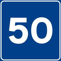
12. Advisory speed limit
This traffic sign indicates an advisory speed. The displayed value recommends an appropriate speed for the road or conditions ahead. Its legal effect depends on the applicable local rules.
English • Traffic sign II.312 • Recommended speed. Shows the speed drivers are advised not to exceed in ideal traffic and weather conditions.
Italiano • Figura II.312 • Velocità consigliata. Indica la velocità che si consiglia di non superare in condizioni ottimali di traffico e meteorologiche.
Sources
🔗 Commons.wikimedia.org
🔗 Normattiva.it • D.P.R. 495/1992 • testo vigente • art. 135, comma 8
🔗 Gazzettaufficiale.it • Gazzetta Ufficiale • Figura II.312 • pagina 313
SVG source: F l a n k e r • Public domain • Original revision 2023-02-12. Wikimedia original unmodified.
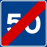
13. End of the advisory speed limit
This traffic sign indicates the end of the advisory speed. The preceding speed recommendation ends at this point. Continue according to the applicable speed limits and road conditions.
English • Traffic sign II.313 • End of recommended speed. Marks the end of the section to which the recommended speed applied.
Italiano • Figura II.313 • Fine velocità consigliata. Indica il termine del tratto al quale si riferiva la velocità consigliata.
Sources
🔗 Commons.wikimedia.org
🔗 Normattiva.it • D.P.R. 495/1992 • testo vigente • art. 135, comma 8
🔗 Gazzettaufficiale.it • Gazzetta Ufficiale • Figura II.313 • pagina 313
Image via Commons.wikimedia.org
F l a n k e r • Public domain • Source revision 2023-02-12. Wikimedia original unmodified.
14. Start of a tunnel
This traffic sign indicates the start of a tunnel. Special traffic rules may apply within the tunnel, including requirements concerning vehicle lighting, speed or following distance. Follow the applicable signs and local rules.
English • Traffic sign II.316 • Tunnel. Marks the entrance to a natural or artificial tunnel. Reminds drivers that dipped headlights are compulsory and stopping, parking and U-turns are prohibited. If stopped by traffic, switch off the engine.
Italiano • Figura II.316 • Galleria. Indica l’inizio di una galleria naturale o artificiale. Ricorda l’obbligo delle luci anabbaglianti e il divieto di fermata, sosta e inversione di marcia. In caso di arresto dovuto al traffico occorre spegnere il motore.
Sources
🔗 Commons.wikimedia.org
🔗 Normattiva.it • D.P.R. 495/1992 • testo vigente • art. 135, comma 10
🔗 Gazzettaufficiale.it • Gazzetta Ufficiale • Figura II.316 • pagina 314
SVG source: F l a n k e r • Public domain • Original revision 2023-11-30. Wikimedia original unmodified.
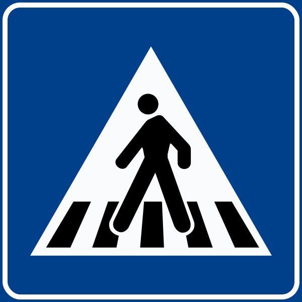
15. Crossing for pedestrians
This traffic sign indicates a crossing for pedestrians. It marks a designated place where pedestrians cross the road. Priority and crossing rules depend on the applicable traffic signs, signals and local regulations.
English • Traffic sign II.303 • Pedestrian crossing. Marks a crossing without traffic signals and away from junctions.
Italiano • Figura II.303 • Attraversamento pedonale. Localizza un attraversamento pedonale non regolato da semaforo e non in corrispondenza di intersezioni.
Sources
🔗 Commons.wikimedia.org
🔗 Normattiva.it • D.P.R. 495/1992 • testo vigente • art. 135, comma 3
🔗 Gazzettaufficiale.it • Gazzetta Ufficiale • Figura II.303 • pagina 311
SVG source: F l a n k e r • Public domain • Original revision 2025-02-23. Wikimedia original unmodified.
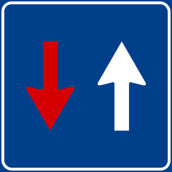
16. Road narrowing, oncoming drivers have to give way
This traffic sign indicates a road narrowing where oncoming drivers have to give way.
English • Traffic sign II.45 • Priority where traffic takes turns through a narrow section. Indicates priority over oncoming vehicles.
Italiano • Figura II.45 • Diritto di precedenza nei sensi unici alternati. In una strettoia regolata a senso unico alternato, indica la precedenza di passaggio sui veicoli provenienti nel senso opposto.
Sources
🔗 Commons.wikimedia.org (F l a n k e r • CC BY-SA 3.0)
🔗 Normattiva.it • D.P.R. 495/1992 • testo vigente • art. 114, comma 1
🔗 Gazzettaufficiale.it • Gazzetta Ufficiale • Figura II.45 • pagina 258
SVG source: F l a n k e r • CC BY-SA 3.0 • Original revision 2023-12-07. Wikimedia original unmodified.
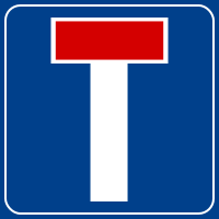
17. Dead end street
This traffic sign indicates a dead end street. The road has no through route for vehicles, although access to properties or other destinations along the road may still be possible.
English • Traffic sign II.309 • Dead-end road. At the start of the road, indicates that it has no exit for vehicles.
Italiano • Figura II.309 • Strada senza uscita. All’inizio della strada indica che essa è senza uscita per i veicoli.
Sources
🔗 Commons.wikimedia.org
🔗 Normattiva.it • D.P.R. 495/1992 • testo vigente • art. 135, comma 7
🔗 Gazzettaufficiale.it • Gazzetta Ufficiale • Figura II.309 • pagina 312
Image via Commons.wikimedia.org
F l a n k e r • Public domain • Source revision 2014-03-28. Wikimedia original unmodified.
18. Road with one-way traffic
This traffic sign indicates a road with one-way traffic. Vehicular traffic may travel only in the permitted direction, subject to any exceptions indicated by traffic signs or local rules.
English • Traffic sign II.349 • One-way road ahead. Indicates that the road is one-way and drivers may use its full width in the indicated direction.
Italiano • Figura II.349 • Senso unico frontale. Indica che la strada è a senso unico e che i conducenti possono utilizzarne l’intera larghezza nel senso indicato.
Sources
🔗 Commons.wikimedia.org
🔗 Normattiva.it • D.P.R. 495/1992 • testo vigente • art. 135, comma 25
🔗 Gazzettaufficiale.it • Gazzetta Ufficiale • Figura II.349 • pagina 322
SVG source: F l a n k e r • Public domain • Original revision 2022-09-21. Wikimedia original unmodified.
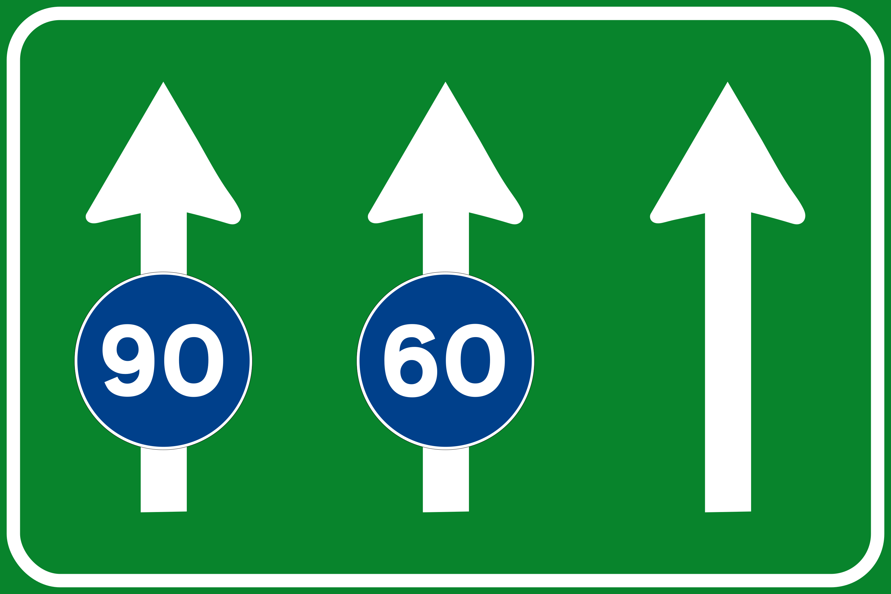
19. Minimum speed of a lane
This traffic sign indicates the minimum speed for the indicated lane. Vehicles using that lane must comply with the displayed minimum speed according to the applicable traffic rules.
English • Traffic sign II.338 • Lane use. Shows compulsory minimum speeds for individual lanes. Vehicles unable to reach the indicated speed must use a lane further to the right.
Italiano • Figura II.338 • Uso corsie. Indica le velocità minime obbligatorie sulle singole corsie. I veicoli che non possono raggiungere il valore indicato devono usare una corsia più a destra.
Sources
🔗 Commons.wikimedia.org (Gigillo83 • CC BY-SA 3.0)
🔗 Normattiva.it • D.P.R. 495/1992 • testo vigente • art. 135, comma 19
🔗 Gazzettaufficiale.it • Gazzetta Ufficiale • Figura II.338 • pagina 320
SVG source: Gigillo83 • CC BY-SA 3.0 • Original revision 2023-06-17. Wikimedia original unmodified.
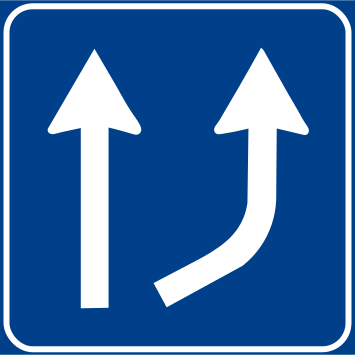
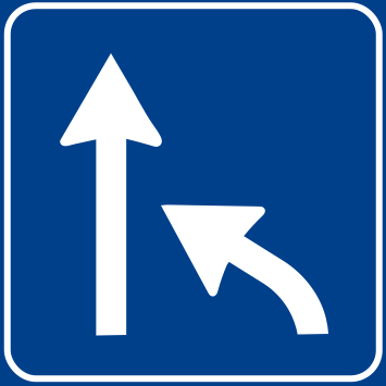
20. Start of a new lane
This traffic sign indicates the start of a new traffic lane. The displayed road layout shows where the additional lane begins and how the traffic lanes continue.
English • Traffic sign II.342 • Increase in available lanes. Shows an increase from one to two lanes in the direction of travel.
Italiano • Figura II.342 • Variazione corsie disponibili — aumento. Indica l’aumento da una a due corsie disponibili nel senso di marcia.
Sources
🔗 Commons.wikimedia.org
🔗 Normattiva.it • D.P.R. 495/1992 • testo vigente • art. 135, comma 20
🔗 Gazzettaufficiale.it • Gazzetta Ufficiale • Figura II.342 • pagina 321
SVG source: Greenyellowcable • Public domain • Original revision 2022-09-11. Wikimedia original unmodified.
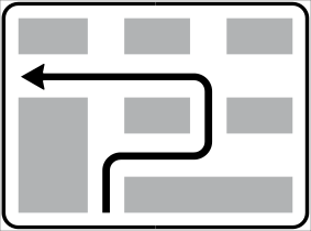
21. Route to be followed in order to turn left
This traffic sign indicates the route to use for a left turn. Follow the indicated route instead of turning left directly at this point.
English • Traffic sign II.325 • Indirect left turn. Warns that an alternative manoeuvre is compulsory where a direct left turn at the next junction is not permitted. Follow the route shown.
Italiano • Figura II.325 • Svolta a sinistra semidiretta. Preavvisa l’obbligo di una manovra alternativa per svoltare a sinistra quando la svolta diretta all’intersezione successiva non è consentita. Si segue il percorso rappresentato.
Sources
🔗 Commons.wikimedia.org (Gigillo83 • CC BY-SA 3.0)
🔗 Normattiva.it • D.P.R. 495/1992 • testo vigente • art. 135, comma 16
🔗 Gazzettaufficiale.it • Gazzetta Ufficiale • Figura II.325 • pagina 317
SVG source: Gigillo83 • CC BY-SA 3.0 • Original revision 2011-09-27. Wikimedia original unmodified.
Current figure reference verified in Normattiva.it • Normattiva, current article 135.
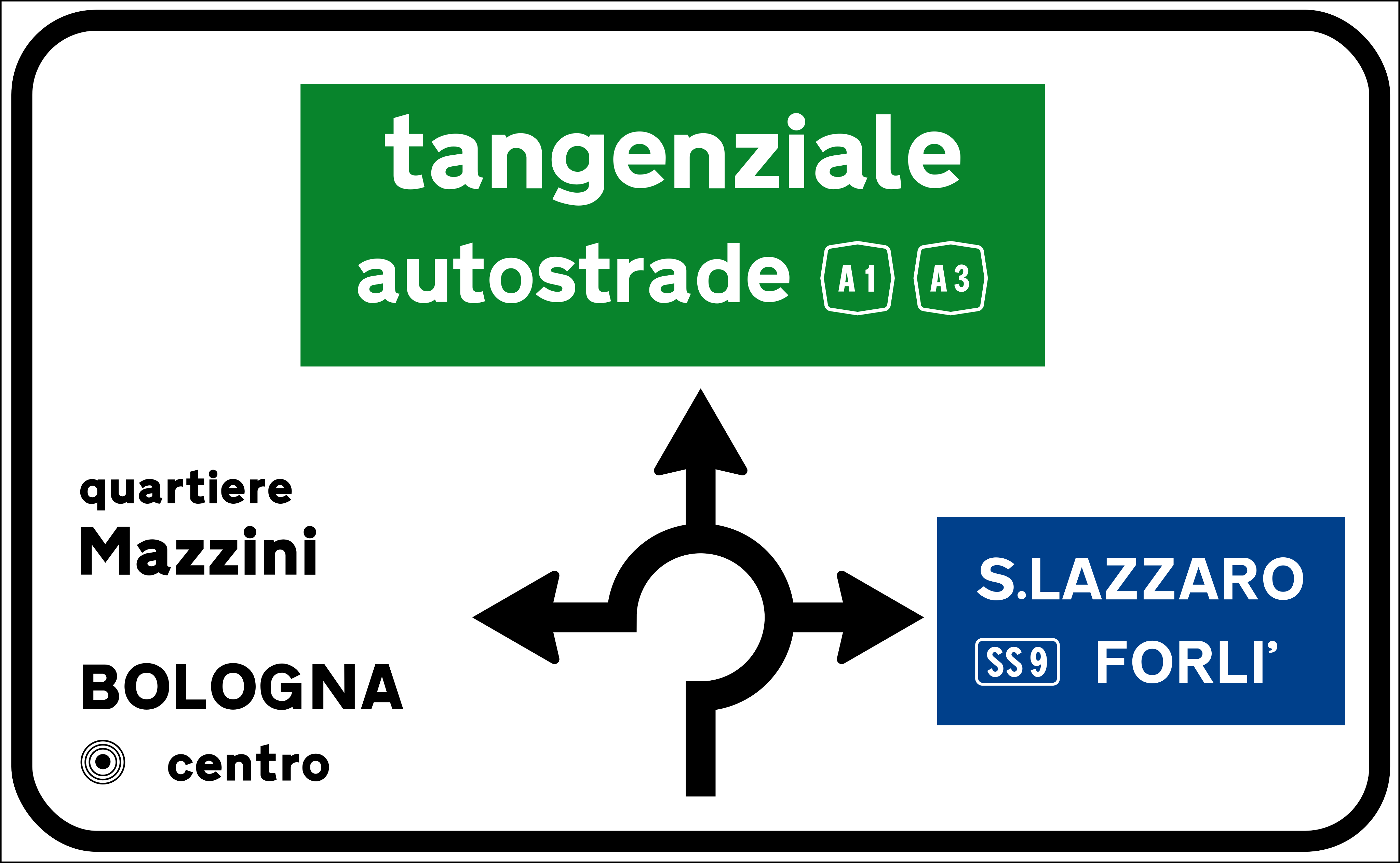
22. Information about the directions of the roundabout
This traffic sign gives information about directions at a roundabout. The diagram shows the available exits and the destinations reached from them.
English • Advance junction sign — article 127 • Advance roundabout junction sign. Shows the roundabout layout and destinations reachable from its branches. The panels and lettering identify the destinations and associated roads.
Italiano • Preavviso di intersezione — art. 127 • Preavviso di intersezione con circolazione rotatoria. Rappresenta l’intersezione con circolazione rotatoria e le destinazioni raggiungibili dai vari rami. I riquadri e le iscrizioni indicano le destinazioni e le relative strade.
Sources
🔗 Commons.wikimedia.org
🔗 Normattiva.it • D.P.R. 495/1992 • testo vigente • art. 127, comma 2, 6, 13
Image via Commons.wikimedia.org
Original: Ministero dei Lavori Pubblici Vectorization: Arbalete • CC BY-SA 4.0 • Source revision 2023-06-01. Wikimedia original unmodified.
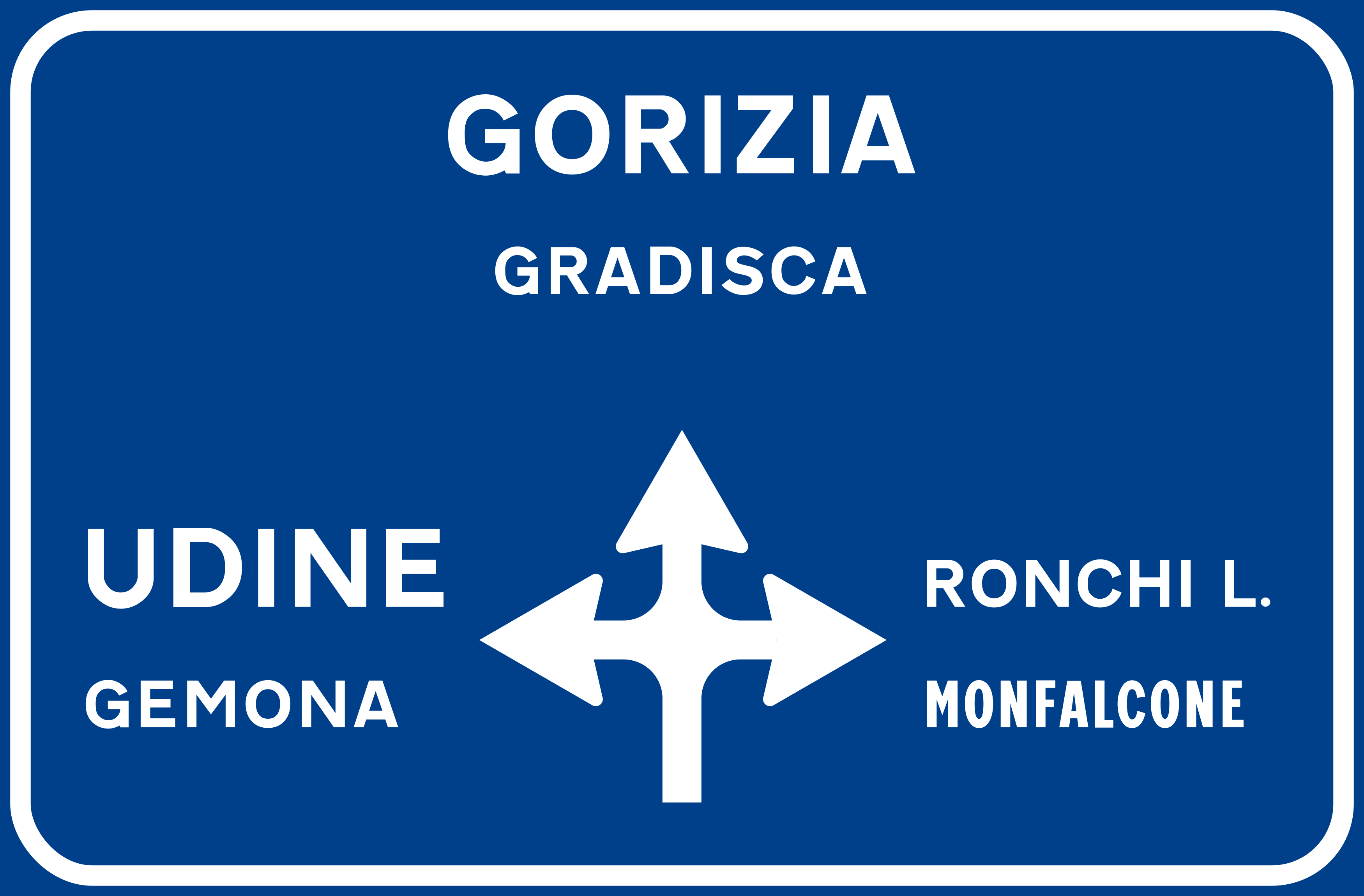
23. Junction layout, directions and destinations
This traffic sign shows the junction layout, directions and destinations. The diagram shows how the roads are arranged and which direction leads to each indicated destination or route.
English • Traffic sign II.234 • Advance junction sign outside built-up areas. Shows the junction layout and the places reachable via its branches.
Italiano • Figura II.234 • Preavviso di intersezione extraurbana. Preavvisa la configurazione dell’intersezione e indica le località raggiungibili attraverso i diversi rami.
Sources
🔗 Commons.wikimedia.org
🔗 Normattiva.it • D.P.R. 495/1992 • testo vigente • art. 127, comma 2
🔗 Gazzettaufficiale.it • Gazzetta Ufficiale • Figura II.234 • pagina 292
SVG source: Original: Ministero dei Lavori Pubblici Vectorization: Arbalete • Public domain • Original revision 2024-05-14. Wikimedia original unmodified.
Current figure reference verified in Normattiva.it • Normattiva, current article 127.
24. End of a lane
This traffic sign indicates the end of a lane. The displayed lane arrangement shows which lane ends and how the remaining traffic lanes continue.
English • Traffic sign II.341 • Reduction in available lanes. Shows a reduction from two lanes to one in the direction of travel.
Italiano • Figura II.341 • Variazione corsie disponibili — riduzione. Indica la riduzione da due a una corsia disponibile nel senso di marcia.
Sources
🔗 Commons.wikimedia.org
🔗 Normattiva.it • D.P.R. 495/1992 • testo vigente • art. 135, comma 20
🔗 Gazzettaufficiale.it • Gazzetta Ufficiale • Figura II.341 • pagina 321
SVG source: Greenyellowcable • Public domain • Original revision 2022-08-28. Wikimedia original unmodified.
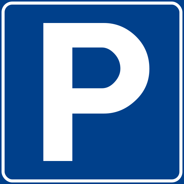
25. Parking allowed
This traffic sign indicates that parking is allowed. Vehicles may be parked in the area covered by the sign subject to any indicated conditions, restrictions or local parking rules.
English • Traffic sign II.76 • Car park. Marks an organised or equipped parking area with no time limit unless otherwise indicated. Plates may specify times, charges, vehicle positioning and permitted or excluded categories.
Italiano • Figura II.76 • Parcheggio. Indica un’area organizzata o attrezzata per la sosta, senza limite di tempo salvo diversa indicazione. I pannelli possono stabilire tempi, tariffe, disposizione dei veicoli e categorie ammesse o escluse.
Sources
🔗 Commons.wikimedia.org
🔗 Normattiva.it • D.P.R. 495/1992 • testo vigente • art. 120, comma 1(c)
🔗 Gazzettaufficiale.it • Gazzetta Ufficiale • Figura II.76 • pagina 267
SVG source: Original: Ministero dei Lavori Pubblici Vectorization: Arbalete • Public domain • Original revision 2024-07-13. Wikimedia original unmodified.
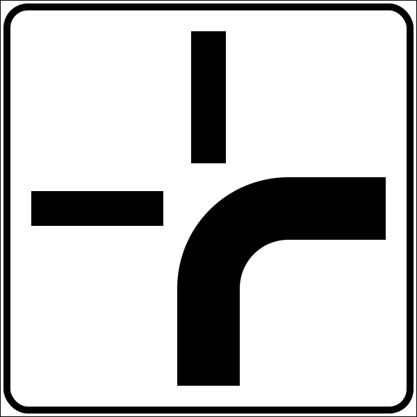
26. Crossroad shape
This traffic sign shows the shape or layout of an upcoming junction. The diagram indicates how the approaching road and connecting roads are arranged.
English • Model II.7 • Course of the priority road. The thicker line represents the road with priority over the narrower branches. Read the plate together with the priority sign. The plate supplements the main sign and must be read together with it.
Italiano • Modello II.7 • Andamento della strada principale. La striscia più larga rappresenta la strada che gode della precedenza rispetto ai rami più stretti. Il pannello va interpretato insieme al segnale di precedenza. Il pannello integra il segnale principale e deve essere interpretato insieme a esso.
Sources
🔗 Commons.wikimedia.org
🔗 Normattiva.it • D.P.R. 495/1992 • testo vigente • art. 83, comma 11
🔗 Gazzettaufficiale.it • Gazzetta Ufficiale • Modello II.7 • pagina 243
SVG source: Original: Ministero dei Lavori Pubblici Vectorization: Arbalete • Public domain • Original revision 2024-07-12. Wikimedia original unmodified.
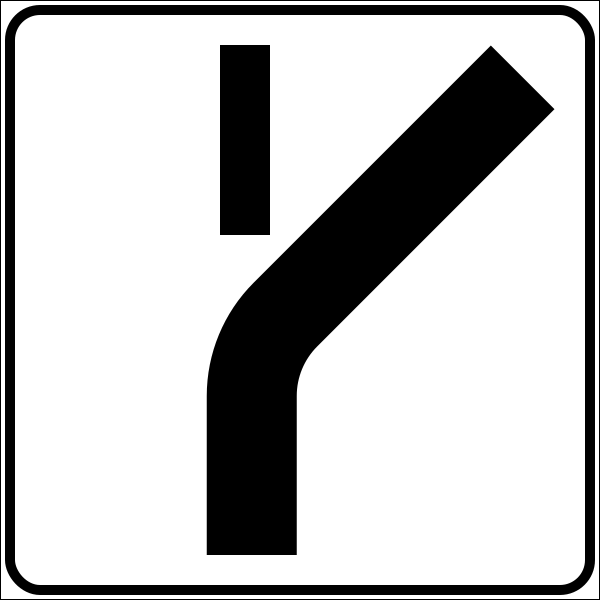
27. Crossroad shape
This traffic sign shows the shape or layout of an upcoming junction. The diagram indicates how the approaching road and connecting roads are arranged.
English • Model II.7 • Course of the priority road. The thicker line represents the road with priority over the narrower branches. Read the plate together with the priority sign. The plate supplements the main sign and must be read together with it.
Italiano • Modello II.7 • Andamento della strada principale. La striscia più larga rappresenta la strada che gode della precedenza rispetto ai rami più stretti. Il pannello va interpretato insieme al segnale di precedenza. Il pannello integra il segnale principale e deve essere interpretato insieme a esso.
Sources
🔗 Commons.wikimedia.org
🔗 Normattiva.it • D.P.R. 495/1992 • testo vigente • art. 83, comma 11
🔗 Gazzettaufficiale.it • Gazzetta Ufficiale • Modello II.7 • pagina 243
SVG source: Original: Ministero dei Lavori Pubblici Vectorization: Arbalete • Public domain • Original revision 2024-07-12. Wikimedia original unmodified.
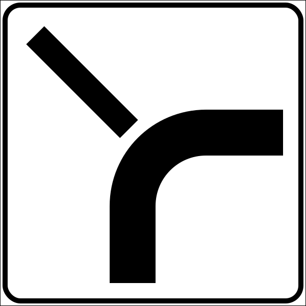
28. Crossroad shape
This traffic sign shows the shape or layout of an upcoming junction. The diagram indicates how the approaching road and connecting roads are arranged.
English • Model II.7 • Course of the priority road. The thicker line represents the road with priority over the narrower branches. Read the plate together with the priority sign. The plate supplements the main sign and must be read together with it.
Italiano • Modello II.7 • Andamento della strada principale. La striscia più larga rappresenta la strada che gode della precedenza rispetto ai rami più stretti. Il pannello va interpretato insieme al segnale di precedenza. Il pannello integra il segnale principale e deve essere interpretato insieme a esso.
Sources
🔗 Commons.wikimedia.org
🔗 Normattiva.it • D.P.R. 495/1992 • testo vigente • art. 83, comma 11
🔗 Gazzettaufficiale.it • Gazzetta Ufficiale • Modello II.7 • pagina 243
SVG source: Original: Ministero dei Lavori Pubblici Vectorization: Arbalete • Public domain • Original revision 2024-07-12. Wikimedia original unmodified.
