loading

Book

This informative book is designed for students who want to pass the quiz with confidence. Packed with clear explanations and visual examples, it keeps you engaged while helping you learn faster and succeed.


1 National speed 2 Motorway 3 Residential area 4 Built-up area 5 Speed limit 6 Footpath 7 Bike path 8 Shared-use path 9 Pedestrian zone 10 Customs 11 One-way traffic 12 Quay 13 Slope 14 Bus lane 15 Bus stop 16 Dead end 17 Stop sign 18 Give way 19 Roundabout 20 Road narrowing 21 Pedestrian crossing 22 Railroad crossing 23 Mandatory direction 24 Overtaking 25 Crossing animals 26 Rockfall 27 Curve 28 Chevron 29 Wrong-way driving 30 Roadworks 31 Height limit 32 Weight limit 33 Traffic lights 34 Pedestrian lights 35 Roadmarks 36 Driving license 37 Location marker 38 Traffic mirror 39 Emergency telephone 40 International border 41 Cycling route 42 No parking 43 No vehicles 44 Disabled parking 45 Traffic management 46 Road surface 47 Tourist attraction 48 Horn 49 License plate 50 Charging station 51 Dangers 52 Cyclist 53 Motorcycle 54 Bus 55 Police 56 Ambulance 57 Fire truck 58 European emission standard 59 Public transport 60 Track 61 Motorcycle equipment 62 Spare tire 63 Mirror 64 Helmet 65 Rush hour 66 Tram stop 67 Train station 68 Interchange 69 Particulates 70 Air pollution 71 Pothole 72 Airbag 73 Lane splitting 74 Forestry vehicle 75 Construction vehicle 76 Semi-trailer truck 77 Trolleybus 78 Speedpedelec 79 Delivery vehicle 80 Idling 81 Tow truck 82 Four-wheel drive 83 Road users 84 Passenger 85 Bicycle 86 Tow hitch 87 Emergency vehicle 88 Agricultural machinery 89 Electric bicycle 90 Electric vehicle 91 Pedelec 92 Quadricycle 93 Microcar 94 All-terrain vehicle 95 Van 96 Recreational vehicle 97 Scooter 98 Trikke 99 Skateboard 100 Segway ...

1. National speed

National speed limits are the default maximum speeds set by law for different types of roads when no specific speed limit signs are present. They vary depending on the road type, vehicle category, and country, and drivers must know and apply them automatically.

  • Speed must always be adapted to conditions (weather, traffic, visibility).
  • Lower limits may apply for specific vehicles (e.g. trucks).

A sign indicating the general speed limits of Italy. (South Tyrol, Italy) © Wikimedia.org/PantheraLeo1359531, CC BY-SA

2. Motorway

A motorway is a high-speed road designed for long-distance travel, with controlled access and no intersections or pedestrian traffic.

  • High speed limits (often 100–130 km/h or 60–80 mph).
  • Multiple lanes in each direction.
  • No traffic lights or stop signs.
  • No pedestrians, bicycles, or slow vehicles allowed.
  • Entry and exit only through on-ramps and off-ramps.
  • Often separated by a barrier or median.
  • Different Names in Different Places:
    • Motorway – UK, Ireland, parts of Europe.
    • Freeway – USA (West Coast), Australia.
    • Expressway – Canada, some parts of Asia.
    • Interstate – USA (Interstate Highway System).
    • Autobahn – Germany (some sections have no speed limit).

3. Residential area

A residential area is a part of a town or city where people live. It’s mostly made up of homes, apartments, and housing complexes, rather than businesses or factories. These areas are designed for safety and quiet living. Speeding or reckless driving here is especially dangerous and often carries higher penalties.

  • Lower speed limits (often 20–40 km/h or 15–25 mph).
  • Be alert for:
    • Kids running into the street.
    • People crossing the road.
    • Parked cars reducing visibility.

© Wikimedia.org/Arbalete, CC BY-SA

4. Built-up area

A built-up area is a place where there are lots of buildings, people, and activity — basically, any area that looks and feels like a town or city.

  • Lower speed limits usually apply (e.g. 30–50 km/h or 20–30 mph).
  • You’ll see more pedestrians, cyclists, and parked cars.
  • Need to be extra careful at crossings, junctions, and near schools.

Begin of a built-up area. (Uetliburg, municipality of Gommiswald, Switzerland) © Wikimedia.org/Dietrich Michael Weidmann, CC BY-SA

5. Speed limit

A speed limit is the maximum speed you are legally allowed to drive on a road. It helps keep drivers, passengers, and pedestrians safe by reducing the risk of accidents. Always adjust your speed for weather, traffic, and road conditions — even if you're below the speed limit!

  • Helps prevent accidents.
  • Gives drivers more time to react.
  • Keeps traffic flowing smoothly.
  • Protects people in areas like school zones or construction sites.

6. Footpath

A footpath (or sidewalk) is a designated path for pedestrians, usually alongside a road. Traffic rules for footpaths ensure the safety of pedestrians and maintain order in urban areas.

  • No driving or parking on footpaths – Vehicles are not allowed to obstruct pedestrian paths.
  • No riding bicycles or motorcycles (unless marked as a shared path).
  • Give way to pedestrians at crossings – Always stop or slow down near footpath exits.
  • Use the footpath only for walking – Do not walk on the road unless necessary.
  • Keep to the left/right (depending on local rules) to allow smooth pedestrian flow.
  • Do not block the path – Avoid standing in groups that obstruct others.

A path for pedestrians. Cyclists prohibited. (Venice, Italy) © Wikimedia.org/Falk2, CC BY-SA

7. Bike path

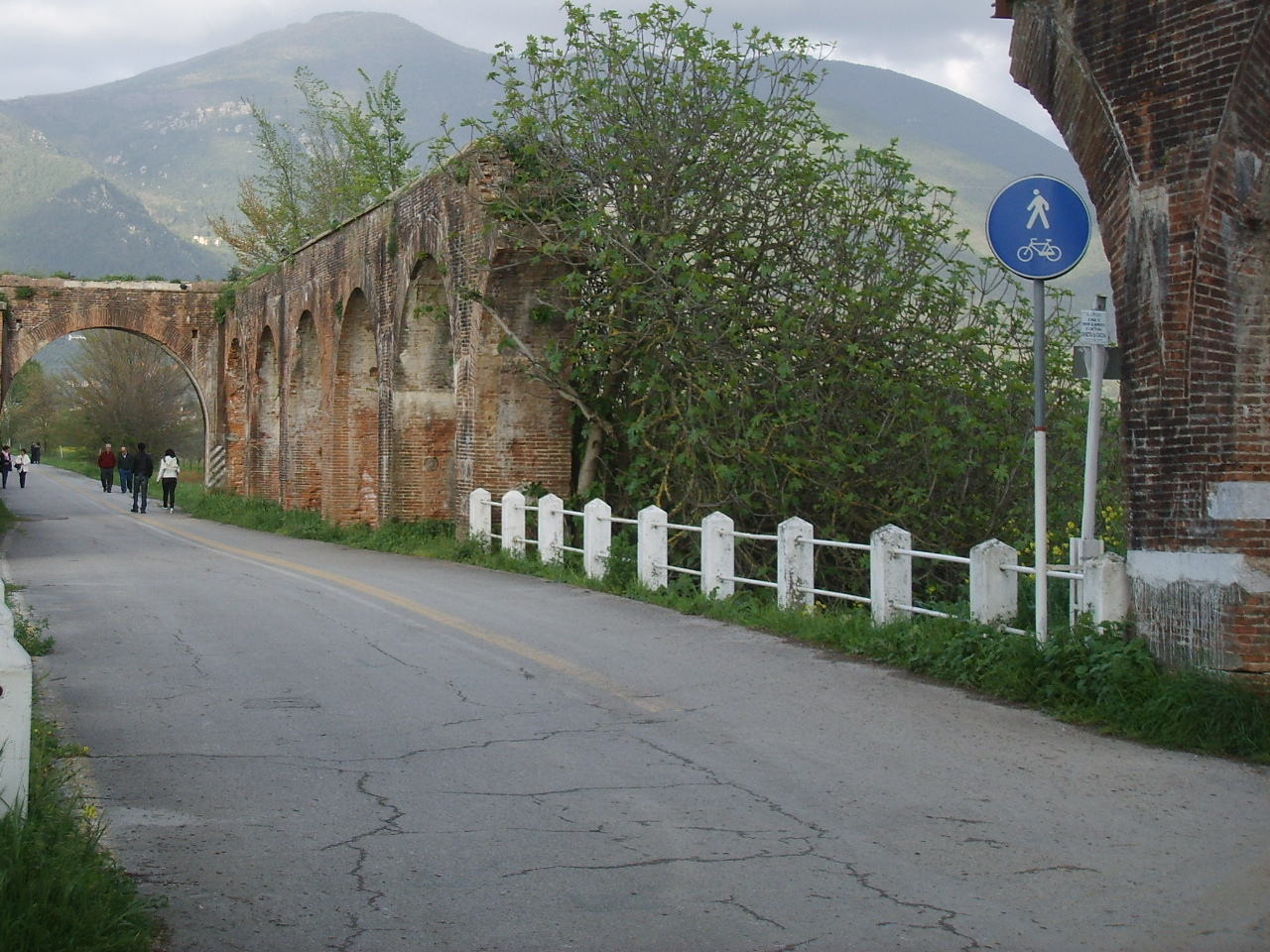
A bike path (also called a cycling path or bike lane) is a designated pathway for bicycles, separate from motor vehicle traffic. It provides a safe and dedicated space for cyclists, reducing the risk of accidents with cars and pedestrians. Bike paths promote safe, eco-friendly transport and reduce traffic congestion!

  • Rules for cyclists:
    • Ride in the correct direction (following traffic flow).
    • Yield to pedestrians on shared paths.
    • Follow traffic signals and signs.
    • No reckless riding (e.g., speeding, sudden turns).
  • Rules for pedestrians:
    • Stay off dedicated bike lanes unless marked as a shared path.
    • Cross bike lanes carefully at intersections.
  • Rules for motorists:
    • Do not park or drive in bike lanes.
    • Yield to cyclists at crossings.

Seperated path for pedestrians and cyclists. (Ferrara, Italy) © Wikimedia.org/Alain Rouiller, CC BY-SA

8. Shared-use path

A shared-use path, mixed-use path or multi-use pathway is a path which is 'designed to accommodate the movement of pedestrians and cyclists'. Examples of shared-use paths include sidewalks designated as shared-use, bridleways and rail trails. A shared-use path typically has a surface that is asphalt, concrete or firmly packed crushed aggregate. Shared-use paths differ from cycle tracks and cycle paths in that shared-use paths are designed to include pedestrians even if the primary anticipated users are cyclists.

  • Physically separated from roads (unlike bike lanes).
  • Wide enough to accommodate multiple users safely.
  • Marked with signs & pavement symbols to guide different users.
  • Smooth surfaces for easy mobility (asphalt, concrete, or packed gravel).
  • Used for recreation & transportation in parks, greenways, and urban areas.
  • Cyclists give way to pedestrians and announce when passing.
  • No blocking the path – Keep moving or step aside.

© Wikimedia.org/sailko, CC BY-SA

9. Pedestrian zone

A pedestrian zone is an area where only people on foot are allowed — no cars, motorcycles, or other vehicles (unless specifically permitted, like for deliveries at certain times). It’s a space in a city or town meant to be safe and comfortable for walking, shopping, or relaxing — with no regular vehicle traffic.

  • No entry for cars or motorcycles.
  • Cyclists may be allowed, depending on local rules (often at walking speed).
  • Sometimes delivery vehicles are allowed during specific hours.
  • Often found in: city centers, shopping streets, tourist areas and near schools or parks.

© Wikimedia.org/Alain Rouiller, CC BY-SA

10. Customs

Road customs (or border customs checkpoints) are official inspection points where vehicles, goods, and passengers cross international borders. Customs officers check documents, collect taxes/duties, and enforce laws to regulate trade and security.

  • Stop at the customs station when crossing a border.
  • Show documents (passport, vehicle registration, import/export papers).
  • Declare goods (items brought across the border).
  • Inspection – Officers may check vehicles and goods for illegal or restricted items.
  • Pay customs duties/taxes (if required).
  • Get clearance and continue your journey.
  • Common Customs Checks:
    • Vehicle Documents – Registration, insurance, and permits.
    • Personal Documents – Passport, visa, driver’s license.
    • Goods & Cargo – Items must be declared and checked.
    • Illegal Substances – Drugs, weapons, or restricted goods are confiscated.

Douane vehicle with text 'Guardia di Finanza' which means financial police. (Rome, Italy) © Wikimedia.org, CC0

11. One-way traffic

One-way traffic is traffic that moves in a single direction. A one-way street is a street either facilitating only one-way traffic, or designed to direct vehicles to move in one direction. One-way streets typically result in higher traffic flow as drivers may avoid encountering oncoming traffic or turns through oncoming traffic.

  • Directional Flow - Vehicles can only travel in a single direction.
  • Road Signs and Markings - One-way signs (usually with an arrow) are posted to indicate the direction of traffic flow.
  • Traffic Regulations - Drivers must follow the direction indicated and are prohibited from driving against the flow of traffic.
  • Intersection Rules - At intersections, traffic signals or signs will also indicate whether you can enter a one-way street from another direction.
  • Parking - Be aware of one-way parking rules on these roads, as parking may only be allowed in certain directions.
  • No U-turns - U-turns are usually prohibited on one-way streets.
  • Be Cautious at Intersections - Ensure you don’t mistakenly enter a one-way street from the wrong direction.

12. Quay

A quay warning is a sign used near quays or docking areas to warn people of potential hazards related to the waterfront, docking operations, or ship movements. These signs are typically placed to ensure the safety of pedestrians, workers, and vessels around the quay area.

  • Safety Alerts - They inform individuals about specific risks, such as slippery surfaces, moving ships, or high tides.
  • Hazard Identification - Some signs may alert people to low visibility conditions, fast currents, or unprotected edges.
  • Visibility - Provides clear and visible alerts to make individuals aware of hazards around the quay, docks, or waterfront.

© Wikimedia.org/CaSclafani, CC0

13. Slope

A slope refers to the incline or decline of a surface, such as a road, hill, or pathway. It shows the steepness of the ground. Driving on slopes requires special attention to ensure safety for both the vehicle and the driver. Here’s how to handle uphill and downhill driving:

  • Driving Uphill (Incline):
    • Shift to a Lower Gear - If driving a manual vehicle, shift to a lower gear (e.g., 2nd or 3rd gear) to ensure the car has enough power to move up.
    • Maintain Steady Speed - Keep a consistent speed. Don’t over-rev the engine, but don’t let the vehicle slow down too much.
  • Driving Downhill (Decline):
    • Use Lower Gears - Always use a lower gear when driving downhill (in manual transmission vehicles) to reduce speed. This lets the engine help slow the vehicle, rather than relying entirely on the brakes.
    • Avoid Excessive Braking - If you brake too hard or too often while going downhill, the brakes can overheat, leading to brake failure. Use engine braking to slow down instead.

© Wikimedia.org/Mateus2019, CC BY-SA

14. Bus lane

A bus lane is a designated lane on a road or street that is reserved specifically for buses. These lanes allow buses to travel more efficiently and avoid traffic congestion, helping them maintain schedules and provide faster public transport services. They are often located near bus stops to allow buses to pick up passengers without delaying traffic.

  • Exclusively for Buses - Bus lanes are typically marked with signs and road markings that indicate they are meant for buses only.
  • Reduces Traffic Congestion - By providing a dedicated lane for buses, these lanes help ensure that buses can avoid getting stuck in regular traffic.
  • Can Be Shared - In some cases, bus lanes may be shared with other types of vehicles during certain times (like taxis, bicycles, or private cars during off-peak hours), but they are mostly reserved for buses during peak times.
  • Clearly Marked - Bus lanes are often marked with special signs or road paint that indicate their purpose and hours of operation.

Lane movement information with lane for buses and taxis. (Milan, Italy) © Wikimedia.org/Arbalete, CC BY-SA

15. Bus stop

A bus stop is a designated location along a bus route where passengers can board or alight (get off) a bus. It is a stationary point marked by signs or shelters, typically located at intervals along the route, where people wait to catch the bus.

  • Signage - Bus stops are usually marked by signposts with the bus company’s logo, route number, and the name of the stop.
  • Shelter - Some bus stops have shelters or benches to provide passengers with comfort and protection from the weather while they wait.
  • Timetable Information - Many bus stops have timelines or information boards displaying bus schedules, routes, and other relevant information.
  • Accessibility - Bus stops are often designed to be accessible for people with disabilities, featuring low platforms or ramps for easy boarding.

A bus stop. (Rome, Italy) © Wikimedia.org/Nicholas_Gemini, CC BY-SA

16. Dead end

A dead end (also known as a cul-de-sac) is a street or road that has no exit or outlet at the end. It is a one-way road that leads to a closed area or a turn-around point, meaning vehicles cannot continue in the same direction and must turn around to exit.

  • No Through Traffic - Dead-end streets do not allow traffic to pass through to another road. The road ends at a point or a circular area where vehicles must turn back.
  • Turnaround Area - Many dead ends feature a cul-de-sac or turning circle, providing a space for vehicles to turn around easily.
  • Typically Residential - Dead ends are often found in residential neighborhoods, offering a quieter environment without through traffic.
  • Street Signage - A dead-end sign is often placed at the start of such streets to warn drivers that the road will not lead anywhere further.

A dead end. (Cadignano, Italy) © Wikimedia.org/Mateus2019, CC BY-SA

17. Stop sign

A stop sign is a traffic control sign that instructs drivers to come to a complete stop at an intersection or crosswalk, check for other vehicles or pedestrians, and proceed only when it is safe.

  • Shape - The stop sign is an octagon (eight-sided), making it easy to recognize.
  • Color - It is usually red with white lettering that says 'STOP'.
  • Placement - Stop signs are typically placed at intersections where traffic from different directions must yield or stop to avoid collisions.
  • Stop completely – Don’t just slow down; make a full stop.
  • Yield the right of way – Give priority to any vehicles or pedestrians with the right of way.
  • Look left, right, and left again – Ensure it’s safe to proceed.
  • Do not block the intersection – After stopping, ensure you don’t obstruct other vehicles from crossing.

18. Give way

"Give Way" means you must slow down or stop to let other road users go first before you proceed. It’s the same as “Yield” in some countries (like the U.S.). A Give Way Sign Looks Like: An inverted triangle. Usually red and white, with the words "Give Way" or "Yield"

  • Slow down as you approach.
  • Check for traffic from other directions.
  • Let other vehicles or pedestrians go first if they have priority.
  • Proceed only when it’s safe.

A give way sign at a roundabout. (Tirano, Italy) © Wikimedia.org/Lord_Koxinga, CC BY-SA

19. Roundabout

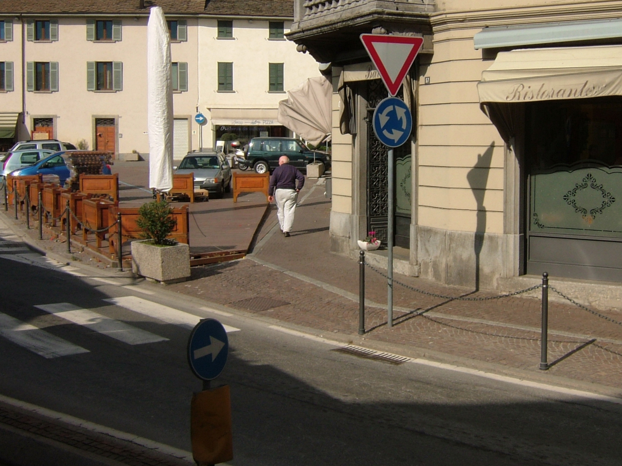
A roundabout is a circular intersection where traffic flows in one direction around a central island. Instead of traffic lights or stop signs, vehicles use yield rules to enter and exit the roundabout safely.

  • Approach slowly.
  • Yield to traffic already inside the roundabout.
  • Enter when it’s safe.
  • Signal before exiting at your desired turn-off.

20. Road narrowing

A road narrowing sign is a traffic sign that alerts drivers that the road ahead becomes narrower, either on one side or on both sides. This change can make passing more difficult and may require drivers to slow down, adjust their position on the road, or be prepared to yield in tight situations. Its purpose is to warn drivers early so they can approach the narrowing safely and avoid conflicts with oncoming traffic.

  • The available road width will decrease ahead.
  • Reduce speed and keep a safe distance from other vehicles.
  • Extra caution is needed, especially on narrow roads or in traffic.

21. Pedestrian crossing

A pedestrian crossing is a designated area on the road where pedestrians can safely cross from one side to the other. It is marked by road markings, signs, and sometimes traffic lights to give priority to pedestrians.

  • Road Markings - Typically, pedestrian crossings are marked with zebra stripes (black and white), which are visible on the road.
  • Traffic Signs - There may be a pedestrian crossing sign (usually a blue or triangular sign) indicating where pedestrians can cross.
  • Traffic Signals - In some locations, pedestrian crossings are controlled by traffic lights, which help manage when pedestrians can cross safely.
  • Location - Pedestrian crossings are often found at intersections, near schools, parks, bus stops, or other areas with high foot traffic.

© Wikimedia.org/Ulflulfl, CC BY-SA

22. Railroad crossing

A railroad crossing (also called a level crossing) is a place where a railway line and a road (or path) cross at the same level — meaning, there’s no bridge or tunnel, just a flat intersection.

  • Stop when lights flash or gates come down.
  • Never try to 'beat the train' — it's dangerous and often illegal.
  • Look both ways, even if you don’t hear or see a train.
  • Wait until gates are fully up and lights stop flashing before crossing.
  • Never stop on the tracks — always make sure there’s room on the other side before crossing.

23. Mandatory direction

A mandatory direction is a traffic rule or sign that tells drivers they must follow a specific direction — such as turning left, going straight, or following a designated route.

  • Usually blue circular signs with a white arrow or symbol.
  • The arrow shows the only allowed direction at that point.
  • Prevent dangerous turns or wrong-way driving.
  • Used at intersections, roundabouts, construction zones, or restricted areas.

Mandatory pass on the left side. (Italy) © Wikimedia.org/CAPTAIN RAJU, CC BY-SA

24. Overtaking

Overtaking is the action of passing another vehicle that is moving more slowly, so you can move ahead of it on the road. Overtaking is a very dangerous maneuver. Only overtake if there is enough space and if the road is completely free. When overtaking a pedestrian, cyclist or moped, there must be at least 1 meter distance. Overtaking is prohibited at crossroads, slopes, dangerous curves and crossings.

  • Check your mirrors and blind spots.
  • Signal your intention to overtake (usually to the right in right-hand traffic, or left in left-hand traffic).
  • Move into the passing lane, speed up safely.
  • Once ahead, signal again and return to your lane when clear.

25. Crossing animals

A crossing animals sign is a warning sign indicating that animals may unexpectedly enter or cross the road. These can be wild animals (e.g. deer) or domestic animals (e.g. cows, sheep), depending on the region.

  • How to Avoid Hitting Wildlife:
    • Slow down in rural, wooded, or signed wildlife zones.
    • Be extra cautious at dawn and dusk—times when animals are most active.
    • Watch for movement along road edges.
    • Use high beams when safe at night for better visibility.
    • If you see one animal, expect more—they often travel in groups.
    • Don’t swerve suddenly—brake firmly and stay in control.
  • What to Do If You Hit an Animal:
    • Pull over safely and check for damage
    • Don’t approach large injured animals—they can be dangerous
    • Report it to local authorities or animal control if the animal is large or a road hazard.
    • If it’s a domestic pet, try to contact the owner or notify animal services.

26. Rockfall

Rockfall refers to the sudden and dangerous falling of rocks onto the road from nearby cliffs, slopes, or mountainsides. This is a natural hazard often found in hilly, mountainous, or coastal areas, and it can create serious risks for drivers and road safety. Always stay alert, obey warning signs, and drive cautiously in these areas.

  • Dangers of Rockfall:
    • Large rocks on the road can cause crashes or damage to vehicles.
    • Falling rocks may strike moving cars or block lanes suddenly.
    • Drivers may swerve dangerously to avoid rocks, leading to accidents.
    • Risk of being trapped if multiple rocks block the road.
  • How to Stay Safe in Rockfall Areas:
    • Watch for warning signs like: "Falling Rocks" or "Rockfall Area – Drive Carefully".
    • Slow down and stay alert—especially around curves and cliffs.
    • Don’t stop unnecessarily near rocky slopes or cliff walls.
    • Look ahead for loose debris or rocks on the road.
    • Be cautious during or after heavy rain or snowmelt.

27. Curve

A curve is a bend in the road where the path gradually changes direction, either to the left or right. It’s different from a sharp turn because it’s more gentle and flowing, but it still requires slower speeds and careful steering. Even gentle curves can be dangerous at high speeds, especially in wet or icy conditions. Always adjust your speed based on the sharpness of the curve and road conditions.

  • How to Drive Through a Curve:
    • Slow down before the curve.
    • Look through the curve to where the road goes.
    • Steer smoothly—don’t jerk the wheel.
    • Avoid braking in the middle of the curve unless necessary.
    • Stay in your lane, especially on two-way roads.

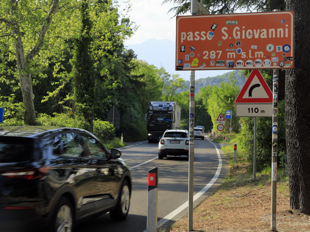
Warning for a curve to the right. (South Tyrol, Italy) © Wikimedia.org/Falk2, CC BY-SA

28. Chevron

A chevron in road safety is a V-shaped pattern or sign used to guide drivers through curves or warn of sharp bends in the road. It helps improve visibility and gives you a clear sense of the road’s direction—especially in dangerous or low-visibility areas. A chevron is a visual guide that says, “Sharp turn ahead—follow me!” It helps you navigate safely through curves by showing you which way the road bends.

  • Chevron signs point in the direction of a curve or turn.
  • They’re often placed in a series along sharp curves or exits.
  • Help drivers judge how tight a turn is and when to start slowing down.
  • Designed to prevent skidding, rollovers, or running off the road.

Chevrons to indicate a sharp curve. (South Tyrol, Italy) © Wikimedia.org/Arne Hückelheim, CC BY-SA

29. Wrong-way driving

Wrong-way driving is when a vehicle travels in the opposite direction of traffic, usually on one-way roads, highways, or exit ramps. It's extremely dangerous and often leads to head-on collisions, which are among the most severe and deadly types of crashes. Wrong-way driving is extremely dangerous and often caused by confusion, distraction, or impairment. The best prevention is staying alert and following road signs carefully.

  • Common Causes of Wrong-Way Driving:
    • Driver confusion, especially at night or in poor visibility.
    • Impaired driving (alcohol or drugs).
    • Missing or misunderstood road signs.
    • Elderly or inexperienced drivers.
    • Distracted driving.
    • Entering an exit ramp or turning the wrong way onto a one-way street.
  • How to Avoid Wrong-Way Driving:
    • Always obey road signs, especially “One Way,” “Do Not Enter,” and arrows.
    • Be extra alert in unfamiliar areas, at night, or in low visibility.
    • Avoid distractions and impairment.
    • Use GPS with voice navigation if unsure of directions.

30. Roadworks

Roadworks are construction, maintenance, or repair activities carried out on or near a road. They can involve lane closures, detours, speed restrictions, and other changes to normal traffic flow. While sometimes inconvenient, roadworks are essential for keeping roads safe and functional. Slow down, stay alert, and respect those working to improve the roads.

  • Dangers and Challenges:
    • Narrow lanes or shifted traffic patterns.
    • Loose gravel, uneven surfaces, or temporary ramps.
    • Construction vehicles entering/exiting the road.
    • Sudden stops or reduced speed zones.
  • Driving Safely Through Roadworks:
    • Slow down – follow posted speed limits (often lower in work zones).
    • Follow signs and cones – they guide you through safely.
    • Stay alert – watch for workers, equipment, and changing conditions.
    • Keep a safe distance – from the car in front and from road workers.
    • Avoid sudden lane changes or distractions.

© Wikimedia.org/Stefano59Rivara, CC BY-SA

31. Height limit

A height limit is a maximum allowed height for vehicles (including any cargo or attachments) on a specific road, bridge, tunnel, or underpass. It's used to prevent tall vehicles from hitting overhead structures, which can be dangerous and cause serious damage.

  • The total vertical measurement from the ground to the highest point of the vehicle or load.
  • Includes anything on top of the vehicle, like cargo, roof racks, or equipment.
  • Applies Especially To: trucks, trailers, buses, RVs and camper vans, construction and agricultural vehicles.

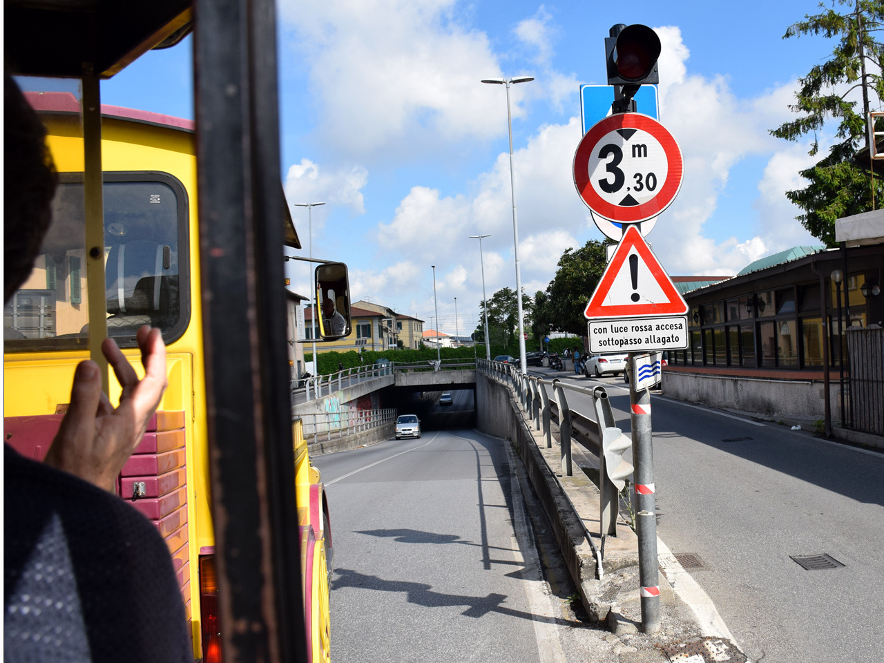
Height limit of 3,30 meter. Warning for flooding if the light flashes. (Pisa, Italy) © Wikimedia.org/János Korom Dr., CC BY-SA

32. Weight limit

A weight limit is the maximum amount of weight that a vehicle or load is legally allowed to carry or move on a specific road, bridge, or area. It helps protect infrastructure, maintain road safety, and prevent vehicle damage.

  • The total weight of a vehicle, including its cargo, passengers, and fuel.
  • Usually measured in tons, pounds (lbs), or kilograms (kg).

© Wikimedia.org/Amadvance, CC BY-SA

33. Traffic lights

Traffic lights are signaling devices used to control the flow of traffic at intersections, pedestrian crossings, and other points on the road. They operate using a universal color system: red means stop, yellow (amber) signals that the light is about to change and warns drivers to prepare to stop, and green allows traffic to proceed when safe. By providing clear and timed instructions, traffic lights help prevent collisions, ensure smoother traffic flow, and create safer conditions for both drivers and pedestrians.

  • Standard Traffic Light Colors:
    • Red - Stop – Do not enter the intersection.
    • Yellow - Get ready to stop, Light is about to turn red.
    • Green - Go – Proceed if the way is clear.
  • Pedestrian Traffic Lights:
    • Red person = Don’t cross.
    • Green person = Safe to cross.
    • Some also beep or count down for accessibility.
  • Arrow Traffic Lights:
    • Show specific directions (e.g., green arrow for turning left).
    • Help manage turning traffic separately from straight-moving cars.

© Wikimedia.org/Davide Papalini, CC BY-SA

34. Pedestrian lights

Pedestrian lights are special traffic signals designed to control the movement of pedestrians at crossings. They typically use clear symbols: a red standing figure telling pedestrians to wait, and a green walking figure indicating it is safe to cross. In many places, the green phase may be accompanied by a countdown timer or a blinking phase to warn that the signal will soon change. These lights help separate pedestrian movement from vehicle traffic, improving safety and reducing conflicts at busy intersections.

  • Red person - Don’t walk – wait at the curb.
  • Green person - Walk – safe to cross.
  • Some lights also include:
    • A countdown timer showing how many seconds are left to cross.
    • Beeping sounds or vibrations to help visually impaired pedestrians.

© Wikimedia.org/Pierfrancesco Prudentino, CC BY-SA

35. Roadmarks

Roadmarks (or Road Markings) are painted lines, symbols, and signs on roads that guide drivers, cyclists, and pedestrians. They help with traffic control, lane discipline, and road safety.

  • Solid White Line - Stay in your lane, no crossing allowed.
  • Broken White Line - You can change lanes when safe.
  • Stop Line - Stop before the intersection or sign.
  • Give Way Line (Yield Line) - Slow down and give way to traffic.
  • Zebra Crossing (Pedestrian Crosswalk) - Pedestrians have right of way.
  • Bicycle Lane Marking - Reserved for cyclists only.
  • Bus Lane Marking - Only buses can use this lane.
  • Hatched Markings (Diagonal Stripes) - No stopping or parking.
  • Box Junction (Yellow Grid) - Keep clear, don’t block the intersection.
  • Speed Limit Markings - Maximum allowed speed.
  • Arrows on Lanes - Shows direction of travel (straight, turn left/right).

36. Driving license

A driving license is an official document issued by a government authority that permits a person to legally operate one or more types of motor vehicles on public roads. It confirms that the holder has met the required standards of knowledge (theory), practical driving skills, and medical fitness, and is therefore considered competent to drive safely within the law.

  • Personal and official document (often a card).
  • Issued after passing theory and practical exams.
  • Valid for specific vehicle categories (e.g. car, motorcycle, truck).
  • Must be carried while driving (depending on country rules).
  • Serves as proof of driving competence and identity.

The frontside of a Italian driving license. © Wikimedia.org, CC0

37. Location marker

A location marker is a symbol, sign, or digital indicator that identifies a specific place or point on a map. It is commonly used in navigation, mapping applications, and road signage to help people find locations or directions.

  • Road & Traffic Management – Mark important junctions, rest stops, and danger zones.
  • Emergency Services – Used by police, ambulances, and firefighters to locate accident sites.
  • Navigation & Maps – Help users find restaurants, hotels, gas stations, and landmarks.
  • Tourism & Travel – Identify popular attractions, scenic routes, and cultural sites.

Kilometer 43 of road SS44. (Bolzano, Italy) © Wikimedia.org/Piergiuliano Chesi, CC BY

38. Traffic mirror

A traffic mirror is a curved mirror placed near roads, intersections, driveways, or blind corners to help drivers and pedestrians see around obstacles and improve safety.

  • Blind corners - Help drivers see oncoming traffic.
  • Tight driveways or exits - Improve visibility when entering a road.
  • Parking lots - Prevent collisions between vehicles and pedestrians.
  • Alleyways or narrow roads - Spot cross-traffic or hidden vehicles.

39. Emergency telephone

An emergency telephone is a special phone used to quickly contact emergency services like police, ambulance, or fire department during a serious or dangerous situation. It allows people to ask for help immediately when they are in trouble, especially on roads, highways, or remote areas where normal phones may not be available.

  • When to Use an Emergency Telephone:
    • Car breakdown on the highway.
    • Accident or injury.
    • Fire or dangerous situation.
  • Where You Might See Emergency Telephones:
    • Along highways or motorways.
    • In tunnels.
    • At railway stations or airports.
    • On university or hospital campuses.
    • In parking garages or large buildings.

An emergency telephone. (Rome, Switzerland) © Wikimedia.org/CAPTAIN_RAJU, CC BY-SA

40. International border

An international border is the official dividing line between two countries. It marks where the territory, laws, and authority of one country end and another’s begin.

  • Border checkpoints - Places where people and goods are inspected (e.g. airports, land crossings).
  • Passports and visas - Usually required to cross legally.
  • Security or fencing - Some borders have fences, walls, or patrols for control.
  • Customs and immigration - Control who and what enters or leaves the country.

An international border sign when entering Italy. © Wikimedia.org/Florian Pépellin, CC BY-SA