HikingGermany

Learn traffic rules with clear explanations and visual examples in our illustrated book, designed to make studying simple and engaging.


97. Hiking

A hiking route is a designated route intended primarily for recreational walking or hiking. It may follow footpaths, forest tracks, rural roads or other suitable routes and can connect natural, cultural or tourist destinations.

Hiking routes are often identified by direction arrows, coloured markers, route numbers, symbols or numbered junctions. Their signs and markings are usually part of a recreational wayfinding system rather than ordinary traffic-control signage.
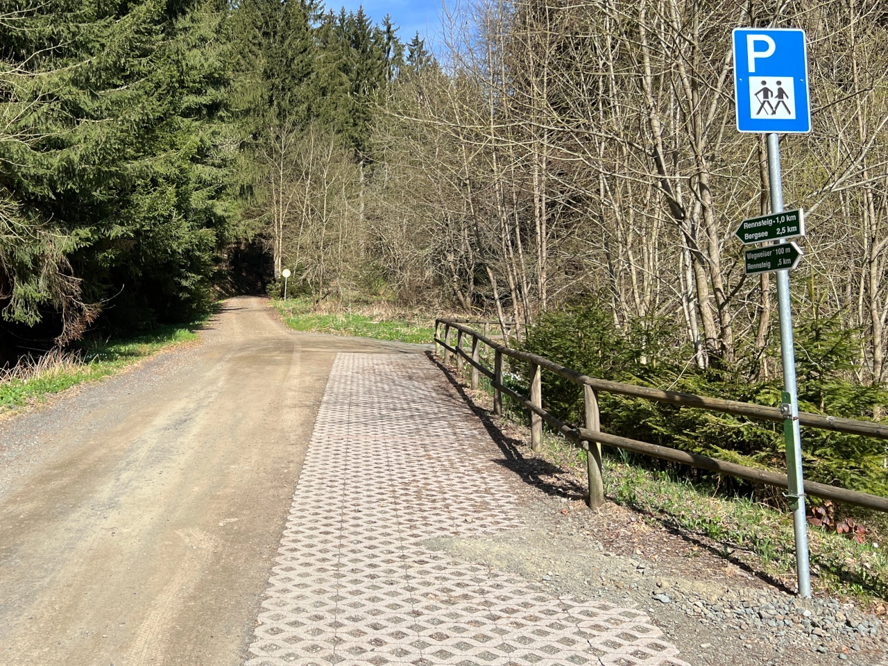
Hiking
Parking for hikers. (Thuringia, Germany)
Wikimedia.org • Lukas Beck • CC BY
What is a hiking route?

A hiking route is a designated route intended for recreational walking or hiking, often through natural, rural or tourist areas.

How are hiking routes marked?

They may be marked using colours, arrows, symbols, route numbers or numbered junctions. The marking system varies between countries and individual trail networks.

Are hiking-route signs traffic signs?

Not necessarily. Hiking-route markers are often recreational or tourist wayfinding signs and do not normally impose traffic rules unless an official traffic sign is also present.

1 Germany 2 Motorway 3 Expressway 4 Residential area 5 Zone 6 Speed limit 7 Footpath 8 Bike path 9 Shared-use path 10 Pedestrian warning 11 Tunnel 12 Bridge 13 Cycling street 14 Pedestrian zone 15 Toll road 16 Customs 17 One-way traffic 18 Quay 19 Slope 20 Bus lane 21 Bus stop 22 Dead end 23 Stop sign 24 Give way 25 Roundabout 26 Priority road 27 Road narrowing 28 Priority over oncoming traffic 29 Give way to oncoming traffic 30 Pedestrian crossing 31 Railway crossing 32 Mandatory direction 33 School area 34 Overtaking 35 Crossing animals 36 Slippery road 37 Rockfall 38 Aircraft 39 Curve 40 Chevron 41 Wrong-way driving 42 Roadworks 43 Crosswind 44 Height limit 45 Width limit 46 Length limit 47 Weight limit 48 Radar speed sign 49 Selective barriers 50 Low-emission zone 51 Intersection direction sign 52 Priority at the next junction 53 Traffic lights 54 Traffic lights warning 55 Pedestrian lights 56 Road markings 57 Junction layout 58 Bike box 59 Speed feedback 60 Driving licence 61 Location marker 62 Countdown markers 63 Traffic mirror 64 Emergency telephone 65 International border 66 Pedestrian underpass 67 Cycling route 68 End of restriction 69 Parking 70 No parking 71 No stopping 72 Parallel parking 73 Park and ride 74 Kiss and ride 75 Parking meter 76 Parking disc 77 Disabled parking 78 Traffic management 79 Reversing 80 Traffic jam 81 Detour 82 Uncontrolled crossroad 83 Road surface 84 Exit 85 Horse riding 86 Provisional licence 87 Hazardous cargo 88 Emergency exit 89 Runaway truck ramp 90 Oversize load 91 Cycle highway 92 Carsharing 93 City limit 94 Gantry 95 Distance board 96 Breakdown bay 97 Hiking 98 Pavement parking 99 Road church 100 Tourist attraction ...