


Information signsFinland
 Traffic rules
 Finland
 Priority signs
 Warning signs
 Prohibitory signs
 Mandatory signs
 Information signs
 Additional signs
Information signs
An information sign is a traffic sign that provides useful guidance or clarification to road users without imposing rules or warnings. These signs inform drivers about things like parking zones, directions, facilities, road layouts, or the start and end of built-up areas. Their purpose is to help drivers navigate confidently by giving clear, practical information that improves orientation, comfort, and overall traffic flow.
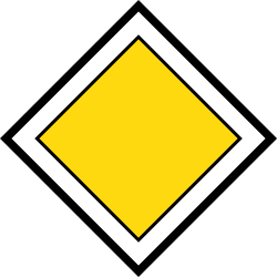

1. Start of a priority road
This traffic sign indicates the start of a priority road. Drivers on the priority road normally have priority over traffic entering from side roads until the priority road ends, unless traffic lights, other signs or applicable traffic rules indicate otherwise.
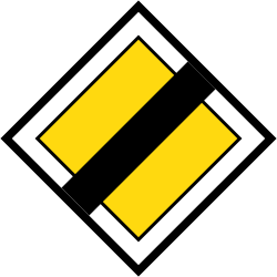
2. End of the priority road
This traffic sign indicates the end of the priority road. The road no longer has continuing priority at subsequent intersections. Follow the applicable traffic lights, priority signs and default priority rules.
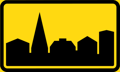
3. Start of a built-up area
This traffic sign indicates the start of a built-up area. From this point, the traffic rules that apply to built-up areas take effect according to the applicable local regulations.
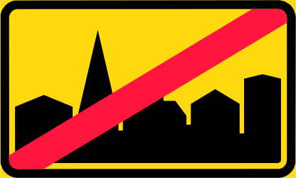
4. End of the built-up area
This traffic sign indicates the end of the built-up area. The traffic rules specifically associated with the built-up area cease to apply from this point according to the applicable local regulations.
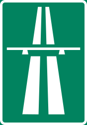
5. Start of a motorway
This traffic sign indicates the start of a motorway. From this point, special motorway rules apply, including restrictions on which road users may enter and on stopping, reversing and other manoeuvres. Follow the applicable speed limits, lane rules and local motorway regulations.
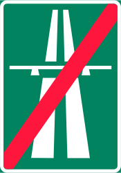
6. End of the motorway
This traffic sign indicates the end of the motorway. The special motorway rules end at this point. Follow the speed limits, access rules and other traffic signs that apply to the road ahead.
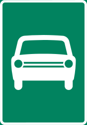
7. Start of an expressway
This traffic sign indicates the start of an expressway. From this point, the traffic rules and access conditions that apply to expressways take effect according to the applicable local regulations.
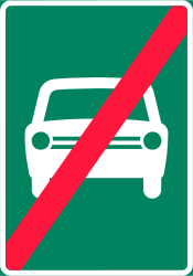
8. End of the expressway
This traffic sign indicates the end of the expressway. The special traffic rules associated with the expressway end at this point. Follow the rules and traffic signs that apply to the road ahead.
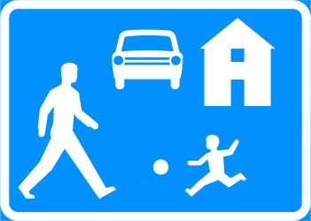
9. Start of a residential area
This traffic sign indicates the start of a residential area. Special traffic rules apply within the area according to the applicable signs and local regulations. These rules may affect speed, parking and how different road users use the road.
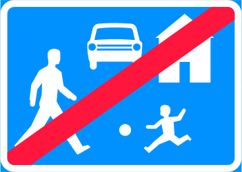
10. End of the residential area
This traffic sign indicates the end of the residential area. The special traffic rules associated with the residential area end at this point. Follow the traffic signs and rules that apply beyond the area.
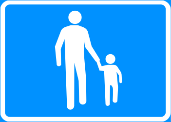
11. Start of a zone for pedestrians
This traffic sign indicates the start of a pedestrian zone. Pedestrians are the principal road users within the zone, while access by vehicles and other road users is subject to the applicable traffic signs and local rules.
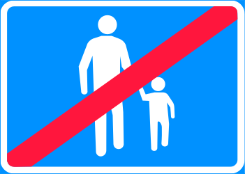
12. End of the zone for pedestrians
This traffic sign indicates the end of the pedestrian zone. The special traffic rules associated with the pedestrian zone end at this point. Follow the traffic signs and rules that apply beyond the zone.
13. National speed limits
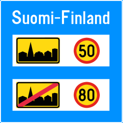
This traffic sign indicates the national speed limits. The applicable default maximum speeds depend on the road type, vehicle category and local traffic rules when no different speed limit is indicated.
14. Advisory speed limit
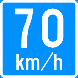
This traffic sign indicates an advisory speed. The displayed value recommends an appropriate speed for the road or conditions ahead. Its legal effect depends on the applicable local rules.
15. End of the tunnel
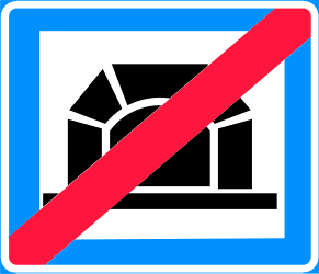
This traffic sign indicates the end of the tunnel. Tunnel-specific rules associated with the sign end where applicable, while separately imposed speed limits, lighting requirements or other restrictions may remain in force.
16. Start of a tunnel with indicated length
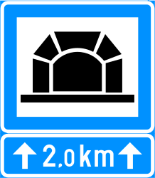
This traffic sign indicates the start of a tunnel and shows its length. The displayed value indicates the length of the tunnel. Follow the traffic rules and any special requirements that apply within it.
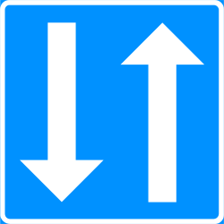
17. Road with two-way traffic
This traffic sign indicates a road with two-way traffic. Traffic may travel in both directions, so vehicles travelling in the opposite direction may be encountered.
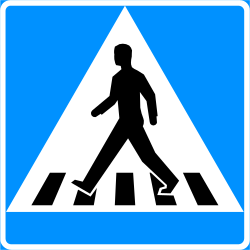
18. Crossing for pedestrians
This traffic sign indicates a crossing for pedestrians. It marks a designated place where pedestrians cross the road. Priority and crossing rules depend on the applicable traffic signs, signals and local regulations.
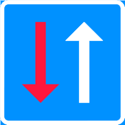
19. Road narrowing, oncoming drivers have to give way
This traffic sign indicates a road narrowing where oncoming drivers have to give way.
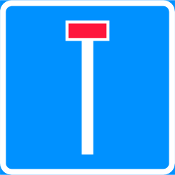
20. Dead end street
This traffic sign indicates a dead end street. The road has no through route for vehicles, although access to properties or other destinations along the road may still be possible.
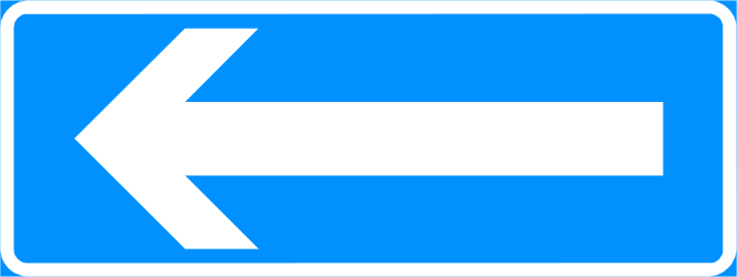
21. Road with one-way traffic
This traffic sign indicates a road with one-way traffic. Drivers may travel only in the permitted direction.
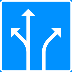
22. Overview of the lanes and their direction
This traffic sign gives an overview of the lanes and their direction. The arrows or other indications show how the lanes continue and which directions or destinations they serve.
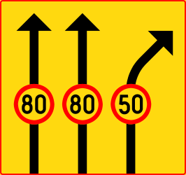
23. Maximum speed of a lane
This traffic sign indicates the maximum speed for the indicated lane. Vehicles using that lane must not exceed the displayed speed limit while the restriction applies.
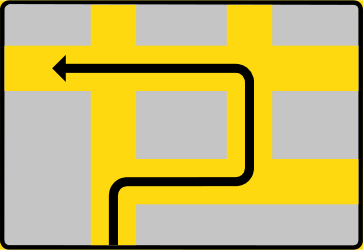
24. Route to be followed in order to turn left
This traffic sign indicates the route to use for a left turn. Follow the indicated route instead of turning left directly at this point.
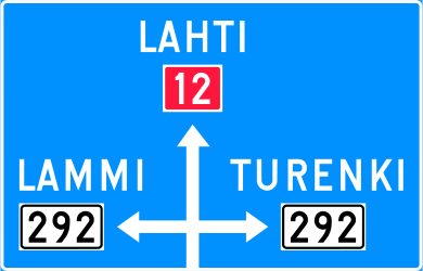
25. Junction layout, directions and destinations
This traffic sign shows the junction layout, directions and destinations. The diagram shows how the roads are arranged and which direction leads to each indicated destination or route.
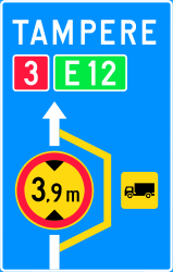
26. Detour for vehicles that are not allowed to pass
This traffic sign indicates a detour for vehicles that cannot continue on the normal route. Vehicles affected by the relevant restriction should follow the indicated alternative route.
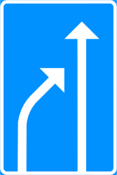
27. End of a lane
This traffic sign indicates the end of a lane. The displayed lane arrangement shows which lane ends and how the remaining traffic lanes continue.
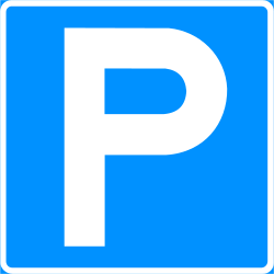
28. Parking allowed
This traffic sign indicates that parking is allowed. Vehicles may be parked in the area covered by the sign subject to any indicated conditions, restrictions or local parking rules.
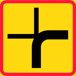
29. Crossroad shape
This traffic sign shows the shape or layout of an upcoming junction. The diagram indicates how the approaching road and connecting roads are arranged.
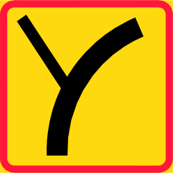
30. Crossroad shape
This traffic sign shows the shape or layout of an upcoming junction. The diagram indicates how the approaching road and connecting roads are arranged.
