
National speed limits are the default maximum speeds set by law for different types of roads when no specific speed limit signs are present. They vary depending on the road type, vehicle category, and country, and drivers must know and apply them automatically.

A sign indicating the general speed limits of Denmark. (Hirtshals, Denmark) © Wikimedia.org/Tomasz Sienicki, CC BY
A motorway is a high-speed road designed for long-distance travel, with controlled access and no intersections or pedestrian traffic.

A built-up area is a place where there are lots of buildings, people, and activity — basically, any area that looks and feels like a town or city.
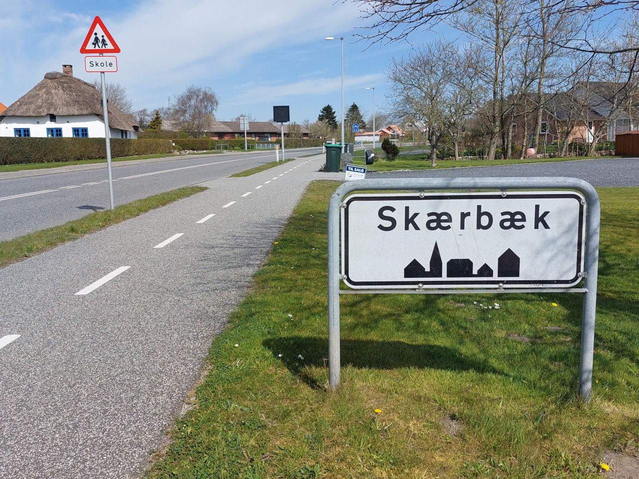
Begin of a built-up area. (Skærbæk, Denmark) © Wikimedia.org/Hjart, CC BY-SA
A speed limit is the maximum speed you are legally allowed to drive on a road. It helps keep drivers, passengers, and pedestrians safe by reducing the risk of accidents. Always adjust your speed for weather, traffic, and road conditions — even if you're below the speed limit!

© Wikimedia.org/Frühstückbeistefanie, CC BY-SA
A footpath (or sidewalk) is a designated path for pedestrians, usually alongside a road. Traffic rules for footpaths ensure the safety of pedestrians and maintain order in urban areas.

A path for pedestrians with direction. (Copenhagen, Denmark) © Wikimedia.org/Leif Jørgensen, CC BY-SA
A bike path (also called a cycling path or bike lane) is a designated pathway for bicycles, separate from motor vehicle traffic. It provides a safe and dedicated space for cyclists, reducing the risk of accidents with cars and pedestrians. Bike paths promote safe, eco-friendly transport and reduce traffic congestion!

Path for cyclists. Cyclists in both directions. (Copenhagen, Denmark) © Wikimedia.org/Leif Jørgensen, CC BY-SA
A pedestrian zone is an area where only people on foot are allowed — no cars, motorcycles, or other vehicles (unless specifically permitted, like for deliveries at certain times). It’s a space in a city or town meant to be safe and comfortable for walking, shopping, or relaxing — with no regular vehicle traffic.

A bus stop is a designated location along a bus route where passengers can board or alight (get off) a bus. It is a stationary point marked by signs or shelters, typically located at intervals along the route, where people wait to catch the bus.

A bus stop. (Aarhus, Denmark) © Wikimedia.org/Leif Jørgensen, CC BY-SA
"Give Way" means you must slow down or stop to let other road users go first before you proceed. It’s the same as “Yield” in some countries (like the U.S.). A Give Way Sign Looks Like: An inverted triangle. Usually red and white, with the words "Give Way" or "Yield"

A give way sign. (Skavnshøj, Denmark) © Wikimedia.org/Beethoven9, CC BY-SA
A roundabout is a circular intersection where traffic flows in one direction around a central island. Instead of traffic lights or stop signs, vehicles use yield rules to enter and exit the roundabout safely.
© Wikimedia.org/Leif Jørgensen, CC BY-SA

 Traffic rules
